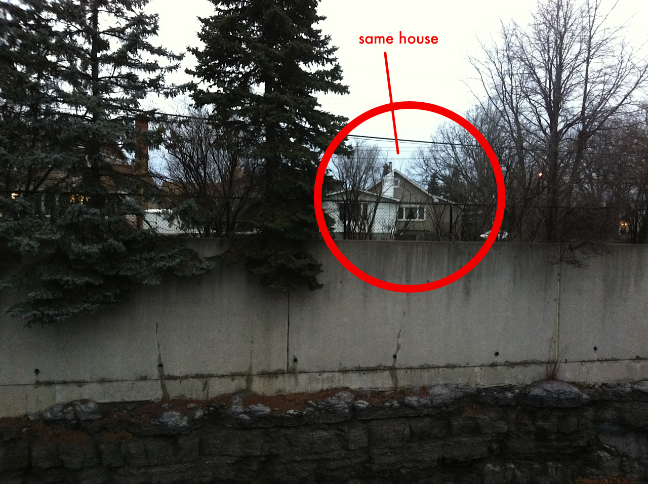
Recently the NCC announced their plans to re-route the LRT line away from the original Sir John A MacDonald Parkway (SJAM). The City Of Ottawa favoured this plan, but the NCC wants to have the rail line cross the NCC owned Rochester Field, beside Keg Manor on Richmond Rd. This route option would mean the rail line would have to come along either the Byron Linear path or Richmond Road, crossing over into Rochester Field and connect to the already existing OC transitway trench.
The City Of Ottawa plans used a 1.2km connection stretch from Lincoln Fields to the Transitway trench using a path along the SJAM. The NCC says that area is off-limits unless it is buried underground and does not impede access to the river. The NCC favoured route has the rail line using Rochester Field saying “It would be up to the city to determine if a transit line that extends up from Rochester Field would be a tunnel, buried below grade, or run on grade.”
This means the connection this cross-over would have to use either the Byron Linear Path from Lincoln Fields or Richmond Rd for the rail line.
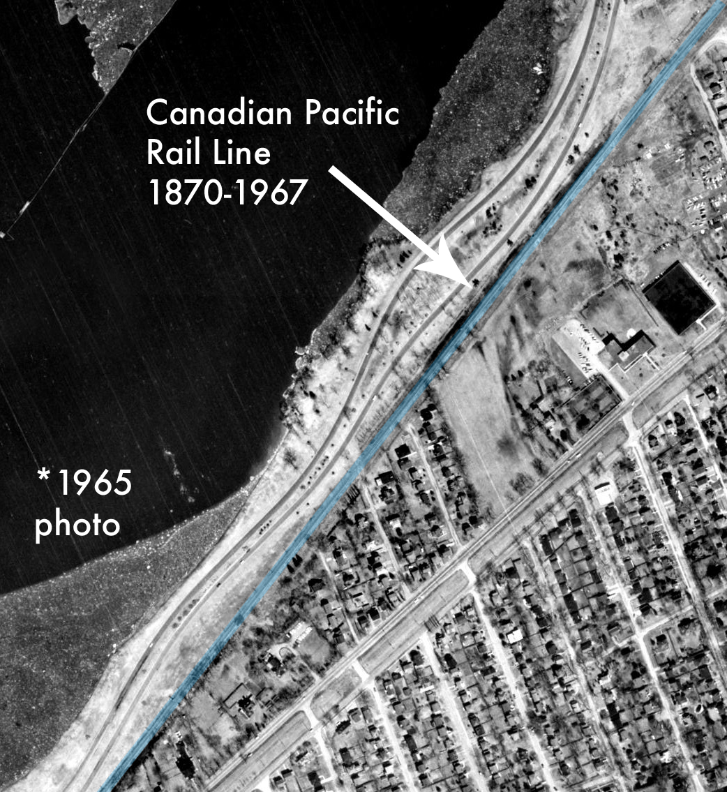
The City’s approach, and the one favoured for the final plan of the western LRT route uses a 1.2km strip of the SJAM. This strip would be located on the southern edge of the SJAM. After doing some research, it seems this strip was actually already a rail line used by the Canadian Pacific Railway for almost 100 years from 1870 1967.
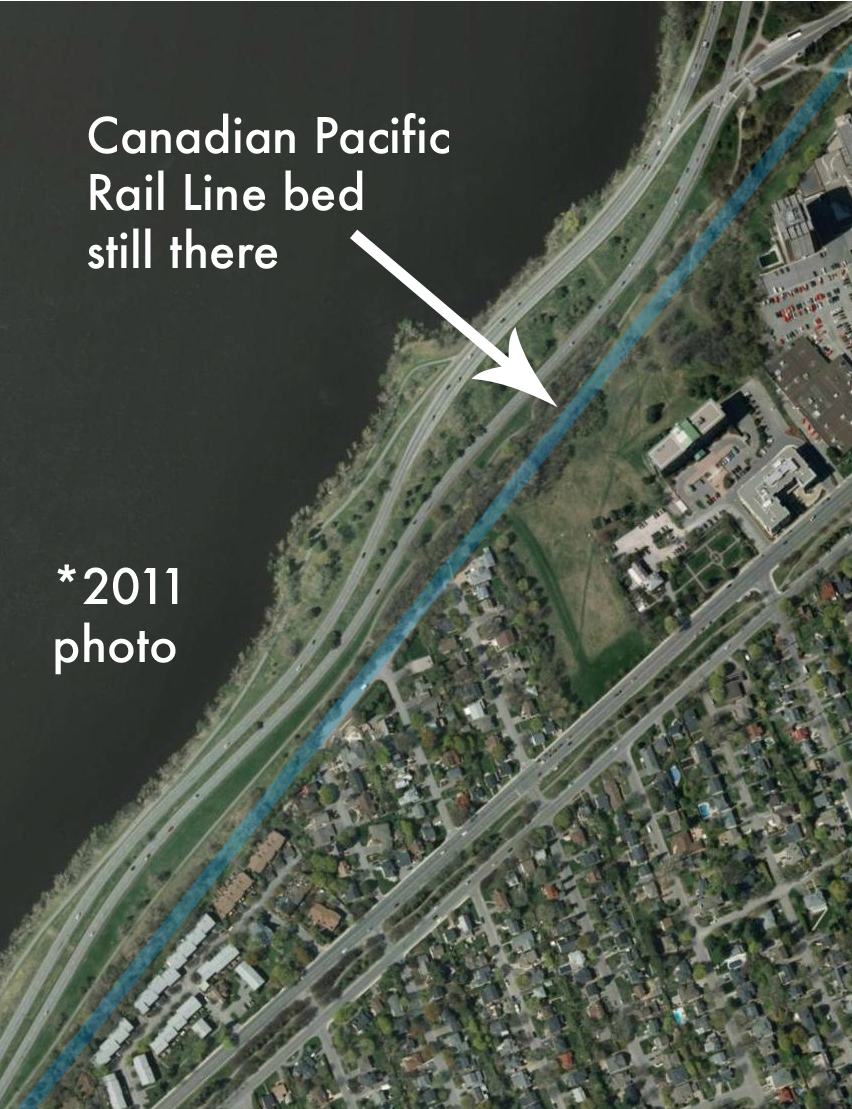
Remains of this CP rail route, the line the LRT would run along, are still there if we go and take a closer look.
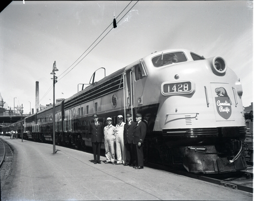
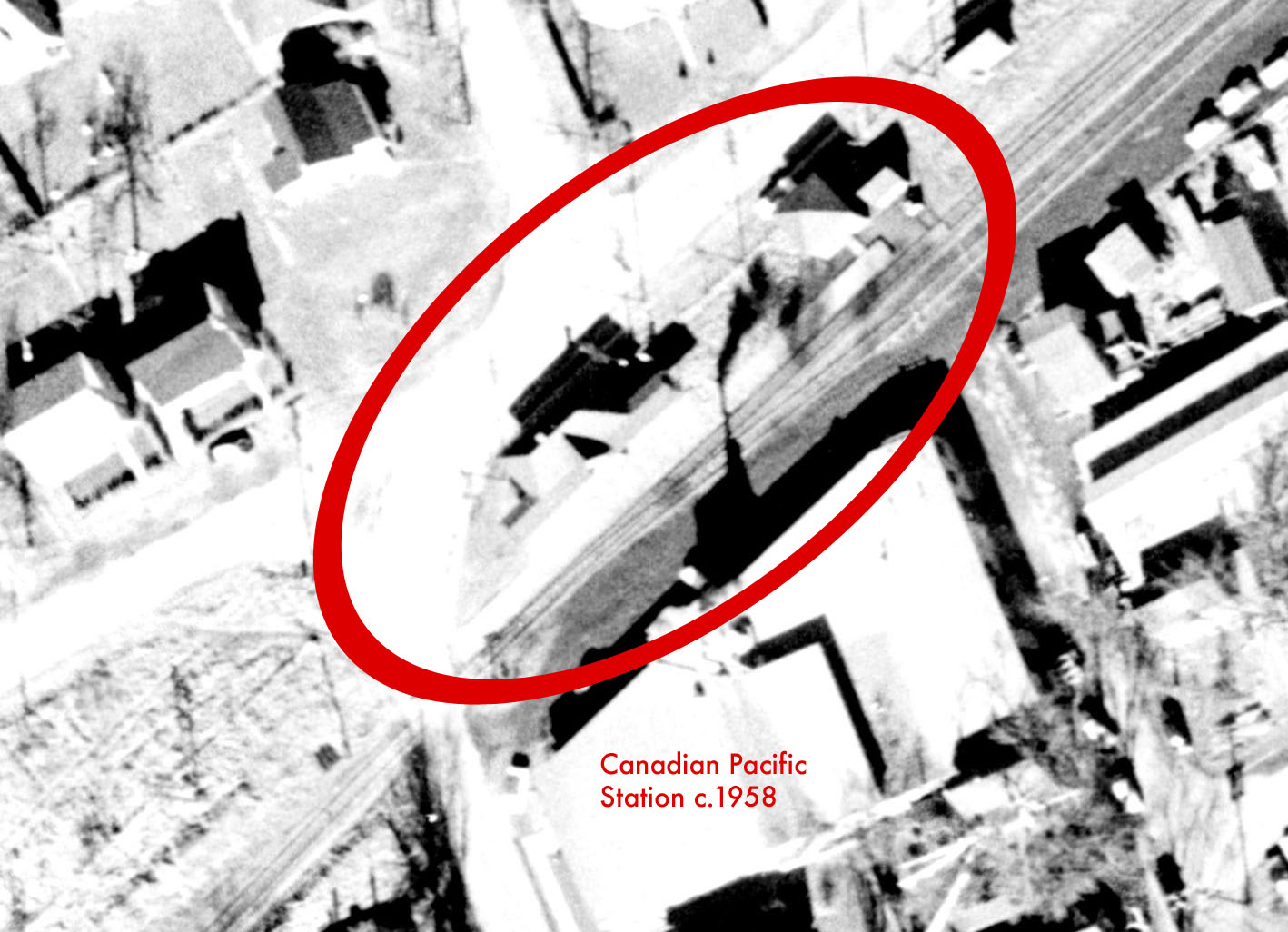
A Canadian Pacific train like this one would have travelled along the SJAM in 1958. (City Of Ottawa archives photo)
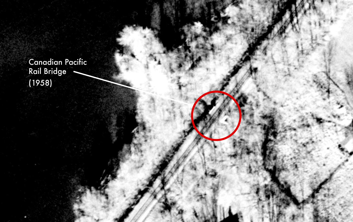
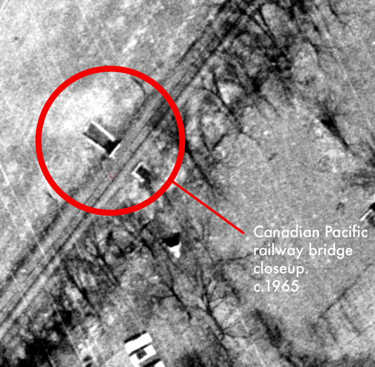
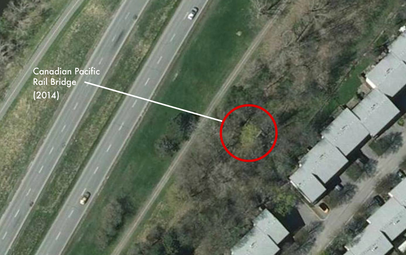
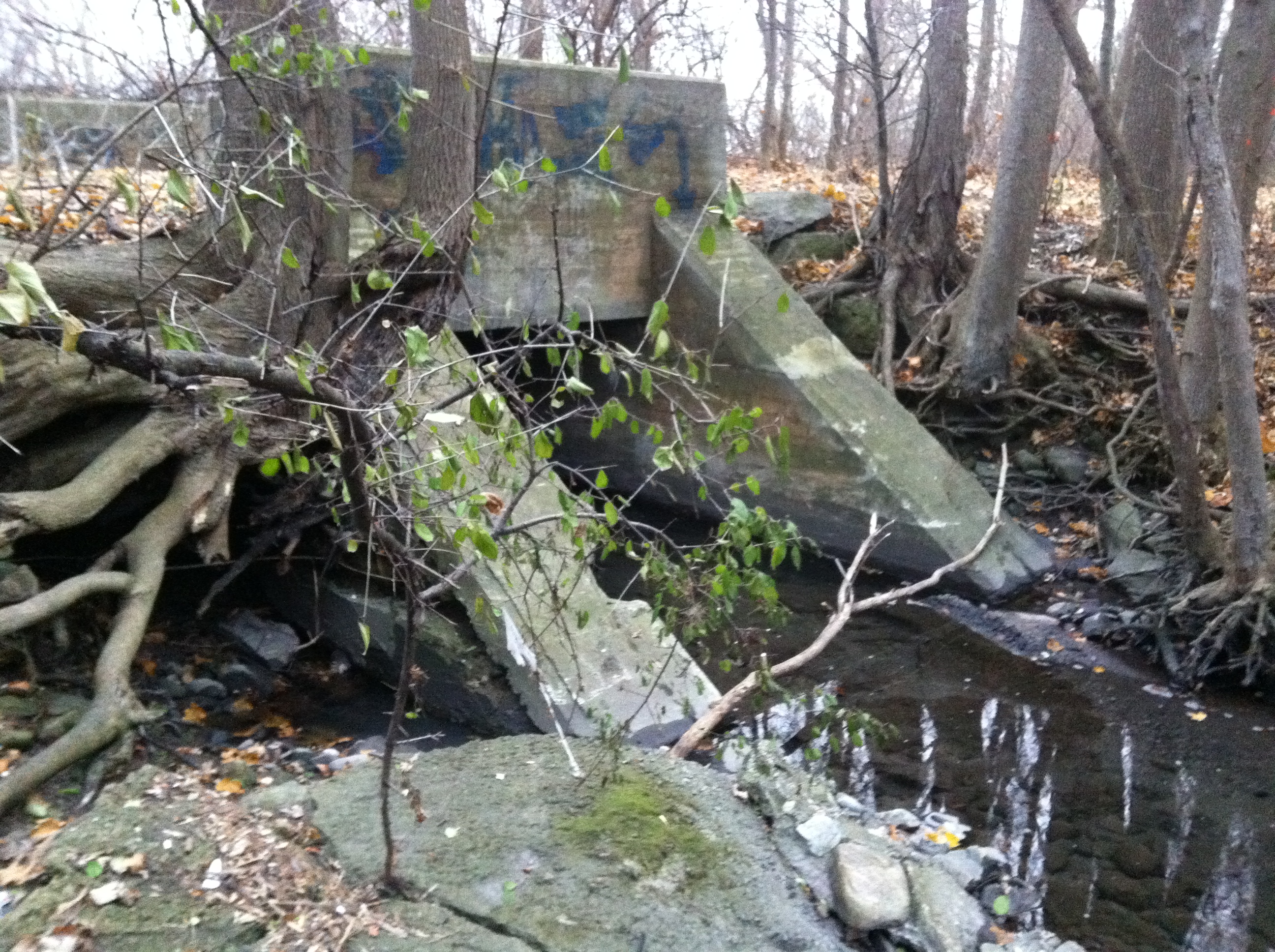
The CP line runs exactly along the same path as the planned LRT line, although now overgrown, the path follows the same route as trains once did 50 years ago. Looking at aerial photos of the area with the old CP line in place and overlaying a current aerial image, we can see where the rail line was. A closer look at old aerial photos reveals a train bridge that CP built at some point. Overlaying that photo over a current aerial image showed the location and so I went there to check it out. Although crumbling and graffiti covered, the leaves have fallen away to reveal this relic of our railway past that still lies on the NCC property exactly the same way it has since 1870.
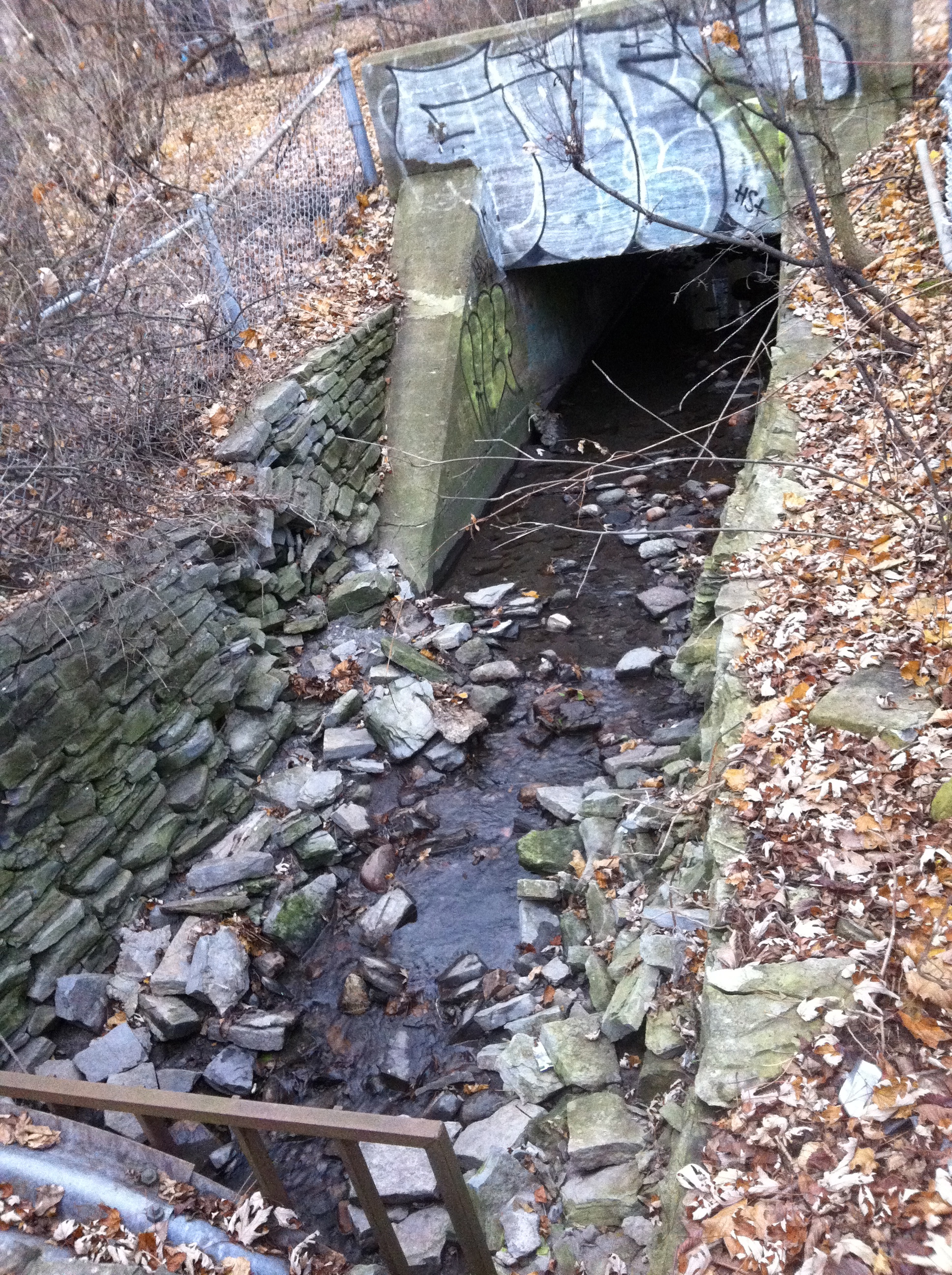
The CP Rail bridge as it looks today on NCC SJAM Parkway
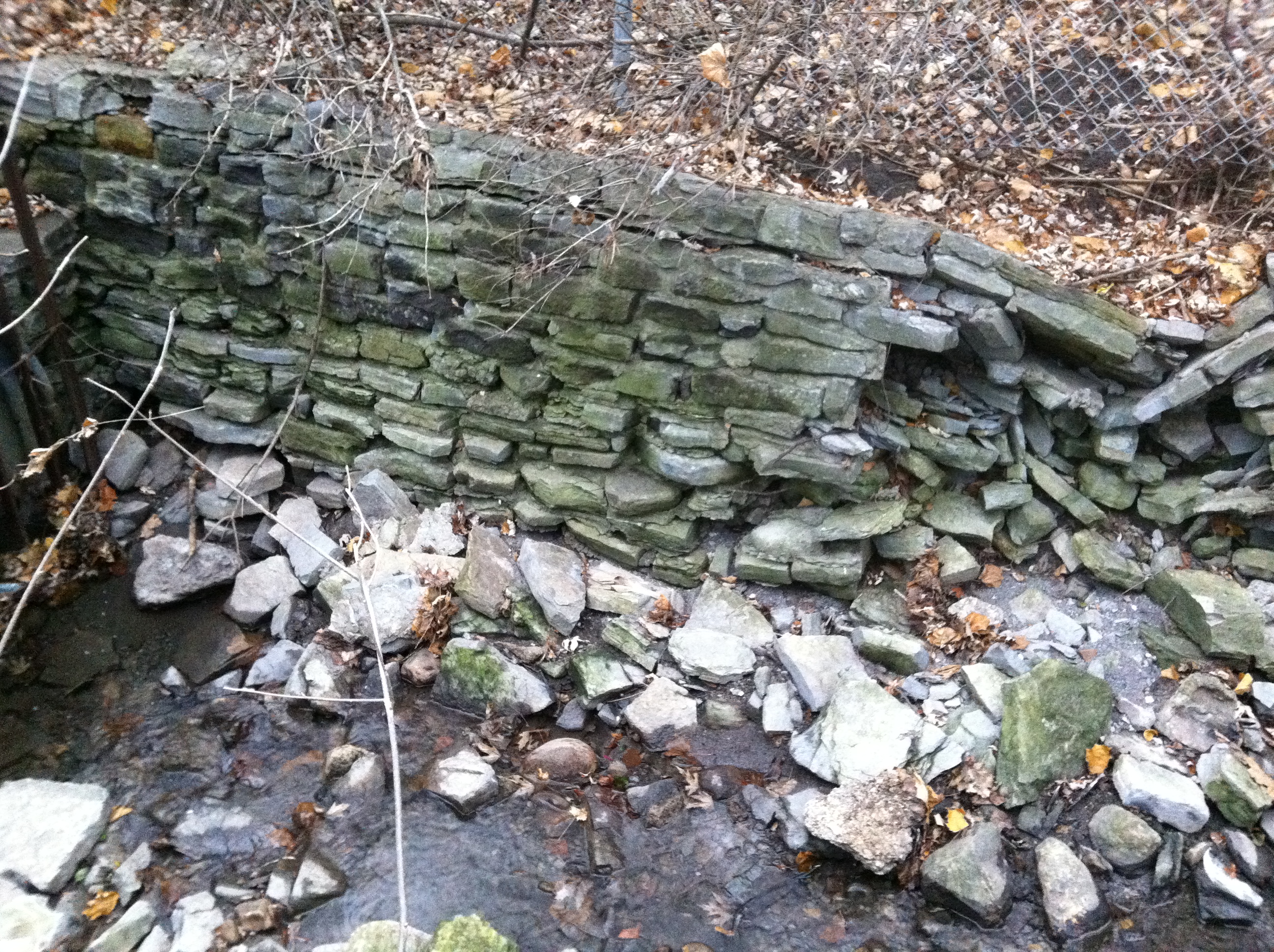
Crumbling remains of 140 year old CP Rail Line.
Hidden by trees and bushes in the summer, the old CP line bridge on NCC property where the proposed LRT route is to go on the SJAM parkway would use this exact same old rail line route.
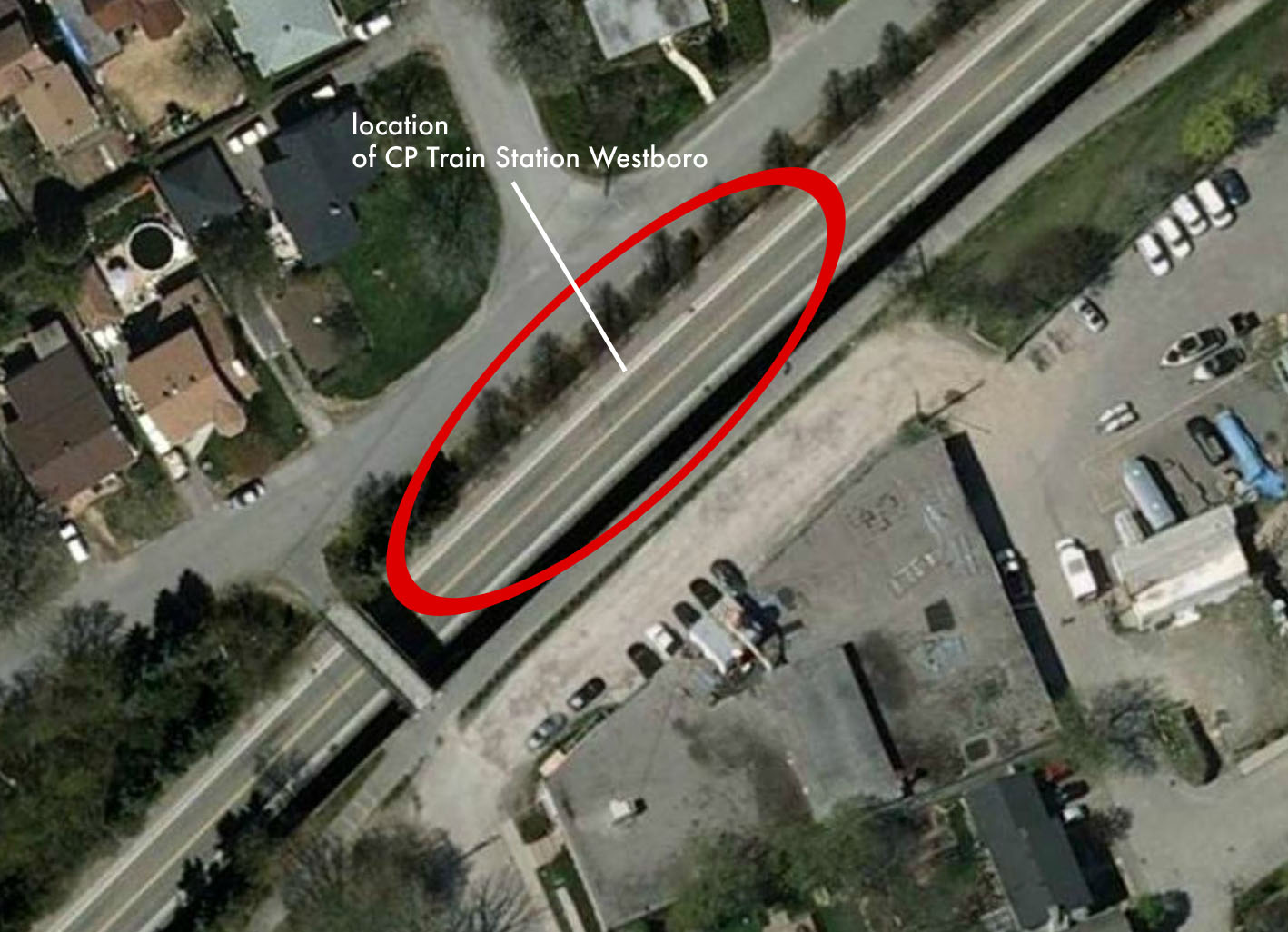
I walked the entire route of the old CP rail line, the route of the old track is still there on the SJAM, unimpeded by trees and a clear stretch right up to where the location of the old Westboro Canadian Pacific train station used to be at the end of Roosevelt St. Built in 1919 and demolished in 1960, the train station is now where the OC Transitway trench is.
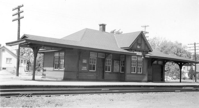
The Canadian Pacific Railway Station in Westboro in 1952 at the end of Roosevelt St.
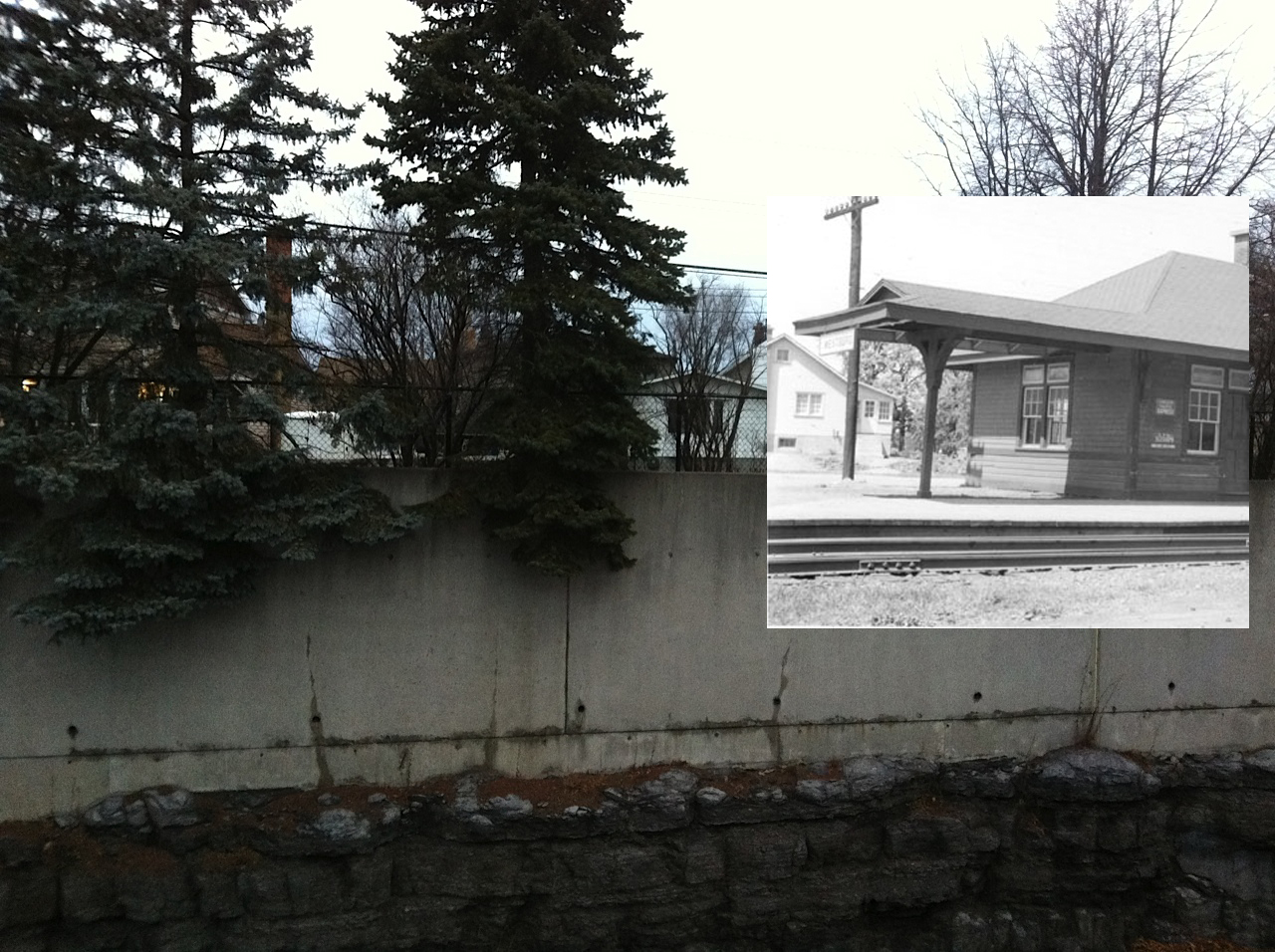
Where the CP Westboro train station was…as it looks today.
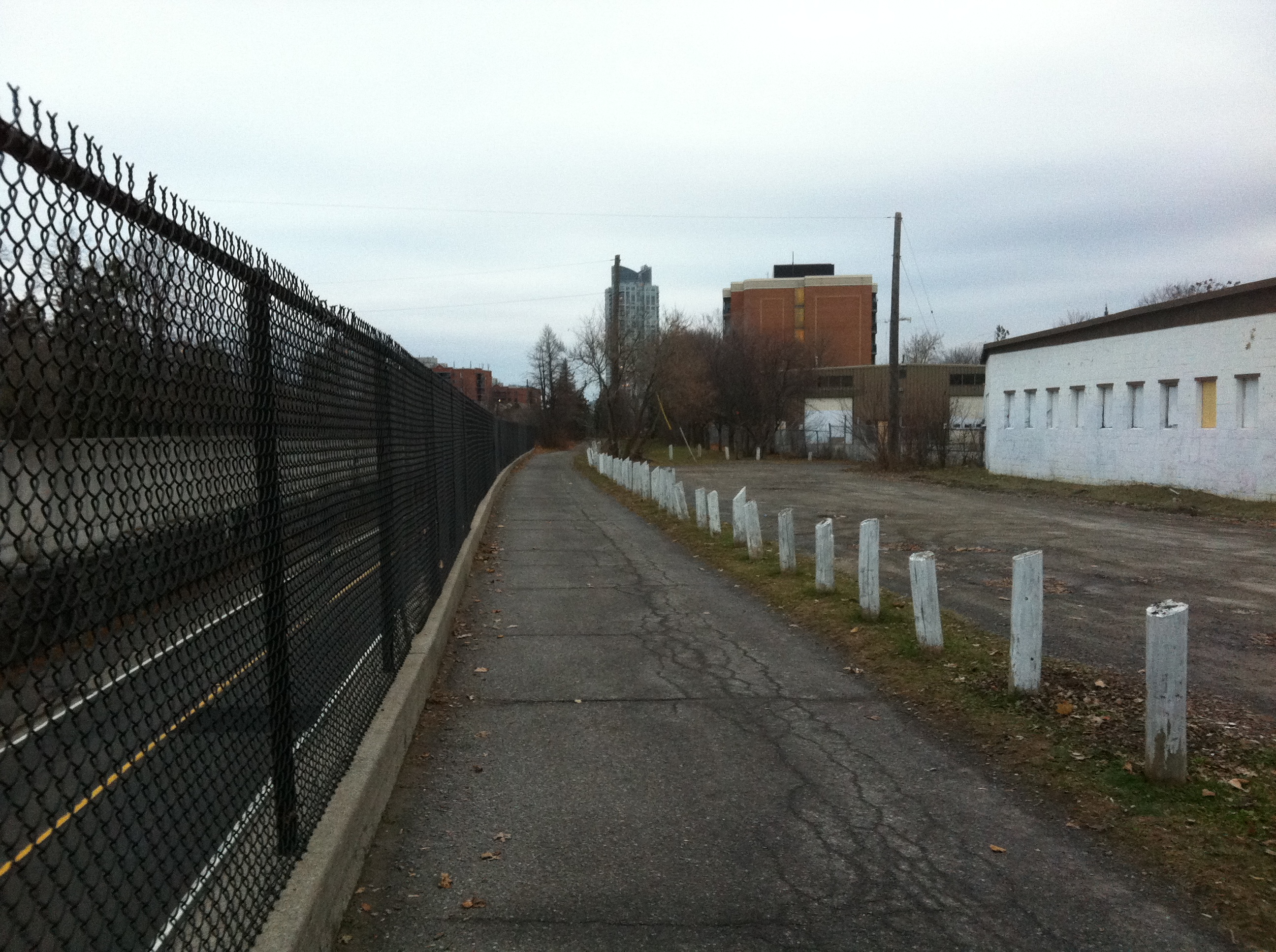
This sidewalk follows the exact same railway route of the Canadian Pacific line 1870-1967.
Both the NCC and the City options have their individual pros and cons, and it seems no one will be happy no matter what route is chosen, but perhaps by looking at our past it can lead us to a solution for the future.
SOURCES
http://www.railways.incanada.net
Google Maps
GEO-Ottawa