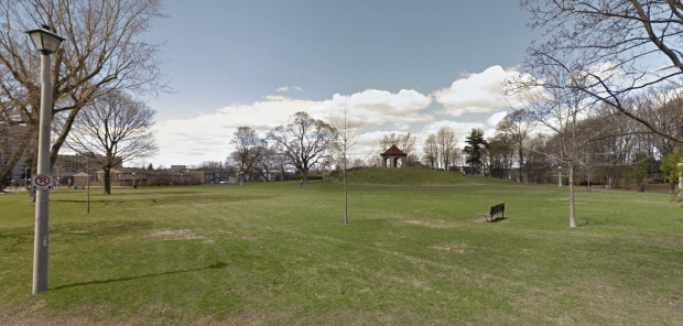
This tranquil city park has a grim secret lying below the surface. (image:GoogleStreetview)
In 1920 a crew of city workers were landscaping the grounds of Macdonald Park, a large and picturesque plot of land in Ottawa’s Sandy Hill district when a passerby noticed a round object roll down an embankment. Upon closer inspection the round object was discovered to to be a human skull. The park was once an old graveyard for Ottawa’s first residents, some of whom still inhabit this tranquil PARK OF THE DEAD.
BURIED IN TIME
Macdonald Park is a quaint little Lowertown park bordered by Heney, Wurtemburg, Cobourg and Tormey streets just north of Rideau street where it meets the Rideau River. Enjoyed by locals who wander its lush grass and meandering pathways, this park was once home to hundreds of graves, and still is. Below the surface forgotten tombstones and skeletal remains of some of Ottawa’s earliest residents lie quietly below the visitor’s feet, part of a long forgotten cemetery that became a park.

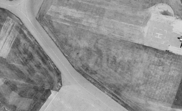
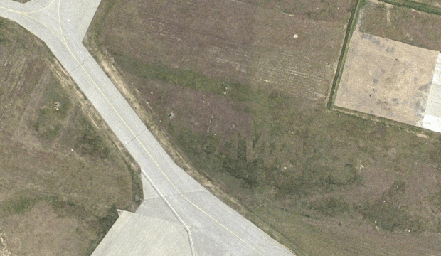
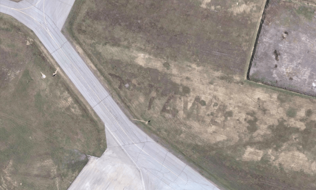
This 1885 map shows a plot of land as “cemeteries”, here circled in red.
The land became a graveyard for Bytown’s earliest settlers when the city’s first graveyard at Elgin and Sparks was moved in the 1840s from its location at the foot of Barrack Hill, a site that you may recall recently had some human bones dug up near Queen and Elgin Streets. Ottawa’s first settlers were buried at this original graveyard but were later moved to a new cemetery east of the city, to what was then called the “city limits”, that being the Rideau River. This second graveyard was opened for burials staring in 1845 and operated until the 1870s when the graveyard had to be moved yet again, this time out to Beechwood.

“Old Cemeteries” as mapped in 1885.
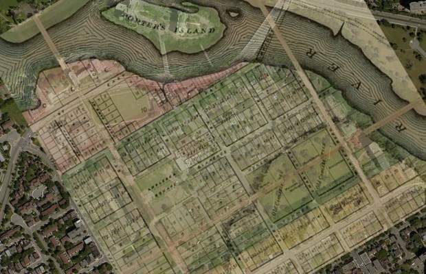

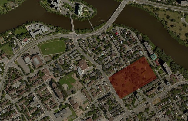
This overlay sequence shows the old graveyard as it appeared on an 1885 map, superimposed on a current aerial image that reveals the location of the park/graveyard.
Hundreds of remains had to be claimed and moved to the new Beechwood cemetery, but many souls had no one to claim them, and their remains were left behind. A report at Bytown.net mentions a time when the abandoned cemetery had cows grazing among skeletons and toppled tombstones for almost 35 years as the land sat vacant. The unclaimed remains were left to the elements until 1911 when the City of Ottawa levelled the area for a new park in honour of Sir John A. Macdonald. Any unclaimed remains and tombstones were flattened over with a bulldozer and reburied under a new park landscape. Out of respect for those left behind, the city of Ottawa read the names, hundreds of them, at a city council meeting and recorded every name and inscription on the re-buried tombstones. Those names and inscriptions are available for viewing today at the Ottawa Room of the Ottawa Public Library Main Branch.
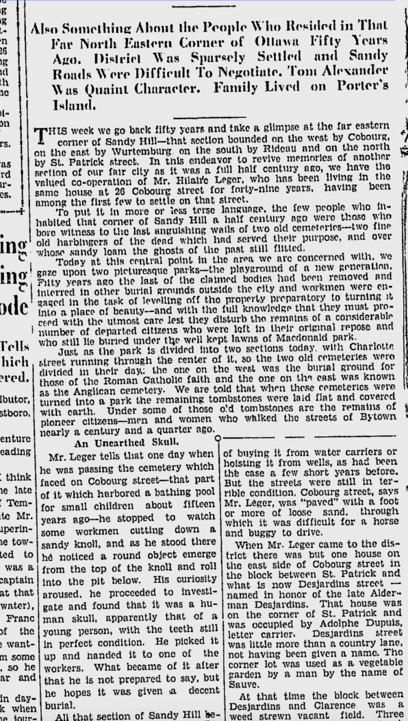
This 1936 Ottawa Citizen article recounts the time a skull was unearthed in the park. (Source:Google News Archives)
Later a stone structure was placed atop a small hill, known as “Summer House”. The park enjoyed years of pleasant use until the 1920s when a 1936 Ottawa Citizen article recounted the story of workers doing some hill landscaping who accidentally unearthed the skull of one of the unfortunate souls left behind.
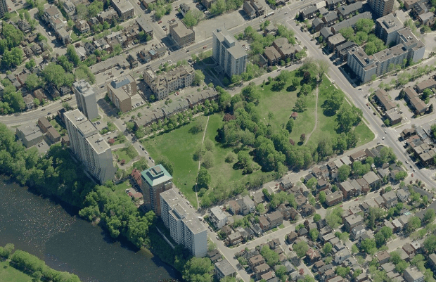
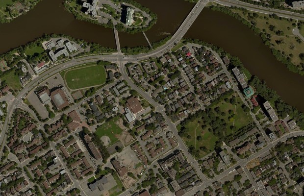
The Park of the Dead, or Macdonald Park. (image: Bing Maps)
Today the quiet park sits much as it has for over a hundred years, its boundaries never shifting, and no new buildings have ever been built atop the lost souls that still lie below the surface. For those that know the haunting secret beneath, the park is a grim reminder of a time when it was where the dead were parked.
Andrew King, January 16, 2017
SOURCES
http://www.bytown.net/oldcemeteries.htm
Bing Maps
Google Maps
Google News Archives, The Ottawa Citizen, Feb.21, 1936
Map of the City of Ottawa, Published by A.S. Woodbrun. Ottawa, 1885
http://www.cbc.ca/news/canada/ottawa/more-bones-found-during-queen-street-road-work-1.2455001