
A stroll in the forest is great for the mind and soul, soaking in the sounds and sights of nature while escaping the absurdities of life, and sometimes you even stumble across something unexpected. It wasn’t a dead body, or a $50 bill, but rather an unusual arrangement of boulders and an “Ontario Well” post. Curious as to what was once situated on this forested hill overlooking the Jock River near Woodroffe Avenue, I returned home and started investigating, leading me on an adventure through time to uncover The Lost Chapel.
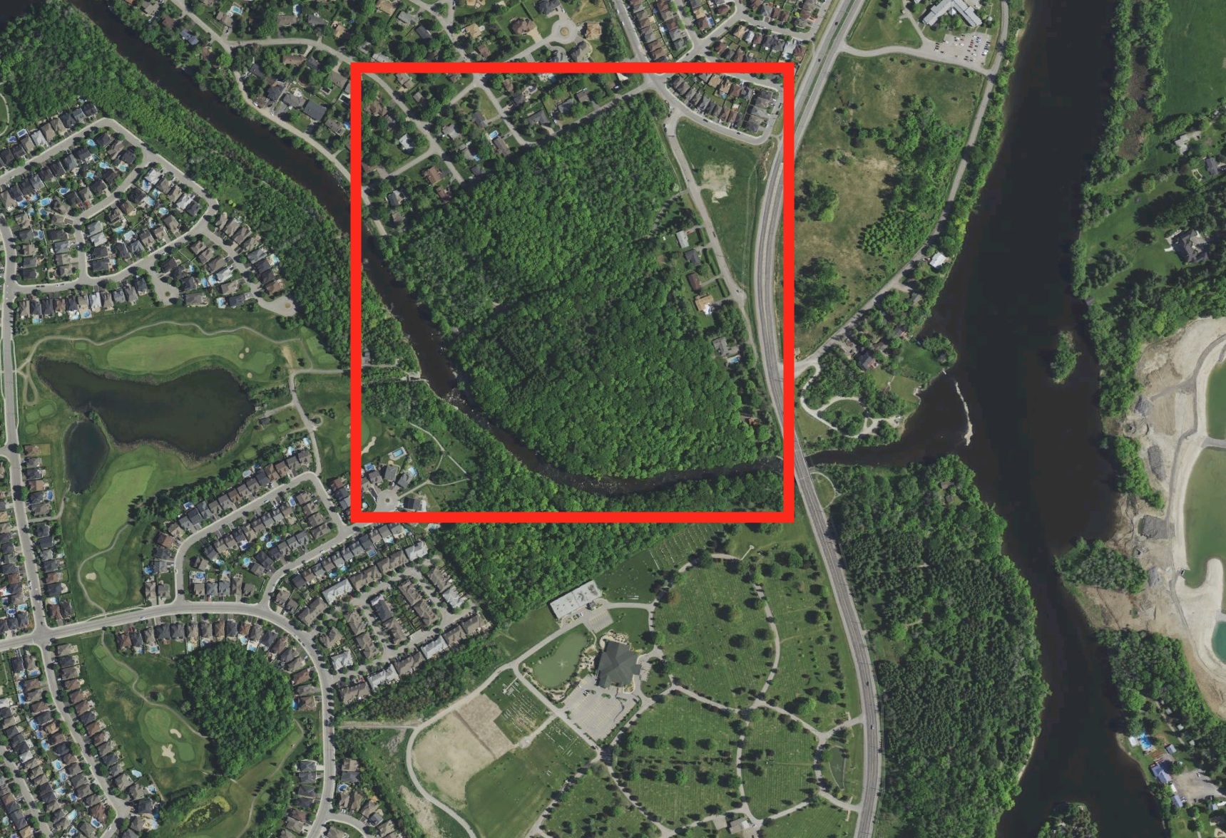
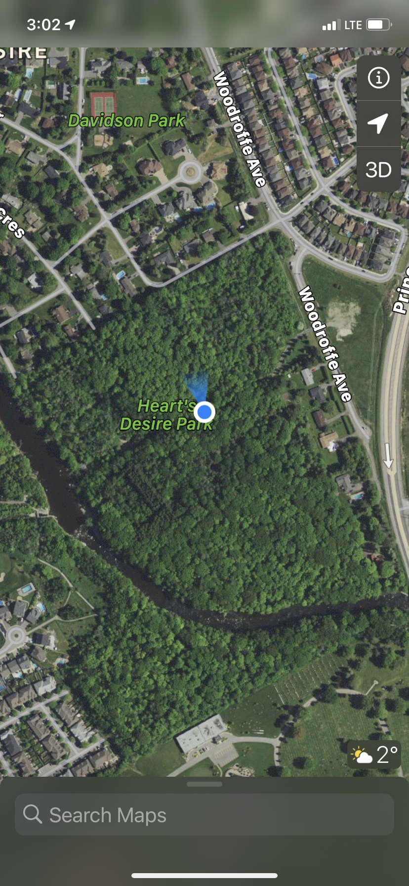
The area in question is a slice of land called “Heart’s Desire Park” and is maintained by the City Of Ottawa at the southernmost end of Woodroffe Avenue at Prince Of Wales Drive. Being surrounded by heavily developed Suburbia, I wondered why this slice of prime land escaped development, a beautiful forest on the banks of the Jock River.
Was there some archaeological site within that has been lost in time? Well, a quick Google Search turned up nothing, so I figured with all the development around it, an archaeological assessment must have been done around here, so I checked out that angle.
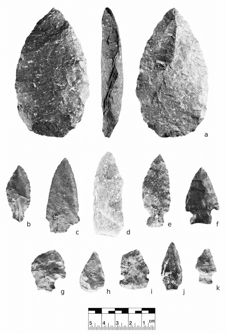
Lo and behold, an archaeological site that was 8,000 years old, BhFw-19, called the “Munro Site” was nearby, a Middle Archaic Period site (approx 6,000BC!) was discovered in 2011. At that site, which is now under a suburban street in Riverside South, they found Archaic Period artifacts like a quartz bi-face. So what might lie in the Heart’s Desire Park?
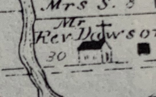
I could find nothing else about that particular area until I read up on the area which is marked lots 10/11 and indicated on a map from 1863. The lots of this particular area were owned by a Mr. George Sherwood, who later sold his land to a Mr. William Dawson in 1877. And this is where our story begins…

When William Dawson acquired Lots 10/11 in 1877 they were at the intersection of what was then called Jockvale Road, later Woodroffe Avenue. There was also the forced road from Richmond Road called “Bren-Maur Road”, part of the whole Chapman’s Mill area.
At was at this time that Dawson built a wooden chapel that measured 37ft by 21ft.
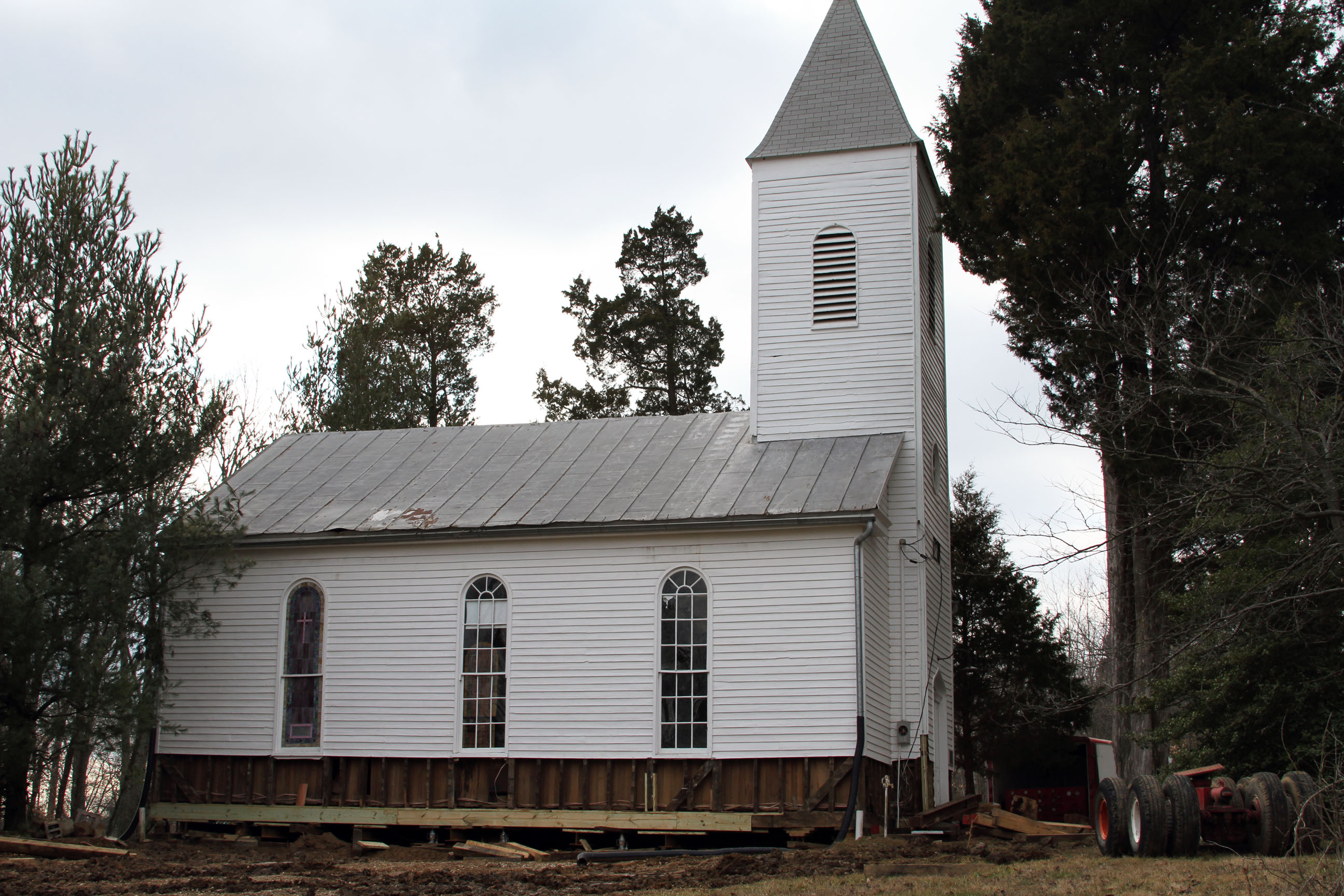
Dawson’s chapel was built on the land that overlooked the Jock River, and had a capacity of 80 persons, with 16 pews and served 45 families from Blacks Rapids, Gloucester, and Manotick. It was called “St. Margaret’s of Jockvale”
After Father Dawson died and his little chapel was deemed unfit for further service by the diocese. Dawson in his will stated that he wanted his land to never be sold, only used as a playground to be enjoyed. His little chapel would later be rented as a barn used to store hay before being demolished at some point, vanishing into obscurity as it became a forested city park.
LOCATION
So where was Dawson’s chapel, one of the first Catholic places of worship in South Ottawa? Using an old 1879 Belden Atlas I was able to find his chapel sketched on the map, right in the middle of his lots 10/11 off Woodroffe Ave. Ghosting that old map over a current Google Map and a GeoOttawa land parcel map, we can then pinpoint roughly where Dawson’s chapel would have been.
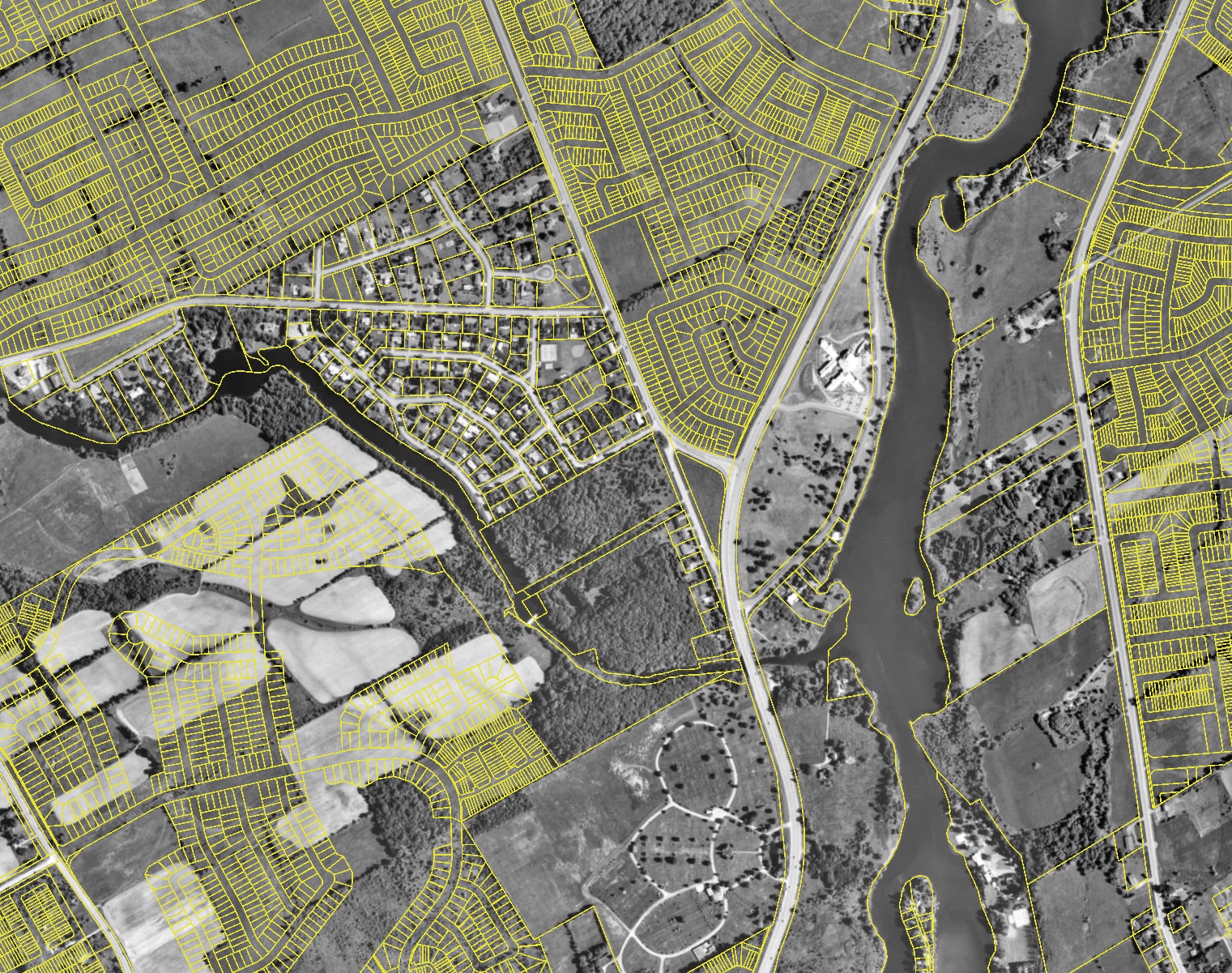
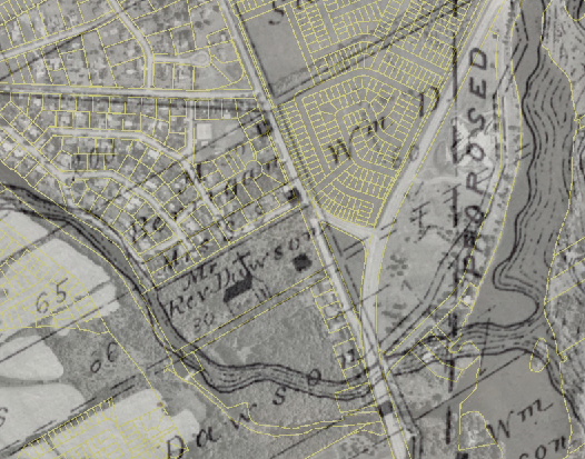
Pinning that location on my phone, I ventured out to the Heart’s Desire Park (not sure the origin of that name) and found the old roadway that led to the chapel. Trudging through the brush and following what was left of the old road, I came upon what looked to be the remains of Dawson’s house, as indicated on the map.

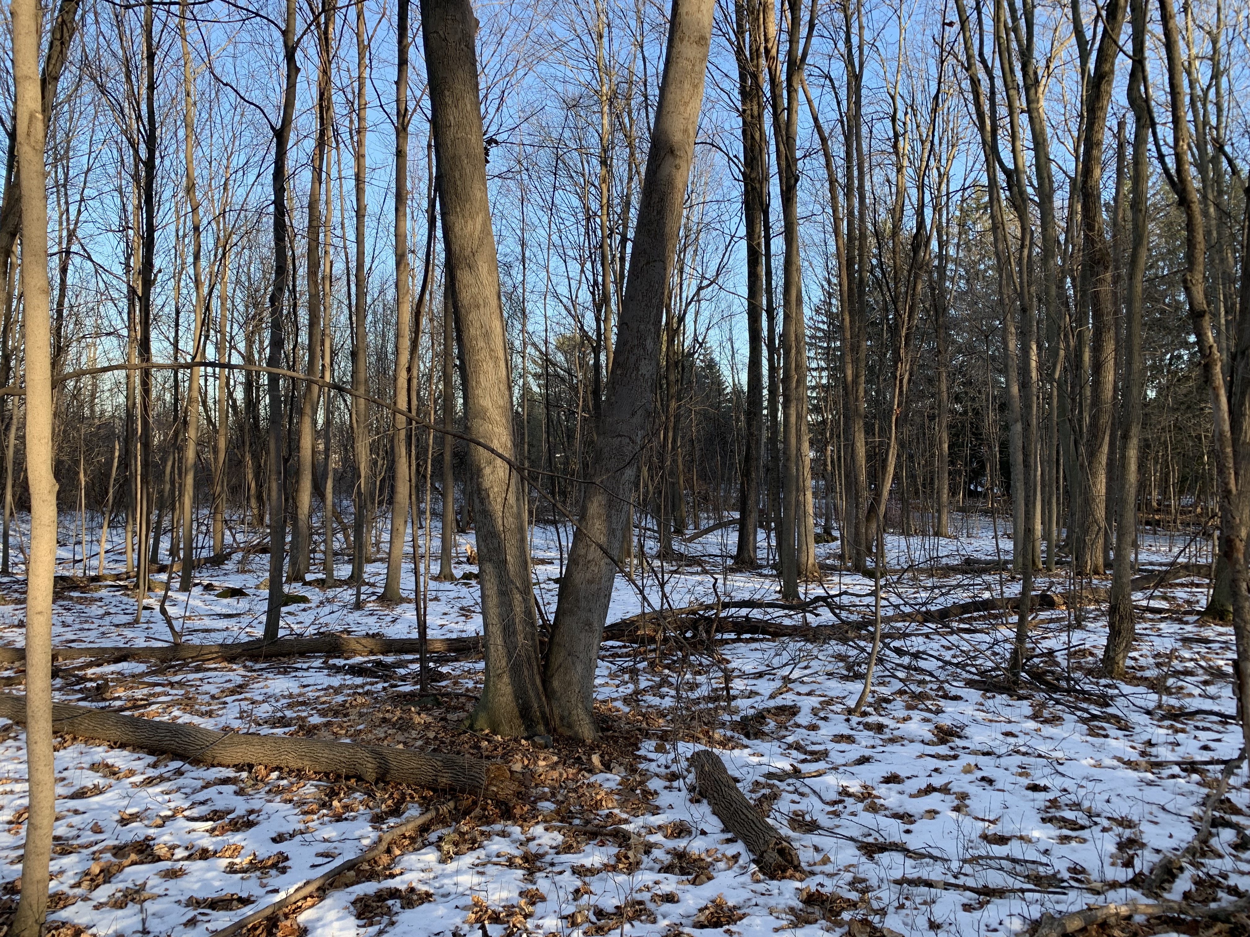

Just a depression in the ground with a pile of strewn stones, likely from the foundation. Onwards I went, up the old road, now overgrown with trees and covered in snow, another depression in the ground exactly where the church was indicated to be, halfway between Woodroffe and the Jock River.

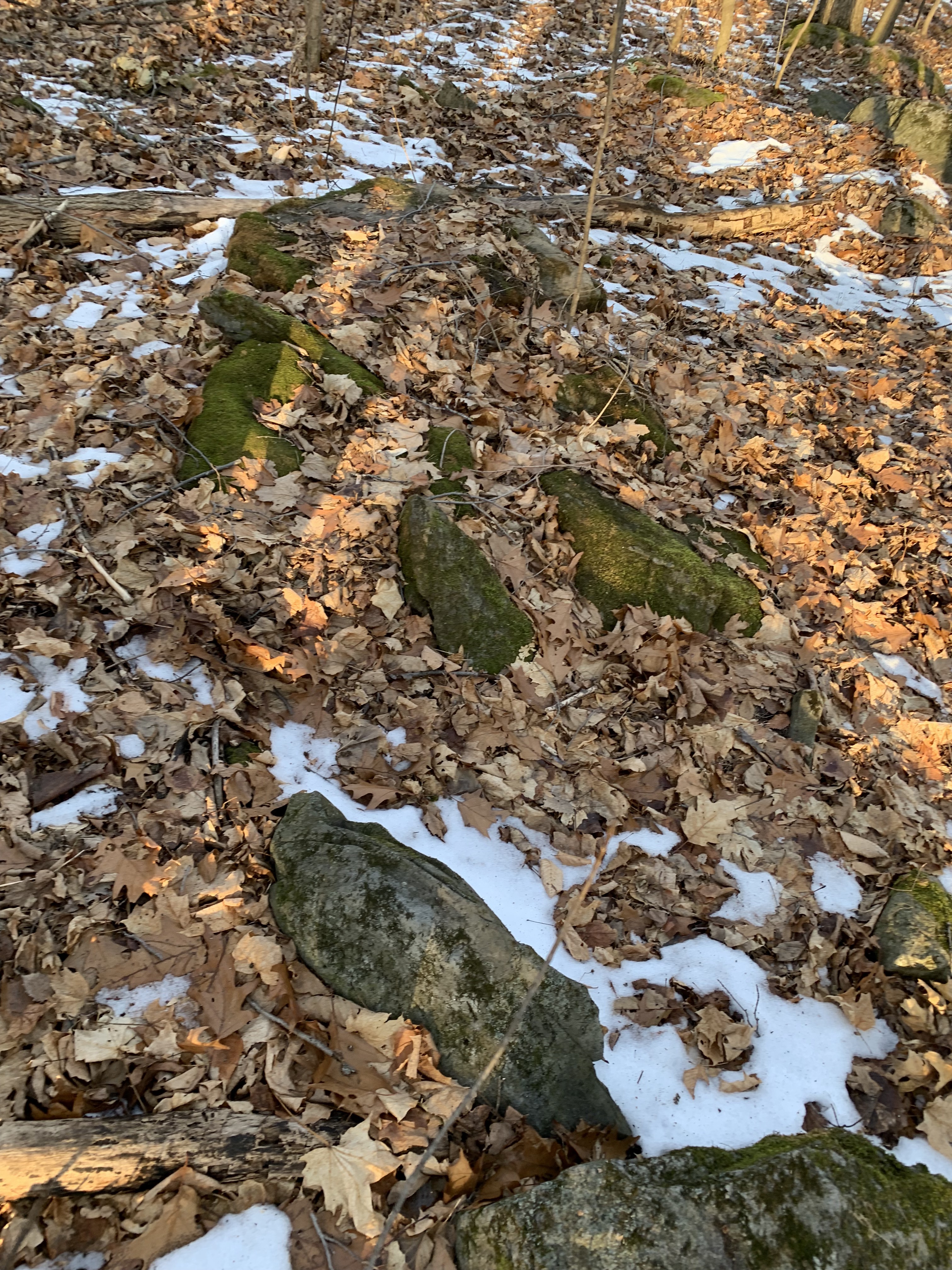
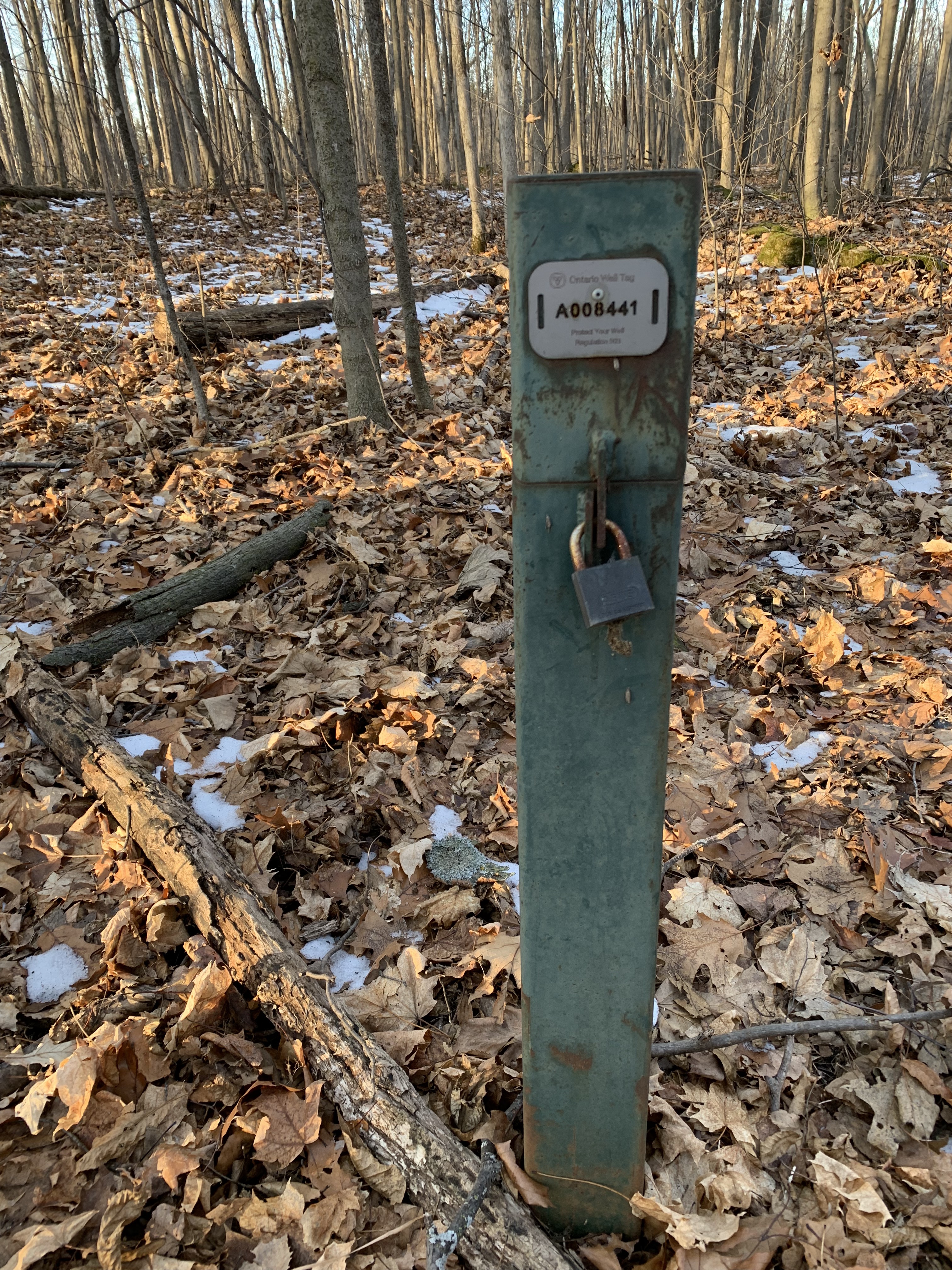
An Ontario Well post was visible, and again, more strewn rocks, likely from the foundation of Dawson’s Chapel. His wishes continue to be granted as his land has not been developed and it remains a park, but no plaque is there to recognize this obscure hidden history, but that is par for the course in Ottawa it seems.


With a crust of frozen snow and ice covering most of the site, it is hard to determine if other remnants of Dawson’s 1879 chapel exists, perhaps the City Of Ottawa may want to further investigate this hidden piece of history, or not, and let the forest continue to consume the memory of the Lost Chapel in The Woods….
Andrew King, December 2021
SOURCES
http://www.bytown.net/longisl.htm
GeoOttawa
Belden’s 1879 Atlas of Carleton County

