
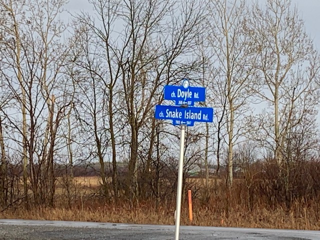
Driving along River Road south of Ottawa is a always a pleasant experience, with scenic views of the Rideau River on one side and pastoral farm fields on the other. Then you pass a crossroad called Snake Island Road and visions of a cursed island full of deadly snakes comes to mind. This would seem like a fictional scenario, except upon further investigation it’s actually true….there once was an island full of snakes that the road is named after.
So my quest begins…
After the Rideau Canal was completed in 1832 hundreds of unemployed laborers started to settle around the areas they once worked, the majority being of Irish descent. They traded in the pickaxes for pitchforks and switched from building canals to barns, with many of them settling in the areas south of Ottawa.
A settlement grew out of the wilds near Greely with the families of O’Connor, Devereaux, Shea, Tobin, and Otto all building a new life in the area of raised land amidst swampy marshes around Concession 4/5 and Lots 20-22.

It was here on this raised land amidst the boggy marsh a settlement of families flourished finding a new life after the canal was finished. Yet what the families did not expect to find was that their new home was also the home of hundreds of snakes.
It seemed the swamps around them were home to a large population of water snakes and black rat snakes, who would seek the higher ground when not hunting for prey in the marsh. Countless snakes slithered around the area and were said to grow up to six feet, likely the now endangered Black Rat Snake, which is the largest snake in Canada.

One settler and his wife, John and Sally, allegedly experienced what would be a deadly snake attack. John decided to venture into the swamp and cut down some marsh reeds to feed their cow over the winter. John gathered his scythe, lunch and pipe and headed off the island to harvest the plentiful marsh reeds.
John soon came across a large snake that reared its head and lunged at John with its open fangs. Sadly for John, the fangs bit into his leg, and he required immediate medical attention which was provided by a passerby who saw the snake attack. John was bandaged up but the snake bite worsened likely by infection, and John soon died.
Not long afterwards the swamps were drained to create farm fields for the settlement, and the island of giant snakes disappeared as the surrounding waters receded.
So where was this legendary Island of Snakes exactly located? If you follow Snake Island Road from one end to the other, it begins at River Road near Kars, and stretches east to Metcalfe. It was along here that the island of snakes was located, but if the snake filled swamps were drained, where would this island have been?

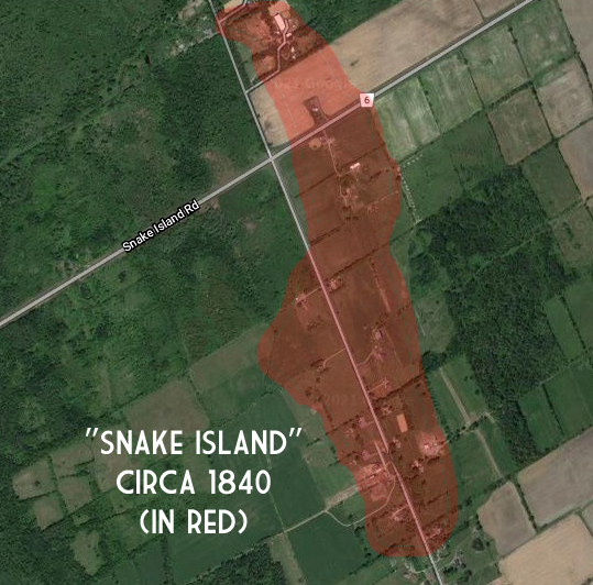
If there was an island in a swampy land, that island would be the highest elevation topographically. That’s when I consulted a great topographic map resource and found the exact elevations of the area. The topo map revealed a highest elevation of about 92m in a marshy area, which would most likely have been the old Snake Island settlement.


Using the old 1880s family names of those that settled on Snake Island, I researched a map from 1879 and saw all those same family names in that same area of high elevation. The two corresponding pieces of evidence thus pinpointed the spot that would have been the Snake Island Settlement.

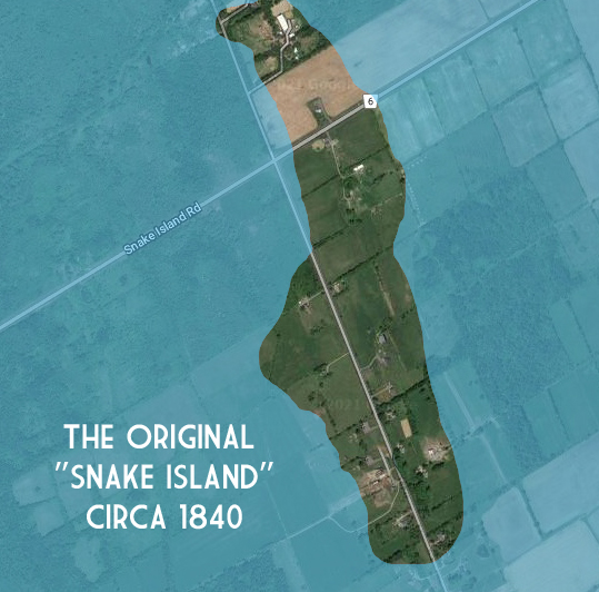
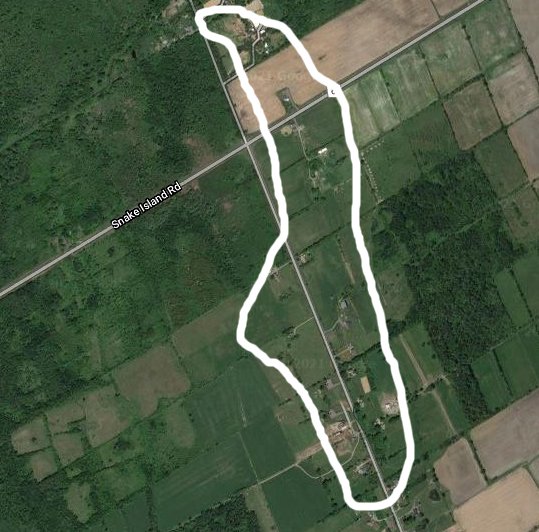
I drove out to this area to investigate and sure enough it is a very swampy area but the road climbs to a higher elevation area that would have been the original Snake Island.
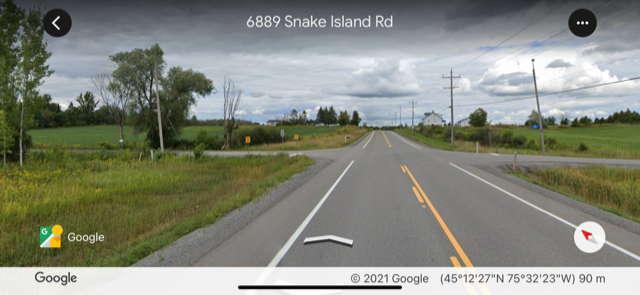
This is at the current crossroads of Snake Island Road and Swale Road. There is even an out of place 1800s stone house (most period homes in this area are wood or log construction) on the top of the hill that would most likely would have been built by a former canal lock labourer who had previously built the stone locks on the canal.


Referencing the old 1880 map of that intersection shows the stone home would have belonged to the O’Connor family, which is listed as one of the settlers on the original Snake Island. There was even a Devereaux Road south of the intersection to confirm the location of the lost island.


A visit to the area reveals that much of that original snake infested swamp still surrounds the area, a reminder of the early days that gave Snake Island Road its legendary name.
Andrew King
March 2021
SOURCES
http://www.bytown.net/snakeisland.htm
https://en-ca.topographic-map.com/maps/q4e/Ottawa/
Google Maps
Historical Atlas OF Carleton County. Belden. 1879
