DISCOVERY
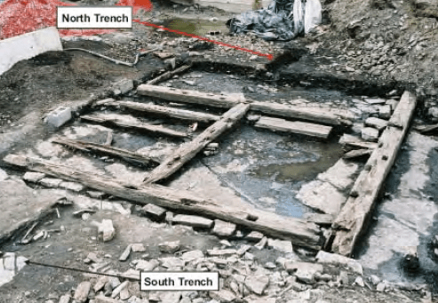
A recent archeological dig on the southwest tip of Newfoundland could reveal a possible second North American Norse settlement that has ignited both the imagination and disdain of many. If proven to be authentic it will validate the Vinland Sagas that spoke of Viking age explorers continuing from their first L’Anse Aux Meadows site to venture further into North America. Many are skeptical they went further, and rightly so, as many past Norse finds elsewhere have been proven to either be a hoax or inauthentic.
Some argue that unusual ruins or remains being considered of Norse origin are a misappropriation of Indigenous cultures. There is no question that Indigenous people have left their mark on this land, along with French missionaries and other colonists who may have created these unidentified remains, but without authentic evidence at the site in question, it is difficult to confirm who made them. However, we should be wary of stifling advancements in archaeological studies of possible Norse settlements because they are deemed too far fetched or nothing more than typical accepted history.
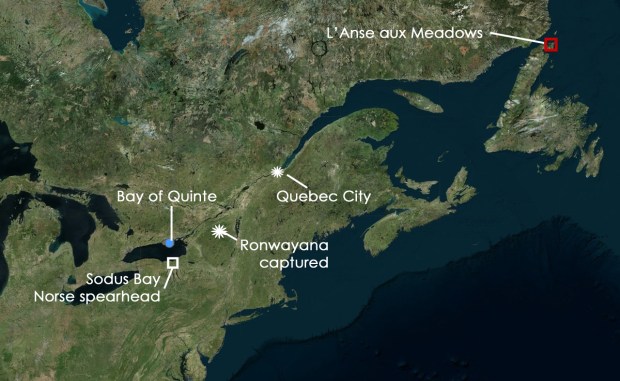
Map showing places of incident in the account of a Viking in the Bay of Quinte.
It should be noted that it was once thought the ruins at L’Anse aux Meadows were simply “Indian Mounds” and that the idea of them being of Norse origin was outlandish. Questioning these “Indian mounds” and using Vinland Saga source material as their guide along with help from the locals, the mounds were finally excavated by the Norwegians Helge Ingstad and his wife Anne Stine, an archaeologist, who in 1960 found remnants of a a Viking settlement at L’Anse aux Meadows. It was conclusive proof that the Greenlandic Norsemen had found a way across the Atlantic Ocean to North America, roughly 500 years before Christopher Columbus. The Ingstads proved the site was an authentic Norse settlement with the artifacts to confirm it, and not what it was once accepted to be.
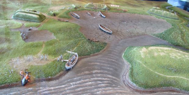
Diorama replica of how the Norse settlement at L’Anse Aux Meadows looked. (Image: Wikipedia)
The site is now a Parks Canada National Historic site and according to Brigitta Wallace, Senior Archaeologist for Atlantic Service Centre of Parks Canada, the L’Anse Aux Meadows site was merely a stepping stone for the Vikings to explore further. “Archaeology of the L’Anse aux Meadows site shows that many elements of the Vinland sagas are factual, in particular Erik’s Saga’s version of the settlement. The Norse did indeed have a northern base camp. This, in turn, lends plausibility to the claim in the sagas that they had some sort of summer/early fall camp farther south.” says Wallace from her 2003 study The Norse in Newfoundland. It also matches the story as told in the Vinland Sagas that describe a place further south called Vinland where there were grapes, butternuts, wild rice, lumber, and plentiful game.
It has been an ongoing mystery as to where this other Norse settlement of Vinland is located, with some experts placing it along the Atlantic East Coast with others saying it was down the St. Lawrence River, both areas where the described items can be found. A number of artifacts have been found to back up claims for each, but they are said to be either hoaxes or inauthentic.
So how can we determine where Vinland is located without treading into the dangerous waters of Indigenous misappropriation or unfounded speculation? It would seem logical to look into the stories of a time when the Vikings sailed Canadian waters as told by the people who were said to interact with them: The Indigenous People. Perhaps insight can be gained from their oral histories around the time of 1000AD when the Norse were said to be exploring. Stories told by Inuit elders helped researchers locate the lost 1846 shipwreck of Franklin’s doomed arctic expedition, the HMS Erebus which was found in 2014. Louie Kamookak, a historian in Gjoa Haven, the community closest to the Franklin discovery, spent more than 30 years interviewing elders to collect the stories passed down about the Franklin expedition.
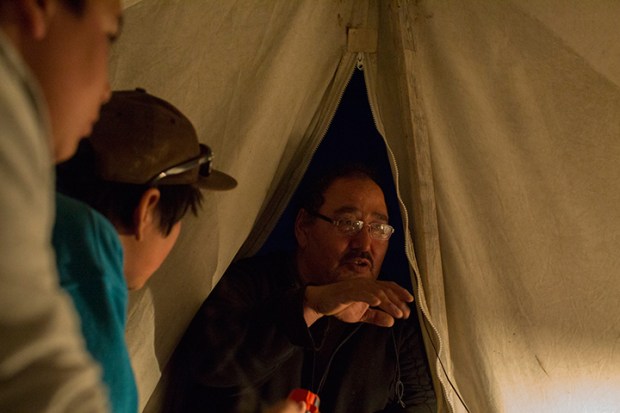
Louie Kamookak, Inuit historian who helped archeologists locate the lost Franklin ship used stories passed down through oral history to locate its position. (Image: Canadian Geographic)
Kamookak then sat down with Parks Canada in 2008 before the search began and provided them with information as to where the ships would likely be found, leading them to the wreck. Using this same theory of noting native oral history stories could shed light on where Vinland may be located, or at least provide some clues to whether it was real, or just a myth.
We should be able to find evidence in the oral histories of Indigenous tribes that Norse explorers ventured into Canada and interacted with them. According to the Vinland Sagas The Norse called the natives they encountered “skraelings”, of which they at first enjoyed trading with amicably, but over time they both become hostile towards each other. The interaction between the two must have been great since it was recorded as part of the Viking Vinland Sagas, and by that same reasoning, one would assume that it must have had an equal impact on the natives who may have also have also recorded it.
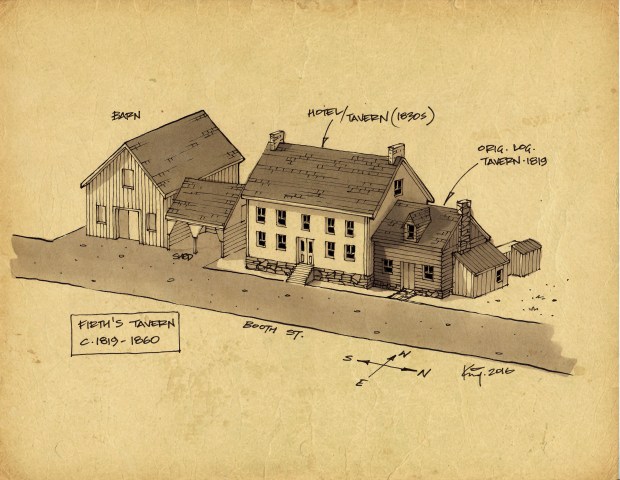
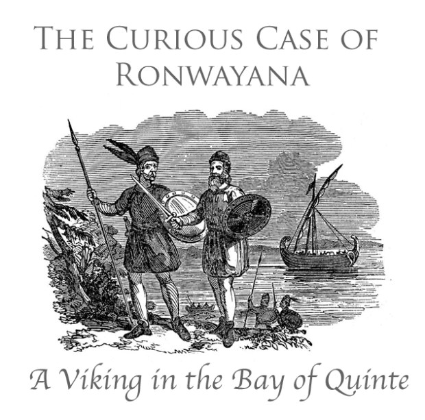
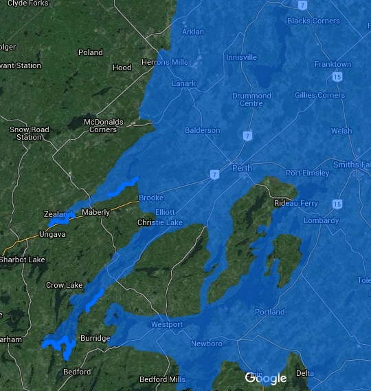
Based on this theory I researched a number of First Nations of the St. Lawrence and Lake Ontario area to see if they had any stories of odd new visitors that may have been recorded. This research led me to the Bay of Quinte region of Lake Ontario, more specifically the Tyendinaga Mohawks who had their oral history recorded in a manuscript by author Wallace Robb. Robb lived among the Mohawks and recorded their rich history and stories of their people on the Bay of Quinte. The manuscript was called “Thunderbird” and within it is the astonishing account of a Viking boy living among the Mohawks called, Ronwayana.
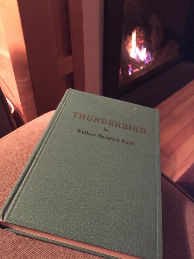
The oral history and stories passed down of the Bay of Quinte Mohawks were written down in the 1940s in a manuscript called “Thunderbird”.
THUNDERBIRD
Author Wallace Robb was born in 1888 and lived in Belleville with his father William Robb, a higher-level employee of the Grand Trunk Railway Company. The region was then called Kente, later known as Quinte. As a child Robb watched a disturbing incident where he saw “white man pummel and kick a helpless Indian,” according to the Historic Kingston Society records. From that moment on Robb began to study the vanishing legends and history of the native people living on the Tyendinga reserve just east of Belleville. In the 1940s Robb lived with the Mohawks at Tyendinaga and became fascinated with their lore and the stories passed down through oral storytelling and decided to record them on paper. In October 1948, Robb was adopted by blood rite into the Mohawk nation of the Kente and gave him the name of Gon-rah-gon O-don-yoh Go-wa or “Great White Eagle”. The stories were published in 1949 in a book called “Thunderbird”, a copy of which I found in a local antique book store.
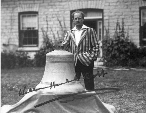
Author Wallace Robb who documented the stories of the Tyendnaga Mohawks passed down through generations in the Bay of Quinte.
Within the pages of Thunderbird the Mohawks describe in great detail the geography of the Bay of Quinte with astonishing accuracy that I can attest to being correct as I grew up in this same area and have traversed both the waters and lands mentioned in the book. Keeping in mind the stories are part of Mohawk folklore and could have been embellished over time, it was still surprising to read of a Viking boy, a youth with blonde hair and blue eyes they had captured on a hunting trip and taken into the tribe, a story told decades before the Vikings were uncovered in Newfoundland.
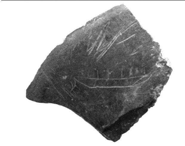
One of the manny accounts of a Viking boy being captured and living among the Mohawks in the Bay of Quinte.
The Mohawks explain they gave him the name Ronwayana, as he had no name when captured from the Algonquins near the Adirondacks. The boy only spoke Algonquin, and the story continues that the Mohawks of the Quinte region knew of such a “white people coming out of the far and unknown seas of salty water.” The Viking boy Ronwayana, aged about 14 years upon capture, recounts how he “lost his father somewhere on the River of the Iroquois down near the sea.” (The River of the Iroquois was the name given to the St. Lawrence River by Indigenous people) which could place the Viking boy and his father near Ile D’Orleans by Quebec City where the river estuary meets the salt water of the sea.
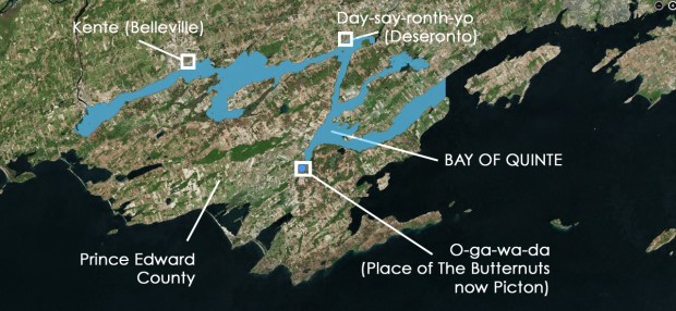
Map showing the various places mentioned in the book.
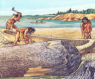
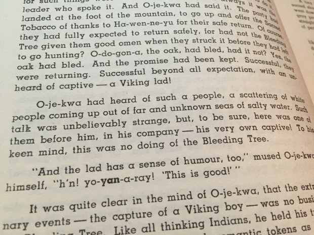
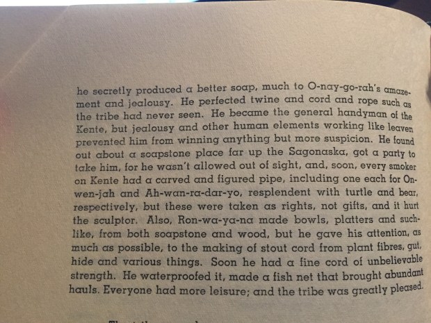
Ronwayana had with him an iron dagger, which was confiscated but later returned to him that he used to later shave his growing beard which mystified the Mohawks. As the Viking boy grew, he assimilated into the Mohawk tribe and showed them things his father had taught him. With spruce resin, animal fat, wood ash and volatile oils Ronwayana made a superior soap much to the amazement of the Mohawks. As the Viking gained the trust of the tribe he was allowed to venture to a small island across from the village of Kente, which is described as being at the mouth of the Sagonaska, now called the Moira River and the location of present day Belleville. On this island, which is now called Zwick Island, Ronwayana secretly began to build a “hollow raft” with a “kite” of cloth built with cedar and a gum he had perfected which the Mohawks used to repair their canoes. The “Viking lad” as he is called by the Mohawks perfected a “twine and cord and rope such as the tribe had never seen”. He carved soapstone pipes for the elders of the tribe, bowls and platters out of wood and stone, but spent most of his time perfecting a “stout cord from plant fibres, gut, and various things” which had unbelievable strength that Ronwayana also waterproofed and made into fishing nets. (of general interest, Bridgeline Ropes, the largest manufacturer of superior ropes in Canada was located in Deseronto within the Tyiendinaga Mohawk reserve.)
The Mohawks describe the Viking as someone who created a variety of items for the tribe such as soap, rope, bowls, pipes.
It is remarkable that the account of Ronwayana’s contribution to the tribe is told by the Mohawks themselves, which can not be labelled a misappropriation of their culture since this is their very own story, and it is a story told BEFORE the unearthing of the Norse at L’Anse Aux Meadows.
QUINTE AS VINLAND
It was during my reading of these tales that I received an email from a gentleman in Norway who sent me details about a 1960 research paper by a Professor Corrado Gini whose work covered both the social sciences and statistics. His interests ranged well beyond statistics, including the location of the Viking’s Vinland.
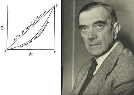
Professor Corrado Gini who theorized that the legendary Vinland was in the Bay of Quinte.
In Gini’s 1960 research paper entitled “The Location Of Vinland” Gini theorized the location of Vinland was in the Bay of Quinte. Gini writes that the Bay Of Quinte matches the description given in the Vinland Saga of the exploration of Leif Ericcson who encountered a great shoal of sand at an estuary which Gini says is the same estuary that is near Ile D’Orleans. The saga says the Leif continued down a river until he reached a lake and camped on its shores where he found wild grapes, wild rice, butternuts, trees the Norse called “Mosurr” (oak or maple).

Butternut found at L’Anse Aux Meadows

Range of butternuts in the St.Lawerence, Lake Ontario region.
Gini says that the Bay of Quinte is the most logical area that matches Vinland, based on the fact that the terrain, wild rice, wild grape vines, and the other described items lie within here. This of course is pure speculation and could be coincidental, but the stories of a Viking in the area as described by the Mohawks could lend crediblilty to the idea that Norse settlers were possibly in the area. The body of water known locally as Hay Bay was once called O-je-kay-da, or the area “full of wild rice”. The place called O-ga-wa-da, was the place of butternuts, now known as the town of Picton in Prince Edward County. It was a butternut that was found in L’Anse Aux Meadows, not native to Newfoundland that revealed the Norse settlers had ventured elsewhere and brought back such a nut from an area where they do grow. In 1929 an authenticated genuine Norse spearhead was uncovered 70km south of the Bay of Quinte in Sodus Bay, New York.

Authenticated Norse spearhead found in Sodus Bay, NY, 70km south of the Bay of Quinte.
How it got there remains a mystery, since the Vikings never traded weapons with the native population. Was it lost in battle and traded to the area or were the Norse at that location just south of the Bay of Quinte? When a number of clues like these start to stack up, one has to question why.
Checking with other tribes of the Lake Ontario region, the St. Lawrence Iroquois that inhabited the St. Lawrence River area have stories of being invaded by a nation of men of giant stature, few in number, called Ronongweca, After retreating from them, they gathered a large number of their own men and defeated them, after which they were supposed to be extinct. It is interesting to note that the Viking boy is named Ronwayana, and the name given to the giants are Ronongweca. This story of giants also matches the Vinland Saga story of the Norse first encountering skraelings of whom they attacked and made retreat but later the natives came back in large numbers and made the Vikings themselves flee back to Greenland.
A SAILBOAT
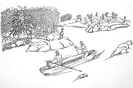
When the great Thunderbird story of the Mohawks concludes, Ronwayana escapes Kente with a beautiful Mohawk girl that he had fallen in love with and the two lovers climb aboard his “raft with a kite” and used the wind to go faster than any of their canoes. The Mohawks also describe the vessel as having ropes and an upright paddle. This seems to describe a sailboat with a mast, sail and a rudder, a boat of which Ronwayana was familiar with in his past life among his family of Norse settlers. The two lovers escape under the guidance of the White Eagle that was a symbol of great importance, never to be seen again as they headed into Lake Ontario. The Mohawk story then advances generations later until the grandson of the Viking and the Mohawk woman, a blonde and blue eyed descendant of the great Ronwayana, returns to Kente where he brings peace and stability to the tribe.
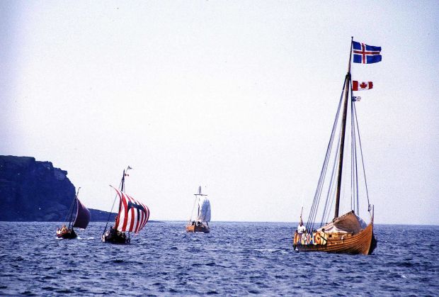
Did the Mohawks of the Bay of Quinte witness a Viking build a Norse sailboat? (Image: Wikipedia)
OCCAM’S RAZOR
In science, the term Occam’s Razor is a discovery tool to guide researchers in the development of theories rather than using the authority of accepted thought. For each accepted explanation, there may be an extremely large number of possible and more complex alternatives. Simpler theories are preferable to more complex ones because they are more easily researched. Maybe we can apply Occam’s Razor to the theory of Vinland being located either on the St. Lawrence River or in the Bay Of Quinte and not discount the important oral history of the Indigenous Quinte people that recorded in great detail the existence of a Viking in their area. If the academic world is skeptical of conventional Viking finds, perhaps we need to embrace the rich heritage and stories of the people that once lived among them. This could finally solve the enduring mystery of where the Norse travelled and if they really were in the Great Lakes region. In addition, if they were here, it also makes sense they would have taken items from this area back with them to Greenland, as described in the Vinland Sagas. We need to start doing some reverse research and look to Greenland/Iceland for items of Ontario origin that could finally prove whether or not Norse explorers indeed went elsewhere other than Newfoundland, pinpointing Vinland before the Norwegians once again, do it for us.
SOURCES
The New York Times
http://www.nytimes.com/learning/teachers/featured_articles/20000509tuesday.html
The Norse in Newfoundland: L’Anse aux Meadows and Vinland by Birgitta Wallace
https://journals.lib.unb.ca/index.php/nflds/article/view/140/236
The Norse Discovery of America, by A.M Reeves, N.L. Beamish and R.B. Anderson,
http://www.sacred-texts.com/neu/nda/nda06.htm
Nunatsiaq Online
http://www.nunatsiaqonline.ca/stories/article/65674inuit_testimony_led_searchers_to_franklin_shipwreck/
CBC
http://www.cbc.ca/news/canada/north/franklin-find-proves-inuit-oral-history-is-strong-louie-kamookak-1.2761362
“Thunderbird”, by Wallace Robb and the stories of Tyendinaga Mohawks , 1949, Abbey Dawn Press
The Kingston Whig Standard
http://www.thewhig.com/2015/03/17/the-poets-walk-of-abbey-dawn
Kaniatarowanenneh: River of the Iroquois, The Aboriginal History of the St. Lawrence River
http://www.wampumchronicles.com/kaniatarowanenneh.html
Corrado Gini: The Location of Vinland. The Institute of Economics, Papers. No. 13, Bergen 1960