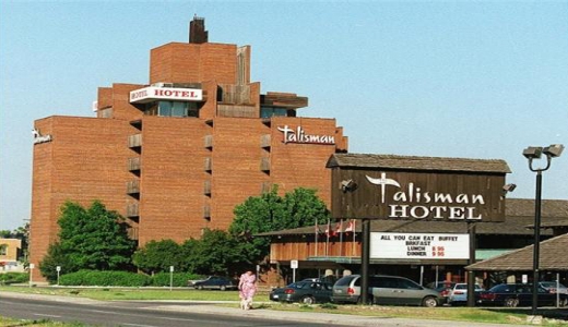
Every city has its favourite night clubs, most of them enjoying the spotlight for a few years before something trendier comes along. Every decade has its hot spots, and in the 1960s, one of the hottest, or should I say coolest night clubs was Ottawa’s “Beachcomber Room”. Located in the Talisman Motor Inn on Carling Avenue, the Beachcomber Room boasted the latest in Tiki culture and entertainment through the vision of Talisman designer William Teron.
Original 1960s postcard of the Talisman Motor Inn that contained the Beachcomber Room
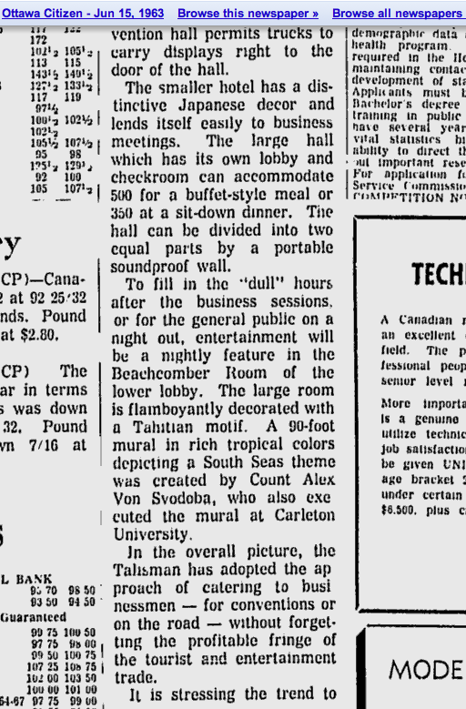
Built in 1963 as Ottawa’s premier business convention centre and hotel, Teron designed the Talisman with a South Pacific theme, including a very faithful replica of a tranquil Japanese garden at the center of the motel. The Beachcomber Room was “flamboyantly decorated in a Tahitian motif” and also featured a 90-foot mural painted by Count Alex Van Svodoba, who also completed a mural at Carleton University.
The Talisman Motor Inn as it appeared in 1989. All original signs have since been removed.
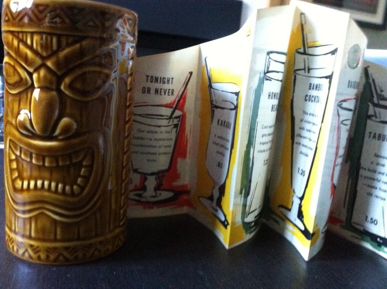
The Polynesian theme of the Beachcomber Room was in tune with the popularity of the Tiki culture during the mid-century era, which was based primarily on “Don the Beachcomber’s” in Hollywood, California. Credited as being the first tiki restaurant that all others copied, its founder, Donn Beach, was the first to mix flavored syrups and fresh fruit juices with rum. The trend became the hot ticket for Hollywood stars and elite, making the Tiki-theme a nationwide phenomenon. Ottawa was no exception, with The Tabu opening in the old Beacon Arms Hotel (now the Capital Hotel & Suites) in the early sixties and The Beachcomber Room opening soon afterwards in 1963, taking its name directly from the original Hollywood establishment.
A newspaper ad from a late 1960s Ottawa Citizen describing the Beachcomber Room with its GO-Go Girls to make “you surge with emotion”
Enjoying almost three decades of popularity as Ottawa’s hottest drinking and entertainment establishment, the Beachcomber Room was THE place to dance, listen to live music and enjoy the quintessential Tiki Mai Tai cocktail. However, as with most bars, its popularity wained and the Talisman name was dropped when it became a Travelodge and it was extensively renovated with a Kids Water Park and its unique Polynesian theme was lost. Remnants of the Japanese gardens are still visible today, as are some architectural details from its illustrious past. But where was the Beachcomber Room? What is left of it? Lets comb the beach…
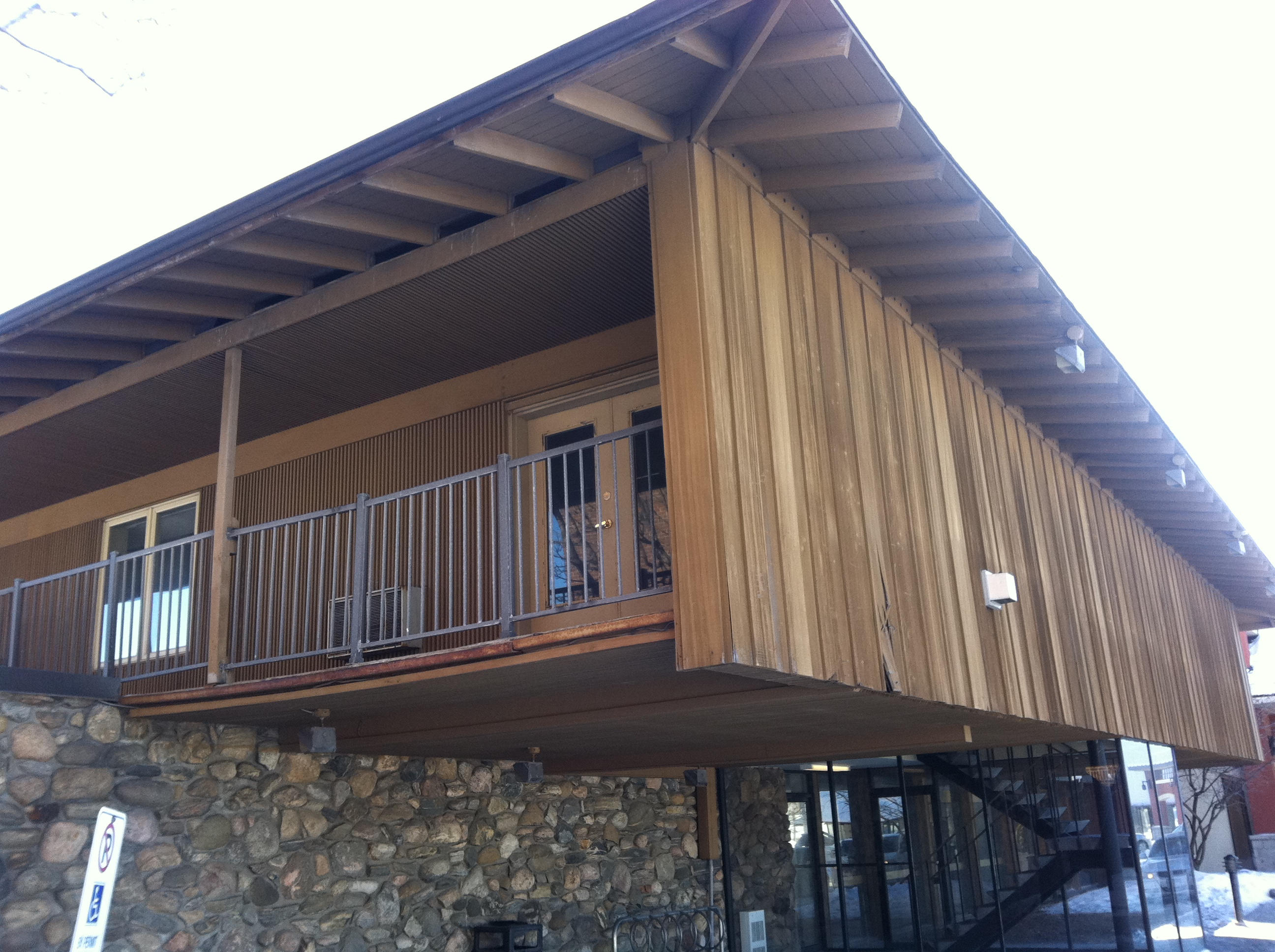
Approaching the old Talisman, its unique 1960s architectural style by Bill Teron is still evident.
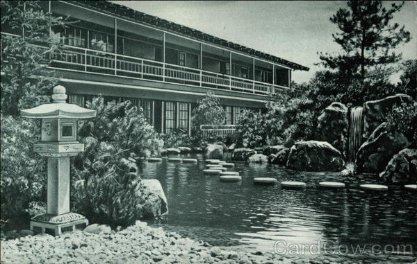
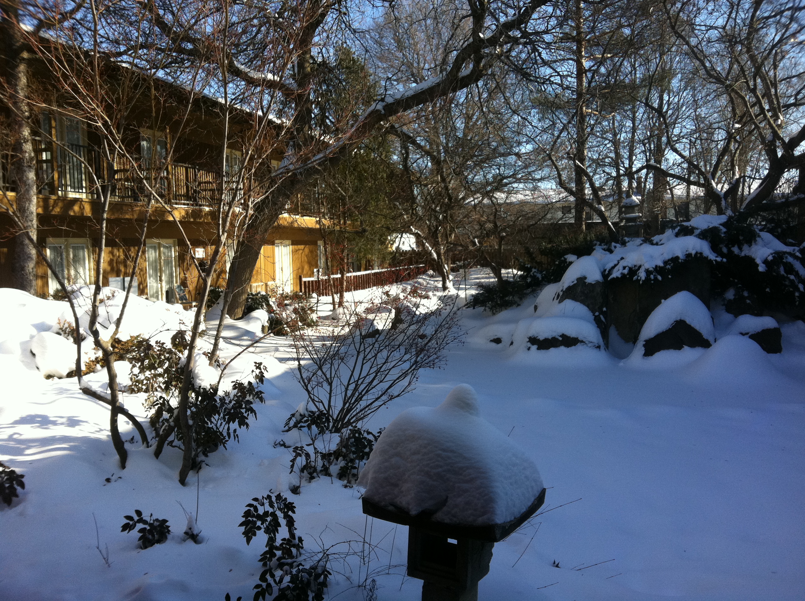
Original postcard of the Talisman central Japanese Garden…
…and that same view as it looks today.
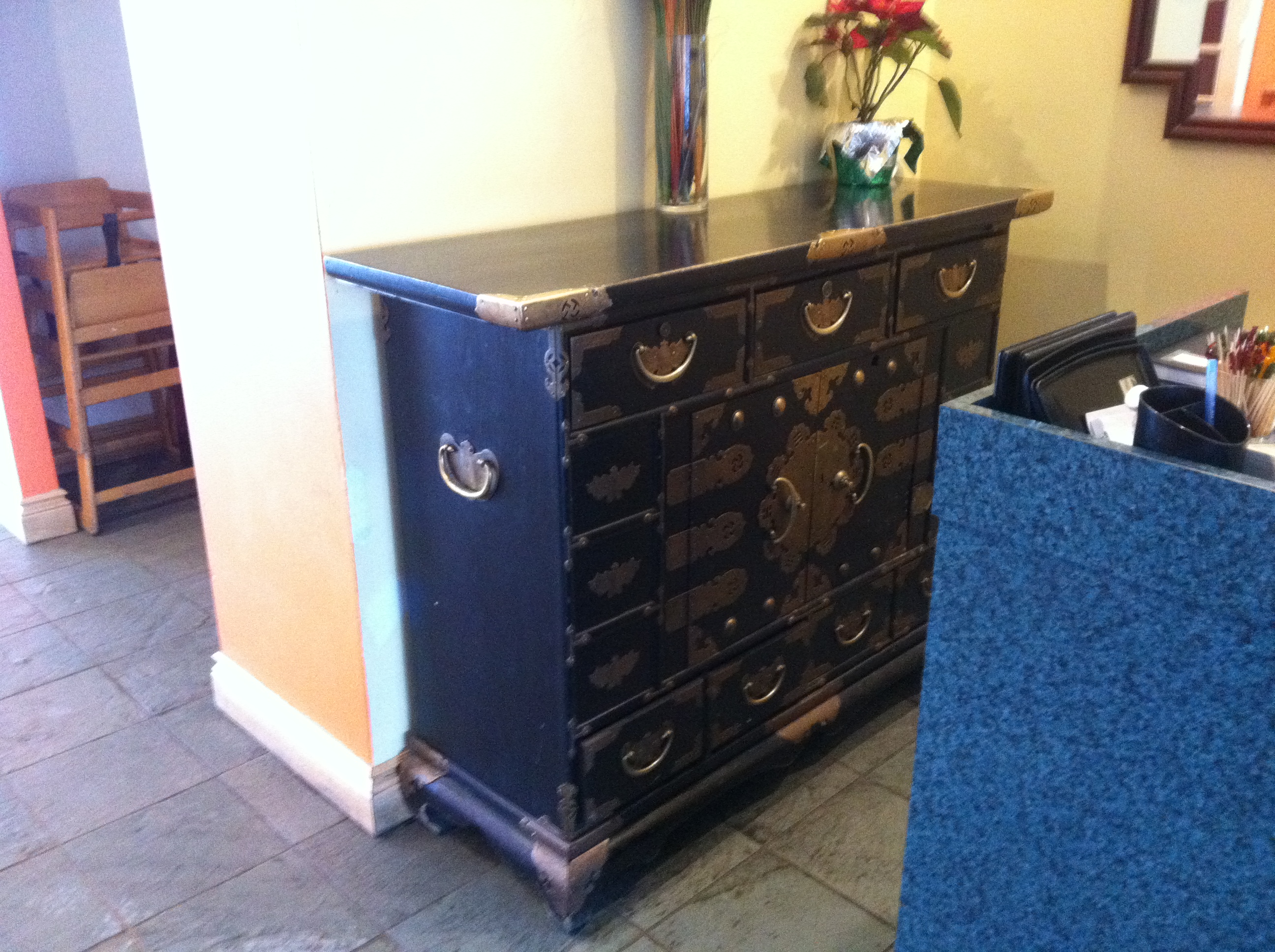
Some left over relics from the old South Pacific themed Talisman can be spotted around the present day hotel, like this Japanese hutch.
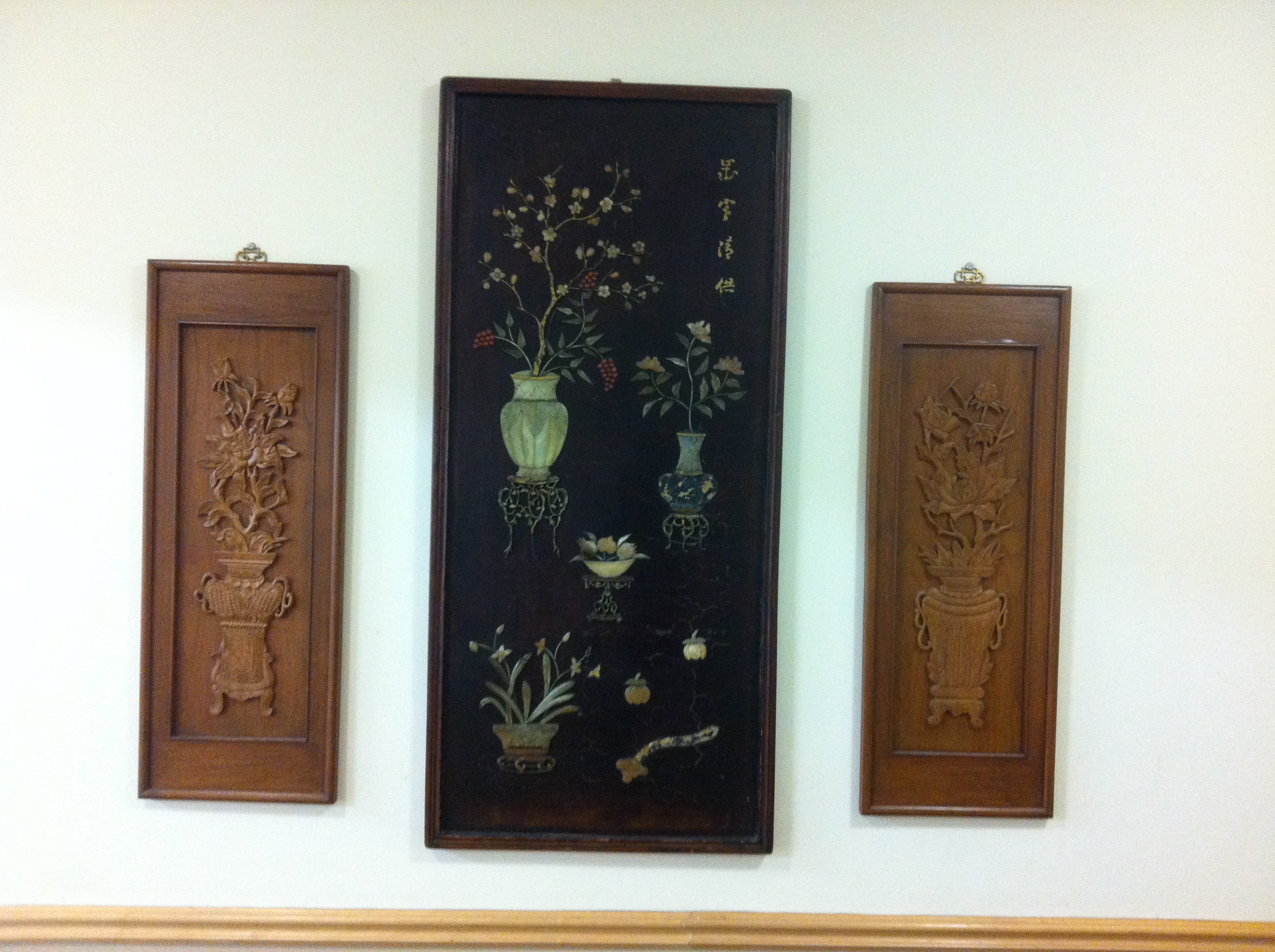
More relics of the Talisman’s glorious Polynesian past…some Asian style wall hangings on a wall hidden away by an emergency exit.
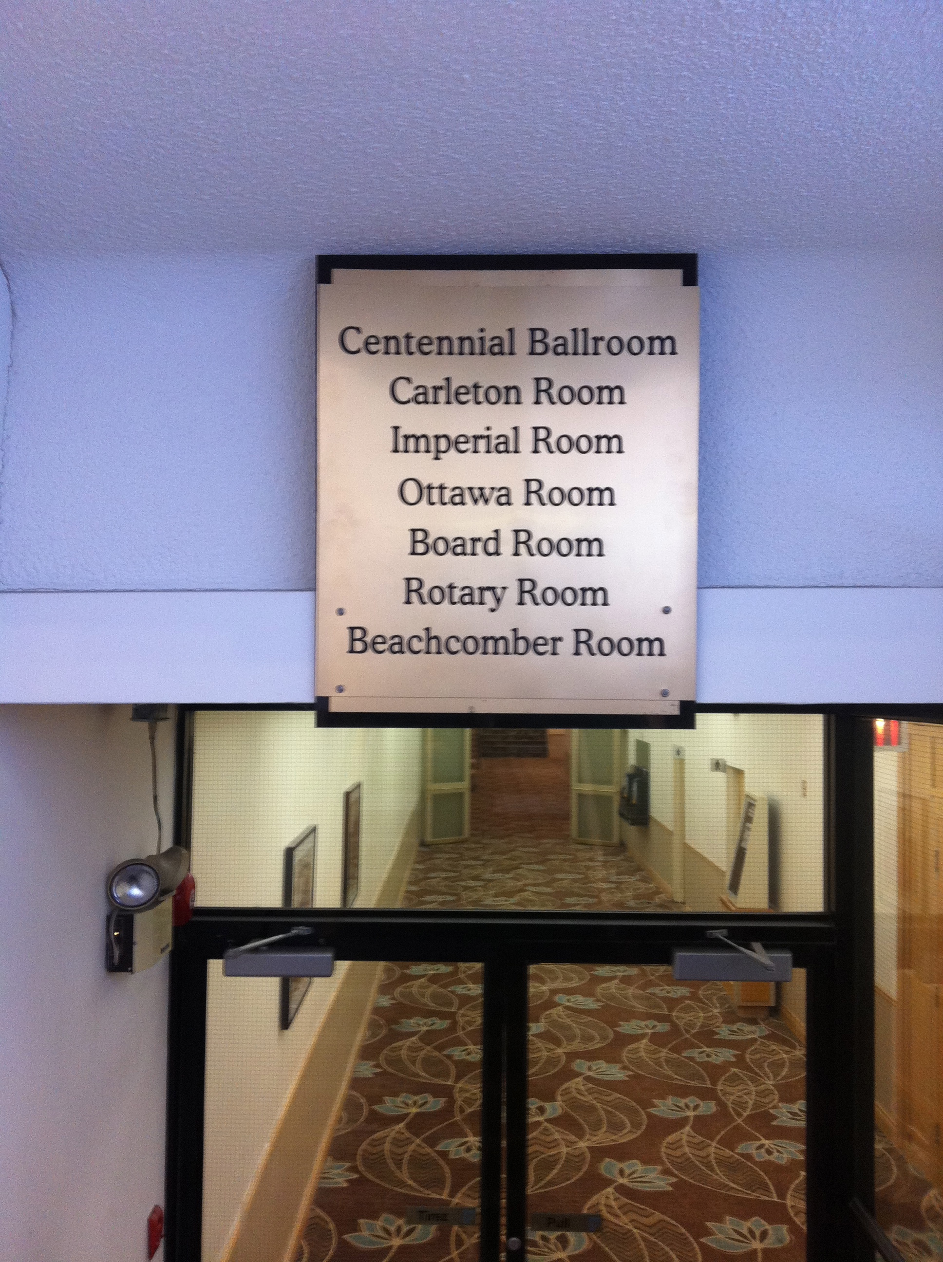
A 1963 newspaper article describes the Beachcomber Room as being in a “lower lobby” – Ottawa Citizen
A clue…marked on an old sign in the stairway is “BEACHCOMBER ROOM”
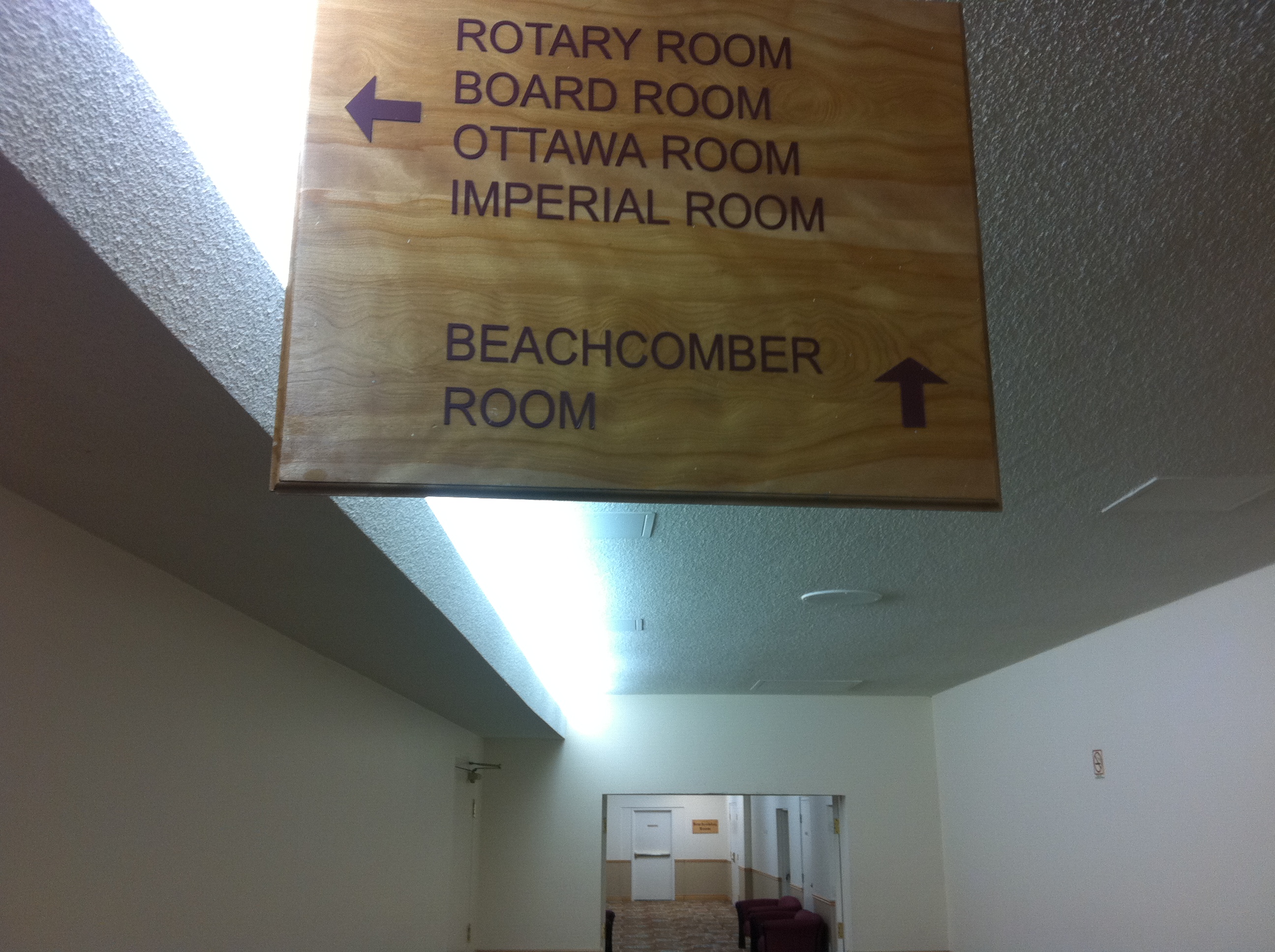
Another sign clue is leading us downstairs in the direction of the Beachcomber Room.
…and there it is. I have no idea what lies behind those doors and if the original 1963 Polynesian themed mural by Count Alex Von Svodoba is still in there.
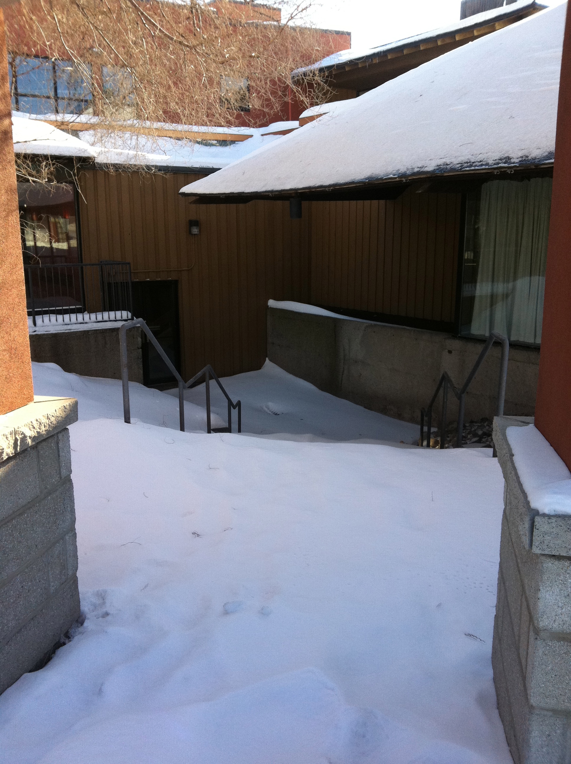
These abandoned snow-covered stairs lead down to what was once Ottawa’s hottest nightclub, the long lost original tiki-bar known as…THE BEACHCOMBER ROOM.
The current hotel website says you can rent out the legendary “Beachcomber Room”….Tiki-party anyone?
This past week I had the opportunity to join Glen Gower from Ottawa Start on a search for the remains of two 1950s motels lost in the woods of the NCC Greenbelt. Here is what we found…
INTRODUCTION BY GLEN GOWER, OttawaStart
A long-time Glen Cairn resident told me recently about an old swing set that he once saw in the greenbelt along the Old Quarry Trail on the south side of Robertson Road. He said he thought it was part of one of an old motel that used to be along the road, before the NCC bought the land and designated it as Greenbelt.
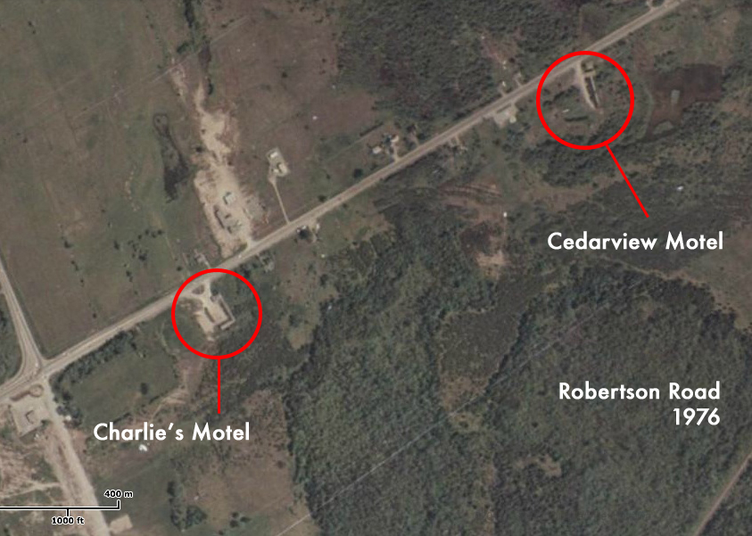
It turns out there was not one, but two motels. Charlie’s Motel and the Cedarview Motel are visible on a 1976 aerial map of Ottawa. Charlie’s has a distinctive striped roof. Back then Robertson Road was known as “Highway 7” or “Highway 15”. Long before the Queensway was built, it was the route to get from Ottawa to Perth and beyond. So these would have been a popular stop for travellers going to or from Ottawa.
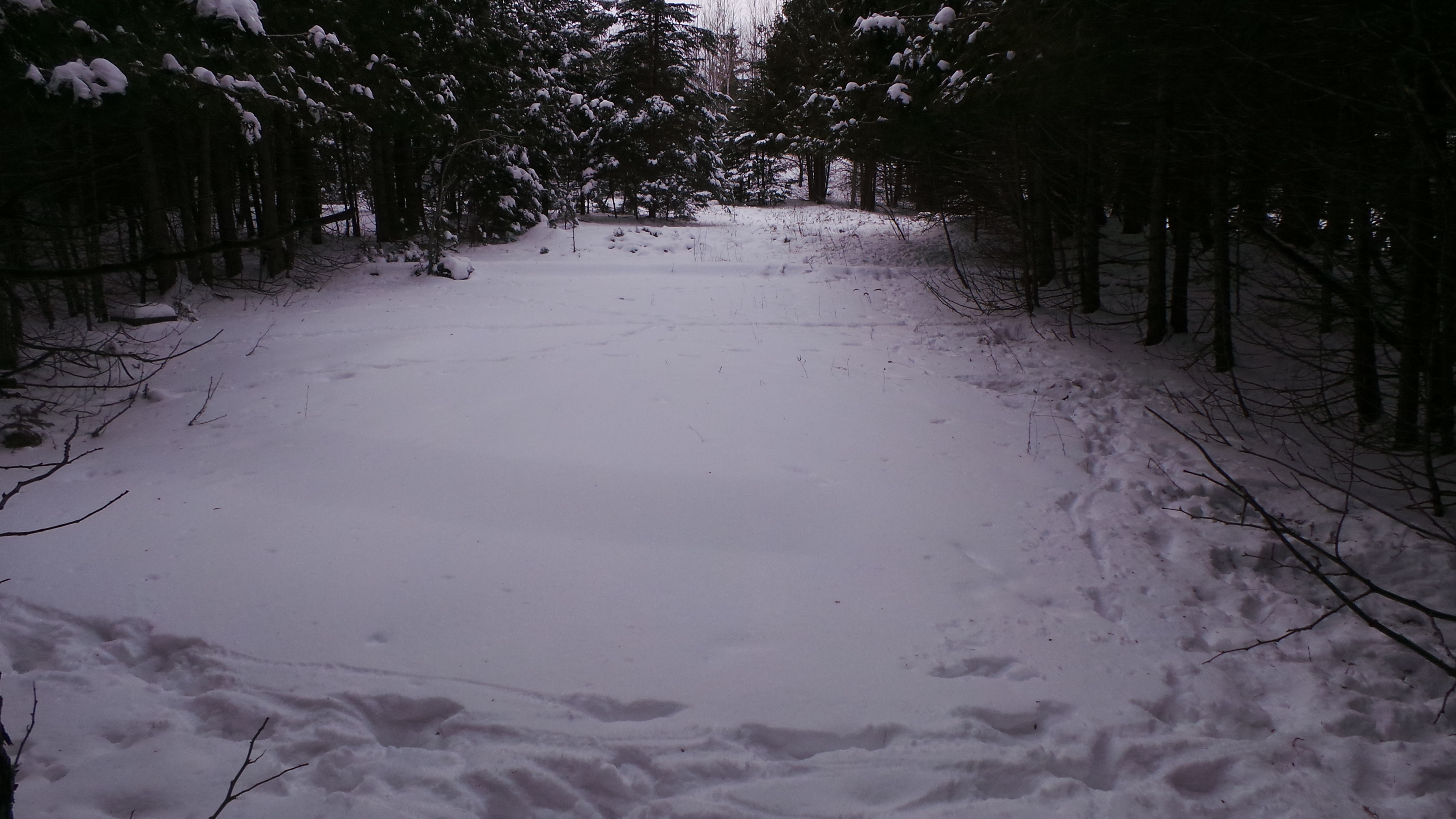
Starting out from the Old Quarry Trail parking lot on Eagleson Road, we set out to see if anything was left of the motels. Our cameras froze and we had to crawl along in the snow at one point, but we found what we were looking for. Not the swings, but something even more interesting…
NO VACANCY: The Search for the Lost Motels
When Glen told me about a story of a hiker who stumbled across the remains of an old motel playground, I was interested in teaming up on an expedition to find it. Doing some preliminary research on the possibility of a lost motel in the woods of the NCC Greenbelt, I referred to a 1965 aerial image of the area to see what was there. Sure enough, not one, but TWO Motels can clearly be seen in the aerial image.
A 1965 aerial image clearly shows two motels in the area of Robertson Road west of Bells Corners.
The two motels are still visible in this 1976 aerial image.
A current aerial image shows the motels have vanished and are now part of the NCC Greenbelt.
Taking those images and overlaying them on a current aerial image provided a bearing on the approximate locations. We then started some historical research…What were these places? What happened to them?
A quick search of what motels could have been in the area showed that the stretch of road they were on was once called the “Whiskey Road” in the mid 1800s. This was due to the fact there were so many taverns in the vicinity, as this was a midway point between Ottawa and Richmond while travelling on Richmond Road between the two places. Now part of what is called Bells Corners and Robertson Road, it was also once known as “Old Highway 15 & 7” during the mid-20th century. It was a stretch of road that was a continuation of both Highway 7 & and Highway 15 and was the only corridor into Ottawa from the West. Being so, a number of motels begand to spring up along this road, most notably during the 1950s when “motoring” was a popular tourist activity, and “Motor Inns” or “Motels” became a popular option for weary drivers and their passengers.
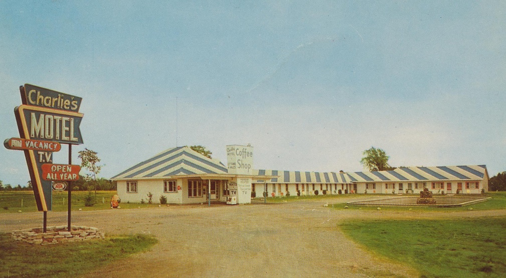
An internet search yielded results for two motels on that stretch of road known as “Old Highway 7 & 15”. It was re-named Robertson Road in 1983 after the owner of a general store and surveyor of roads in Bells Corners. The two motels were called “Charlie’s Motel” to the west and “Cedarview Motel” to the east. Locating vintage 1950s postcards of both motels as they appeared in the 1950s, the bizarre diagonal roof striping as shown on the 1965 aerial photo of confirm that the postcard was indeed that of Charlie’s Motel.
A 1950s postcard showing “Charlie’s Motel”. Note the distinctive striped roof.
The same distinctive striped roof as shown on the 1965 aerial image close up. A match.
The Cedarview Motel from a 1950s postcard. (delcampe)
A 1965 aerial image close-up showing the Cedarview Motel. Note swimming pool at centre.
The Cedarview Motel gained some notoriety in 1961 when a helicopter pilot en route from Montreal landed his helicopter at the motel for dinner and an overnight stay, which made the news in the Ottawa Citizen.
A clipping from the Ottawa Citizen of a guest who landed a helicopter at the Cedarview for dinner and night’s stay.
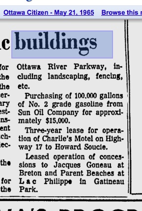
With both motels now known and identities confirmed, a further search history showed that both motels were later purchased by the National Capital Commision who bought the properties, left them abandoned, which later resulted in the Cedarview burning to the ground, and Charlie’s being demolished. An Ottawa Citizen article from 1965 shows that the NCC had at that time purchased the land and was leasing it to Charlie’s Motel proprietor Howard Soucie for a three year contract.
A 1965 Ottawa Citizen article shows the motel land had already been purchased by the NCC who then leased it back to the motel.
The abandoned Cedarview Motel burned down in 1979. (image courtesy Christopher Ryan/Ottawa Journal)
A 1976 aerial image shows both were still in existence at that time, but a 1979 Ottawa Journal article and photo shows that the Cedarview burned down. It is not known when or how Charlie’s Motel met its fate.
THE SEARCH
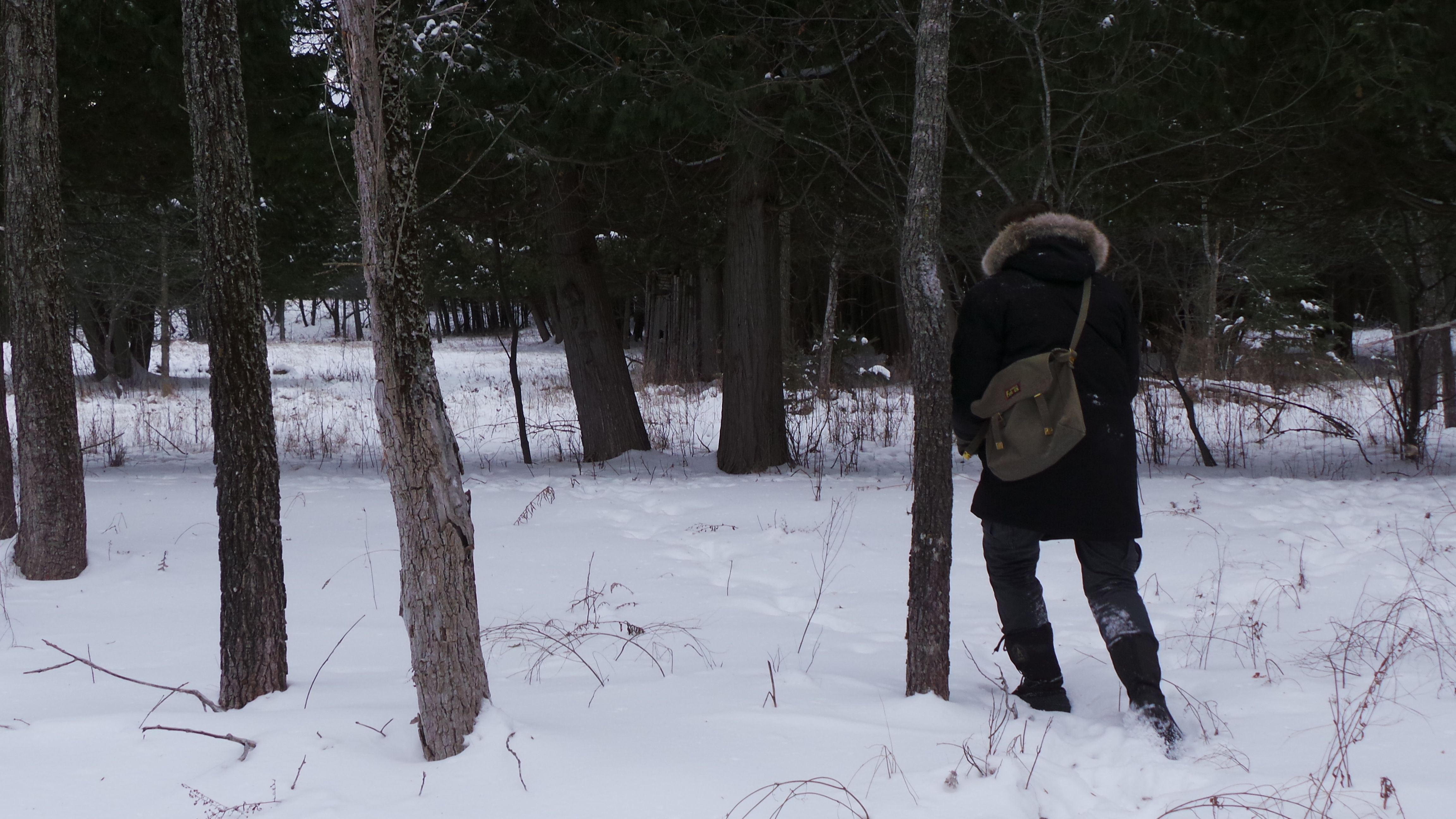
Overlaying the known locations over a current map Glen and I were able to locate the vicinity of the motels and where the remains of these mid-century motels may lie. Arranging to meet nearby, we happened to pick one of the coldest days of the winter for our expedition, and needless to say, a half hour into our adventure our cameras and batteries began to freeze up. Keeping them close to our bodies for restorative warmth, we trudged through the -20 temperatures and crunching snow to discover the site of Charlie’s Motel.
The site of Charlie’s Motel as it appears today.
Nothing much is left of Charlie’s, just an empty field with some surrounding trees. Perhaps in the summer, more of the ruins are visible, but on our trek, we decided to keep moving through the NCC Greenbelt woodlands towards whatever remained of the Cedarview Motel.
Making our way through the snow covered trees, we came across the area where the Cedarview should be, crawling underneath some fallen cedar branches to get to the site. The whole area was actually full of cedar trees, so we knew this was most likely the home of the “Cedarview Motel”. Aptly named.
Entering the area of the Cedarview Motel.
Nothing was readily apparent until we spotted a cedar branch structure that indicated a man-made influence.
A cedar structure was spotted.
The 1965 aerial image of the Cedarview Motel showed it once had an in-ground swimming pool, a feature filled in as shown on the 1976 image. Stumbling through the deep snow we soon came across a clearing with absolutely no vegetation growing on it. Was this the filled in swimming pool? Overgrowth had consumed the Cedarview Motel area, but for some reason, this area was devoid of any trees, which I think would be because the trees would not be able to take root within an in-ground concrete swimming pool.
An odd clearing…likely the swimming pool of the Cedarview Motel.
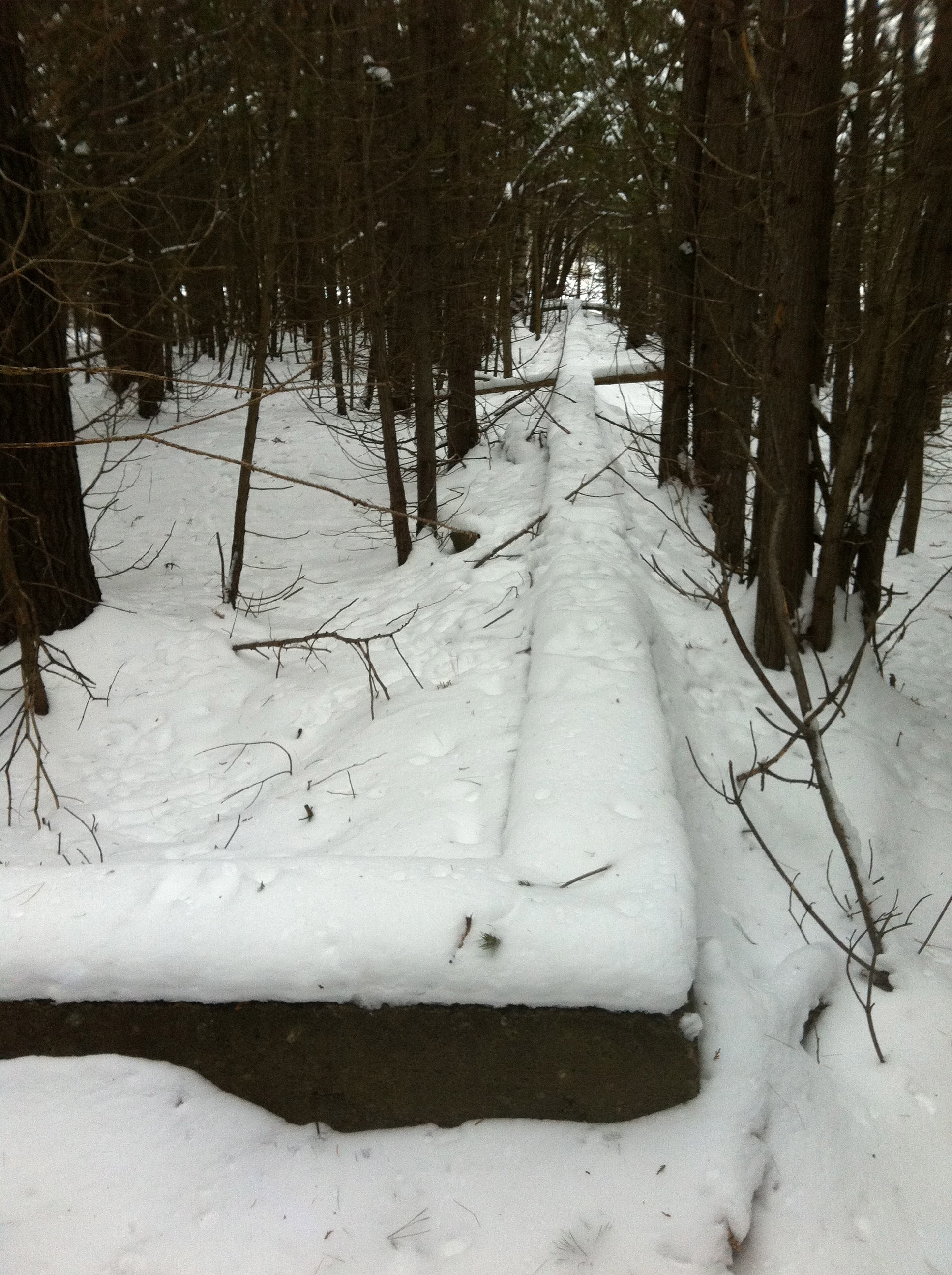
An inspection of the clearing then revealed something more concrete…literally concrete…the foundation of the old Cedarview Motel.
DISCOVERY
Discovery of the concrete ruins of the Cedarview Motel.
The concrete foundation of the Cedarview is clearly lying among the overgrown forest of cedars it was aptly named after more than sixty years ago. The long, straight shape of the motel rooms illustrated on the aerial image and on the postcard were discovered buried under the snow, running through the forest of trees that reclaimed the footprint of the original motel. The outline of the motel structure lay hidden in the forest, slowly being enveloped by the cedar forest from which it was named, the only remnants of its fiery demise.
Concrete ruins of the Cedarview Motel.
Forest remains of the Cedarview Motel.
Old motel stanchions sit in the woods from motel days gone by.
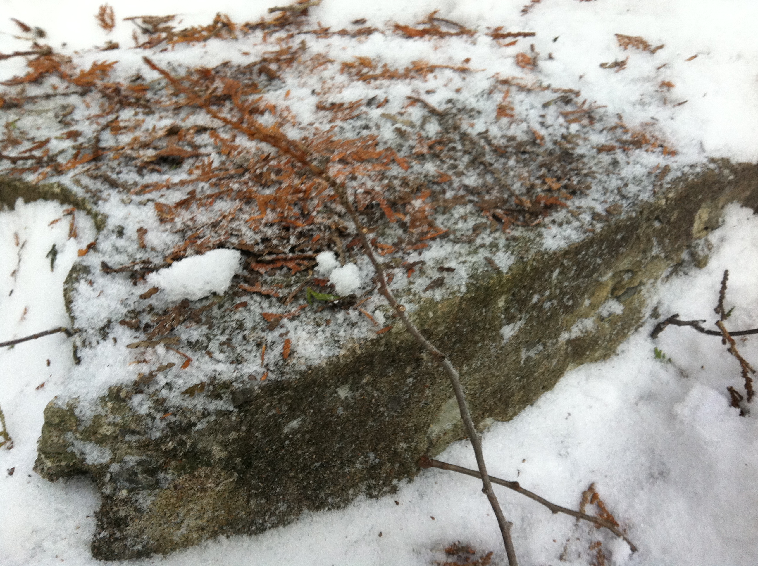
Close up of what lies beneath the snow.
Concrete forms from the old motel lie quietly resting in the forest of the NCC Greenbelt.
The motel area as it appears today….the clearing in the centre is where the swimming pool once was.
Other motel artifacts were discovered as Glen and I searched the area, including concrete forms, barrier posts, more foundations, wooden fence posts and piles of rubble. the majority of the Cedarview Motel lies hidden beneath the forest canopy of cedar trees for which it was named. A hidden reminder of its past accommodating weary motorists on their way to or from the Nation’s Capital. After photographing the area, Glen and I headed back to warm both our cameras and ourselves.
The ruins of the Cedarview and Charlie’s Motel sit silently in the woods of the Greenbelt, a by-product of the NCC’s vision of a green space for the city and its tourists to enjoy, but evidently with no vacancy on Robertson Road.
As a kid growing up on the shores of Eastern Lake Ontario, I had always heard tales of old ships and gunboat battles that occurred in the waters in front of our house near Millhaven, On. With Kingston being a strategic military location throughout Great Lakes history, I always imagined the vessels that may have plied the waters offshore from my home. Tales of mighty gun battles between opposing sides from the 18th and 19th centuries always filled my imagination with shipwrecks, cannon fire and buried treasure. One such tale, perhaps more of a legend, was that of lost gold from a French gunboat during the Seven Years War that apparently still lies buried in the sands of Prince Edward County, about one hour west of Kingston. The gold was reportedly buried in 1758 and never recovered, fuelling local folklore since then. Now, with time I had over the Christmas holidays, and resources never before available, I finally researched this legend of lost gold and hit the sands on a quest for lost gold…
THE STORY
The Seven Years War pitted British and French against each other on the Great Lakes in a battle to secure Upper Canada and control the area north of the the United States. Gunships from both sides sailed the waters of Lake Ontario, exchanging cannon fire in an attempt to gain lake superiority.
British gun ship fleet from the Seven Years War on Lake Ontario.
French gunship fleet on Lake Ontario during the same period of 1758.
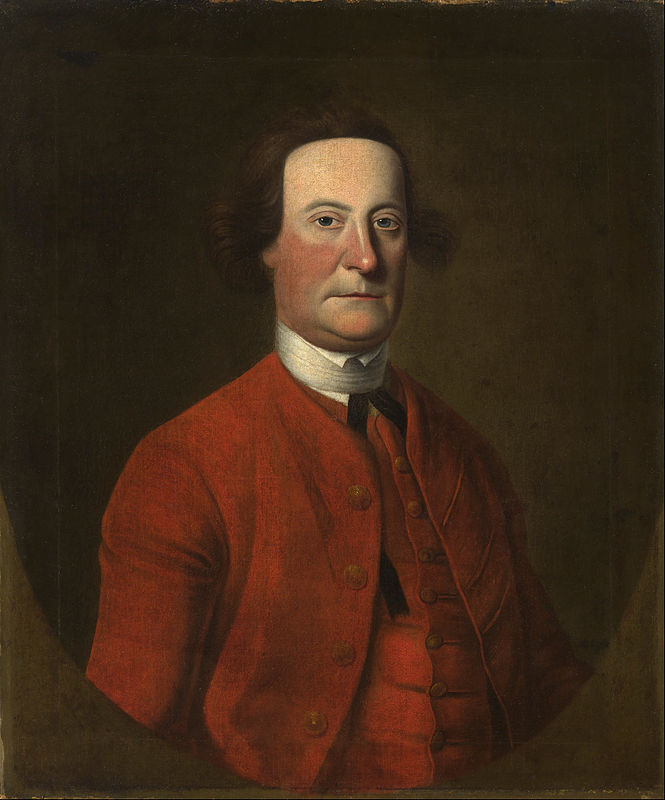
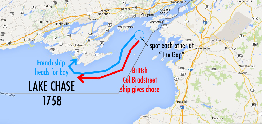
On such incident had a French gunboat sailing across the southern shores of the Eastern end of the lake near what we call the “Gap”, an open space between two of the larger islands on that end. Laden with military documents and a barrel of gold headed to Fort Frontenac (presently Kingston) the French ship was nearing the gap when a Bristish ship under the command of Captain Bradstreet spotted the French vessel on his way across the lake from Oswego, NY.
Captain Bradstreet. British commander of the ship who spotted the French gunboat near Kingston, On.
Bradstreet gave chase to the French ship, cutting it off before it could reach its destination of Fort Frontenac. Evading a most certain engagement and possible capture, the French ship reversed direction and sailed back west trying to escape Bradstreet’s ship. The French ship headed west along the southern edge of what is now Prince Edward County trying to outrun Bradstreet. Realizing evading the British was impossible, the French ship headed for a bay called ‘Little Sandy Bay”.
The Lake Chase Incident of 1758
Not giving up, Bradstreet chased the French ship into the bay, and with their fate almost certainly sealed, the French captain beached his ship, ordered the crew to evacuate with the documents and gold, then torched his ship to the ground to avoid it being captured by the British. The captain and crew then headed inland towards their destination of Fort Frontenac on foot, and as the story goes, buried the heavy barrel of gold to return with reinforcements from the fort to retrieve it later. They arrived at Fort Frontenac only to find it had been attacked and destroyed by the British. The gold, now on British controlled land, was never recovered and apparently still lies buried where it was placed over 250 years ago.
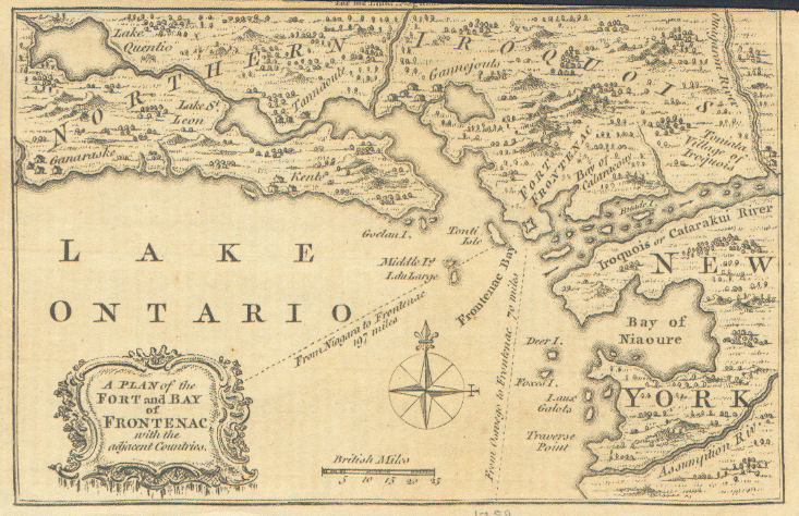
A British map from 1759 of the same area soon after they captured Fort Frontenac.
LEGEND OR TRUTH?
Over the years, the story of the lost gold has evolved through many incarnations, some more fanciful than others, but they all tell of how the gold remains buried and is waiting to be discovered. Always ready to solve a “history mystery”, I thought it would be fun to re-visit the story in more detail and use some new resources that we may not have previously been able to use. One such resource was a book I came across from 1892 that outlines the story in exacting detail…a story I have never seen written down before, which adds some credibility to the story. Next, we can use old maps and overlay them with current satellite imagery to pinpoint exact areas that are mentioned in the 1892 story. Regardless of what we find, it is a fun and interesting exercise with some fascinating results that I will share with you below…
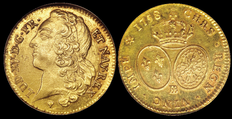
French gold coins from 1758 that may be the ones still buried in the sands of Prince Edward County.
THE QUEST
Using the text from the book “Picturesque Prince Edward County” from 1892 that outlines the story, I studies the details mentioned in the account.
The story as told in 1892, 134 years after the incident occurred.
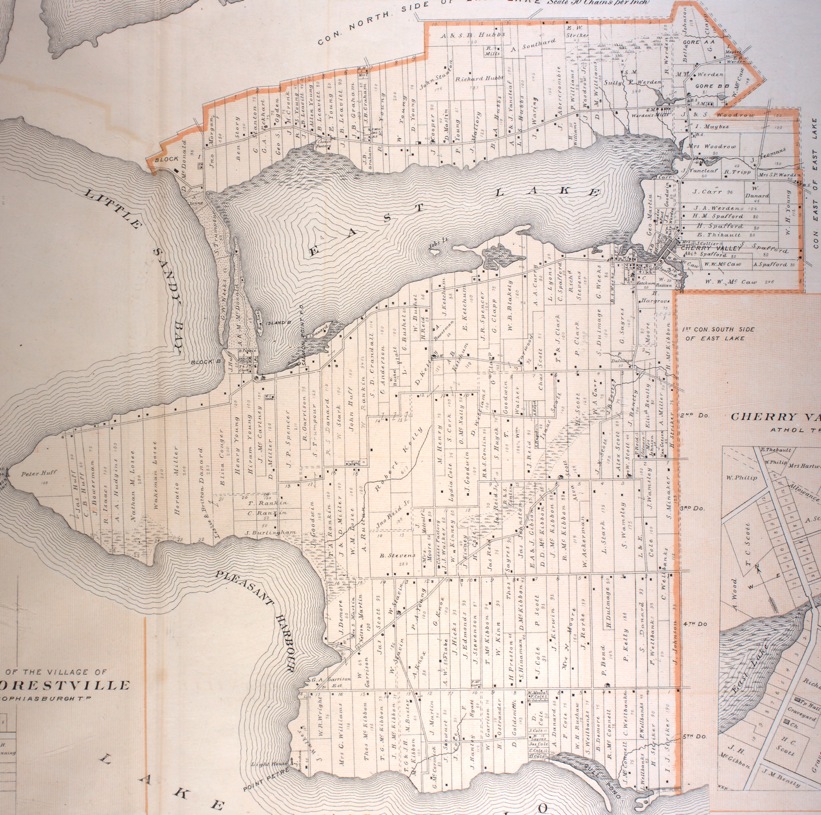
Carefully noting details in the story, I was able to create a list of landmarks mentioned, and using a map of the same time period in the 1870s, mark them on the map.
A map of the area the French ship apparently entered with the gold. Circa 1878.
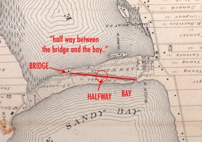
“Little Sandy Bay” is shown on the map as well as a bridge and cabin, mentioned in the story where the tale tells us the gold was buried “half-way between the bridge and the bay”…
Now using a current Google satellite map we can overlay it on the old map:
This gives us an approximate location which we can zero in on to explore for more clues…mostly being the location of the “Old Bridge” which no longer exists since new roads have been built since 1878.
Traget area that’s the “halfway” point as mentioned.
So with some rough ideas of where the bridge and the half-way point could be, I went off with a neighbour in search of some real evidence to help confirm their existence.
Where the “old bridge” is supposed to be located…sure enough, the foundations remain of this old bridge.
Remnants of the old bridge can be seen where it was indicated on the map.
Exactly where it is supposed to be is the cabin (dated 1830) that is also shown on the old map as a black dot…
close-up detail of the old map that shows both the old bridge and the log cabin location.
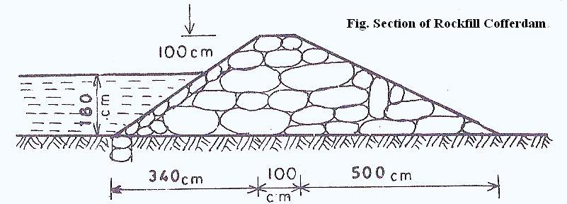
So now that we have confirmed the location of the old bridge, we can now mark the “halfway” point where the gold was buried near a “cofferdam”, which is a small dam that would have built from stones.
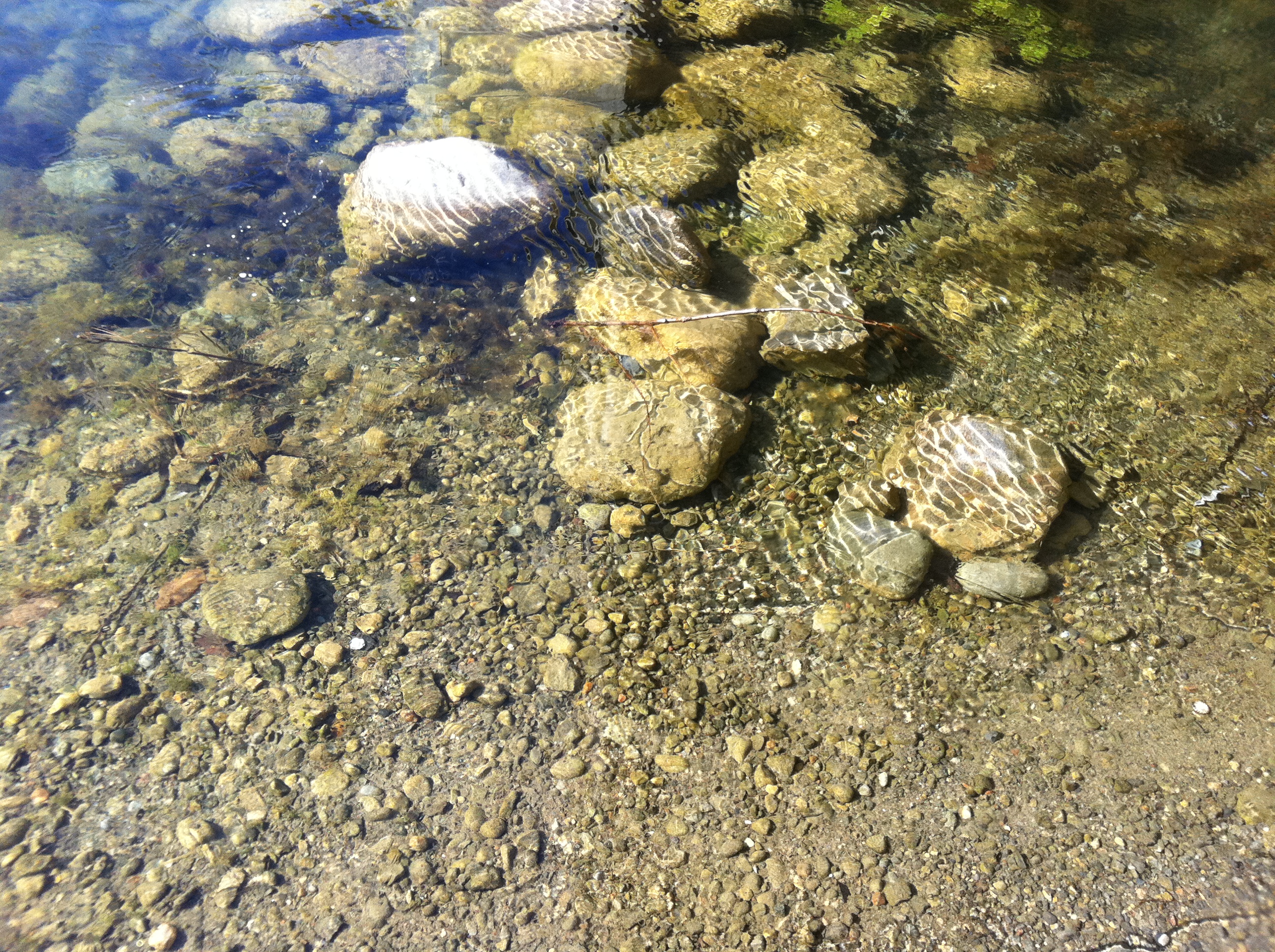
Heading to the halfway point and where the cofferdam should be, there are some collapsed stones….
…but they are now replaced with a modern bridge.
Could this new bridge have been built upon the old cofferdam location which was the half-way point where the gold is supposedly buried? I decided to explore the rest of the area and see if anything else unusal could be found that may give us some further clues. If not, then at least it would be fun to re-trace the supposed steps of the French captain back to the bay where he burned his ship in 1758.
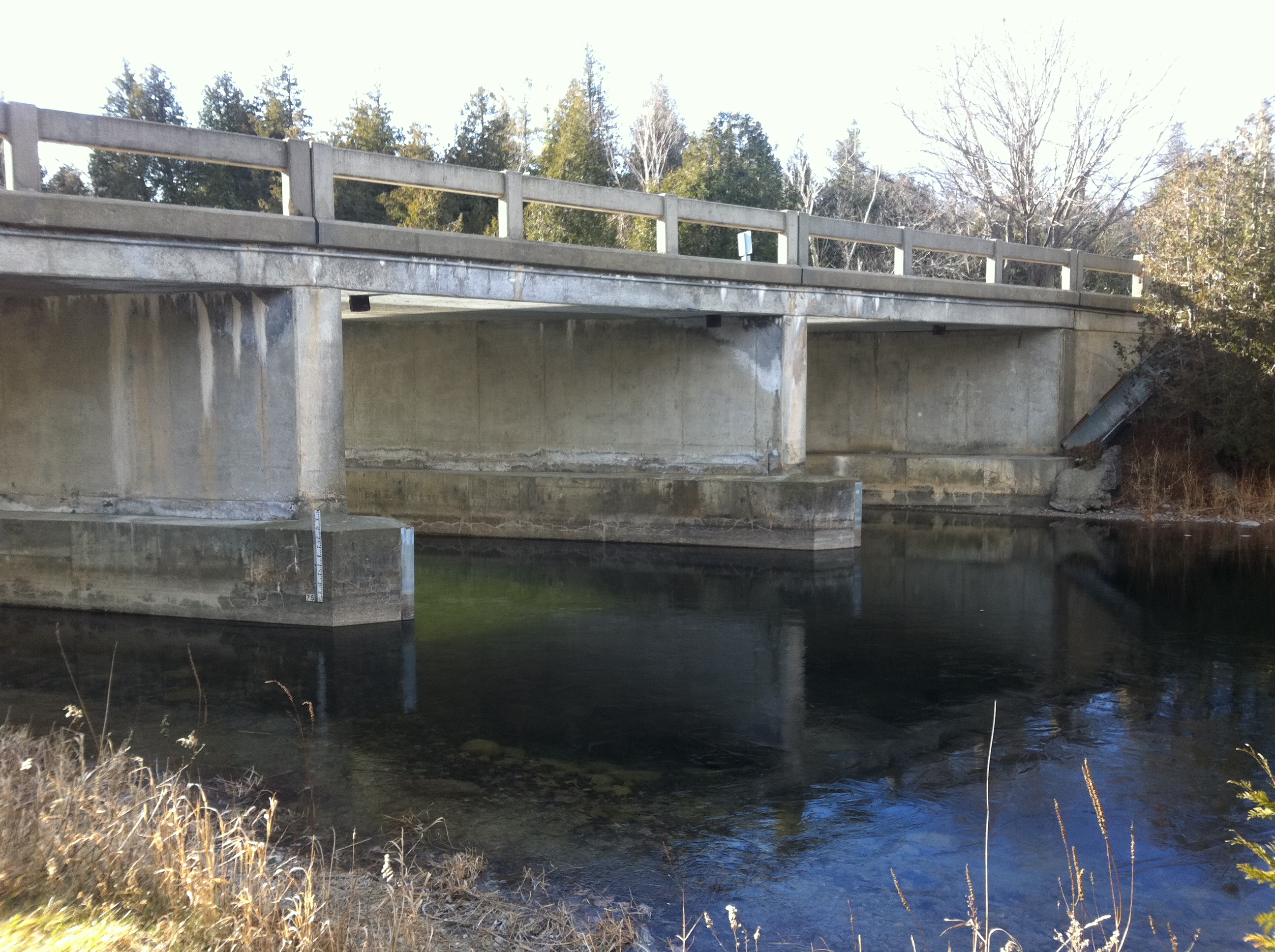
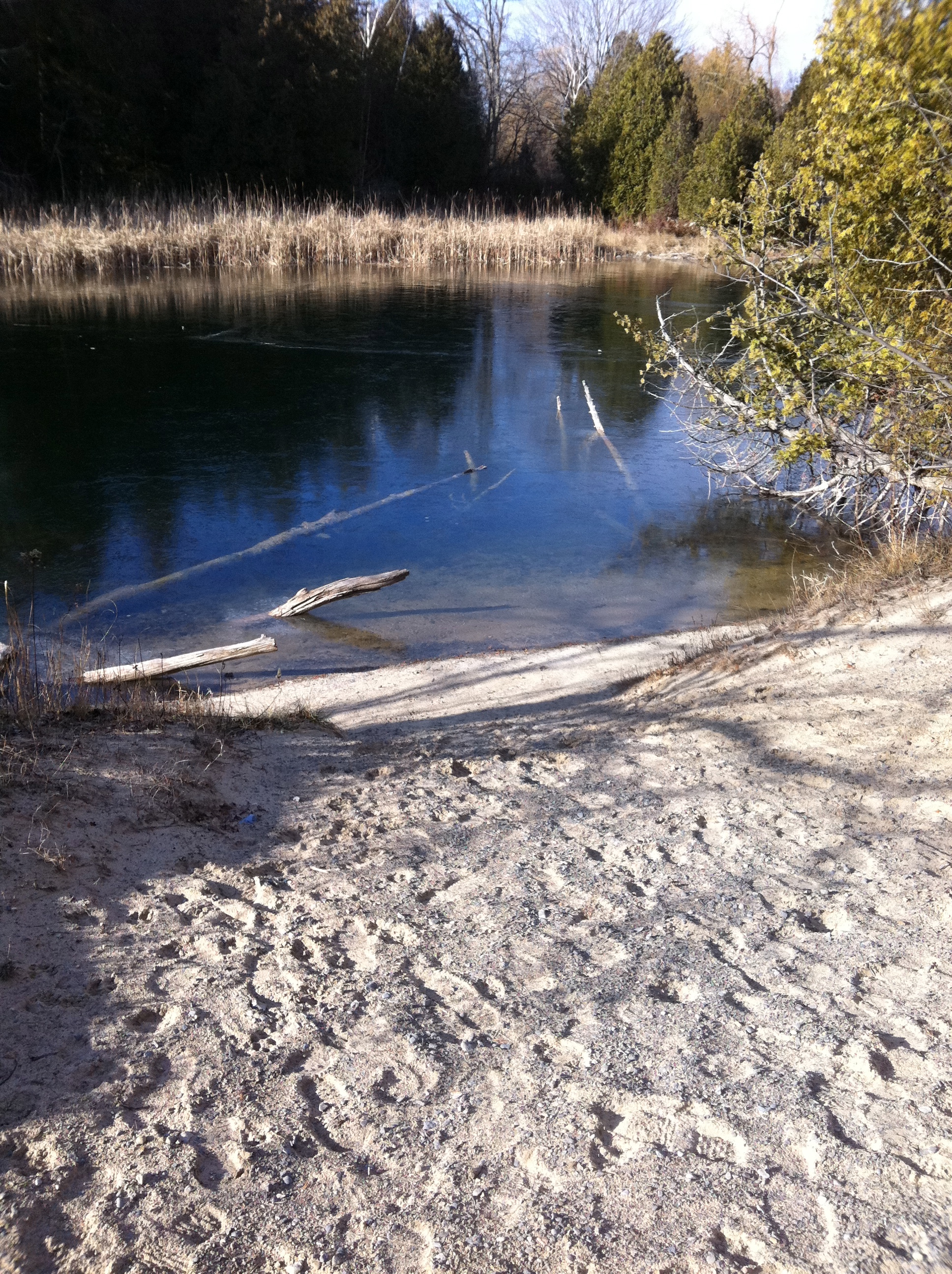
I explored the riverbanks and re-traced the path of the French captain back to the bay where he burned his ship in 1758.
The area is very sandy, and is now part of Sandbanks Provincial Park.
A large man-made mound was discovered on the shoreline walking towards the bay.
Further along the river, I came across what looked to be a man-made mound in the forest on the banks of the river. Some cut logs were supporting it, but the date of this structure is unknown.
Some cut logs were supporting the mound structure. Date unknown.
Following the river to where it empties into the bay, this is where the gold-laden French ship apparently was beached and burned.
This is the beach where the ship apparently was burned to avoid being captured.
Looking out towards Lake Ontario and Sandy Bay.
Reaching the end point of the quest, which was actually the start point for the French captain in 1758, no gold was recovered nor were there any further clues to investigate. The empty land is part of Sandbanks Provincial Park, and remains as a beautiful place to walk and fuels the imagination as to what may have happened all those years ago according to the recorded tale below from 1892:
Having successfully re-traced the reported path of the French captain from 1758, the gold could very well still be buried under the shifting sands of the area, and perhaps it will remain as it has for the past 250 years….a LEGEND OF LOST GOLD.
SOURCES
“Picturesque Prince Edward County”, 1892, by Helen Merrill
Google Maps
Hastings and Prince Edward County Historical Atlas, 1878