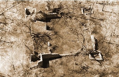
A 17th century stone fortress ruin lies in someone’s backyard on the banks of the Ottawa River 90minutes east of Ottawa. (photo: Google Maps)
When you think of a stone castle fort with gun ports and swiveling cannon bastions, images of European castle fortresses probably come to mind. A stone fortification that repels invaders with projections for pouring hot liquids and/or rocks down on attackers seems in place within medieval Europe, but yet this castle fortress lies not there, but on the Ottawa River. Hidden amidst trees in someone’s backyard, there lies the ruins of a 17th century stone fortress.
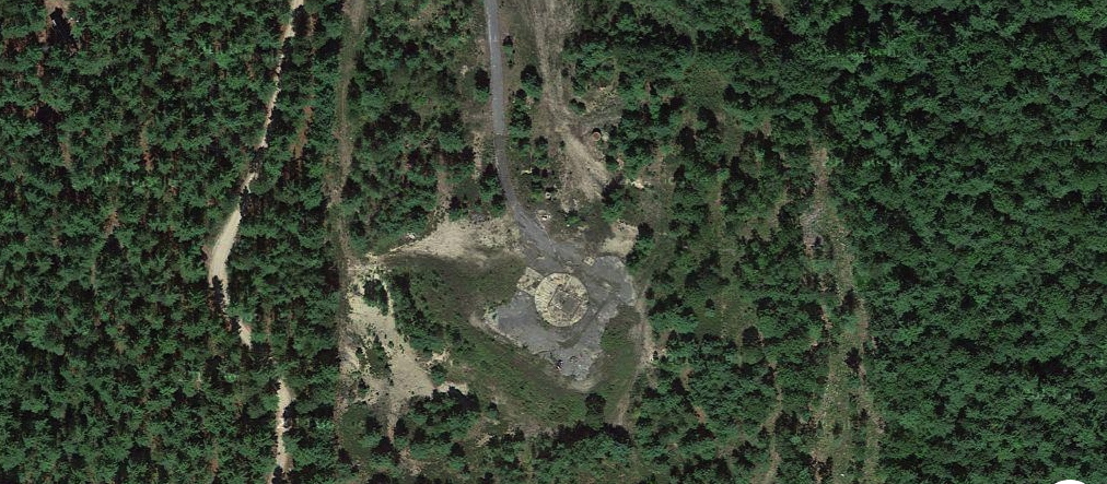
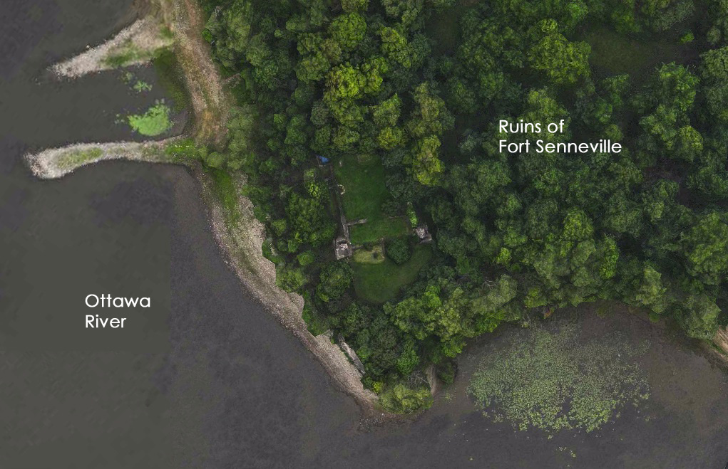
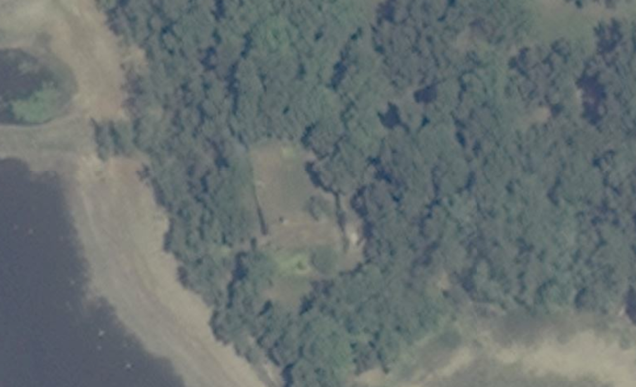
Aerial image of what remains of Fort Senneville built in 1692. (photo: Google Maps)
Approximately 160km east of Ottawa hidden from view on the banks of the Ottawa River sit the remains of Fort Senneville, a 17th century stone castle-fort built to protect French settlers. The fortress ruins sit in the backyard of a residence on Senneville Road, designated a National Historic Site, but out of view from the general public. The fort can however be seen with the use of aerial images such as Google Maps and Bing Maps where we can further study this fascinating piece of history under the trees.
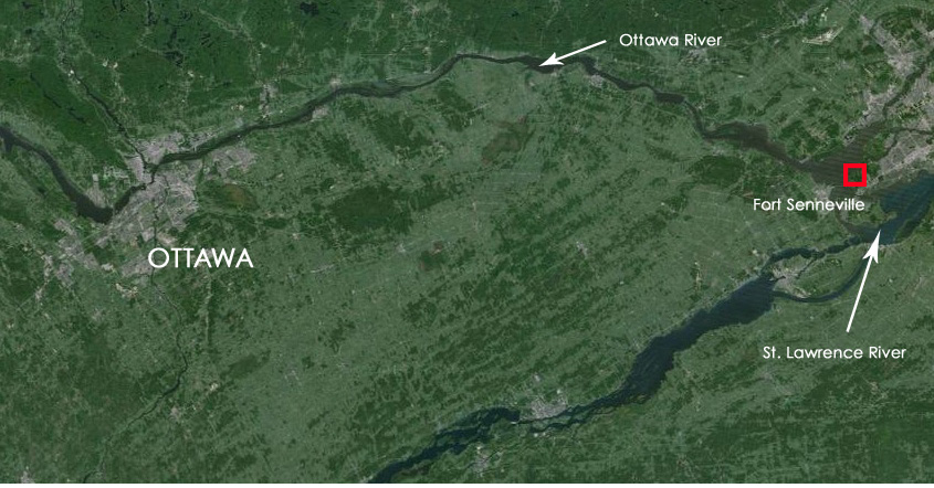
Location of the fort in relation to Ottawa.

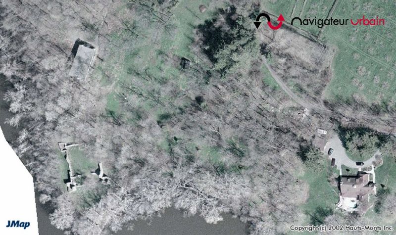
Closer aerial view showing the location of the fort.
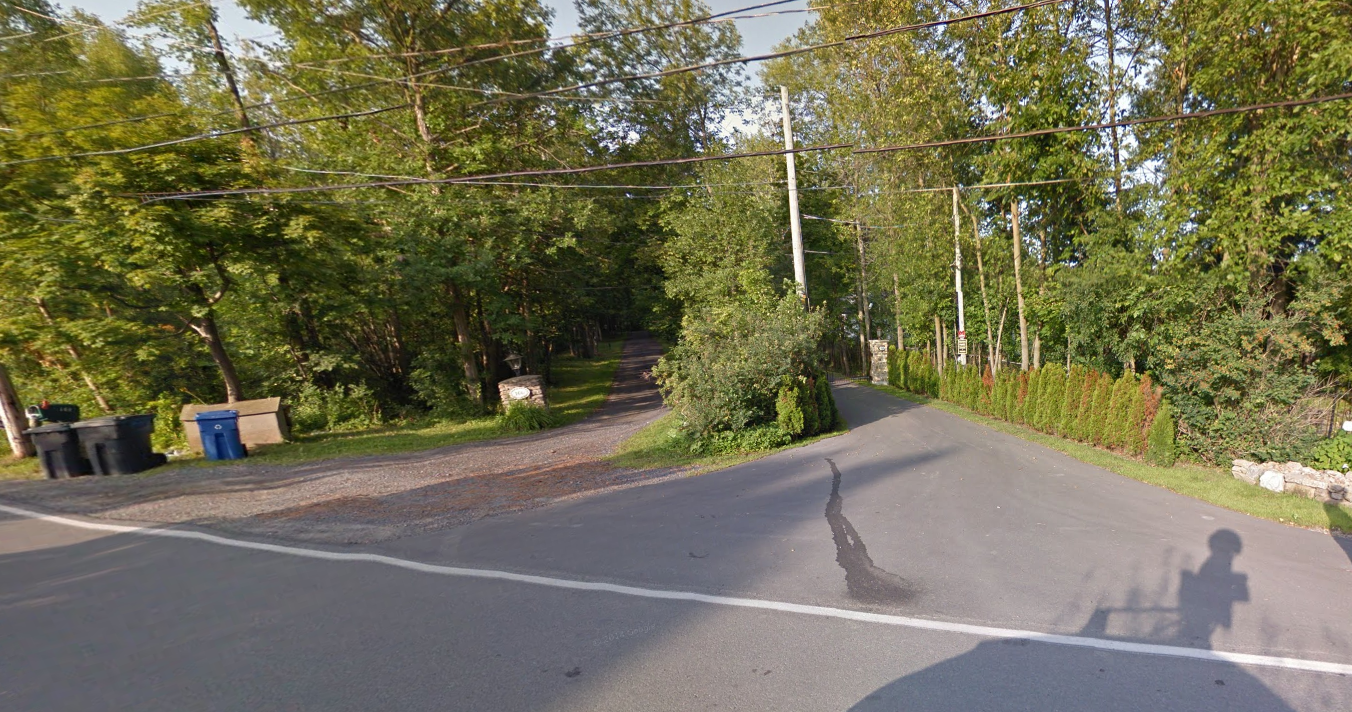
Google streetview showing the entrance to the private residence where the fortress sits in their backyard.
The fort is the westernmost stone fortification built by the French on the Ottawa River when they constructed a protective string of 30 outlying forts to repel the Iroquois threat to the expansion of French settlements. Originally the fort was constructed of wood in 1671 and was attacked by the Iroquois in 1687, a year after a fortified stone mill was built on the site that also served as a watchtower overlooking the Ottawa River. The initial attack was repulsed, but the Iroquois returned in greater force in 1691 when they successfully attacked and burned the wooden fort to the ground.
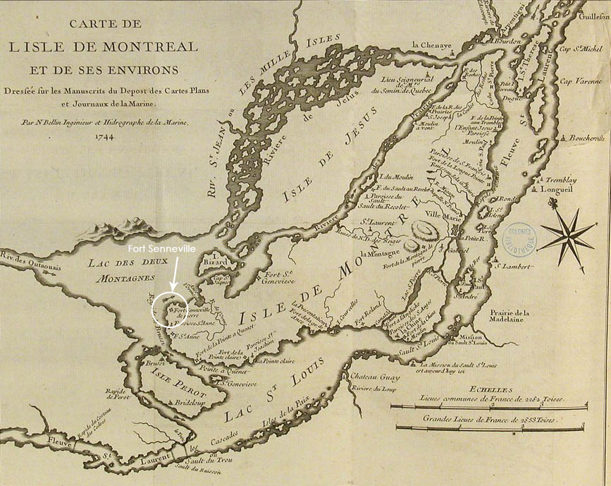
A map from 1744 showing the location of Fort Senneville.
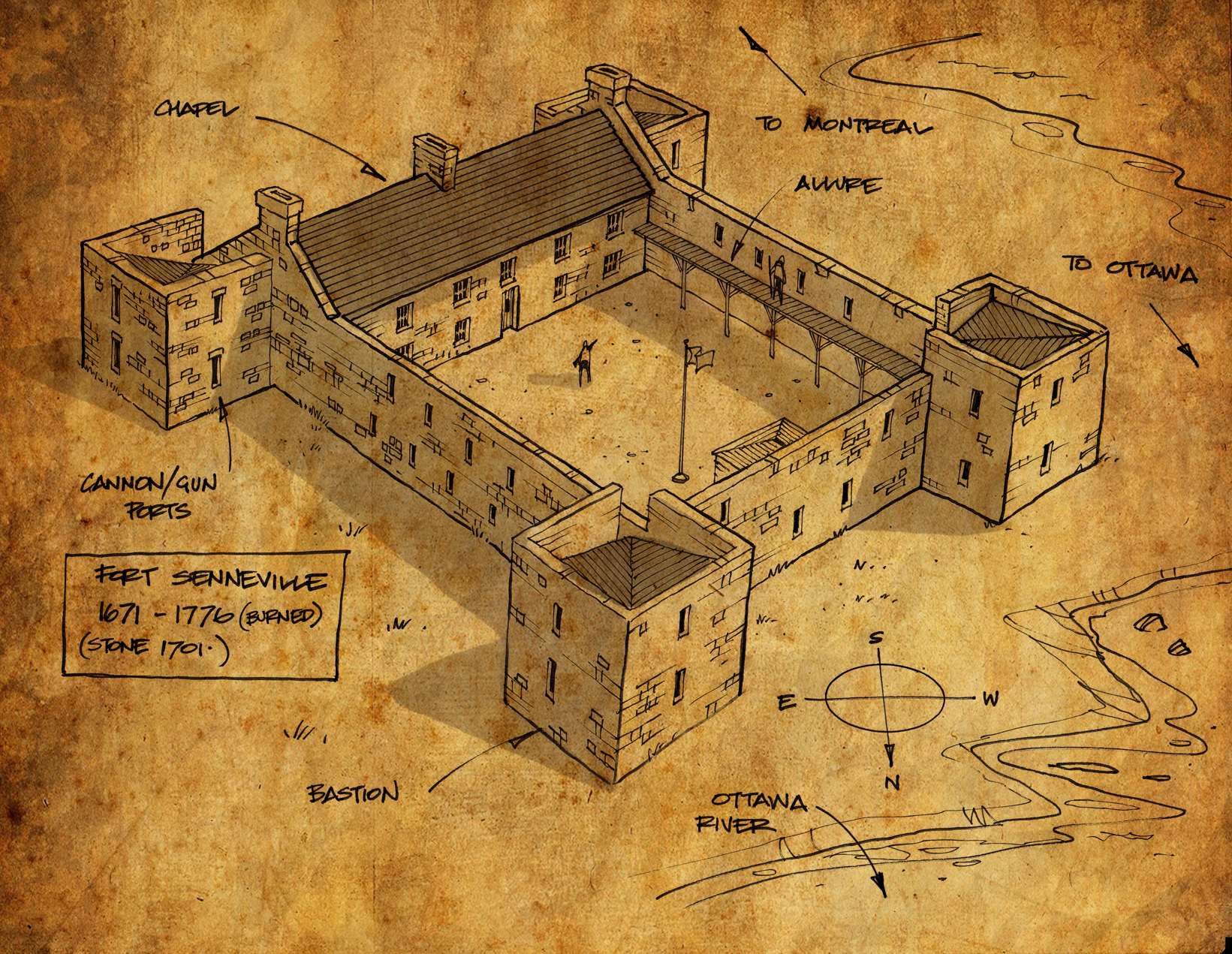
Governor-General Frontenac then ordered the construction of a stronger, more substantial fort, and in 1692 Fort Senneville was constructed using thick stone walls and corner tower bastions, cannon ports, musket ports, and extensive swivel wall guns. Fort Senneville on the Ottawa River was the “most substantial castle-like fort” near Montreal.
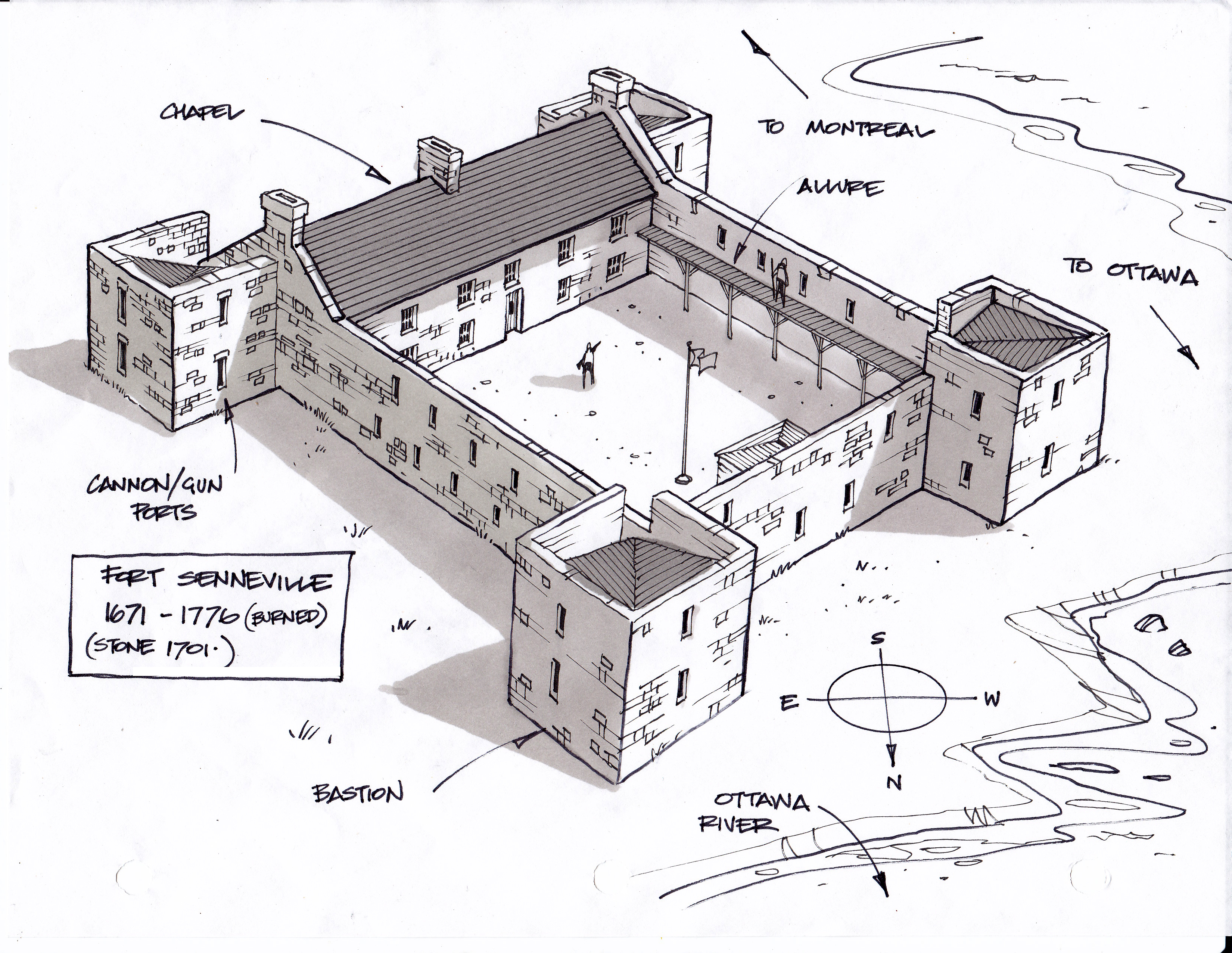
My conceptual sketch of how Fort Senneville may have looked in the 1700’s
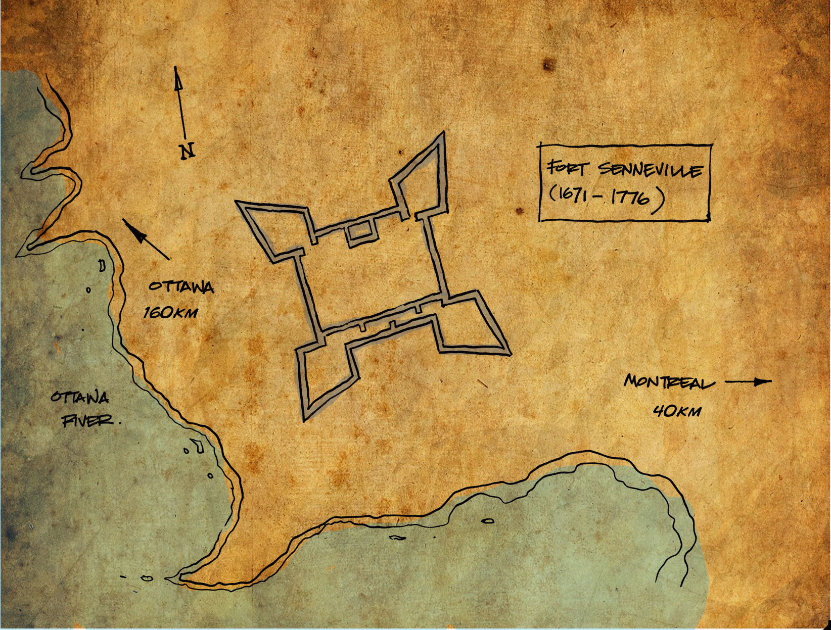
Top view sketch of the fort footprint near the Ottawa River.
This new fortress was never attacked again. It remained a stronghold on the easternmost end of the Ottawa River near where it meets the St. Lawrence River, a strategic location for shipping and fur trading operations.
This imposing castle-like French fortress was ceded to the British in 1763 after the fall of New France and it remained an unused outpost. However, in 1776 during the American Revolutionary War, the fort was doomed.
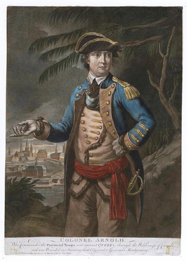
Benedict Arnold, who destroyed the fort in 1776.
Benedict Arnold leading his Continental Army troops in military maneuvers during the Battle Of The Cedars took over the fort and burned it to the ground as they retreated back to the United States. Arnold successfully destroyed the fort before he switched sides and joined the British around 1780.
Benedict Arnold took over, then later burned the fort as he retreated to the USA during the American Revolutionary War in 1776.
The ruined Fort Senneville was purchased in 1865 as a summer residence by the former prime minister of Canada and mayor of Montreal, John Abbott. The property then changed hands again in 1898 to Edward Clouston, the General Manager of the Bank Of Montreal.
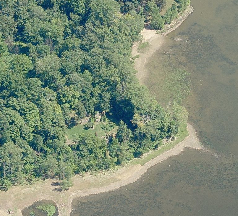
A photograph of the fort exposing the ruins when the foliage has cleared during the autumn season.
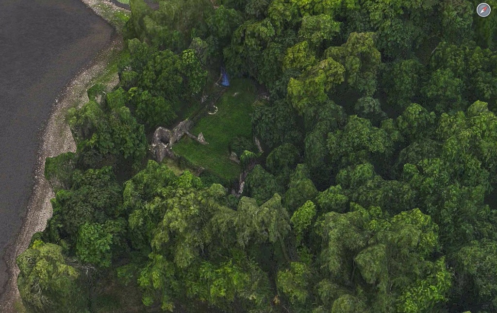
A Google Map image showing what remains of the 17th century fortress.
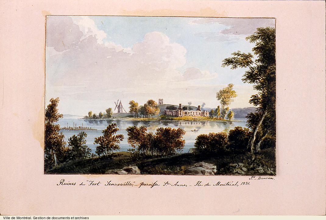
Artwork from 1831 showing the ruins of the fort, which look to be in good condition at the time.
Since then the property has been privately owned and the hidden stone fortress remains cloaked under trees on the shores of the Ottawa River. It was designated in 2003 by Quebec for historical significance by classifying it as a “site historique” . Archaeological research and repairs funded by the Ministry of Culture and Communications has helped preserve what remains, and in 2009 it became a National Historic Site.
This aerial image shows the modern residences nearby with the fort in their backyard.
Bing Map image showing the ruins of the fort near the Ottawa River.
The ruins of the fort continue to be under private ownership and public access is not allowed. It is interesting to think that what remains of the largest stone castle-like fortress on the Ottawa River from the 17th century remains hidden in someone’s backyard, out of sight for those of us that aren’t invited to their backyard barbecue.