Cairns are an interesting form of marking a special place. The word cairn comes from the Scottish Gaelic word, “càrn”, and have been used for a variety of purposes from prehistoric times.
In Prince Edward County, known for its blossoming vineyards, there is a winery called “Chadsey’s Cairns” named after Ira Chadsey, a late 19th century farmer who built stone cairns at the back of the property claiming they would guide him home in the afterlife when he returned as a white horse. The stone cairns were more likely fence posts of field rubble, piled there by Ira clearing his fields, but the story is a legend in the County.
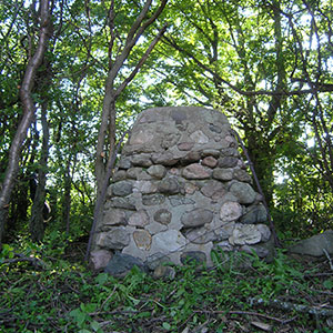
Chadsey’s stone cairn. (image: ByChadseysCairns.com)
There is another cairn in the County with an equally interesting legend, that of a cairn being erected on the highest point in all the land. On a beautiful, sunny June day I thought it would be fun to try and find this cairn that marks the “Peak Of The County”.
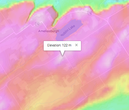
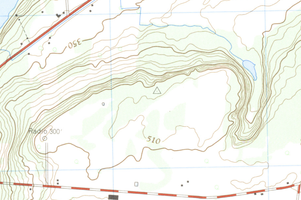
A modern topographic map shows the “high” area in white.
Apparently located in Ameliasburgh Township on the west side of the island, our first stop was the Ameliasburgh Heritage Museum to look for clues. An amazing museum that recreates 19th century County life, many historic buildings from around the County were moved here, which you can enter and visualize what early life must have been like in the County.
Not finding much, I checked Google to see what kind of topographic map I could find that may show the highest point in PEC. A map from what looks to be from the 1950s shows the topography of the county and there on the map was the typical “pyramid” symbol that denotes some kind of survey marker.
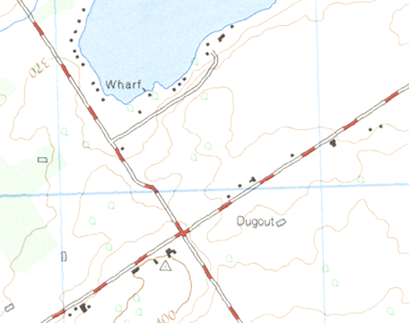
A “pyramid” symbol denotes a high elevation marker on this old topographic map of the County.
That pyramid likely marks the spot where a geodetic survey marker was placed, called a “horizontal control point” indicating the highest elevation in an area, this case being Prince Edward County.
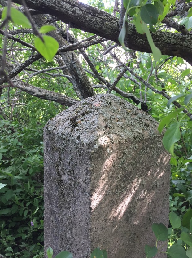
Noting the location, just south of Ameliasburgh, we headed in that direction visually scouting the land looking for what could be the highest point. Guessing one side of the hill near Salem and Whitney roads, we scoured the scrub brush and scanning the overgrown field, an obelisk was soon visible. We had found the cairn.

Standing about 4 feet high, the concrete obelisk has now been consumed by nature, overgrown, and hidden from view. Unless you knew of it, it would be lost in time forever, sitting like a quiet sentinel on a windswept peak of Prince Edward County. Likely erected when the survey maps data was compiled in 1927, this almost one hundred year old cairn remains intact, yet concealed by the bushes that surround it.
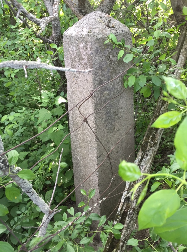
Likely built in the 1920s to mark the high elevation point, the concrete obelisk is quietly hidden in the overgrown hilltop south of Ameliasburgh.
However, a quick fact check as to whether this really was the highest point in the County showed that it was not, as it is noted to be at 122m elevation, but another pyramid on the map near Glenora showed an elevation of 156m!
This area near Glenora looks to be the HIGHEST point in the County, but if there is a cairn there, it is inaccessible by road.
Checking the old topographic map there is indeed another pyramid symbol near Glenora, but that cairn, if there, is in a completely inaccessible area. Perhaps another adventure for another day.
Andrew King, June 2018