Month: May 2018

OAK ISLAND IN AN ACORN SHELL

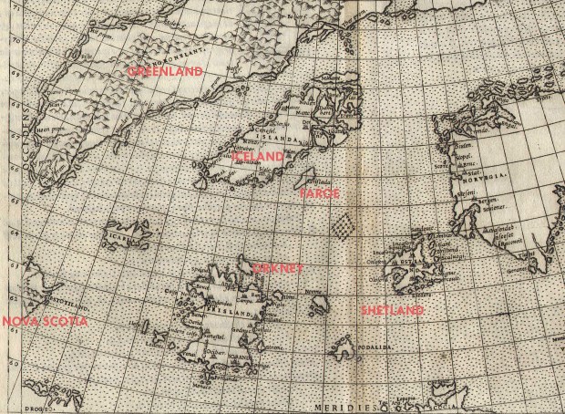
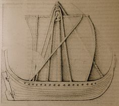
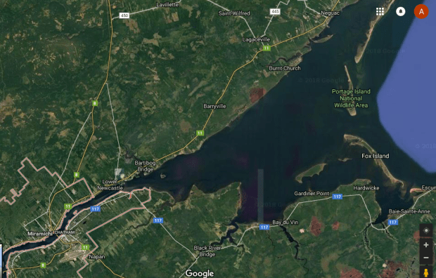
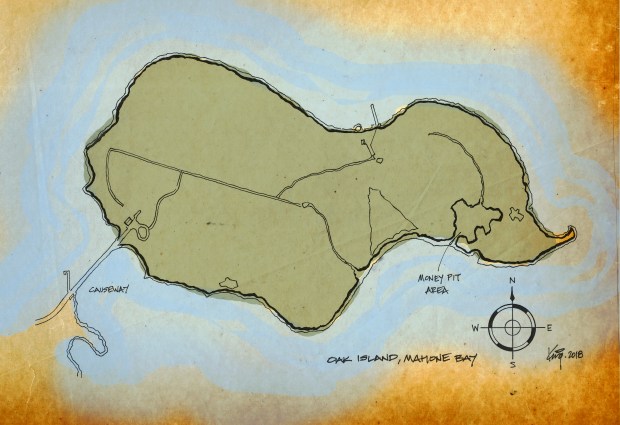
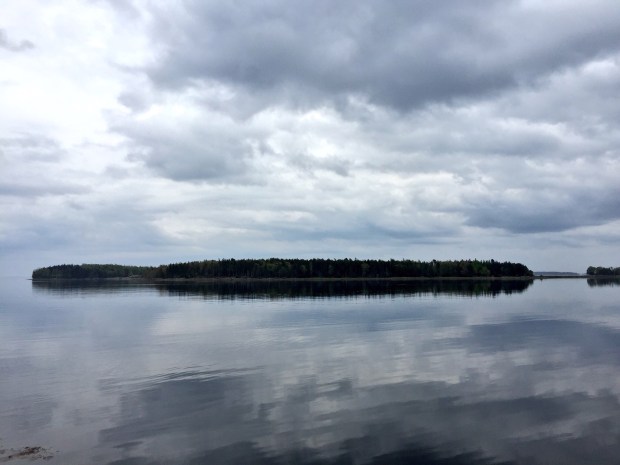
Much has been written, explored and theorized about Oak Island, a modest sized island in Mahone Bay, about an hour;s drive from Halifax, Nova Scotia. The word “mahone” can be traced back to early 18th century settlers in the region, but the world can also be seen as a derivative of the French word “mahonne”, which is a type of ship. In Spanish, “Mahon” is a harbour port, oddly what this bay area is, but this is likely a coincidence.

oakisland

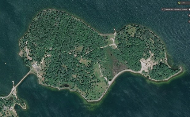
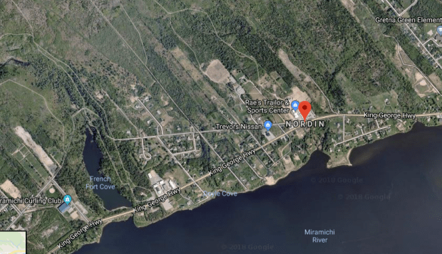
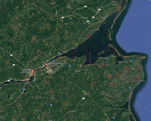
Oak Island, Mahone Bay, Nova Scotia. (Google Maps)

One of the over 350 islands in Mahone Bay, Oak Island covers 140-acres and is privately owned. The Mik’Maq natives of the area soon saw an influx of  Europeans, which were French fishermen who, by the 1750s, had built a few houses on the future site of what is now Chester. In the late 1750s the British who had taken over Acadia from the French, enacted a series of measures to encourage settlement of the area by the European-descended New Englanders.

In 1762 Oak Island was officially surveyed and divided into 32 four-acre lots, but was known as “Smith’s Island” after a settler of the area. In 1778 it was re-named “Gloucester Isle”. Later it became “Oak Island” and in 1784, the government made additional land grants, this time to former British soldiers, which included parts of Oak Island.

1876012384

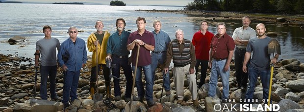
The cast of the popular TV show on the History Network “Curse of Oak Island” (OakIslandTours website photo)

Oak Island Tours now operates on the island, a partnership between Dan Blankenship, brothers Rick and Marty Lagina, Craig Tester and Alan J. Kostrzewa that started in 2007. In 2013 Prometheus Entertainment and The History Channel started producing “The Curse of Oak Island”, which follows these partners in their continued exploration efforts.

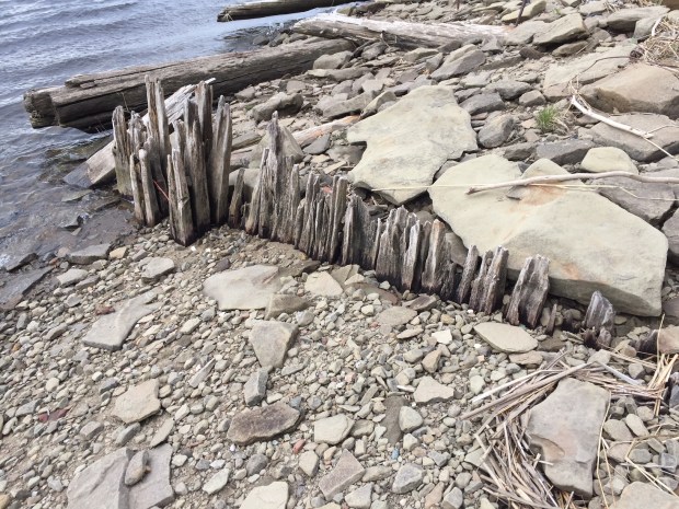
The first time there was ever any concept of something being buried on the island comes from Daniel McInnis, who at age 13 in June of 1795, discovered on Oak Island a clearing in the forest, with many old oak stumps surrounding a huge single oak tree with a sawed-off limb and a block and tackle hung from it, about 16 feet off the ground. Underneath the limb was a noticeable bowl-shaped depression about 13 feet in diameter suggesting something was buried below, the ground having settled. Information on this first account can be found in newspaper articles of the years 1861-64.

2014-03-21_15-36-13_538.622x621

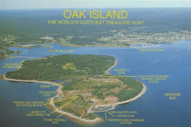
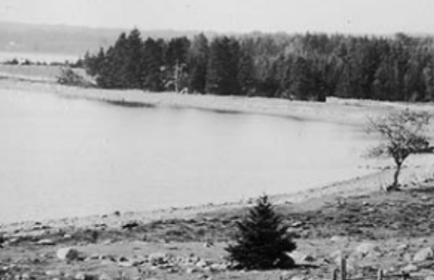
A 1970s postcard aerial view of Oak Island.

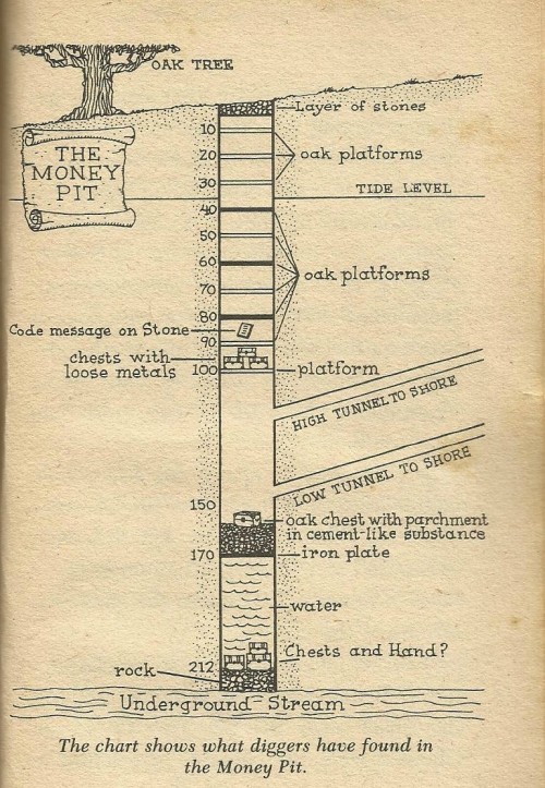
The next day Daniel McInnis returns to the site with friends John Smith (age 19) and Anthony Vaughan (age 16). This time they find the remains of a road from the oak tree to the western tip of the island. Digging into the depression that was found they find at a two foot depth below the surface there is a layer of flat stones. Now at ten feet down, a platform of rotting oak logs is encountered, with ends embedded in the clay walls which show signs of previous pick axe digging.

Underneath that oak platform is a gap of two feet from soil settling and then another platform at twenty feet. Once the boys get to 25 feet after several weeks digging, they stopped and refiled the hole, looking for help.

Later that same month, one of the boys, John Smith buys Lot 18, the site of the pit, and builds a house.

oak-island-money-pit-levels-diagram-e1420554461845

Schematic of the dug pit on Oak Island.

It would not be until 1804 when a group of interested gentlemen who called themselves “The Onslow Syndicate” begins excavations on the Pit. Work begins again and they find notches in the sides every ten feet down, where oak platforms were originally embedded. At 30 feet, charcoal is encountered, likely used in a ventilation furnace. At 40 feet, a lot of putty is encountered, likely used for sealing an air vent or to plug water leaks. At 50 feet, beach stones are encountered, likely used for backfilling a flood tunnel. At 60 feet, much coconut fibre is found, perhaps used for rope, or caulking with putty. At the 90 foot level, a large stone slab weighing 175-500 pounds measuring 24-36 inches by 12-16 inches is found, with an inscription. Now at 90 feet, water is slowly seeping through the clay. Hitting the 93 foot level, the ground is probed with an iron bar where at 98 feet, they hit a another wood platform. The extent of the wood goes to the the sides of the pit. Work is halted, but when they return a couple of days later, they find the fit has now filled with water, up to a 33ft. depth.

Screen shot 2018-05-27 at 7.03.15 PM

Early 20th century photo of Oak ISland. (Nova Scotia Archives)

This would be the start of an unbelievable amount of future endevours, loss of life, and millions of dollars spent on trying to solve the mystery of what is actually on Oak Island. These tales are best left to the myriad of books out there, which I encourage you to read.

I only wanted to give a brief background as we will focus on something completely different than the infamous Money Pit.

THE STONE

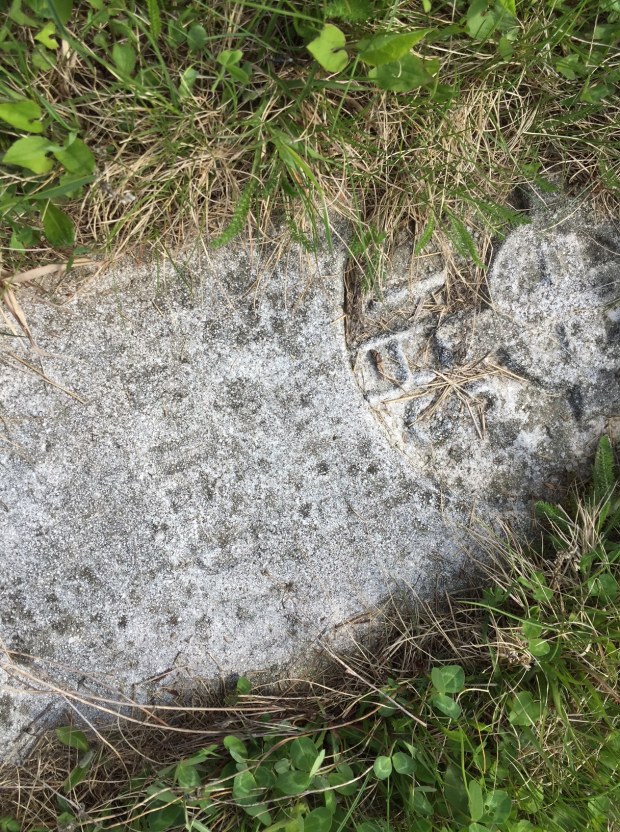
When at the 90 ft. depth, a stone with odd symbols inscribed on its surface was found face down in the dug out shaft. Not much is known about the stone because it has since disappeared, but it is reported to have been 2-3′ long by 12-16″ wide.

IMG_0110

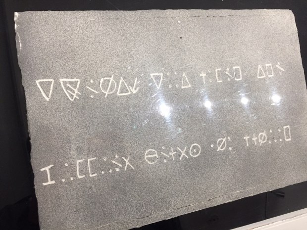
The inscribed stone, a replica of it as the original has gone missing.

The stone was was first reported in a July 2, 1862 Halifax Sun and Advisor article, which mentioned a June 2, 1862 letter that talked about the inscribed stone. A description of its discovery during the 1804 excavation recalls:

“Some [layers] were charcoal, some putty, and one at 80 feet was a stone cut square, two feet long and about a foot thick, with several characters cut on it.”

The odd symbols defied explanation for years and it was not until 1949 when Edward Rowe Snow’s book, “True Tales of Buried Treasure” translated it into something special.

The stone evaded location but in an 1863 newspaper article, the stone was said to have been built into the “chimney of an old house near the pit”. That chimney of the house was the house of Smith, the original discoverer who had purchased the area of the pit and built a house nearby, as mentioned previously. It was described then to have some unusual features:

“There were some rudely cut letters, figures or characters upon it. I cannot recollect which, but they appear as if they had been scraped out by a blunt instrument, rather than cut with a sharp one.”

Later, inquiries in 1864 discovered that the said chimney had been enclosed in wood and surrounded by a staircase

It was later reported that the stone was removed and taken to Halifax. Among those who worked to remove the stone was Jefferson W. MacDonald. According to another source, the stone was taken out of the chimney and moved to Halifax where it was said to have been deciphered, saying:

“Ten feet below are two million pounds buried”

Fast forward to 1911 when the stone was now being used at Creighton’s bookbindery in Halifax. Apparently a generation later, with the inscription nearly worn away, the stone went to a bookstore in Halifax, and then disappeared altogether from history.

No tracings or rubbings of the original have survived although it was said to have been viewed by hundreds of people. The only symbols that can be seen today are those recorded from a secondhand source, and a replica stone exists in the Oak Island museum.

Because of its lack of of authenticity, I will forgo trying to theorize what the inscription says, although it does look similar to the “Pigpen” ciphers used by the Knights Templar and later the Freemasons (more on them later) and also the the Rosicrucian brotherhood.

51stEyRPGEL

pigpen-cipher-font-character-map

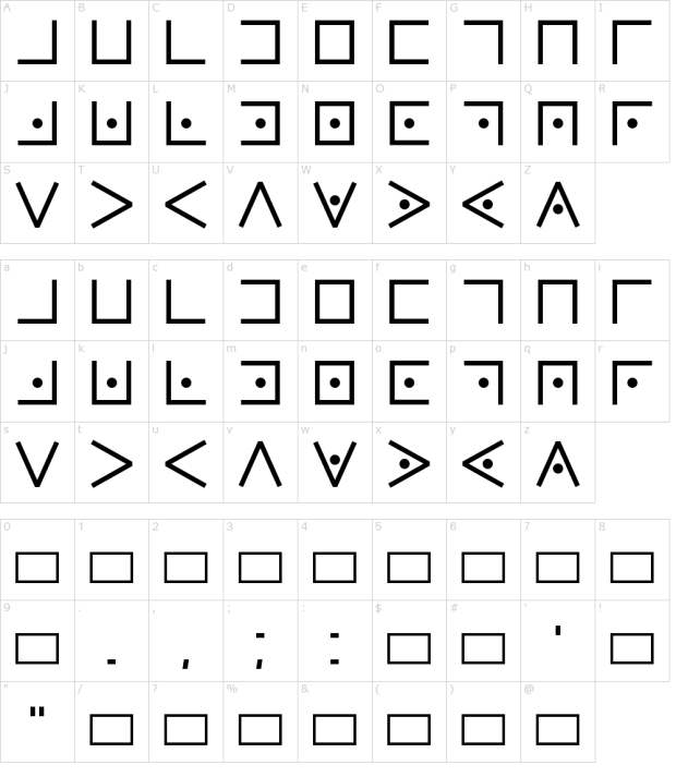
The Templar cipher was used by the Knights Templar during their era of activity to keep messages secret between brothers of the Templar. It uses the Templar cross as its cipher basis. Freemasons began using the cipher in the early 18th century to keep their records of history and rites private, and was used for correspondence between lodge leaders.

Tombstones of Freemasons can also be found which use the system as part of the engravings. One of the earliest stones in Trinity Church Cemetery in New York City, which opened in 1697, contains a cipher of this type which deciphers to “Remember death” and George Washington’s army had documentation about the system, and during the American Civil War, the cipher system was used by Union prisoners in Confederate prisons.

It is remarkable the similarities between the Templar/Freemason cipher and the Oak Island stone which lends itself to the theory that the Templars/Freemasons were involved with Oak Island…but more on that later.

Andrew King, May 27th, 2018

OAK ISLAND: Clues and suspects

CLUE

The game of Clue is a board game developed in 1949, currently distributed by the American game and toy company, Hasbro. The object of the game is to determine who murdered the game’s victim, where the crime took place, and which weapon was used. Then each player deduces the answer by strategically moving around a game board representing the rooms of a mansion, collecting clues and finally solving the mystery of who the murderer was and where they did the crime and with what weapon. Its an amazing game and I still enjoy playing it today.

This is not far off off how we should be looking at the various clues left behind in Canada, and elsewhere, as to who was visiting these shores in the Great Gap. The Great Gap would be between the years 1000 and 1497, when it is said the Norse came here and then 500 years later, John Cabot.. Who would be capable of making a trans-oceanic journey during that time? Why would they come, what is their motivation? Are there clues left behind that can help us determine the answer to these questions?

So, using a detective game as our inspiration, let’s examine the Who, What, When, and Where of this very vague historical gap.

THE PREMISE

In between 1000 and 1497 you would need to get to Canada via a boat of some sort. So who had boats that could successfully cross the Atlantic during that time?

THE SUSPECTS

THE NORSE

Being hardy seafarers for centuries, and with their success at crossing the Atlantic being already proven with their ruins and objects left behind at L’Anse Aux Meadows, we can consider the Norse as a suspect on Oak Island. Their recorded sagas of the journey tell us that they left Canada to return home again due to strife within their group and with the indigenous population. The hardships of settlement in what was likely the Miramichi area just wasn’t worth their time here. That’s not to say other Norse settlers came over, it’s just that those trips were not recorded, and I believe there is proof of that in the Arctic regions where they found European objects which have been carbon dated to around the 1300s.

figure 1300

A white pine figure carved of cloaked person with a cross on the chest, dated to 1250-1300. (Image:Museum Of History)

Those objects, some of which are on display at the Museum Of Canadian History, include chain mail armour, sword blades, oak wood barrels, a carved figure in a tunic with a cross (that story previously told here) and woven cloth. Was it the Norse? Could it have been someone else from Europe? Perhaps Northern Irish or Scottish adventurers made their way over to Canada, venturing into Nova Scotia, Mahone Bay and Oak Island.

THE PORTUGUESE

Corte-Real_statue

Statue of Corte-Real in St. John’s, NFLD (image: Wikipedia)

The Portugese only became leaders of exploration during their intensive maritime exploits of the 15th and 16th centuries, focusing mostly on Africa and the southern Atlantic. There is speculation that a Portuguese sailor by the name of João Vaz Corte-Real visited Canada in 1473, which is based on a recording of his adventures from Gaspar Frutuoso’s book “Saudades de terra” from around 1570-80. In it there is a description of a claim Corte-Real discovered a place called Terra Nova do Bacalhau ( New Land of the Codfish), which is considered to be modern day Newfoundland. A statue of him is in St. John’s, NFLD.

Evidence of their travels to Atlantic Canada can be seen in various place names, such as Labrador, which is thought to be named after João Fernandes, a “lavrador,” (a farmer).

It is said that Alvares Fagundes in 1520 tried to set up a colony in Canada, yet its location  has never been found, possibly it is in Cape Breton. There are no permanent Portuguese settlements currently known to have lasted, with many of these 15th-16th century Portuguese fisherman staying in their boats up near Newfoundland, a presence that is still seen today while they fish for cod on the Grand Banks. It seems unlikely these boat based fishermen would have come south to Oak Island, but they are a suspect nonetheless.

THE SCOTTISH

Medal_of_Nicolo_Zeno._Panteon_Veneto;_Istituto_Veneto_di_Scienze,_Lettere_ed_Arti

Nicolo Zeno (Wikipedia)

During the 14th century, two brothers from Venice, Italy by the names of Nicolò and Antonio Zeno became famous during the Renaissance for an alleged adventure exploring the waters of the North Atlantic and Arctic regions. They had another brother, a Venetian naval hero named Carlo Zeno. This whole Zeno family was part of the Venice aristocracy and held the franchise for transport between Venice and the Holy Land during the Crusades. The Zenos built up a sizable amount of wealth and were well established in Venice.

Now it should be mentioned before we dig deeper into the Zenos and their important part in this mystery that the academic community considers their stories a fraud. For reasons about to be mentioned, the Zenos have never really been considered a plausible source of historic fact, but you, as the reader, can decide if what we are about to hear is real or a fabrication.

In the year 1558, 150 years after the deaths Nicolo and Antonio Zeno, a family descendant discovered a series of letters, maps and correspondence between the two brothers written around 1400. In these old letters it is recorded that the Zeno members embarked on a fantastic voyage of exploration throughout the North Atlantic to distant lands under the command of a prince named Zichmni. (More on Zichmni later)

ZenoMap 1561

The Zeno map of their adventures showing the places they explored, including “Estotiland” shown on the far left, possibly Nova Scotia.

Estotiland

In the letters Nicolo wrote to his brother Antonio, Nicolo says he headed from Venice to England in 1380 and then returned to Venice five years later around 1385. In that time Nicolo says he was blown off course in his ship, running aground and stranded on an island. Here on this island Nicolo was rescued by someone called  “Zichmni”, who is described as a prince who owned some islands off the coast of another island called Frislanda. He ruled the area of Sorand, south-east of Frislanda.

Nicolo in the letters says he and his brother should go back to Frislanda, which they do and hang out with this said Prince Zichmni. While there, the Zeno brothers and Zichmni decide to embark on some adventures to Iceland and around the northern Scottish islands of the Shetlands and Faroe Islands. While on this adventure the gang meets a fisherman who was apparently blown off course and was stranded in a far off land for 25 years. Here the fisherman encountered strange animals, natives and a man with books who spoke Latin. The fisherman had eventually made it back to Frislanda and recounted the tale to his prince, Zichmni. Inspired by this fantastic voyage Zichmni decides he too wants to visit this land described by the fisherman and puts Antonio Zeno in charge of a fleet of ships to make the voyage to the distant land mentioned by the fisherman.

The year is now 1398 and Zichmni and Antonio Zeno sail west of Frislanda where they land in a place they call “Trin”, on the southern end of place they call “Engrouelanda”. Zichmni likes the climate and the soil, but his sailors find it inhospitable so they return home with Antonio while Zichmni remains behind with some of his men to explore the area and build a town. Maps were drawn of the exploration and were included with the letters that were written.

What?

First of all, let’s see if any of this makes sense. Frislanda is thought to be the area of northern Scotland and the Faroe Islands. If we look at the names mentioned, the land ruled by Prince Zichmni is called Sorand, or “Sorant”, possibly a translation of “Scotland”. If we look at who was ruling northern Scotland and the Faroe Islands during the 1380-98 time period, we come across the name Johann Reinhold Forster. Forster was an 18th century naturalist, best known as the resident naturalist on James Cook’s second Pacific voyage in 1772. Forster proposed that Zichmni was in fact the Earl of Orkney, Henry Sinclair. Henry Sinclair was the son and heir of William Sinclair, Lord of Roslin, and his wife Isabella, daughter of Maol Ísa, Jarl of Orkney, or “Earl Of Orkney”.

map-labeled


map1 copy

Orkney is a set of islands north of Scotland, invaded and forcibly annexed by Norway in 875 and settled by the Norse. Henry Sinclair took over the lands from Norway in 1379 as the earldom passed to the Sinclair family, who were also barons of Roslin near Edinburgh in Scotland. Sinclair Of Orkney, which makes Orkney being the possible location of Frislanda. When we compare a map of the Zenos of Frislanda, and the Orkney islands, they are a match. The only confirmed map of Scotland is from 1560, the exact same time the Zeno map was found. The “confirmed” map of Scotland clearly shows Orkney as an island as does the Zeno map, which called is Frislanda.

Map2

_90488130_firsteverprintedmapofscotland1560

A confirmed authentic map of Scotland showing Orkney from 1560. (image: BBC)

These elements lead Forster to claim that Sinclair and Zichmni were one and the same, as his timeline of rule, places of rule and his actions match the Zeno narrative. It must be noted that despite the fact that most historians call the Zeno maps and letters a hoax, there is a remarkable number of coincidences that so make it seem plausible.

657354

Sinclair of Scotland or Zichmni of Sorand?

The Zeno story does seem fantastical, and it outlines details that seem hard to imagine and the reasoning for including them puzzling. For example Antonio Zeno describes a spring of pitch running down to the sea int the newly discovered land. Detractors of the Zeno stories say that if it was Henry Sinclair that was Zichmni, then why isn’t there a record of the trip in Sinclair’s official history? Perhaps history sometimes doesn’t need to be written down to be accepted, and in fact, maybe it was Zeno who was put in charge of recording the event for Sinclair/Zichmni?

These are the major suspects as to who could have been lurking in the Nova Scotia area in the distant past. More recent suspects that may have been at Oak Island also come into play…

PIRATES AND THOSE OF DESPERATION

170px-Hanging_of_William_Kidd

Captain Kidd after his execution in 1701.

One of the earliest theories about Oak Island is that it held treasure buried there by Captain Kidd. Born in Scotland himself, Kidd was a known pirate on the New England coast, and before his execution in 1701, was known to have buried his treasures before his arrest while sailing an obscure sloop, so it is possible Kidd came to the island.

Perhaps Spanish sailors went to Oak Island to hold treasure from a wrecked ship. Another theory is that there were British troops stationed there during the American Revolution, or that they buried loot on the island from the British invasion of Cuba.

During the Seven Years War between 1756 and 1763, it could have also been French Army engineers hiding the treasures of the Fortress Of Louisburg after it fell to the British.

There are many clues on Oak Island that reveal who was most likely there, clues we will look at in a future post. These and more will become more clear in the following pages as we peel back the layers of a very complex puzzle on Oak Island.

TOMORROW: The Island.

Andrew King, May 26th, 2018


DAY 2: Cog In The Wheel

Screen shot 2018-05-25 at 8.54.39 AM

Samuel deChamplain’s 1632 map of the East Coast.

Samuel de Champlain’s map of 1632 refers to a tributary in Miramichi Bay as “Crow Brook”. This is what is now known as “French Fort Cove” because at its mouth on the western bank, known as Kethro lookout, it was the site of a French battery in 1756. It is curious that Champlain on more than one occasion has appeared on the scene in the footsteps of previous explorers, in this case the Norse, who likely settled in the Miramichi area.

Screen shot 2018-05-25 at 6.37.44 PM

French Fort Cove and Nordein marked on Google Maps.

It is also curious that the area known as French Fort cove fits the description of Hop from the Norse sagas. It has a hill where the settlement was built (other parts of Miramichi towards the coastal area is relatively flat), has a protected harbour area, and a stone cliff that is mentioned in the sagas where they battled the natives. A flowing brook would have been full of salmon, also mentioned. Wild grapes grow in the cove on its hills. A few hundred metres from this area the village of “Nordin” exists, a Nordic name. Coincidence perhaps.

IMG_0025

An arrangement of four cut stones at French Cove. Date unknown.

IMG_0026

Stone cleared off with scribed marks.

IMG_0030

IMG_0045

Amazingly, I stumbled upon the abandoned 1800s quarry used to provide the stone for Langevin Block (Prime Minister’s Office) in Ottawa.

A brief exploration of the area turned up some interesting finds, but it is unclear the age of these historic artifacts. They could be quite possibly be remnants of the 1700s French Fort that was there.

IMG_0056

IMG_0063

IMG_0069

IMG_0076

Another search occurred at Oak Point, as oak was revered by the Norse for its boat building use. This did not fit the description. Also checked out was Burnt Church, a place near the mouth of the river that housed a 1600s French missionary, later burnt down by the British. This also fit the description, but is an active reservation for the Burnt Church First Nation Mi’kmaq. The Norse likely traded with the Mi’kmaq, but relations turned ugly and the two battled often, a possible reason for their departure.

IMG_0080

Carved stone found at Burnt Church, ‘IHS” and the cross. “In Hoc Signo”  a Latin phrase meaning “In this sign you will conquer”

We have a very specific timeline of history regarding our first overseas visitors to Canada. History tells us the Norse Vikings from Iceland via Greenland came around 1000AD, then John Cabot in 1497AD. That is almost a 500year gap. So we are to believe that in those 500 years no one came over to Canada…no one at all? I find this very hard to believe.

The Norse were on the eastern coast of Canada in 1000AD, so the possibility exists someone else did it in the 500 year gap between them and Cabot. We know that the “Cog” ships were of a more advanced construction than the Nose Knarr boats, which we know made the journey. Northern Europe had such ships during the medieval era that would ply the Atlantic full of trade goods. A cog is a type of ship that first appeared in the 10th century, and was widely used from around the 12th century on. Cogs, and their sister ships, the birlinn, were clinker-built, generally of oak. They resembled and were constructed very similarly to the Norse knarr ships, probably due to the fact that the Norse and Scots were close in both proximity and relations at that time. Sharing stories of exploration and ship building technology would have been common.

Fitted with a single mast and a square-rigged single sail, these vessels were mostly associated with seagoing trade in medieval Europe and ranged in length from about 15 to 25 meters (49 to 82 ft) with a beam of 5 to 8 meters (16 to 26 ft), and could carry up to about 200 tons of cargo.

899c8398845424ccb67ab76aca2c3f2e--wood-etching-a-legend

Cogs had a flat bottom at midships but gradually shifted to overlapped planks near the bow and stern. Caulking of hull planks would have been tarred moss that was inserted into curved grooves, covered with wooden laths, and secured by metal staples called sintels. Using a a stern-mounted hanging central rudder (which was a unique northern development) to steer. These ships were the most common vessels of the medieval era and would have made long distance trips. It would not be stretch that these vessels would hopscotch between islands of northern Scotland/Ireland, over to Greenland and Iceland, with Canada being almost the same distance between those aforementioned areas.

2989-004-68F644D6

It is curious to see flying here in Miramichi that the provincial flag of New Brunswick illustrates a medieval trading vessel called a “lymphad”. Used primarily in Scotland, a wooden vessel propelled by sail and oars, traversed the Highlands and was used to sail west in the Hebrides during the 1100s-1500s. The flag of New Brunswick took the old ship symbol and made that lymphad the prominent feature. An interesting choice indeed!

IGLESIA-INGJALDSHOLL-PENINSULA-SNAEFELLSNES-2-550x413

A painting depicting Columbus in Iceland in 1477 getting directions to America.

We also know that the Norse kept tales of the new lands they discovered alive because in 1477 Christopher Columbus visited them to get that information from them. Arriving in Iceland and living at a farm called Ingjaldshóll, Columbus learned about the former Norse settlement in Vinland, and how the Vikings sailed to a New World, and about the travels of Leif Eiríksson and the rest of the Norse who had already been to North America five centuries earlier.

Columbus is credited because his “discovery” was celebrated and recorded with great pomp and circumstance, yet the Norse voyage to America was only made known when there was proof in 1960 after L’anse Aux Meadows was dug up. So what evidence do we have of another possible trip to Canada by another group of seafarers in the Northern Atlantic? That group, who heard tales from their Norse neighbours and trading partners most likely arrived here during the 1300s and I think that evidence of their arrival lies on an island in Mahone Bay off Nova Scotia. Someone followed in the footsteps of those original Norse settlers that spun tales of their old adventures and prompted some very curious people to arrive at Oak Island for their own reasons which we will soon discover.

Andrew King, May 25th, 2018

Oak Island and Miramichi: Why here?

What does Miramichi have to do with Oak Island? A question you may ask, and it is a very valid question about this quest. I believe Miramichi, New Brunswick is an important clue in a great puzzle and forms the basis for what happened on Oak Island.

The discovery of North America by Europeans can not really be attributed to any one person at any one time, yet society feels a need to label that milestone for some reason. Perhaps because it gives us a sense of place and a benchmark from which to gauge our own history. Yet, that date the academic world likes to tell us is likely wrong.

Screen shot 2018-05-24 at 8.11.03 PM

The Miramichi area that matches the Norse saga descriptions almost perfectly. (GoogleMaps)

We know it was wrong when they said it was Christopher Columbus who discovered America in 1492, which was proven incorrect with the 1960 discovery of the pre-Columbian Norse ruins at L’Anse Aux Meadows, Newfoundland. So what else is wrong? Maybe we just haven’t yet found the ruins that will alter history once again.

How far back do we go to determine who first discovered the North American continent? You could say it was migration of humans from Asia across the Bering land bridge about 20,000 years ago. This is the theory we are told in grade school and has been imprinted on us from an early age, but another concept could be that seagoing coastal settlers may have crossed over to North America much earlier than the land trudging bridge crossers.

Yet, in order to prove this we would need to study the coastal sites of that time period for their evidence of habitation, which unfortunately now lie submerged in up to a hundred metres of water offshore. This study will likely never happen but remains could be waiting for a discovery when our technology and drive to prove this theory coincides. Until that time comes, lets look at the periods of history where actual stories tell us of people visiting our North American shores with some astonishing similarities.

IMG_0007

Do the residents of Miramichi know something?

According to the Icelandic sagas—Eirik the Red’s Saga, Saga of the Greenlanders, plus chapters of the Hauksbók and the Flatey Book, the Norse that left Scandinavia started to explore lands to the west of Greenland only a few years after their Greenland settlements were established.

IMG_0002

An excerpt from the translated Vinland Sagas describing the details of “Hop” in Vinland by the Norse settlers.

These stories, or “sagas” as they are called describe that in 985AD while sailing from Iceland to Greenland with a migration fleet consisting of 400–700 settlers and 25 ships (14 of which completed the journey) a merchant named Bjarni Herjólfsson was blown off course, and after three days’ sailing he spotted a land west of the fleet. Bjarni was only interested in finding his father’s farm In Greenland, but he described his discovery of a new land to Leif Erikson who later explored the area in more detail and planted a small settlement there fifteen years later, which puts Europeans in North America in 1000AD.

The sagas describe three separate areas discovered during this exploration: Helluland, which means “land of the flat stones”; Markland, “the land of forests” and Vinland, “the land of wine”, found somewhere south of Markland. It was in this Vinland that the Viking settlement described in the sagas was founded, and which is thought to be somewhere in the Atlantic provinces of Canada, although this major settlement has yet to be found.

IMG_0003

Bay Du Vin…is this Vinland as described in the sagas?

What was discovered in 1960 was a temporary Norse encampment at L’Anse Aux Meadows, Newfoundland, since butternuts were found there that are not, and never were, native to Newfoundland where the Norse ruins were unearthed. This means that the inhabitants of this camp ventured further south, likely into New Brunswick, but no new evidence has yet been found, nor has any expedition been ignited to find the true Vinland of the Norse sagas.

IMG_9994

A view of the entrance to Miramichi Bay with the sandbar in the background.

That area known as Vinland or “Hop” in the sagas, a settlement of Norse in Canada is likely in Miramichi, NB as it matches the saga description almost perfectly. From the saga description of Hop we know the following:

-wild wheat in low lying areas
-wild grapes on the hills
-salmon
-wooden palisade built around farm
-on a hill
-inland lake fed by a river with sandbar to ocean
-across from large island (PEI)
-built houses above the lake on a hill, other huts near the shore

-noticed natives in boats coming from south, so settlers are on north side

-battled natives up river where they faced a cliff wall

Tomorrow we will explore this area and see what evidence we can find. A needle in a haystack, but hey, let’s try and thread this needle. We are sewing a massive quilt that threads into other visitors, visitors that later came to Oak Island.


Andrew King, May 24th, 2018

OAK ISLAND ADVENTURE: DAY 1-Miramichi

In preparation for what may lie on Oak Island, one must know the history of the East Coast, and its past inhabitants and visitors.

The Mi’kmaq are a First Nations people indigenous to Canada’s Atlantic provinces, and their territory was the first portion of North America that Europeans exploited at length for resource extraction.

Mi'Kmaq_Women_Selling_Baskets,_Halifax,_Nova_Scotia

An image from the 1800s depicting the Mi’kmaq of the time. (image: Wikipedia)

Reports by John Cabot, Jacques Cartier, and Portuguese explorers about conditions there encouraged visits by Portuguese, Spanish, Basque, French, and English fishermen and whalers, beginning in the early years of the 16th century, but before that it was likely the area called “Vinland” by Greenlandic Norse explorers 500 years earlier.

The stories of these Norse explorers are called “sagas” and they describe that in 985AD while sailing from Iceland to Greenland with a migration fleet consisting of 400–700 settlers and 25 ships (14 of which completed the journey) a merchant named Bjarni Herjólfsson was blown off course, and after three days’ sailing he spotted a land west of the fleet, the coast of Canada. Bjarni was only interested in getting to Greenland, but he described his discovery of this new land to Leif Erikson, who took on the adventure of finding this place and explored the area in more detail and planted a small settlement fifteen years later, which puts Europeans in North America in 1000AD.

Skálholt-Karte

A 15th century map of the Norse sagas depicting the land where they settled south west of Greenland. 

The sagas describe three separate areas discovered during this exploration: Helluland, which means “land of the flat stones”; Markland, “the land of forests” and Vinland, “the land of wine”, found somewhere south of Markland. It was in Vinland that the settlement described in the sagas was founded, and which is thought to be somewhere in the Atlantic provinces of Canada, although the main settlement has yet to be found.

What was discovered in 1960 was a temporary Norse encampment at L’Anse Aux Meadows, Newfoundland, as butternuts were found there that are not, and never were, native to Newfoundland where the ruins were unearthed. This means that the inhabitants of this camp ventured further south, likely into New Brunswick, but no new evidence has yet been found, nor has any expedition been ignited to find the true Vinland of the Norse sagas.

In 1347, it has been recorded that a ship arrived in Iceland, after being blown off course on its way home from Canada to Greenland with a load of timber. The implication is that the Greenlanders had continued to use Canada as a source of timber over several centuries, which means people were travelling and talking about the east coast of Canada in Europe between the first visit in 1000AD and what the history books tell us was the next visit by John Cabot in 1497. There were definitely people coming to the east coast from Europe in between, and they be a prime suspect as to who built what is on Oak Island in Nova Scotia.

MIRAMICHI

I recently read the Vinland Sagas, The Vinland Sagas as translated by Keneva Kunz
and the description the Norse give in their account of Vinland matches an area I think is in Miramichi, New Brunswick. the only confirmed spot in Canada the Norse visited is L’Anse Au Meadows but that was simply a temporary settlement, as that camp contained items from areas further south, such as in New Brunswick.

Screen Shot 2018-05-24 at 5.02.18 AM

The Miramichi region that matches the Norse saga description of their settlement area called “Hop”. Two rivers that meet, an inland lake with sandbars to the ocean. 

The saga notes describe a large inland lake past a sandbar from the ocean, with islands and countryside abounding with natural wheat, salmon, and timber. This where they settled for at least a few years, calling it “Hop” before things got too dicey with the locals and their own in-fighting that they later headed back to Greenland and Iceland.

Screen Shot 2018-05-24 at 5.03.40 AM

Studying Google Earth maps and Streetview to scope out the east coast of New Brunswick, the Miramichi area fits this description very well, and it would make sense that this area would be where they settled. Birgitta Wallace, the archaeologist who studied the Norse settlement at L’Anse Aux Meadows thinks so too, as noted in her interview with CBC where she asserts that Miramichi, NB is where Hop was located.

So we will go here on our first leg of the journey and see what we can find and if there can be any possible links found to another place south of it, Oak Island.

Andrew King, May 24th, 2018


On The Trail Of Oak Island

PRELUDE

History is always evolving. Things we were taught in school about ancient history is sketchy at best, a kind of a “fill in the blanks” exercise using the few archaeological relics that have been found and what scant amount was actually written down to put together a kind of half full bookshelf of history for us to believe.  Yet this bookshelf is full of books that have yet to be written, books with empty pages waiting to be filled. What we think we know can change in an instant with a certain new discovery. A land once thought impossible to have been visited by a certain group of people suddenly becomes an accepted fact because someone had a theory,  took a chance and made a discovery that altered everything that was once thought to be the only possibility.

In 1960 the Norwegian couple Helge and Anne Ingstad put the academic world on end when he and his wife theorized, and then successfully proved that Norse explorers had arrived and settled in North America 500 years before Christopher Columbus was said to have “discovered” the New World.

After years of careful research, thorough investigation and a dash of imagination and thinking outside the academic box, their theory was then proven as a fact when an archeological dig turned up confirmed Norse artifacts that were once thought to be part of only a “legend”. And thus, history and its textbooks were changed forever. What is to say that can not happen again? History is constantly evolving as new discoveries shed a different light on what really happened in our past. And is with that same spirit of “what ifs” that you will see in the following adventure.

Taking what we do know, and filling in the blanks with possibilities that may not fit the accepted norm will definitely irk the established history experts, but these ideas must be explored if we are to understand and determine the truth about our actual history.

I leave Thursday for the East Coast to explore the realm of the shores in New Brunswick and Nova Scotia. 

So buckle up, toss your history textbooks out the window and let’s uncover what I think really happened on small island off the coast of Nova Scotia, an island we know as:

OAK ISLAND.

Follow this blog for daily updates on the adventure and on Twitter at @TimeWinders and @TwitAndrewKing