The word “cathartic” traces back to the Greek word “kathairein”, meaning “to cleanse, or purge.” Catharsis became a medical term having to do with purging the body of toxins, and soon people started to also use the word cathartic in reference to an emotional release and a spiritual cleansing.
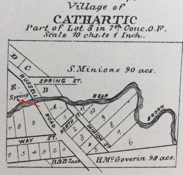
This old map from 1879 shows a village called “Cathartic” which is now Carlsbad Springs.
Just a few kilometres east of Ottawa there once was a place actually called CATHARTIC, due to the fact that at one time the land there contained a number of ancient bubbling mineral springs that were known to heal and cleanse those who entered them. This place became known as Carlsbad Springs. Ottawa’s own “Fountain Of Youth”, where the wealthy and elite of Ottawa’s upper class ventured in attempts to reverse the aging process and to renew their bodies and mind.
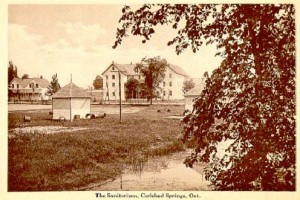
An early 1900s postcard showing the resort and spring houses.
The healing mineral waters of the springs became incredibly famous, and a number of resort hotels and even a CN train station were built around the bubbling baths. Then, as quickly as they were built, the station and hotels were demolished, the once coveted springs soon fading from memory. But do the springs still exist, and if so, where are they? As Ponce de León once searched for the Fountain of Youth, I began to search for our Lost Springs of Carlsbad Springs.
SPRING IS HERE
I always enjoying glancing through old maps, and my curiosity was piqued when I saw a small town outside Ottawa called “Cathartic” in 1879. Knowing what the word meant, but not knowing if that place still exists on current maps, I looked further into where this village may have been located. It turns out that CATHARTIC became what we now call Carlsbad Springs. Upon further investigation it turns out this small area has a most intriguing past.

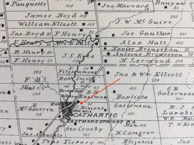
A red arrow indicates the location of the healing spring on this map from 1879.
Situated on a small creek called “Bear Brook” off Russell Road, Cathartic/Carlsbad Springs was located an and old native trail that once linked Ottawa to Montreal. Used for centuries by the indigenous people during their travels through the area, the trail became Russell Road as pioneer settlers took over the land in the 1850s.
The natural springs in the area were noted for their mineral content and qualities, with ancient bedrock waters bubbling up from subterranean aquifers.
Once called Boyd’s Mills, after the first mill owner on the creek, the settlement became known as “Cathartic” in 1870 and the first hotel was built in the vicinity of the springs by the Dominion Springs Company, who touted them for their healing properties.
By 1892 another hotel was built, and soon a train station to allow passengers to visit this new wonder, and what was Ottawa’s largest dance hall, the area’s first bowling alley, and many other recreational activities. Visitors from around the world soon flocked to Cathartic to drink its healing waters and soak in the bubbling baths. The mineral water was soon being bottled and sold throughout North America, and in true capitalist form, the village was rebranded in 1906 as “Carlsbad Springs” after the most fashionable aristocratic resort in Europe. The springs were given names based on the properties of the waters coming from them, such as Soda, Sulphur, Magic, Lithia, and Gas. A special fountain was constructed near the hotel that would be set on fire each night due to the flammable content of the water.
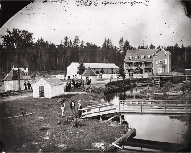
An 1890s photo shows the first hotel and the original sheds built over the healing springs.
Thousands of Ottawa’s most wealthy residents took the trip to the “Springs” to relax, enjoy the nature trails and amenities of the hotels. This would all soon disappear when the Great Depression and World War 2 hit, sending the resorts and their healing waters down the drain. Even though all the hotels and buildings have since been demolished, the natural springs should still exist, so I thought let’s go find them.
MAPS
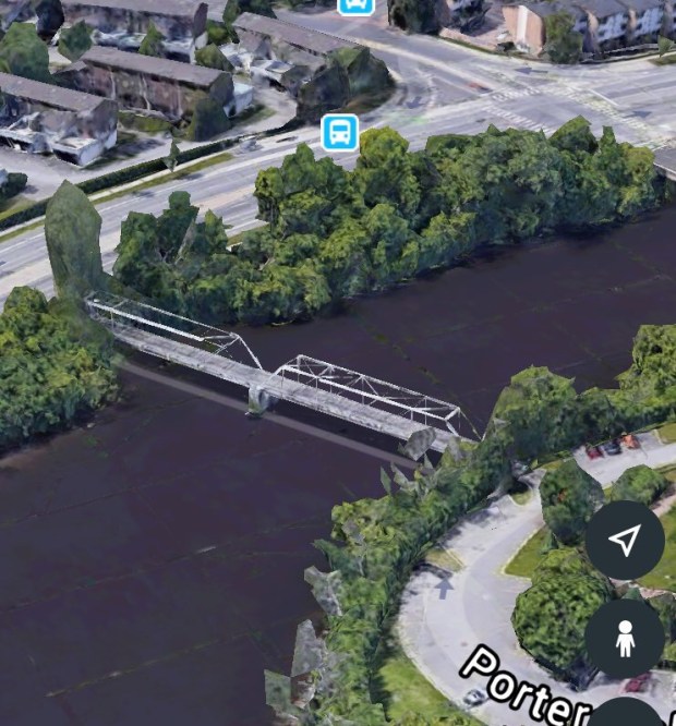
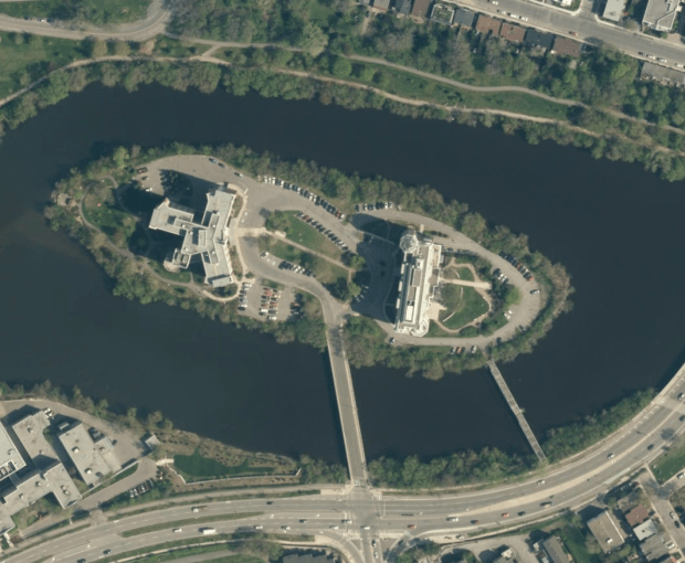
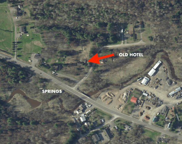
An old map of Cathartic from 1879 shows a spring labelled on it next to the Bear Brook, and a small stream leading from it down to the creek. Comparing that to a modern Google Map of Carlsbad Springs, it reveals that nothing much is there now, and the old road has been shifted south, however the area where our fountain of youth was located looks to still be undeveloped.
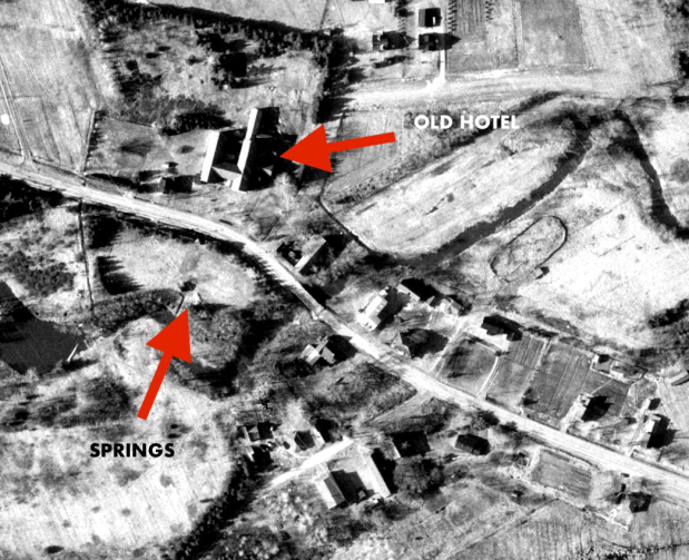
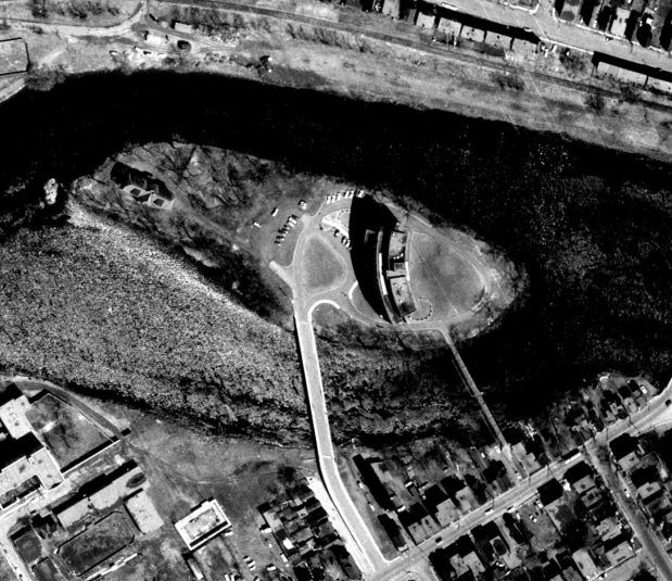
This GeoOttawa aerial view from 1965 shows the old hotel still standing in the upper left side. The springs would be across from it as referenced in the old 1890s photo.
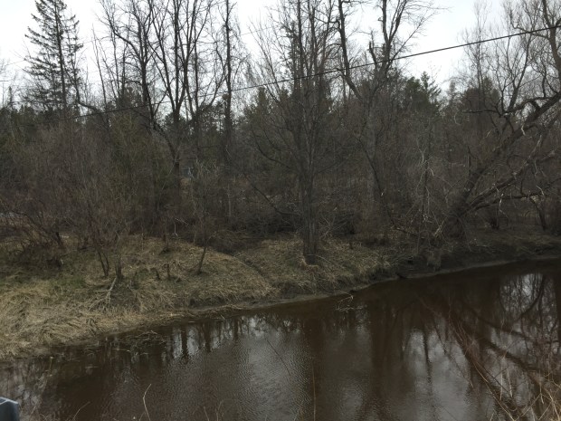
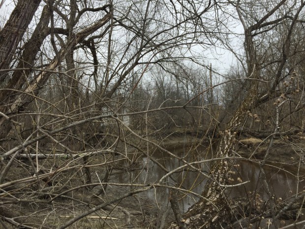
Heading out to Carlsbad Springs and walking along the muddy shoreline of the BearBrook creek to where the spring was supposedly marked on the old map, a trickling sound was soon heard, and following it up the riverbank I came across a spring!
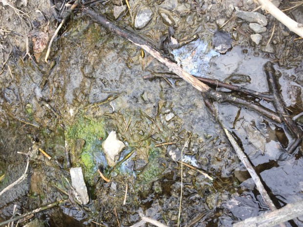
The source of the cathartic waters, and a late 1800s resort town were right there, still bubbling up from the earth, hidden amidst rocks and leaves of the now overgrown landscape. You could see the almost oily nature of the water with a film of some chemical on top of the bubbling water.
The National Capital Commission now owns the land and has graciously restored one of the old Spring House structures, which were built over the springs back in the early resort days. In the summer when the park is open there is a parking lot nearby.
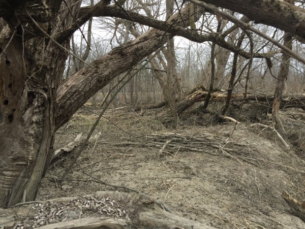
I managed to find the spot where a promotional photo was taken in the 1890s, but it looks unrecognizable. A quick survey of the area revealed more old springs and their own particular properties as mentioned earlier. Some were moss laden, others were rust coloured.
A comparison photo..THEN and NOW…Almost unrecognizable. The restored Spring House structure is visible through the brush.
At one spring source there was what looked to be an old glass bottle used in the bottling of the spring water back in the popular resort days.

One of the old bottles used to bottle the cathartic mineral water?
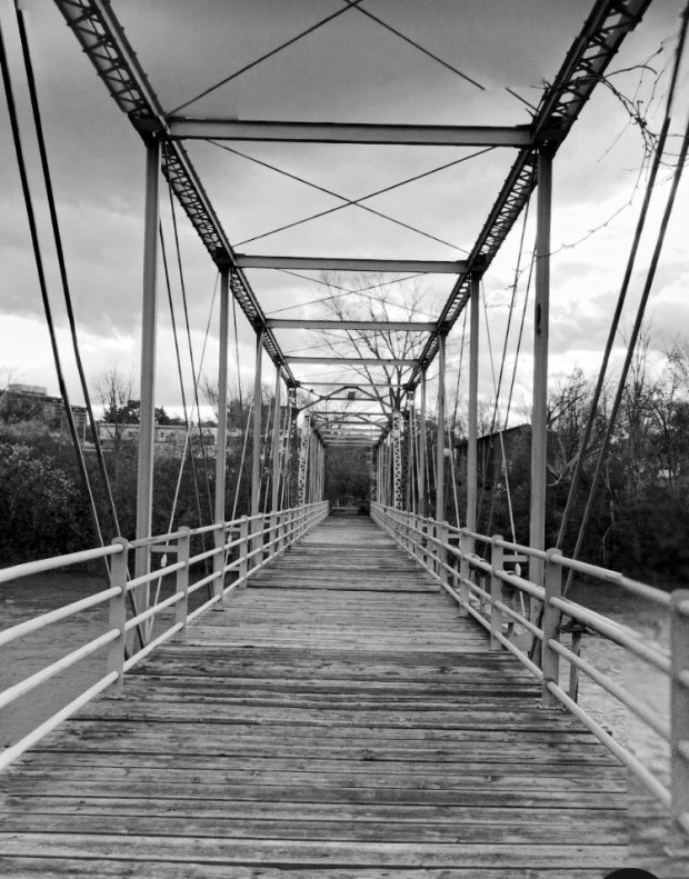
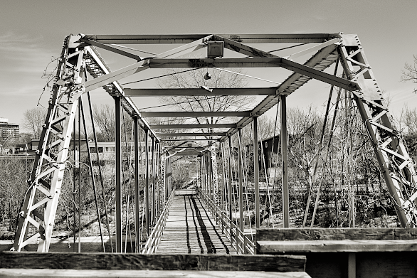
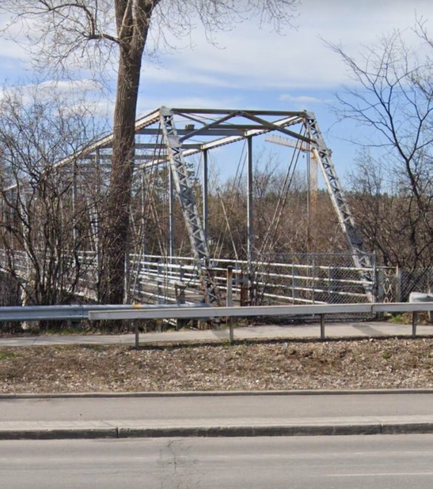
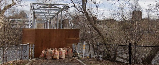
Nothing much else remains to indicate the once prosperous resort that used to be there. The old bridge area is visible with some interesting artifacts found around it.

This is where the old hotel would have been, note the old Russell Road in front of it.

Where the old bridge was located over the Bear Brook.

Old foundation ruins along the shoreline.


Remnants of a Carlsbad Springs’ glory days as a Health Spa Resort.
Perhaps there lies a cure to the current coronavirus waiting in these forgotten healing springs, from a time when people put their health and faith in mysterious liquids bubbling up from the ground.

The once famous healing and cathartic springs is now nothing more than a forgotten trickle from the ground.
Andrew King, April 26, 2020
SOURCES:
Google Maps
https://en.m.wikipedia.org/wiki/Carlsbad_Springs,_Ontario
Carleton Atlas, 1879 Edition
https://www.carlsbadsprings.ca/history/