*PLEASE NOTE: Samuel de Champlain uses the term “sauvage” or savage (meaning “wild” or people of the forest) to refer to the Indigenous peoples of North America. It’s important to understand that the term was not always used negatively and was used in a neutral or even positive context, particularly when referring to their natural connection and knowledge of the land.
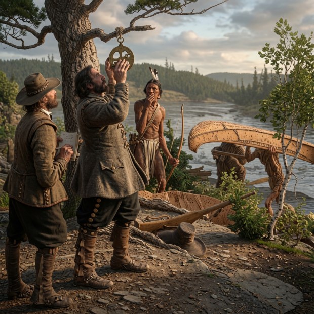
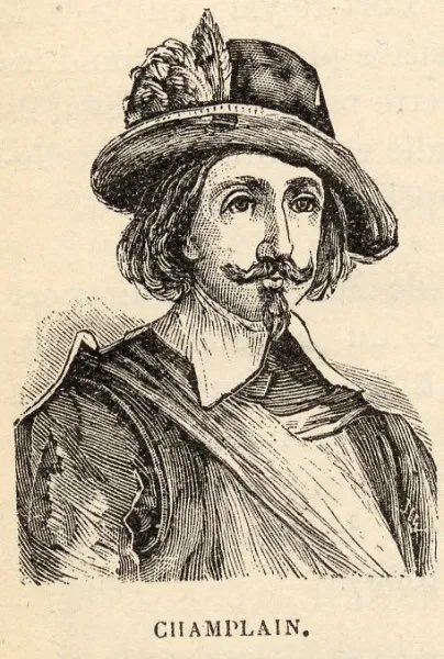
**DOUBLE NOTE: *The above image of Champlain is a Grok Imagine generated image using the original 1928 sketch by C.W. Jeffreys titled: “Champlain Taking an Observation with the Astrolabe” Credit: Library and Archives Canada, Acc. No. 1972-26-84
Copyright: Expired. Since no authentic portrait or definitive image of Samuel de Champlain is known to exist, I wanted to create an engaging colour image that best represented his adventure. All commonly reproduced “portraits” of the explorer are actually 19th-century fabrications based on an engraving of an entirely different person. Since I do not have the time or skills to paint my own original scene, using Grok Imagine was the best option to bring Champlain to life on his Ottawa River Adventure. For those who express negative displeasure with the image, please feel free to unsubscribe to this FREE site, do not read the article, or perhaps paint your own image for me to use at no charge. For those that like to learn, thank you for reading and enjoy!
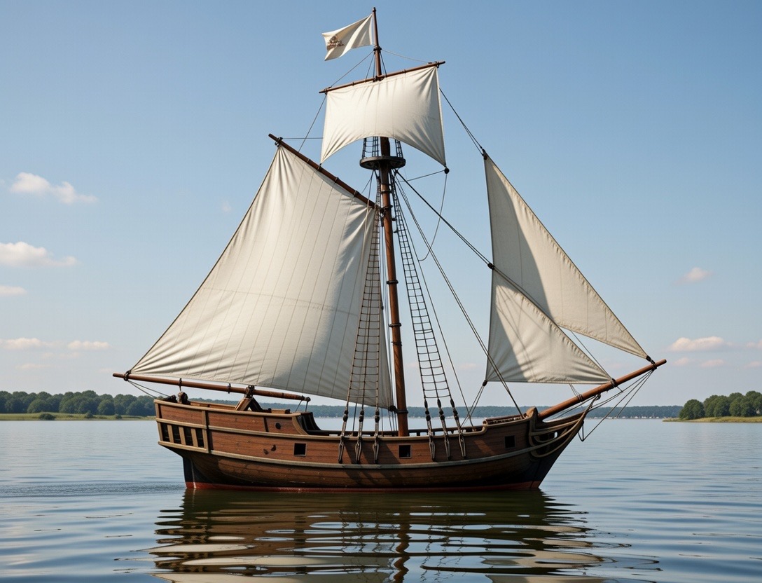
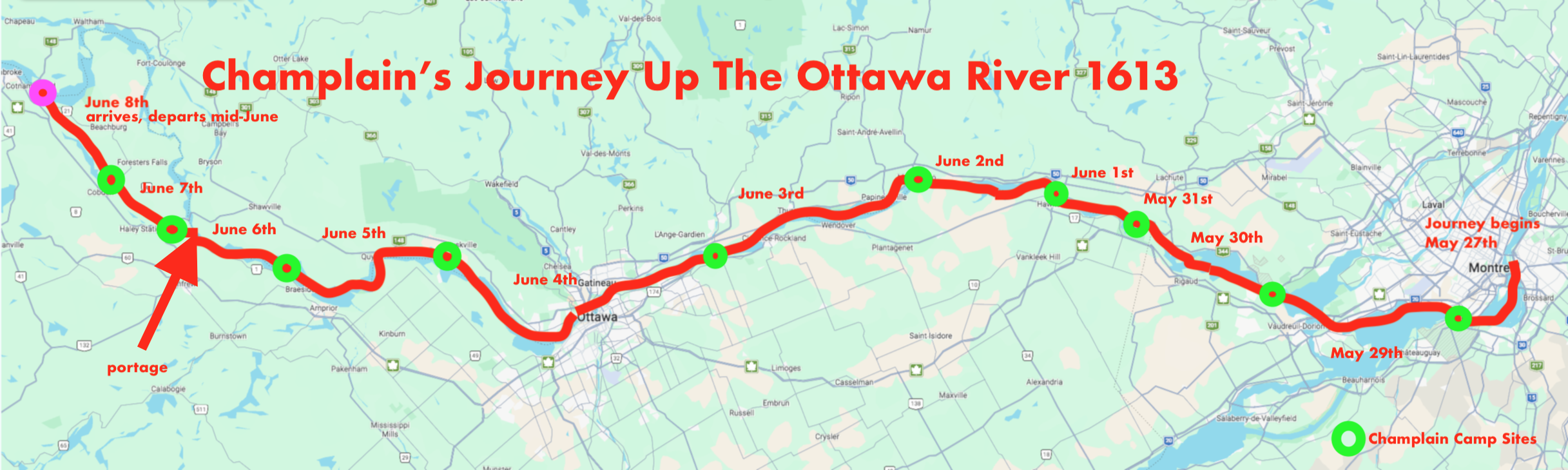
In a search for the Northern Sea and a route to the riches of the Far East, explorer Samuel De Champlain traveled up the Ottawa River this very week in 1613. Between the last week of May and first weeks of June, Champlain embarked on an adeventure he documented in his diary that has been made publicly available through the US Library of Congress.
Champlain was accompanied by Nicolas de Vignau, who claimed to have seen the Northern Sea, but it was the Algonquin leaders Nibachis and Tessouat that ultimately convinced Champlain that Vignau had lied about visiting the Northern Sea.
THE ADVENTURE BEGINS
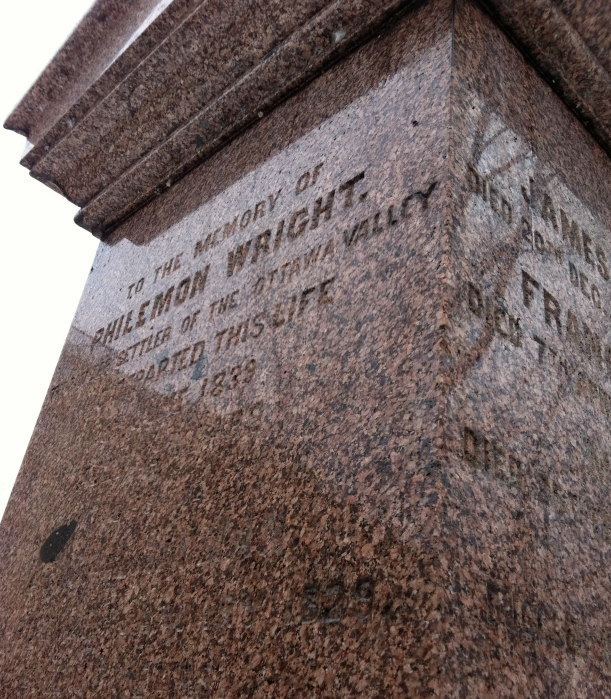
Samuel de Champlain was a French navigator, cartographer, draftsman, soldier, geographer, ethnologist, diplomat, and chronicler. He made 20+ trips across the Atlantic and founded New France and Quebec City in 1608. Probably the most important figure regarding the beginnings of Canadian history, but he remains lost in time after his death, his final resting place a complete mystery.
But details do exist of his journey up the Ottawa River on this exact week of June in 1613. Amazingly, the US Library Of Congress has a digitized version open to the public, of which I read and would like to share with you here. A day by day synopsis of Champlain’s grand adventure 413 years ago.
Before we begin our time travels with Champlain, we must first start deciphering this 413 year old account with an analysis of the original journal and how it translates into present day terms.
Champlain uses the term “lieue”or “league” to measure distance on his journey. But what is a league, how far is that in today’s modern measurement of distance?
This of course is crucial to tracking Champlain properly and is a key element to matching his distances on today’s maps for an accurate plotting of his route.
The “old French league” was a measurement used by the French up until 1674 and was defined as 10,000ft. With Champlain traveling in 1615 and his journal of his exploits being published soon after, this falls into the right unit of measurement for that time. 10,000 feet converts into a modern metric measurement of 3.25km.
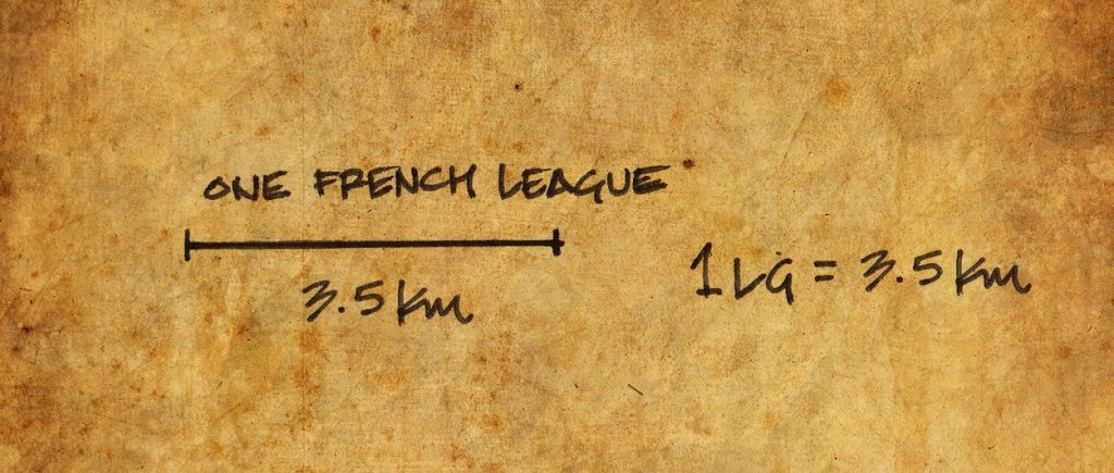
The French League however differed with Champlain depending on what type of surface he was traveling on. A French Land League ranged between 3.25km-4.68km, (an average of 4km). Champlain used a different measure of league at different points of his adventures, on the open sea and St. Lawrence River he used a league that was 4.0-4.5km compared to the approximate 3.4km league he used for inland travel.
Because Champlain was traveling over both land and water on this 1613 journey which makes it almost impossible to pinpoint an EXACT measurement of his mentioned league. So I will be using the average of 3.5km=one Champlain league.
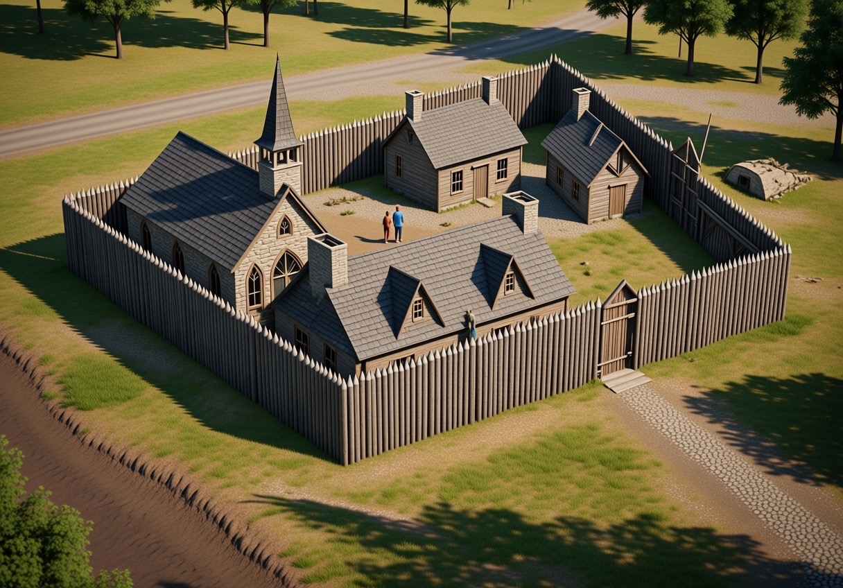
The journey up the Ottawa River by Champlain would be the first recorded trip by a European in what is now Canada.
DAY ONE: May 27th, 1613
The journal describes the start of the journey from what is present day Montréal on May 27th, 1613. Champlain states:
“Accordingly, our canoes being laden with some provisions, our arms, and a few articles of merchandise for making presents to the savages, I set out on Monday the 27th of May, from Isle St. Hélène with four Frenchmen and one savage, a parting salute being given me with some rounds from small pieces.
This day we went only to the Falls of St. Louis, a league up the river, the bad weather not allowing us to go any farther.”
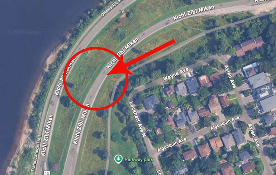
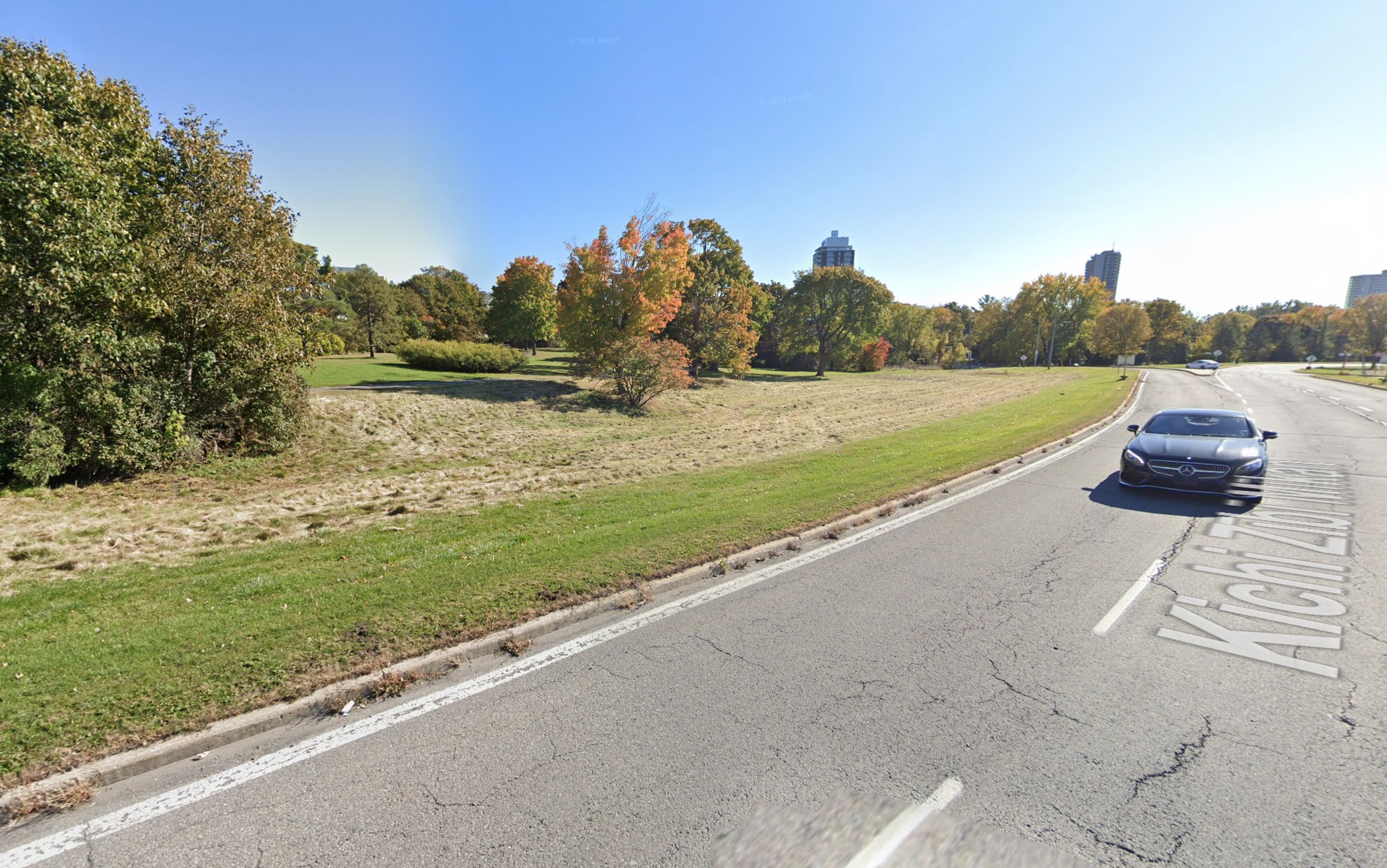
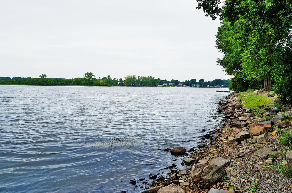
Leaving Montréal from “Isle St. Helene”…this island in Montreal is where Expo 67 took place, and it was named in 1611 by Samuel de Champlain in honour of his wife, Hélène de Champlain.
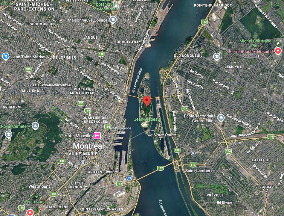
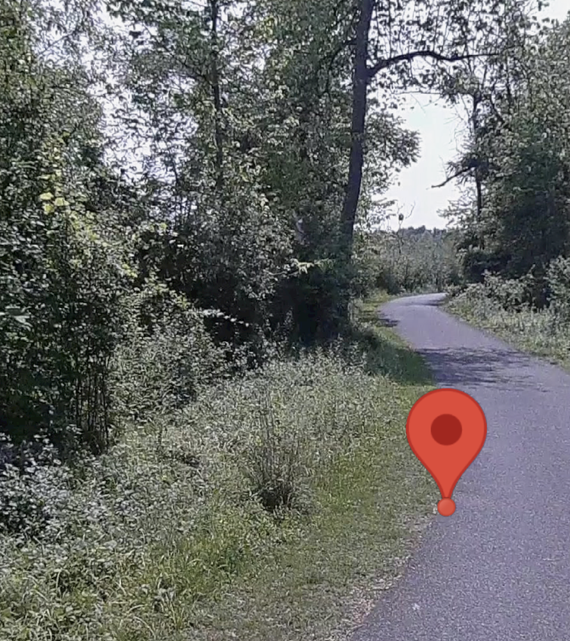
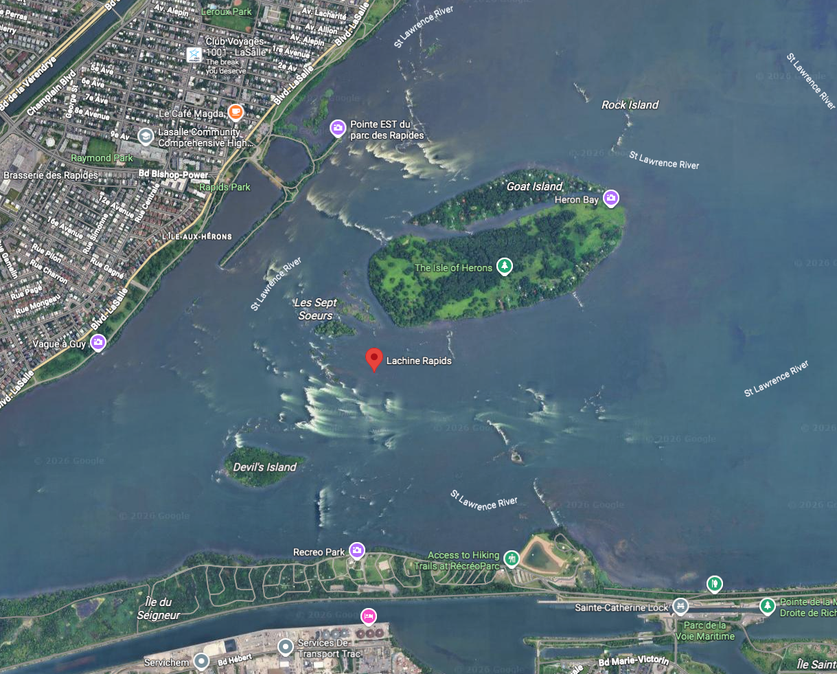
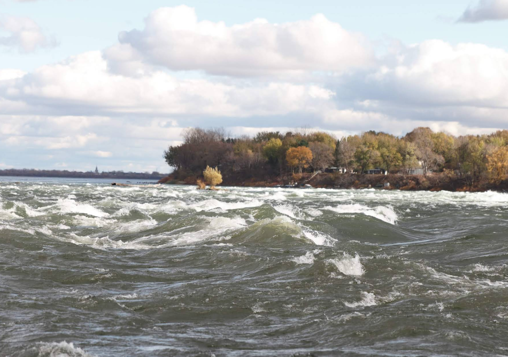
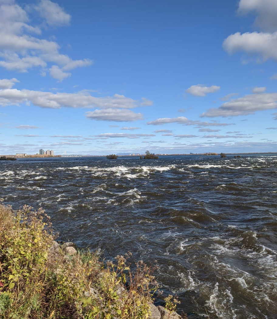
When he says they headed west to the “Falls Of St Louis” , that would be the current “Lachine Rapids”. In 1611, Samuel de Champlain named the rapids “Sault Saint-Louis”, after a teenaged crewman named Louis who drowned here; the name later extended to Lac Saint-Louis. This name remained in use until the mid-19th century. Champlain would stay a couple of days here then depart the Falls on May 29th, 1613…Here is where that spot is and how it looks today:
MAY 29th, 1613
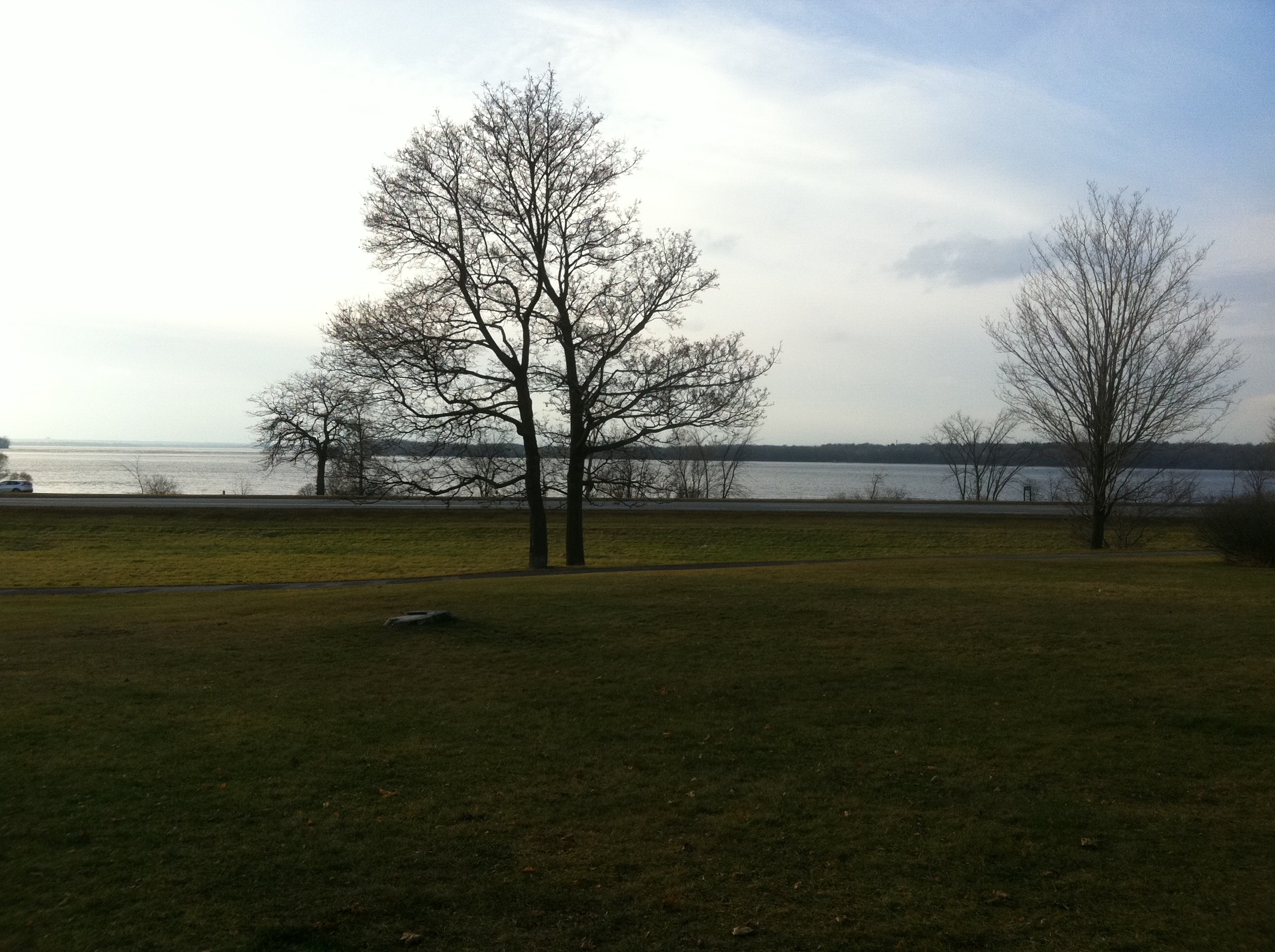
“On the 29th we passed the Falls, partly by land, partly by water, it being necessary for us to carry our canoes, clothes, victuals, and arms on our shoulders, no small matter for persons not accustomed to it. After going two leagues beyond
the Falls, we entered a lake,’ about twelve leagues in circuit, into which three rivers empty; one coming from the west, from the direction of the Ochateguins, distant from one hundred and fifty to two hundred leagues from the great Falls;’ another from the south and the country of the Iro-quois, a like distance off.”
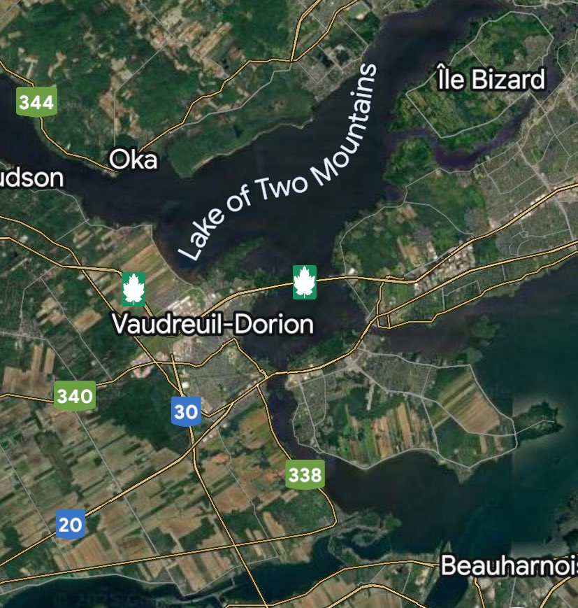
This is the area where the St. Lawrence and Ottawa River meet. Lake St. Louis is a widening of the St. Lawrence River in the Hochelaga Archipelago. It is also fed by the Ottawa River via the Lake of Two Mountains at Sainte-Anne-de-Bellevue, the Beauharnois Canal, the Soulanges Canal, the Saint-Louis River, and the Châteauguay River.
Champlain states:
“This river on the north, according to the report of the savages, comes from a source more remote, and passes by tribes unknown to them and about three hundred leagues distant.”
This would be the Ottawa River. As he moves up the river he describes the landscape:
“This lake is filled with fine large islands, containing only pasturage land, where there is fine hunting, deer and fowl being plenty. Fish are abundant. The country bordering the lake is covered with extensive forests. We proceeded to pass the night at the entrance to this lake, making barricades against the Iroquois, who roam in these regions in order to surprise their enemies; and I am sure that if they were to find us they would give us as good a welcome as them, for which reason we kept a good watch all night.”
This would be the Oka/Hudson area where Champlain stayed overnight.
May 30th, 1613
The next day Champlain states:
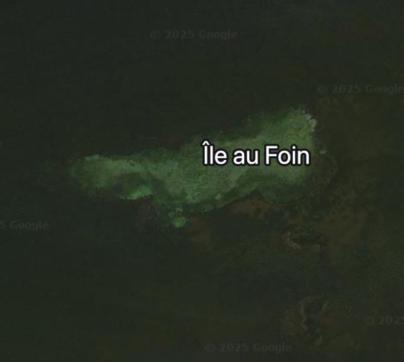
“I took the altitude of the place, and found it in latitude 45° 18. About three o’clock in the afternoon we entered the river which comes from the north, and, passing a small fall by land so as to favor our canoes, we proceeded to a little island, where we spent the night.”
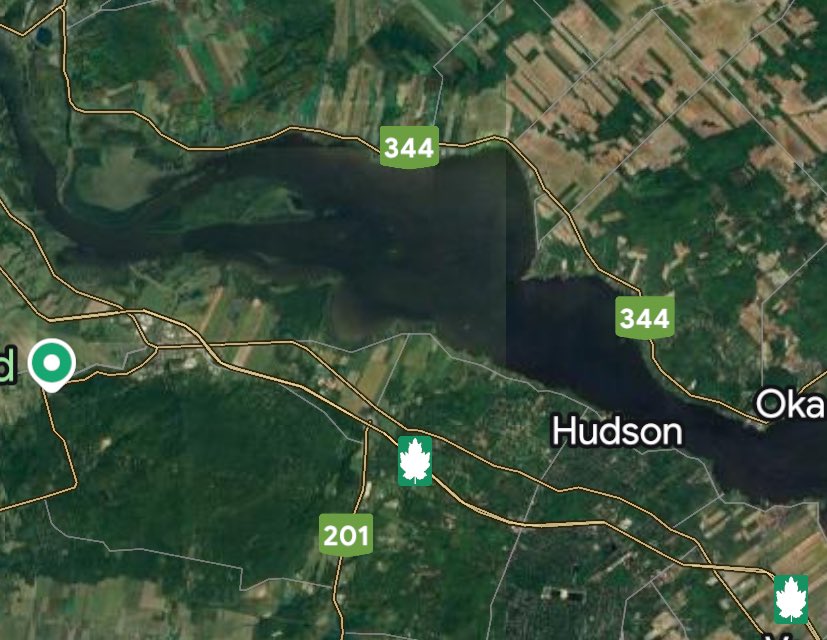
Now moving up the Ottawa River from the Oka/Hudson area, Champlain appraoches a small island. What island did Champlain camp out on?
My guess would be Ile Au Foin, now partly submerged from the recent dam flooding.
May 31st, 1613
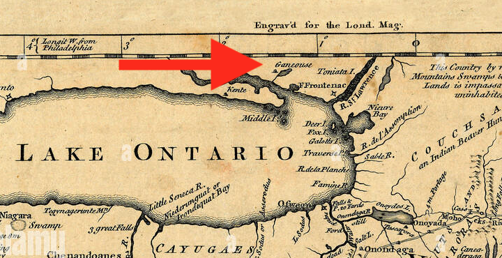
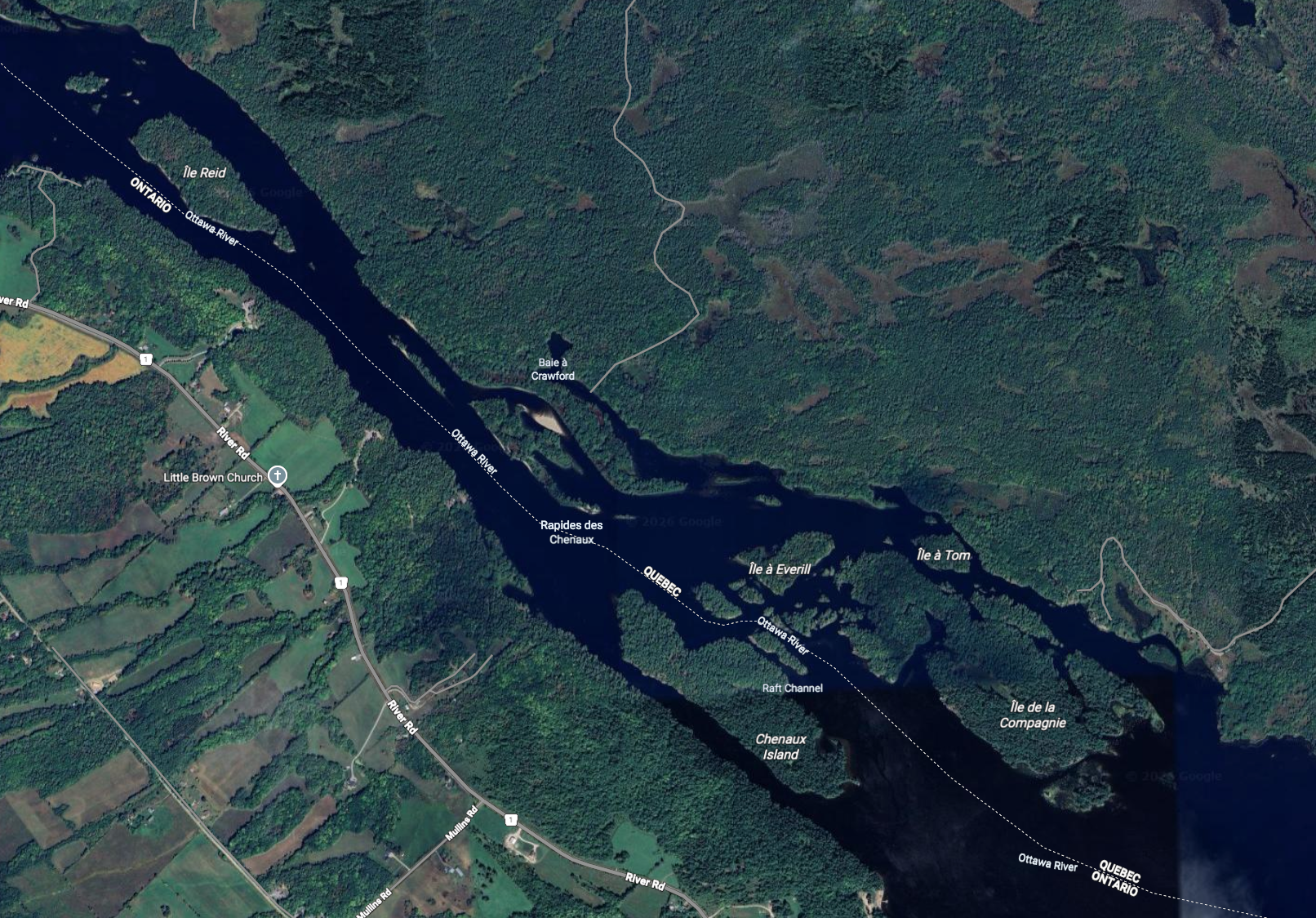
“On the last day of May we passed another lake,’ seven or eight leagues long and three broad, containing several islands. The neighboring country is very level, except in some places, where there are pine-covered hills. We passed a fall called by the inhabitants of the country Quenechouan, which is filled with stones and rocks, and where the water runs with great velocity.We had to get into the water and drag our canoes along the shore with a rope. Half a league from there we passed another little fall by rowing, which makes one sweat. Great skill is required in passing these falls, in order to avoid the eddies and surf, in which they abound; but the savages do this with the greatest possible dexterity, winding about and going by the easiest places, which they recognize at a glance.”
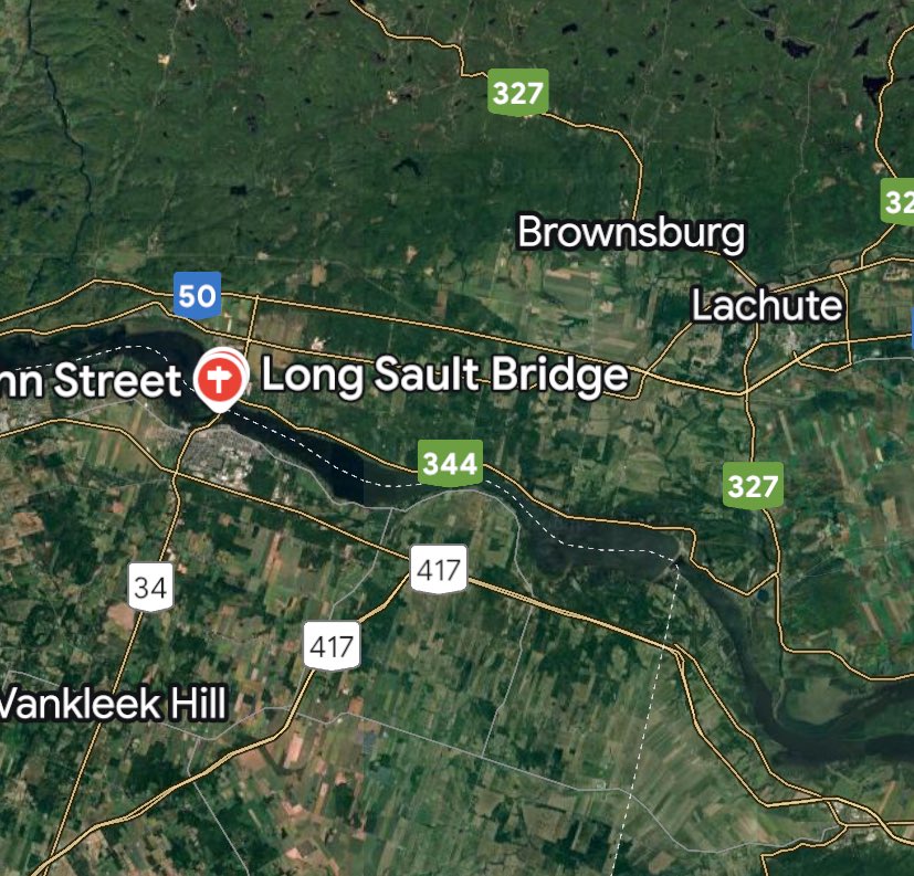
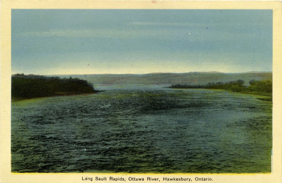
This is what we know today as “Long Sault” near Hawkesbury…the falls here have since been flooded out by the Carillon Dam that was built in 1964.
June 1st, 1613
On June 1st, 1613, Samuel De Champlain almost died in the rapids of Long Sault near Hawkesbury.
“On Saturday, the lst of June, we passed two other falls; the first half a league long, the second a league, in which we had had much difficulty; for the rapidity of the current is so great that it makes a frightful noise, and produces, as it descends from stage to stage, so white a foam everywhere that the water cannot be seen at all. This fall is strewn with rocks, and contains some islands here and there covered with pines and white cedars. This was the place where we had a hard time; for, not being able to carry our canoes by land on account of the density of the wood, we had to drag them in the water with ropes, and in drawing mine I came near losing my life, as it crossed into one of the eddies, and if I had not had the good fortune to fall between two rocks the canoe would have dragged me in, inasmuch as I was unable to undo quickly enough the rope which was wound around my hand, and which hurt me severely and came near cutting it off.”
As Champlain pulled himself out of danger, he thanked his companion…
“Later our savage came to help me, but I was out of danger. It is not strange that I was desirous of preserving my canoe, for if it had been lost it would have been necessary to remain, or wait until some savages came that way, a poor hope for those who have nothing to dine on, and who are not accustomed to such hardship. As for our Frenchmen, they did not have any better luck, and several times came near losing their lives; but the Divine Goodness preserved us all. During the remainder of the day we rested, having done enough.
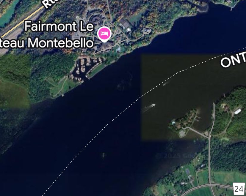
The next day we fell in with fifteen canoes of savages called Quenongebin,’ in a river, after we had passed a small lake, four leagues long and two broad. They had been informed of my coming by those who had passed the Falls of St. Louis, on their way from the war with the Iroquois. I was very glad to meet them, as were they also to meet me, but they were astonished to see me in this country with so few companions, and with only one savage.”
This likely would have been near Montebello…
June 2nd and 3rd, 1613
Champlain decides to camp on another island…possibly Miller Island across from Montebello.
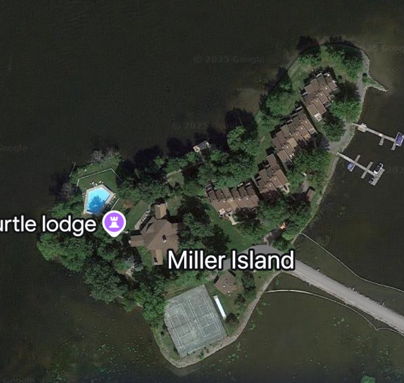
“To this they assented, and we encamped on an island. The next day I explained to them that I was on my way to their country to visit them, and fulfil the promise I had previously made them, and that if they had determined to go to the war it would be very agreeable to me, inasmuch as I had brought some companions with this view, at which they were greatly pleased; and having told them that I wished to go farther in order to notify the other tribes, they wanted to deter me, saying that the way was bad, and that we had seen nothing up to this point.
Wherefore I asked them to give me one of their number to take charge of our second canoe, and also to serve us as guide, since our conductors were not ac-quainted any farther. This they did willingly, and in return I made them a present and gave them one of our Frenchmen, the least indispensable, whom I sent back to the Falls with a leaf of my note-book, on which for want of paper I made a report of myself.
Thus we parted, and continuing our course up the river we found another one, very fair, and broad, which comes from a nation called Ouescharini,’ who live north of it, a distance of four days’ journey from the mouth.“
This river is very pleasant in consequence of the fine islands it contains, and the fair and open woods with which its shores are bordered.”
(This river may be the De Lievre River where Buckingham, QC is located)
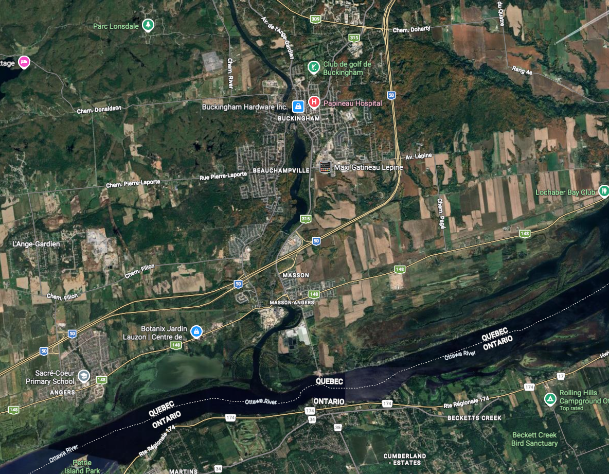
Champlain continues his journey and states:
“The land is very good for tillage. On the fourth day we passed near another river coming from the north, where tribes called Algonquins live. This river falls into the great river St. Lawrence, three leagues below the Falls of St. Louis, forming a large island of nearly forty leagues? This river is not broad, but filled with a countless number of falls, very hard to pass.
Sometimes these tribes go by way of this river in order to avoid encounters with their enemies, knowing that they will not try to find them in places so hard to access”
This would seem to point to what is the Gatineau River, although it is somewhat cryptic in mention.
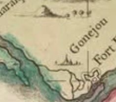
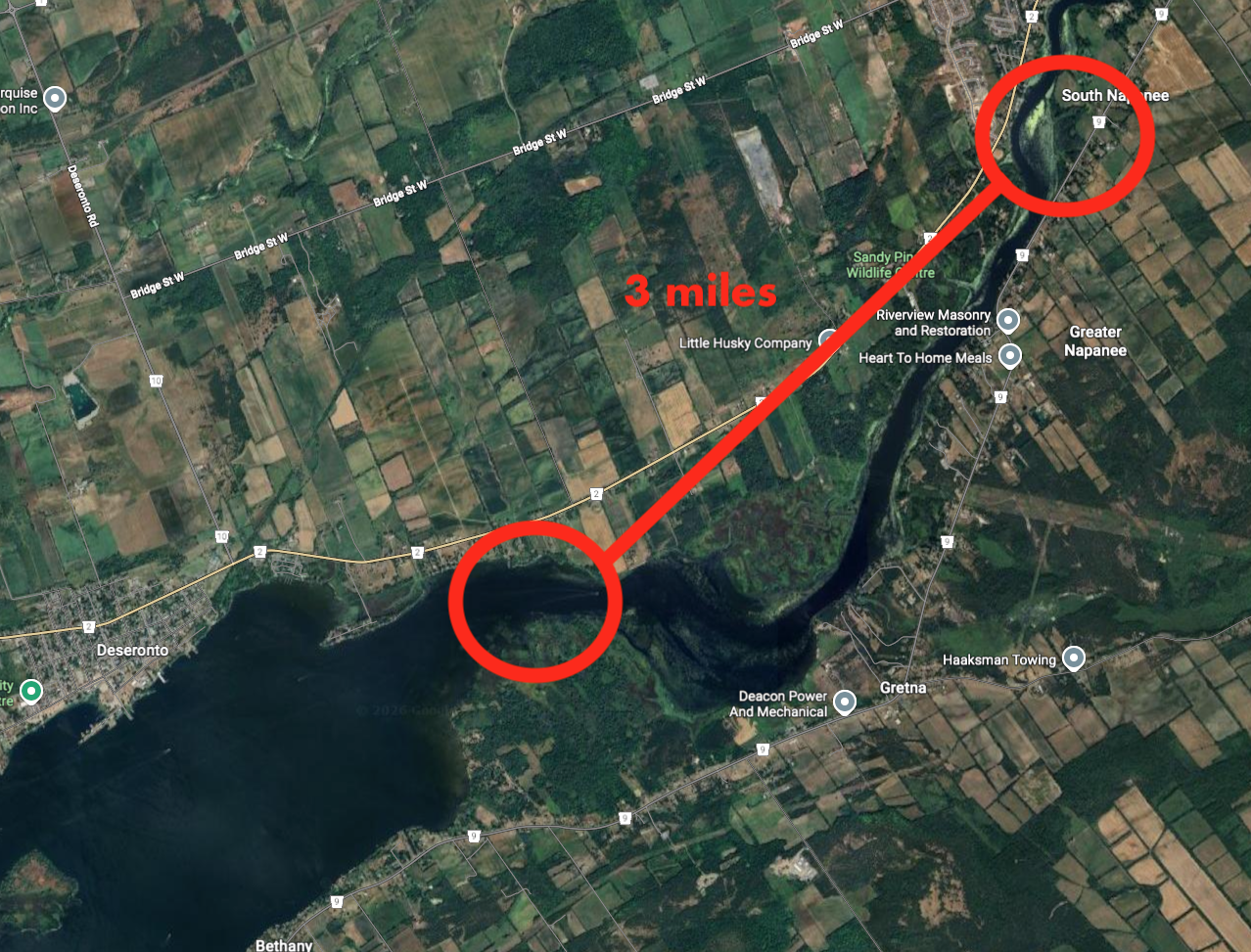
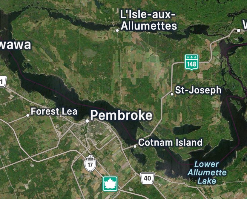
June 4th, 1613: OTTAWA
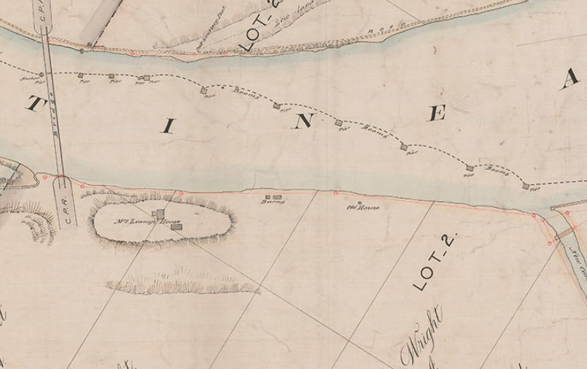
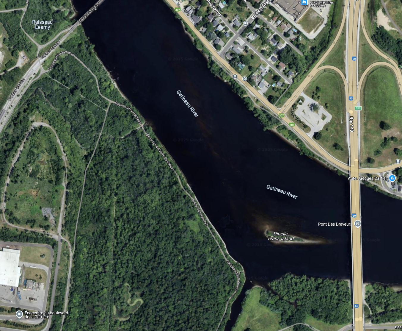
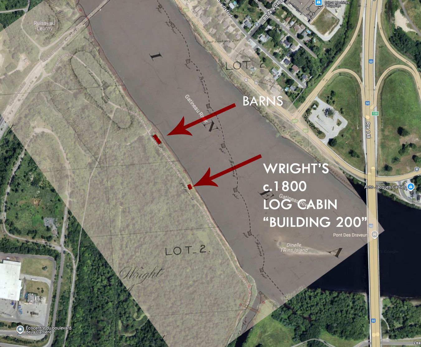
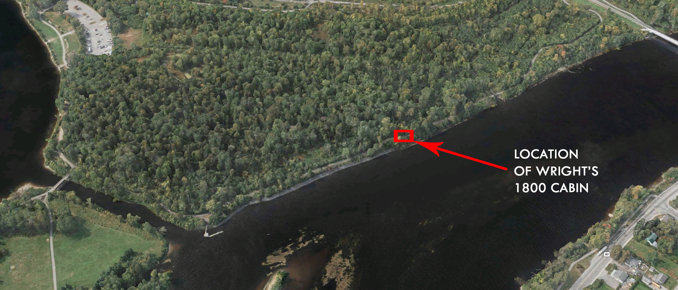
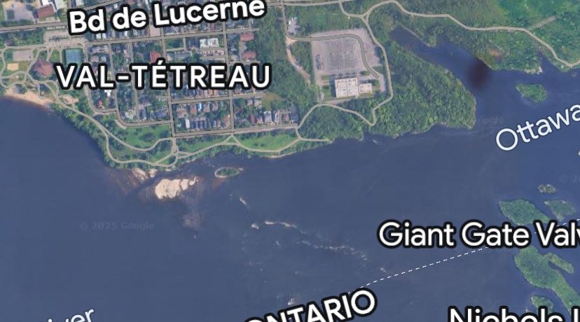
Now on June 4th, Champlain enters the Ottawa Area and describes the currently known Rideau Falls which is across from the Gatineau River:
“Where this river has its debouchure is another coming from the south,’ at the mouth of which is a marvellous fall. it descends a height of twenty or twenty-five fathoms with such impetuosity that it makes an arch nearly four hundred paces broad. The savages take pleasure in passing under it, not wetting themselves, except from the spray that is thrown off.
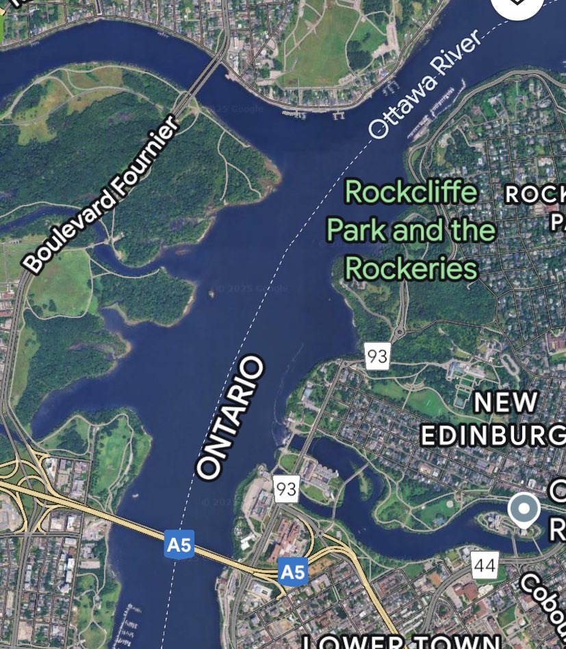
There is an island in the middle of the river which, like all the country round about, is covered with pines and white cedars. (Probably Lac Leamy Island)
When the savages desire to enter the river (The Rideau River) they ascend the mountain, carrying their canoes, and go half a league by land. The neighboring country is filled with all sorts of game, so that the savages often make a stop here.
The Iroquois also go there sometimes and surprise them while making the passage.”
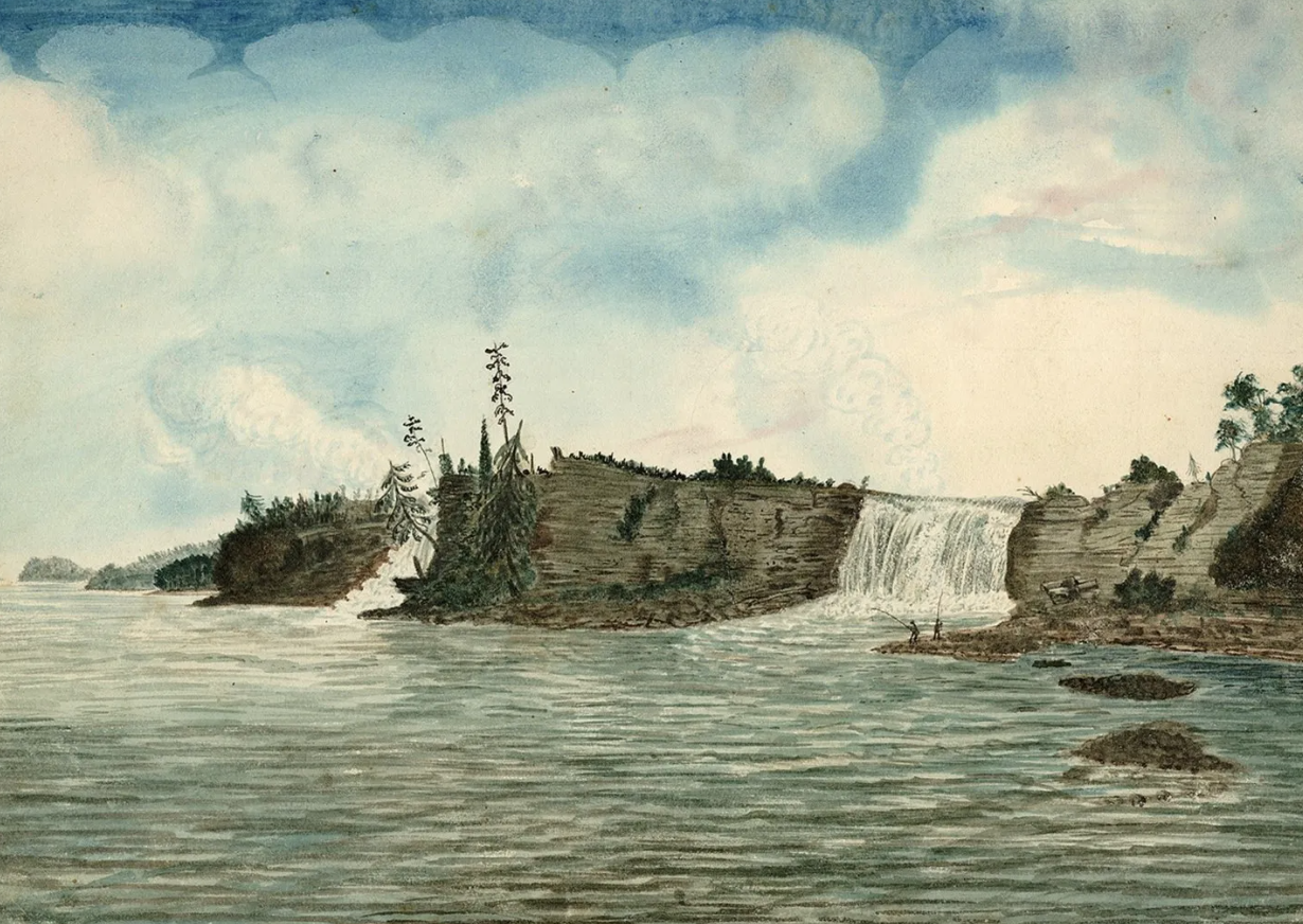
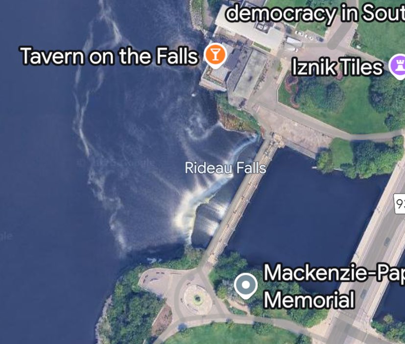
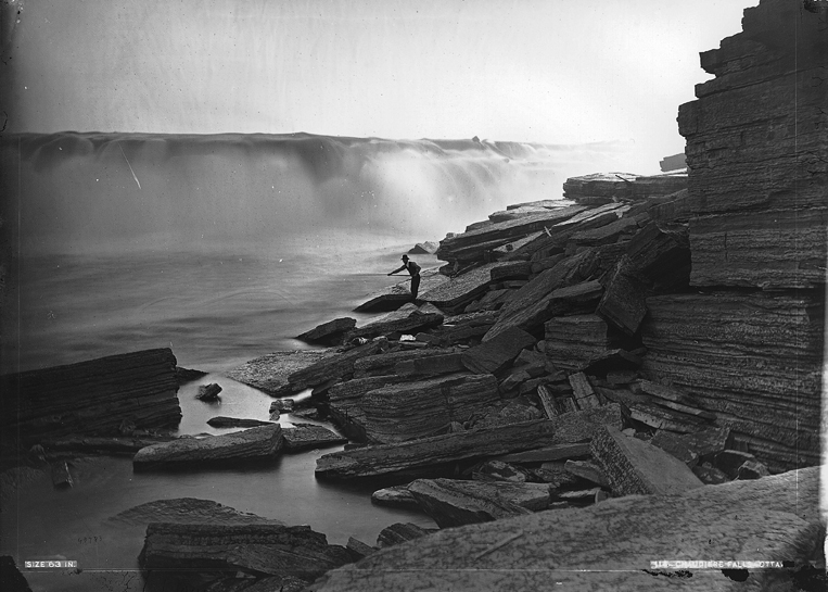
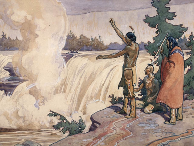
Champlain continues paddling up the Ottawa River and reaches the mighty Chaudiere Falls.
“We passed a fall a league from there, which is half a league broad, and has a descent of six or seven fathoms. There are many little islands, which are, however, nothing more than rough and dangerous rocks covered with a poor sort of brushwood.
The water falls in one place with such force upon a rock that it has hollowed out in course of time a large and deep basin, in which the water has a circular motion and forms large eddies in the middle, so that the savages call it Asticou, which signifies boiler.’ This cataract produces such a noise in this basin that it is heard for more than two leagues.
The savages when passing here observe a ceremony which we shall speak of in its place.”
After passing the Chaudiere Falls Champlain moves up the Ottawa River portaging at Hull.
“Here the savages took their canoes, my Frenchmen and myself our arms, provisions, and other necessaries, and we passed over the rough rocks for the distance of about a quarter of a league, the extent of the fall.
Then we embarked, being obliged afterwards to land a second time and go about three hundred paces through copse-wood, after which we got into the water in order to get our canoes over the sharp rocks, the trouble attending which may be imagined. I took the altitude of this place, which I found to be in latitude 45° 38.”
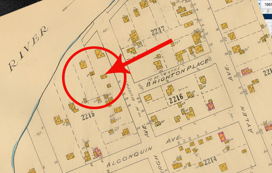
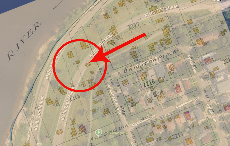
That is here:
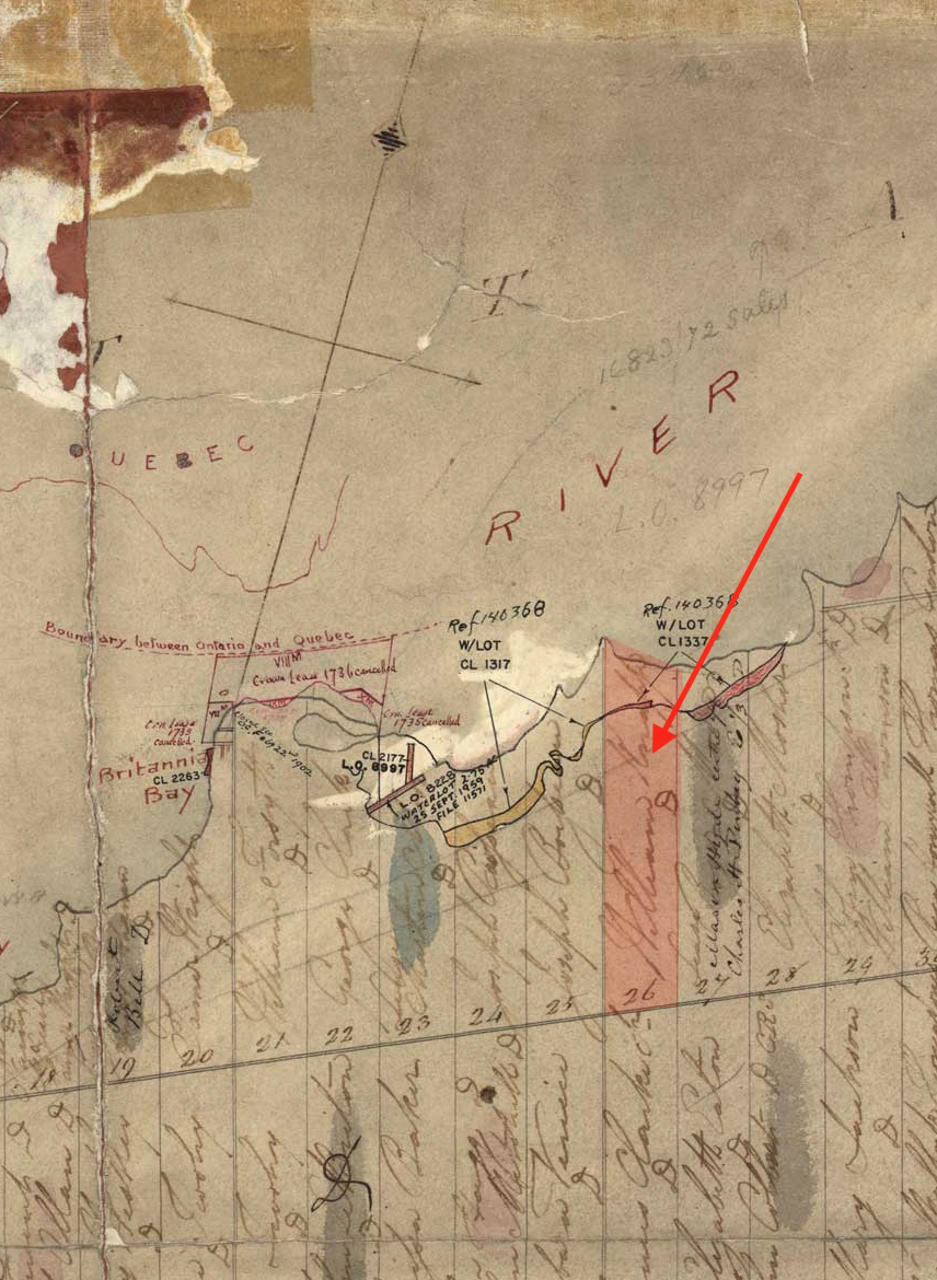
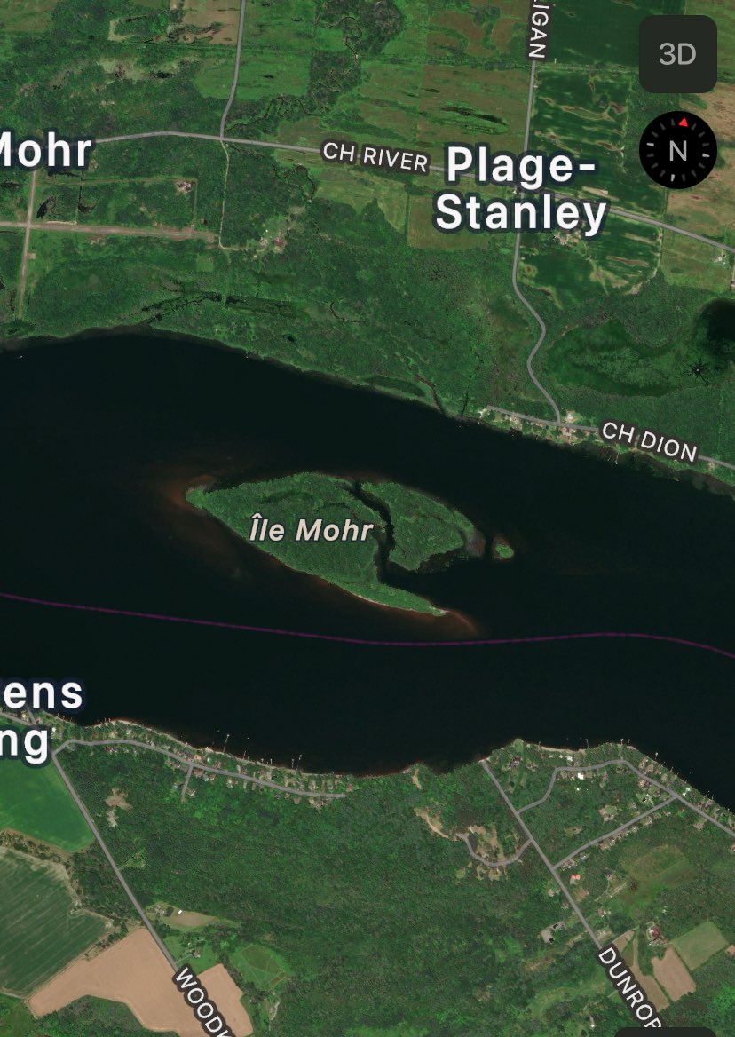
Then Champlain moves on past Ottawa and enters the wide section past Britannia…past Dunrobin…Lac Deschenes.
“In the afternoon we entered a lake, five leagues long and two wide, in which there are very fine islands covered with vines, nut-trees, and other excellent kinds of trees. Ten or twelve leagues above we passed some islands covered with pines. The land is sandy, and there is found here a root which dyes a crimson color, with which the savages paint their faces, as also little gewgaws after their manner.
There is also a mountain range along this river, and the surrounding country seems to be very unpromising. (Gatineau Hills)
The rest of the day we passed on a very pleasant island.”
That island would have been Isle Mohr near Constance Bay.
June 5th, 1613
Champlain then leaves Isle Mohr and heads to Chats Falls:
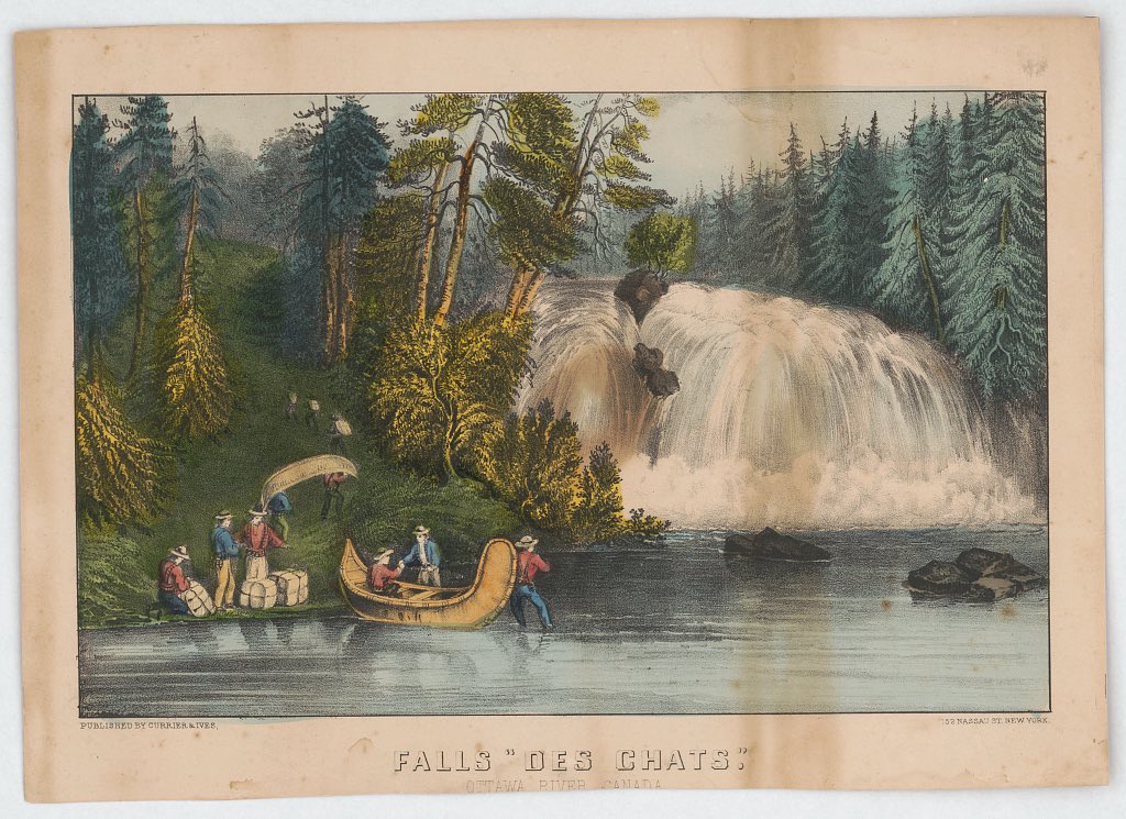
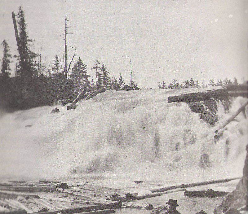
“The next day we proceeded on our course to a great fall, nearly three leagues broad, in which the water falls a height of ten or twelve fathoms in a slope, making a marvellous noise. It is filled with a vast number of islands, covered with pines and cedars. In order to pass it we were obliged to give up our maize or Indian corn, and some few other provisions we had, together with our least necessary clothes, retaining only our arms and lines, to afford us means of support from hunting and fishing as place and luck might permit. Thus lightened we passed, sometimes rowing, sometimes carrying our canoes and arms by land, the fall, which is a league and a half long, and in which our savages, who are indefatigable in this work and accustomed to endure such hardships, aided us greatly.”
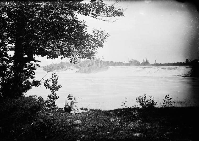
Chats Falls was dammed and obliterated in 1932.
Champlain continues his journey up the Ottawa River and constructs a large wooden cross which he erects on an island:
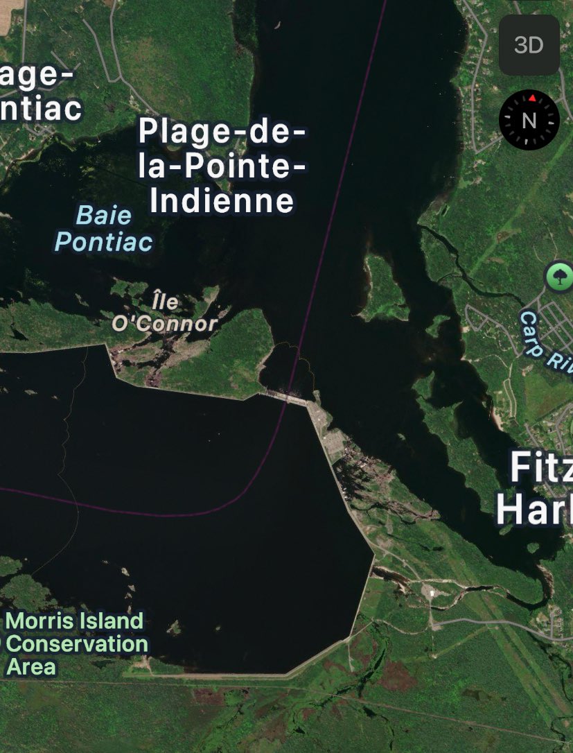
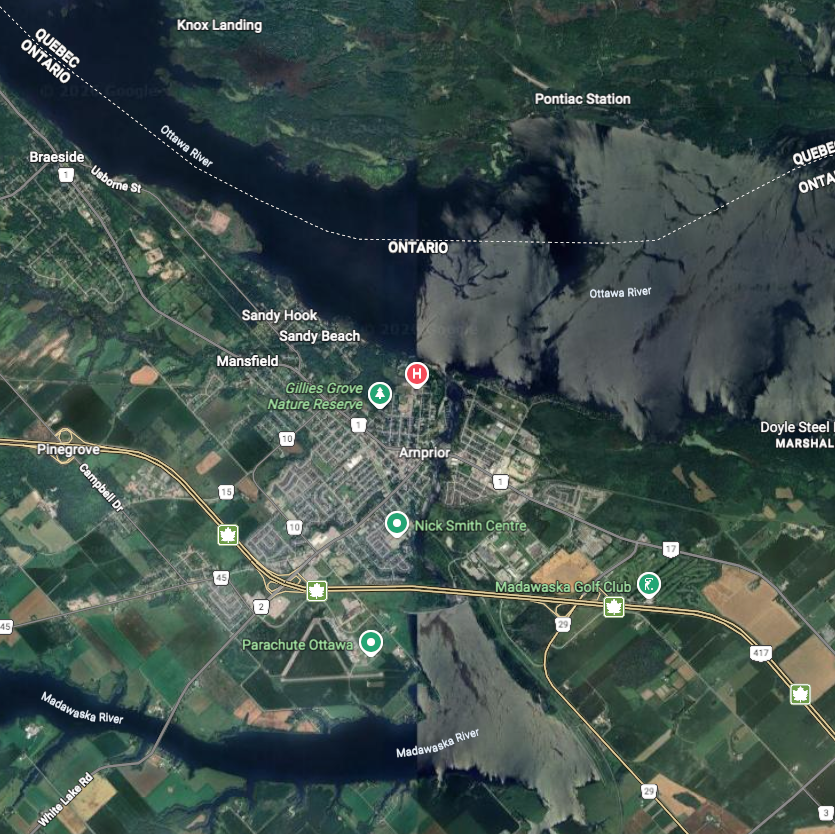
“Continuing our course, we passed two other falls, one by land, the other with oar and poles standing up. Then we entered a lake,’ six or seven leagues long, into which flows a river coming from the south,’(The Madawaska at Arnprior) on which at a distance of five days’ journey from the other river live a people called Matou otescarini.
The lands about the before-mentioned lake are sandy and covered with pines, which have been almost entirely burned down by the savages.
There are islands, in one of which we rested ourselves. Here we saw a number of fine red cypresses, the first I had seen in this country, out of which I made a cross, which I planted at one end of the island, on an elevated and conspicuous spot, with the arms of France, as I had done in other places where we had I called this island Sainte Croix.”
I believe that the island Champlain erected a wooden cross on is currently called “Ile Lighthouse”
June 6th, 1613
The next day Champlain leaves his newly cross constructed island and heads further north…
“On the 6th we set out from this island of St. Croix, where the river is a league and a half broad, and having made eight or ten leagues we passed a small fall by oar, and a number of islands of various sizes.
Here our savages left the sacks containing their provisions and their less necessary articles, in order to be lighter for going overland and avoiding several falls which it was necessary to pass.
There was a great dis-pute between our savages and our impostor, (Vignau) who affirmed that there was no danger by way of the falls, and that we ought to go that way.
Our savages said to him, tired of living, and to me, that I ought not to believe him, and that he did not tell the truth. Accordingly, having several times observed that he had no knowledge of the places, I followed the advice of the savages, which was fortunate for me, for he sought for dangers in order to ruin me or to disgust me with the undertaking, as he has since confessed, a statement of which will be given hereafter.
We crossed accordingly towards the west of the river, which extended northward I took the altitude of this place and found it in latitude 46° 40′.
We had much difficulty in going this distance overland. I, for my part, was loaded only with three arquebuses, as many oars, my cloak, and some small articles.”
This would be where Champlain landed on June 6th, 1613 with his guns. Brown’s Bay.
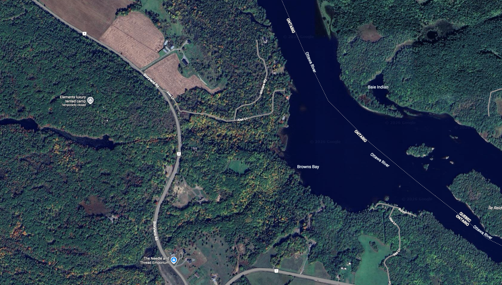
Champlain left the Ottawa River in an area called Brown’s Bay on June 6 to traverse overland following a string of lakes up to Pembroke. His journal makes account of travelling west:
“Thus after having passed four small ponds and walking two and one half leagues, we were so tired that we could go no further…therefore we stayed by the edge of a pond, which was pleasant enough, and made a fire to drive away the mosquitoes which molested us greatly.”
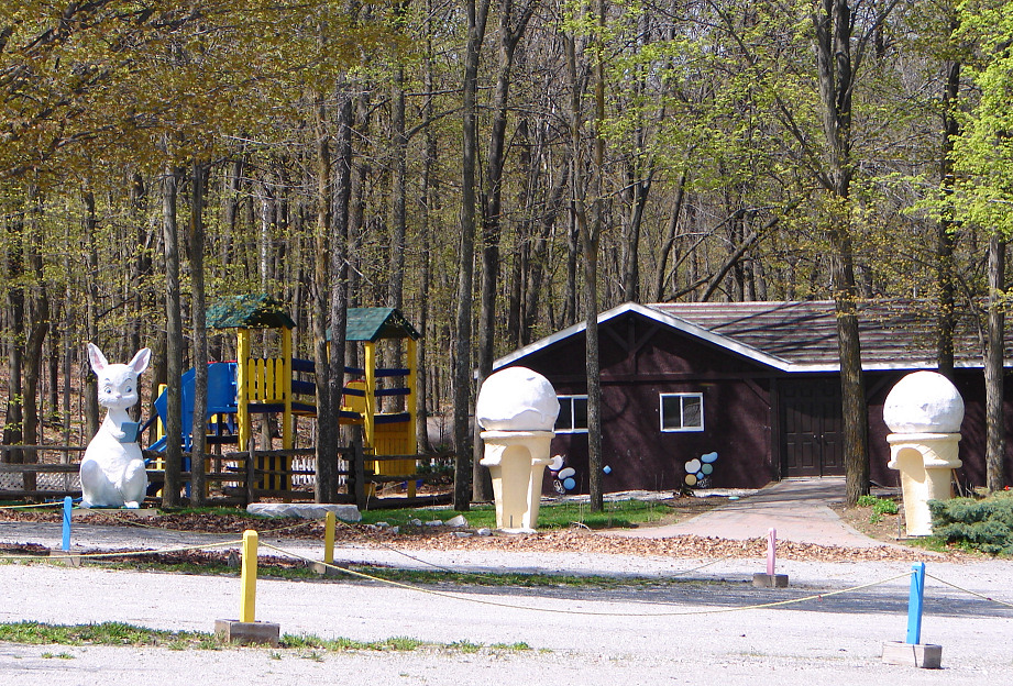
This pond where Champlain rested would have likely been at a place that later became “Storyland”, a children’s theme park featuring depictions of classic fairy tale scenes.
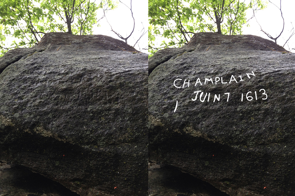
In 1953 a large glacial rock was found in the area bearing a chiselled inscription. The carved letters spelled out “CHAMPLAIN JUIN 7 1613” .
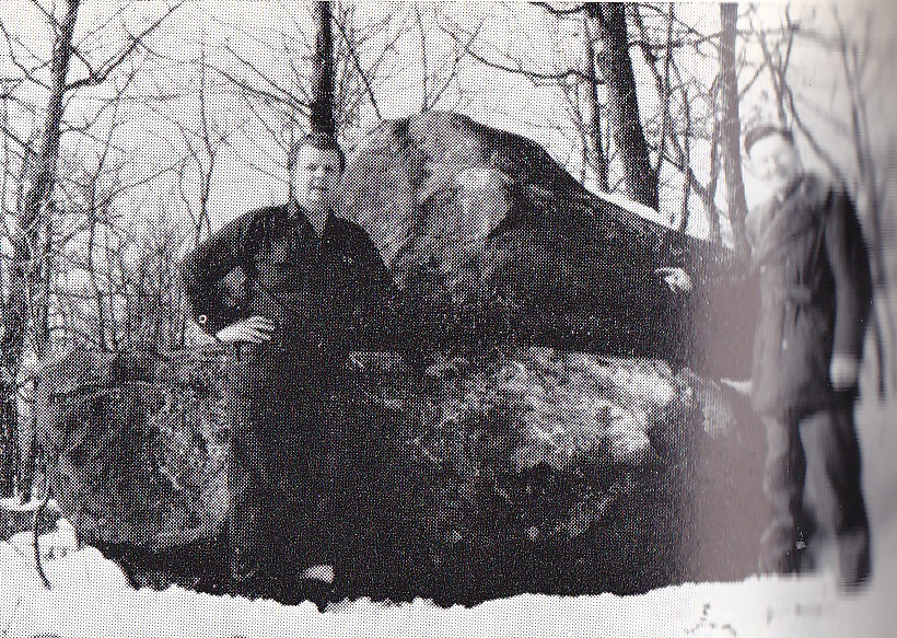
The stone was later deemed a hoax because 17th century French placed the number date ahead of the month, and used an “I” as the first letter of the month instead of a “j”. It was thus deemed a mysterious hoax, with no one ever confessing how or why they made it. The Champlain Stone was soon forgotten and it once again became lost in the deep woods from whence it was found. Its authenticity remains in question and currently resides on private property.
June 7th, 1613
Champlain then states in his journal:
“Accordingly we rested on the border of a pond, which was very pleasant, and made a fire to drive away the mosquitoes, which annoyed us greatly, whose persistency is so marvellous that one cannot describe it.
Here we cast our lines to catch some fish. The next day we passed this pond, which was perhaps a league long. Then we went by land three leagues through a country worse than we had yet seen, since the winds had blown down the pines on top of each other. This was no slight inconvenience, as it was necessary to go now over, now under, these trees.
In this way we reached a lake, six leagues long and two wide,’ very abundant in fish, the neighboring people doing their fishing there.
Near this lake is a settlement of savages, who till the soil and gather harvests of maize.
Their chief is named Nibachis, who came to visit us with his followers, astonished that we could have passed the falls..
After offering us tobacco, according to their custom, he began to address his companions, saying, that we must have fallen from the clouds, for he knew not how we could have made the journey, and that they who
these bad ways: and he gave them to understand that I accomplished all that I set my mind upon; in short, that he believed respecting me all that the other savages had told him.”
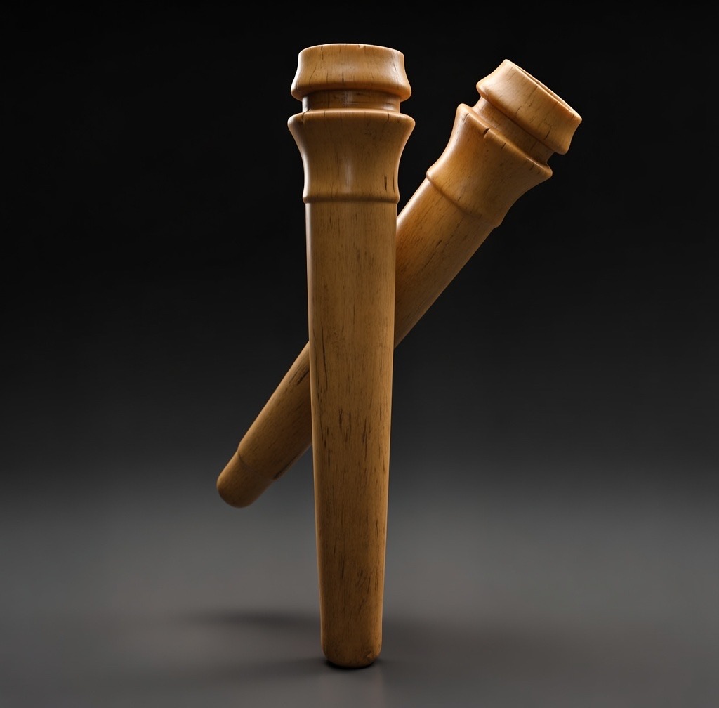
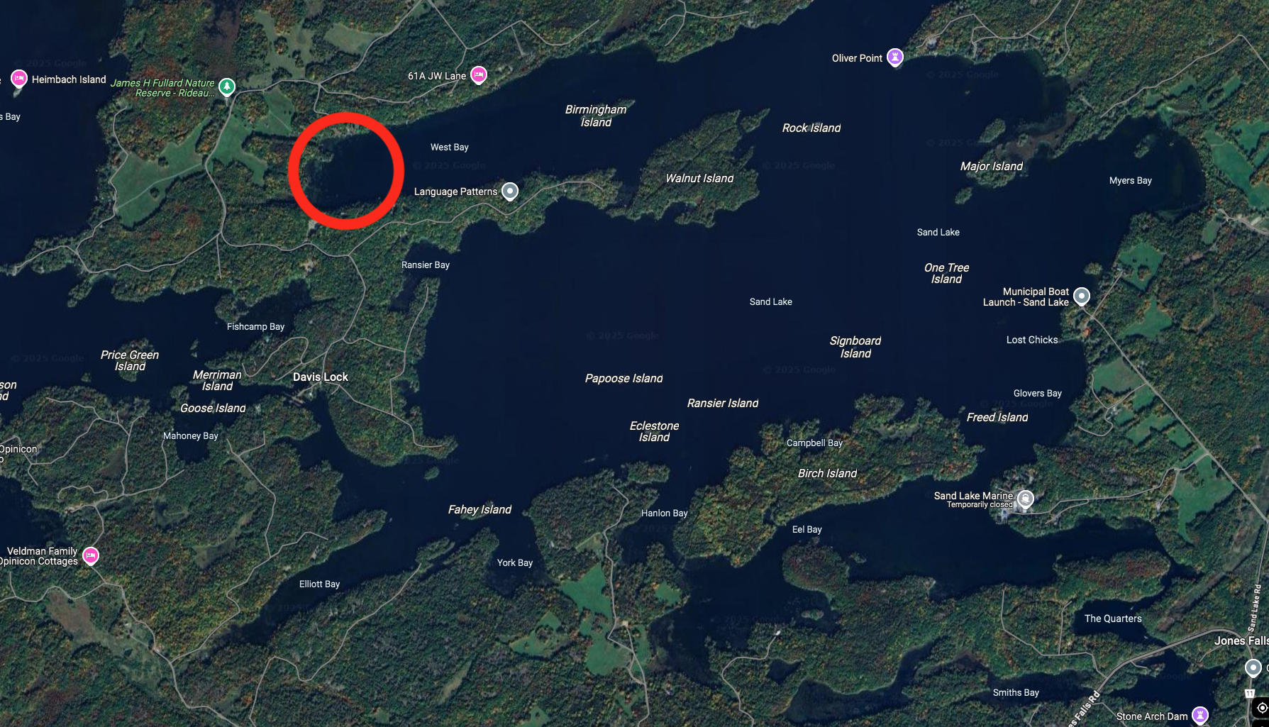
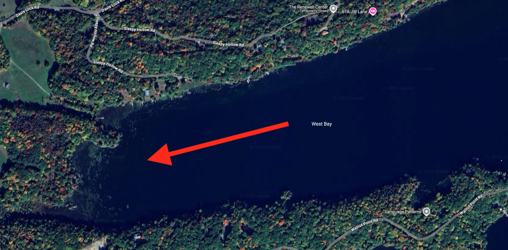
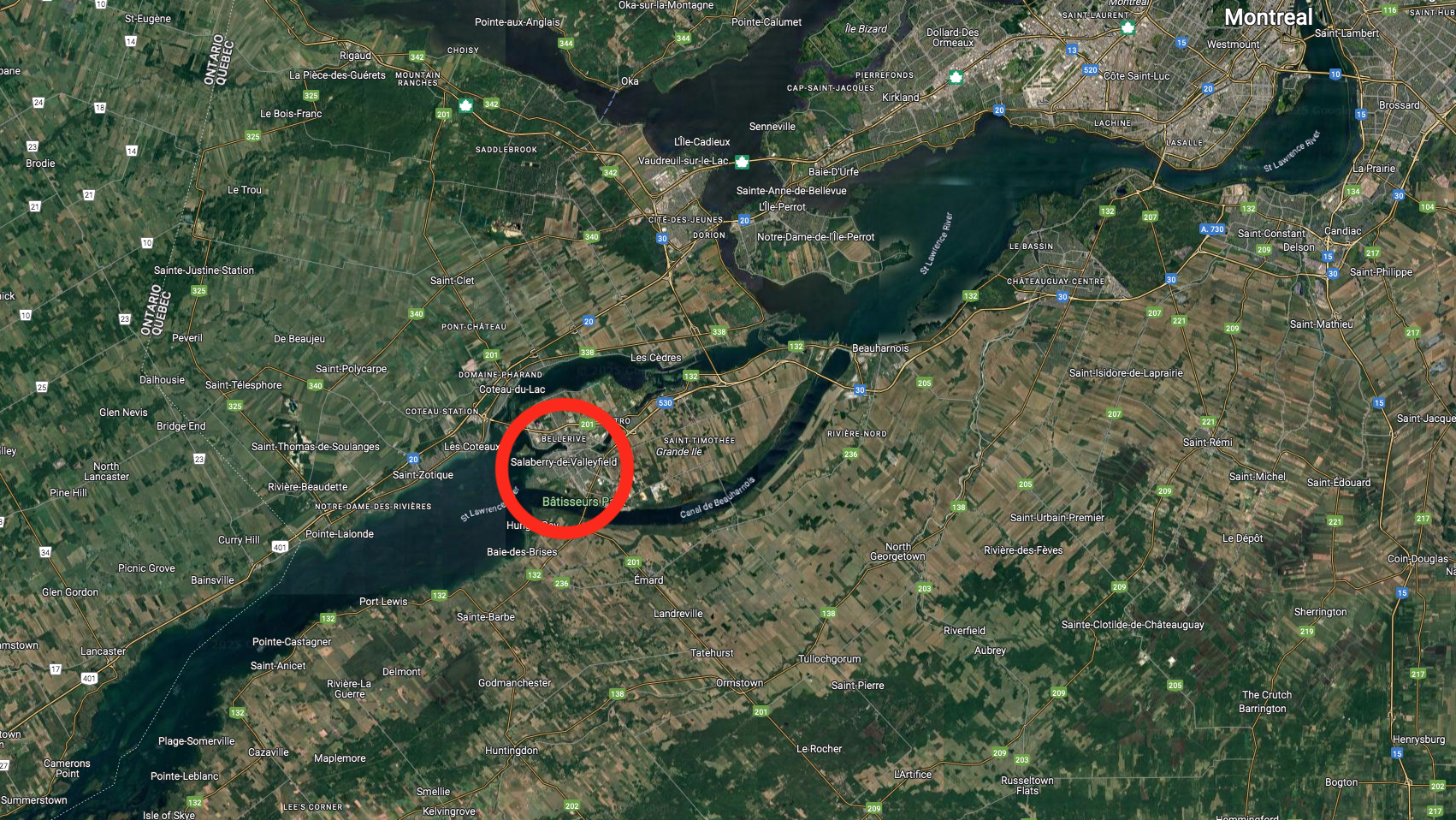
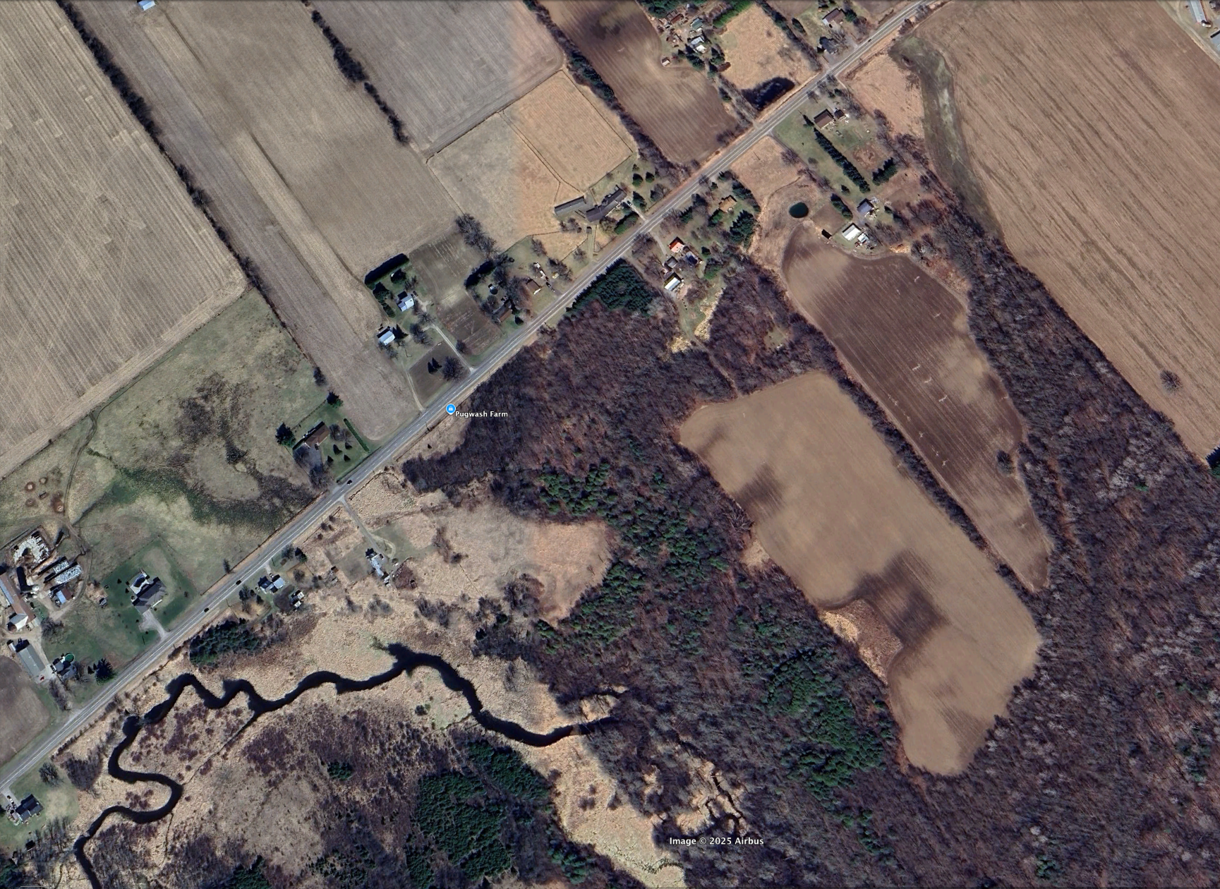
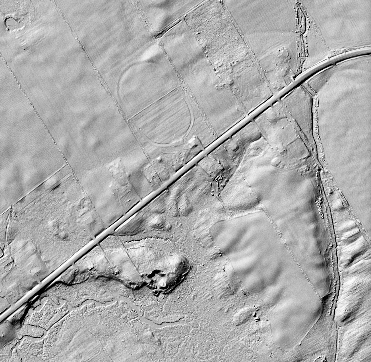
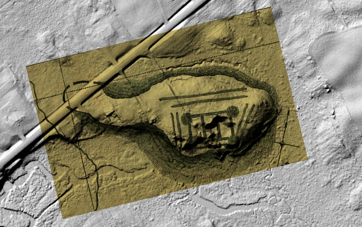
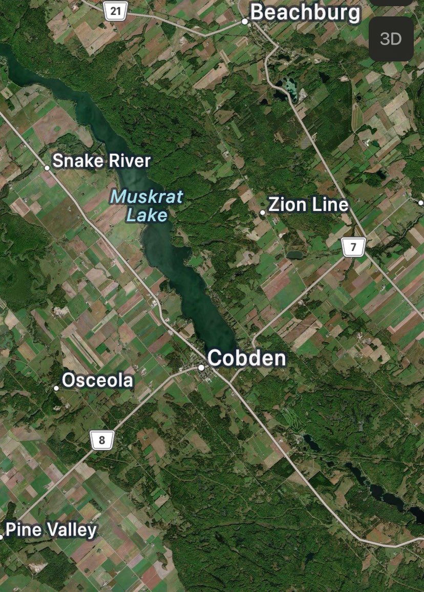
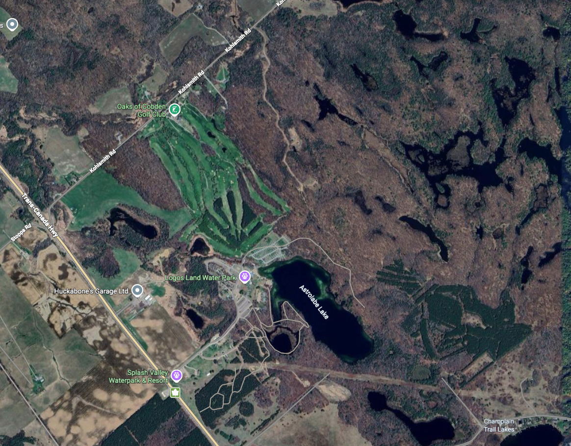
This would be Muskrat Lake. In this neighborhood was found in 1867 an astrolabe with the date 1603, probably lost by Champlain during this expedition.
The astrolabe, an instrument for taking the altitude of the sun or stars, has long since been superseded by the quadrant or sextant.

Credit: Library and Archives Canada, Acc. No. 1972-26-84
Copyright: Expired
It is interesting to note that after this point Champlain no longer states the latitude in degrees and minutes, according to his previous custom, but only in degrees.
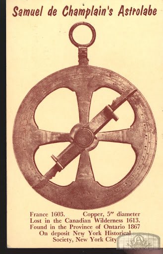
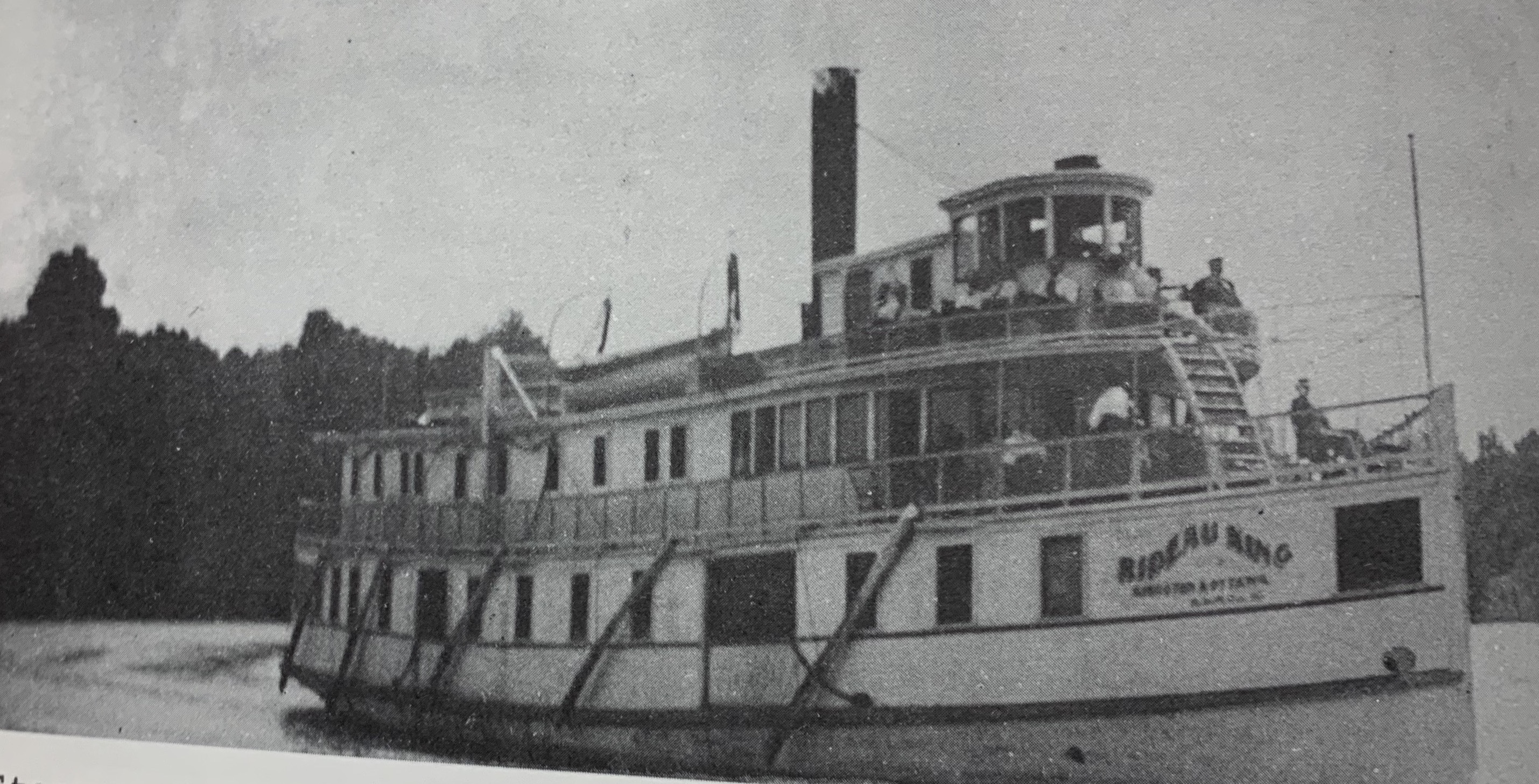
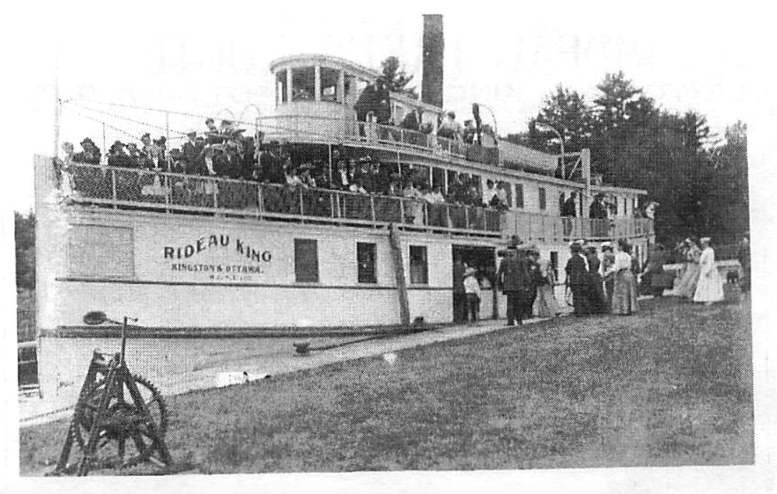
Academia and scholars will debate the 1600s astrolabe that was found is actually Champlain’s from this journey. A 14-year-old farm boy named Edward Lee found it in 1867 while helping his father clear trees by Green Lake, now Astrolabe Lake.
Captain Cowley who operated steamships on the Ottawa River offered Lee ten dollars for the astrolabe. Lee never received the money nor saw the astrolabe again. Cowley sold the astrolabe to his employer, R.W. Cassels of Toronto, President of the Ottawa Forwarding Company. It was then sold to a New York collector, Samuel Hoffman. The astrolabe was willed to the New York Historical Society in 1942 where it remained until June 1989, when it was acquired by the Department of Communications for the Canadian Museum of Civilization where it remains on display today.
June 8th, 1613
“Arrival at the abode of Tessoüat, and his favorable reception of me. Character of their cemeteries.
The savages promise me four canoes for continuing my journey; which they however shortly after refuse.
Address of the savages to dissuade me from my under-taking, in which they represent its difficulties. I reply to these objections.
Tessoiat accuses my guide (Vignau) of lying, and of not having been where he said he had.
The latter maintains his veracity. I urge them to give me canoes. Several refusals. My guide convicted of falsehood, and his confession.
Nibachis had two canoes fitted out, to conduct me to another chief, named Tessoüat, who lived eight leagues from him, on the border of a great lake, through which flows the river which we had left, and which extends northward. Ac-cordingly, we crossed the lake in a west-northwesterly direc-tion, a distance of nearly seven leagues.
Landing there, we went a league towards the northeast through a very fine country.”
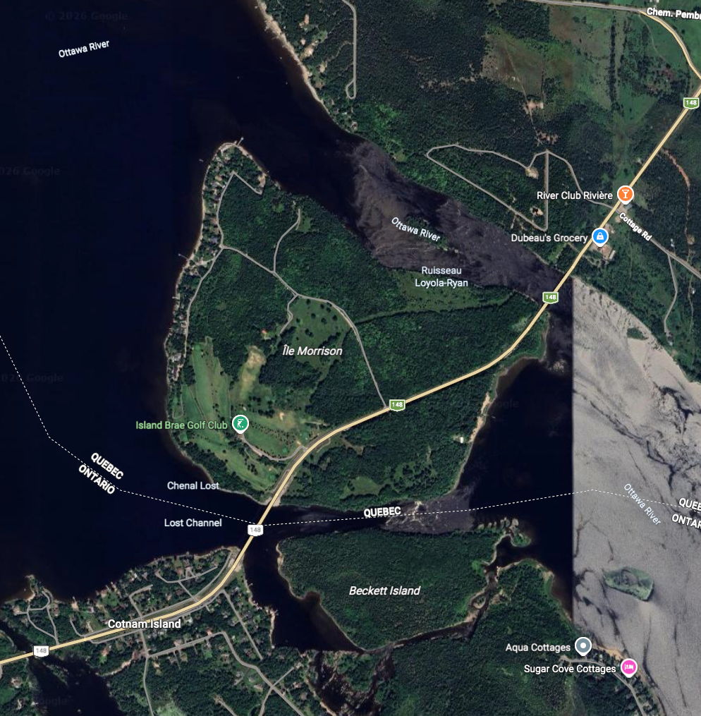
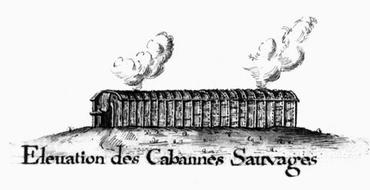
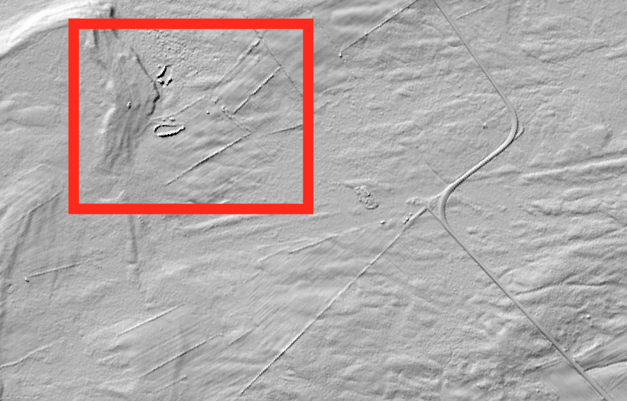
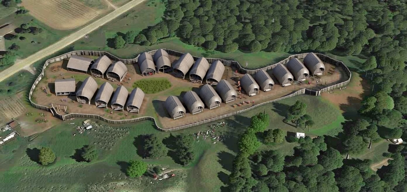
“Thence we crossed on to an island, where their cabins are, which are poorly constructed out of the bark of trees. The island is covered with oaks, pines, and elms, and is not subject to inundations, like the other islands in the lake. This island is strongly situated; for at its two ends, and where the river enters the lake, there are troublesome falls, the roughness of which makes the island difficult of access. They have accordingly taken up their abode here in order to avoid the pursuit of their enemies. It is in latitude 47°, as also the lake, which is twenty leagues long,”
Tessoüat welcomed Champlain with a “tabagie” (celebration) on Morrison Island, but the chief did not want Champlain to travel any further. During this meeting, Champlain was told that Vignau had lied about his journey to Hudson Bay and the Northern Sea. He was expelled from the group once they got back to Montreal, and Champlain never saw him again. Unable to travel farther on this particular expedition, Champlain returned to Quebec and back to France.
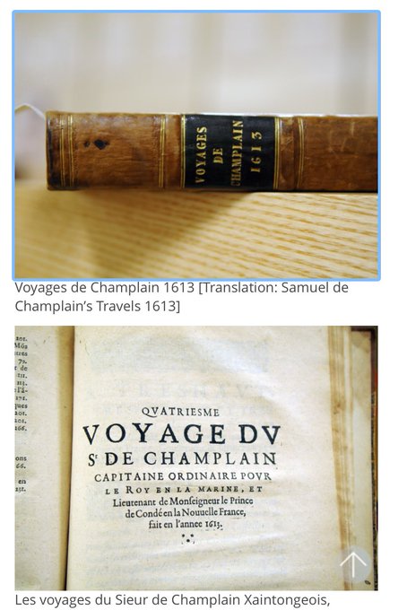
In France, Champlain published an account of this journey titled “Les voyages du Sieur de Champlain, Xaintongeois, capitaine ordinaire pour le Roy, en la marine.”
You can read the translated digital online version here:
https://archive.org/details/voyagessam00chamrich/page/186/mode/2up
https://archive.org/details/lesvoyagesdusieu00cham_1/page/n3/mode/2up
He also worked to establish a new investment group, the Compagnie du Canada, or “Champlain’s Company,” to ensure continued financial support for exploration and settlement in New France.
It is unclear if any archeological investigations were ever done along the route and at his speculated camp sites along the way. I’m sure if we made a concerted effort in searching for artifacts from Champlain’s expedition at the locations mentioned above, one might find some interesting artifacts. For now, all we have as a reminder of this fantastic voyage is the astrolabe that was found near Cobden that some say isn’t even his. Perhaps some day new physical evidence will come to be found that connects us back to Champlain’s adventure 413 years ago.
Thanks for joining me on this time travel adventure tracking Champlain’s journey!
Andrew King, June 2026
SOURCES:
Library and Archives Canada
Google Maps
https://archive.org/details/lesvoyagesdusieu00cham_1/page/n3/mode/2up
https://archive.org/details/voyagessam00chamrich/page/186/mode/2up