
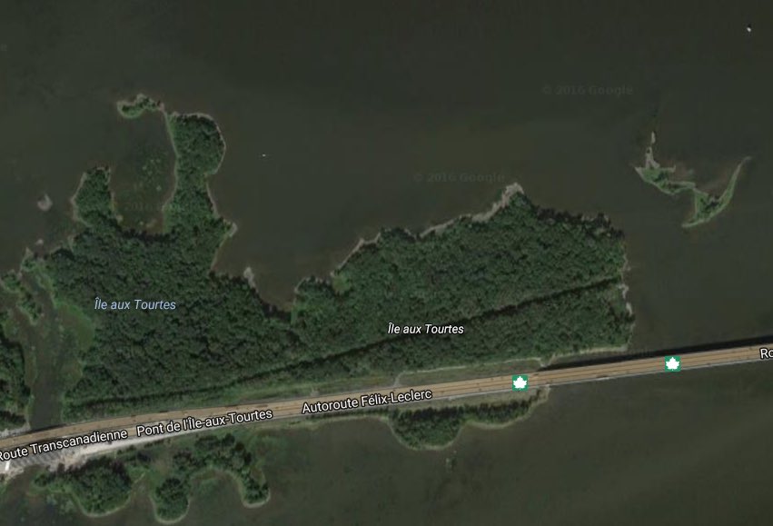
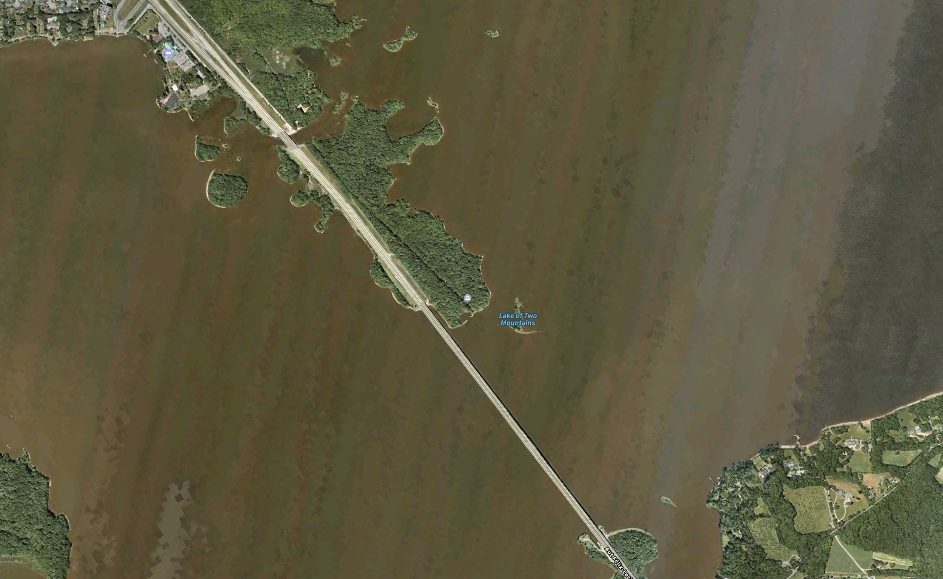
There is a curious island one and a half hours east of Ottawa that many of us have crossed on AutoRoute 40 heading to Montreal.
I’ve always been interested in this island, as it is situated at a historically strategic position where the Ottawa River meets the St.Lawrence River, a short distance from Montreal. It is called “Ile-Aux-Tourtes” and it seems to be a likely candidate for some interesting history being at a position where these two major waterways converge.


In a previous post I studied a point of land nearby where there are ruins of a 1600s French stone fort built across fromI le-Aux-Tourtes at Senneville.
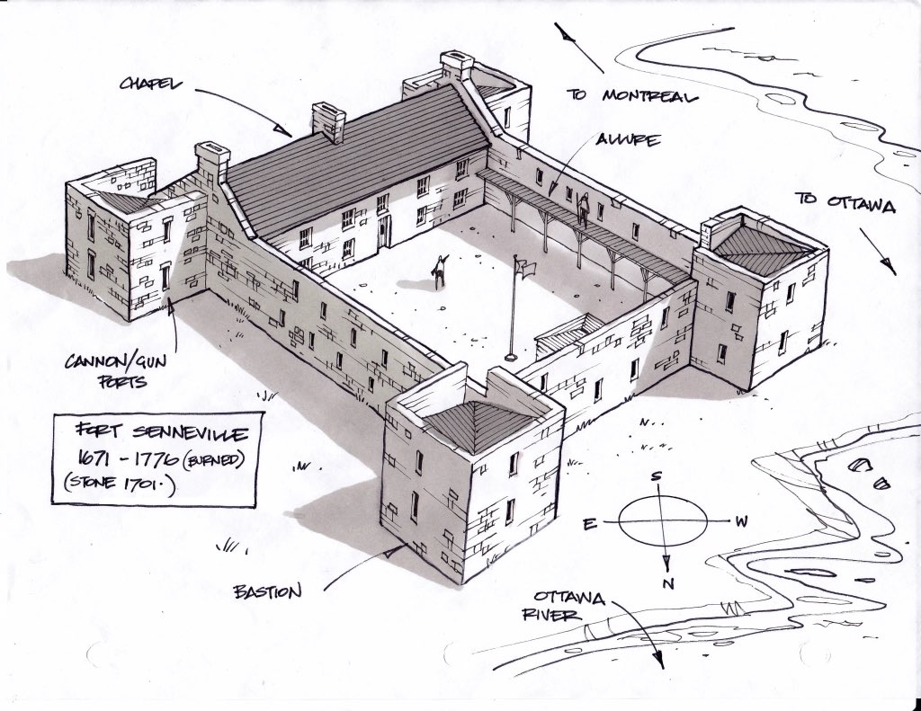
That Story: https://ottawarewind.com/2015/02/19/hidden-fortress-17th-century-fort-on-the-ottawa-river/…
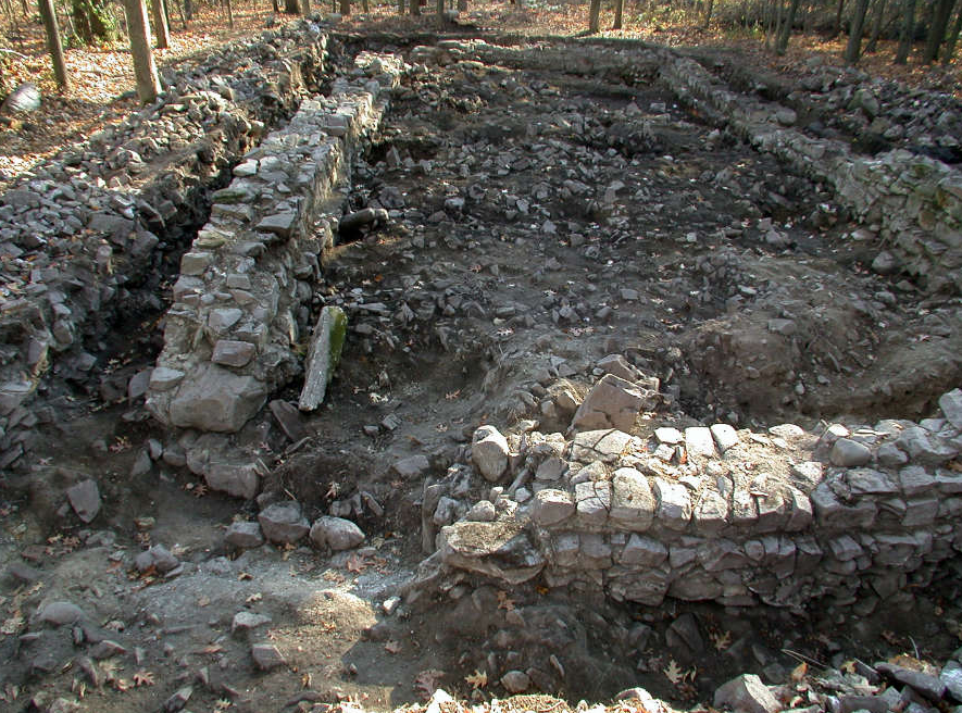
A quick Google search of key words “archeology” and “Ile-Aux-Tourtes” turned up some incredible information that does indeed indicate a unique history to this island. It seems archeological investigations between the 1990s and 2000s revealed that there are stone ruins hidden amidst the forest in addition to evidence that it was occupied 6000 years ago.
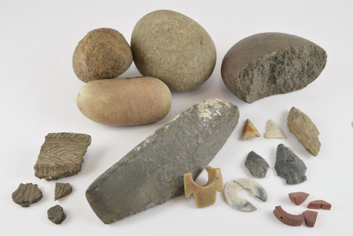
It was notably used as a burial site as bleached bones were found buried in a pit covered with flat stacked stones in a funerary ritual associated with the Lower Woodland period (3000 to 2400 years ago). Also found were ceramic shards and stone tools belonging to a variety of prehistoric periods.
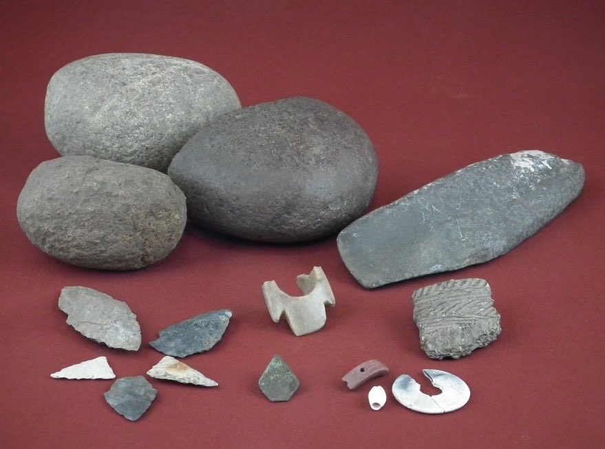
Fast forwarding through time, it was also discovered that this was a commercial area linked to the fur trade, and most remarkably the remains of built stone structures that indicate a presence sometime in the early 1700s.
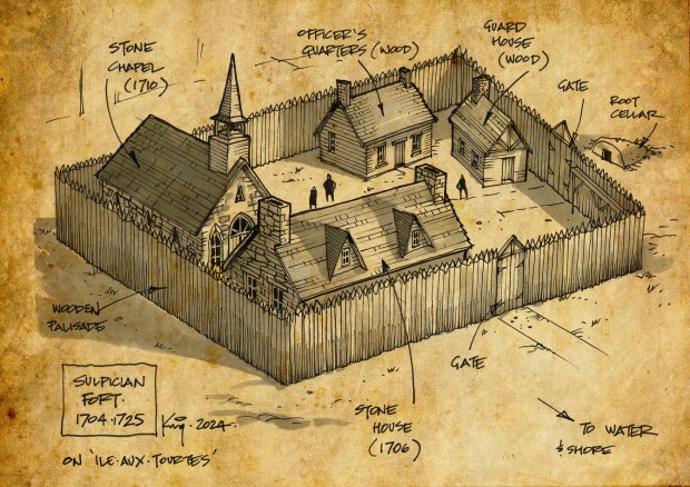
Stone piles suggest a foundation for a wooden palisaded fort that contained other buildings as well. But what was it? A search of old maps of this area turned up an interesting drawing of some kind of fort on the island, which would substantiate the unearthed stone ruins on the island, but who constructed such a structure and when?

To find out we have to look back on the history of the area when such a structure would have been built and by whom. The first group of Europeans to develop the land around Montreal were the Sulpicians in the 1600s. The Sulpicians played a major role in the founding of the city of Montreal, where they engaged in missionary activities, trained priests and constructed the Saint-Sulpice Seminary founded in 1657 by the Society of Priests of Saint Sulpice, who have been the sole owner of the building since its creation.

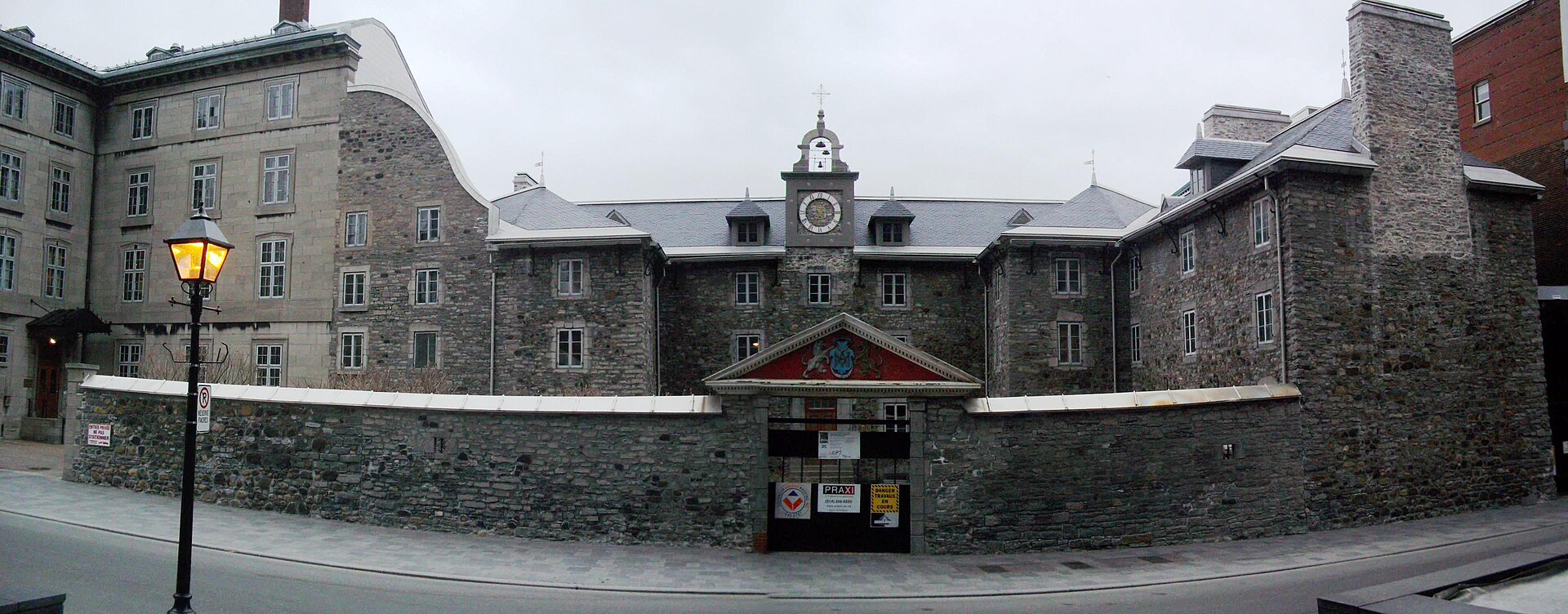
Construction began in 1684 by François Dollier de Casson, superior of the Sulpicians, and was completed in 1687. The Sulpicians of Montreal in the 1600s were from France and served as missionaries, judges, explorers, schoolteachers, social workers, supervisors of convents, canal builders, urban planners, colonization agents, and entrepreneurs.
Their seminary in Montreal was constructed with the aid of a Master Mason and carpenter, Etienne Trudeau, the patronymic ancestor of the Trudeau family & Canadian Prime Ministers Pierre and Justin Trudeau.

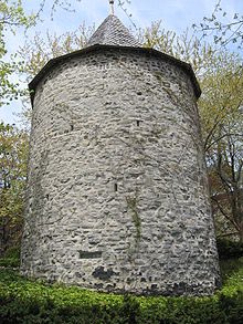
The Sulpicians also built a stone fort in 1685, at the base of Mount Royal later abandoning it. It was almost completely destroyed in the 1850s to build the current college on the site. Only the two towers remain of this 340 year old Sulpician stone fort, a testament to their ability to build hardy stone structures.

The Sulpicians are named after the Church of Saint Sulpice from Paris, France where it was founded in 1641. The founder of the Sulpicians was Jean-Jacques Olier who had with a global outlook for the Sulpician Order. He thus created the Society of Our Lady of Montreal which created the colony of Fort Ville-Marie in New France, the basis of the modern city of Montreal. The Sulpicians undertook their first overseas mission at the colony in 1657, and eventually were given the control of the seigneury of much of the colony.

Olier was devoted to the Blessed Virgin Mary. He specifically desired that the members of the Society of Saint Sulpice celebrate her in a feast called the “Presentation of Mary in the Temple”, which occurs each year on November 21. The Sulpicians were thus under the protection of Mary and this is the reason that the overlapping initials “A” and “M” are found in all Sulpician institutions, representing the Latin expression “auspice Maria” – under the protection of Mary.

When the Sulpicians began their mission around what is now Montreal, it was according to Sulpician records that around 1700 the Sulpician René-Charles de Breslay decided establish a mission on Île aux Tourtes…our island in question.

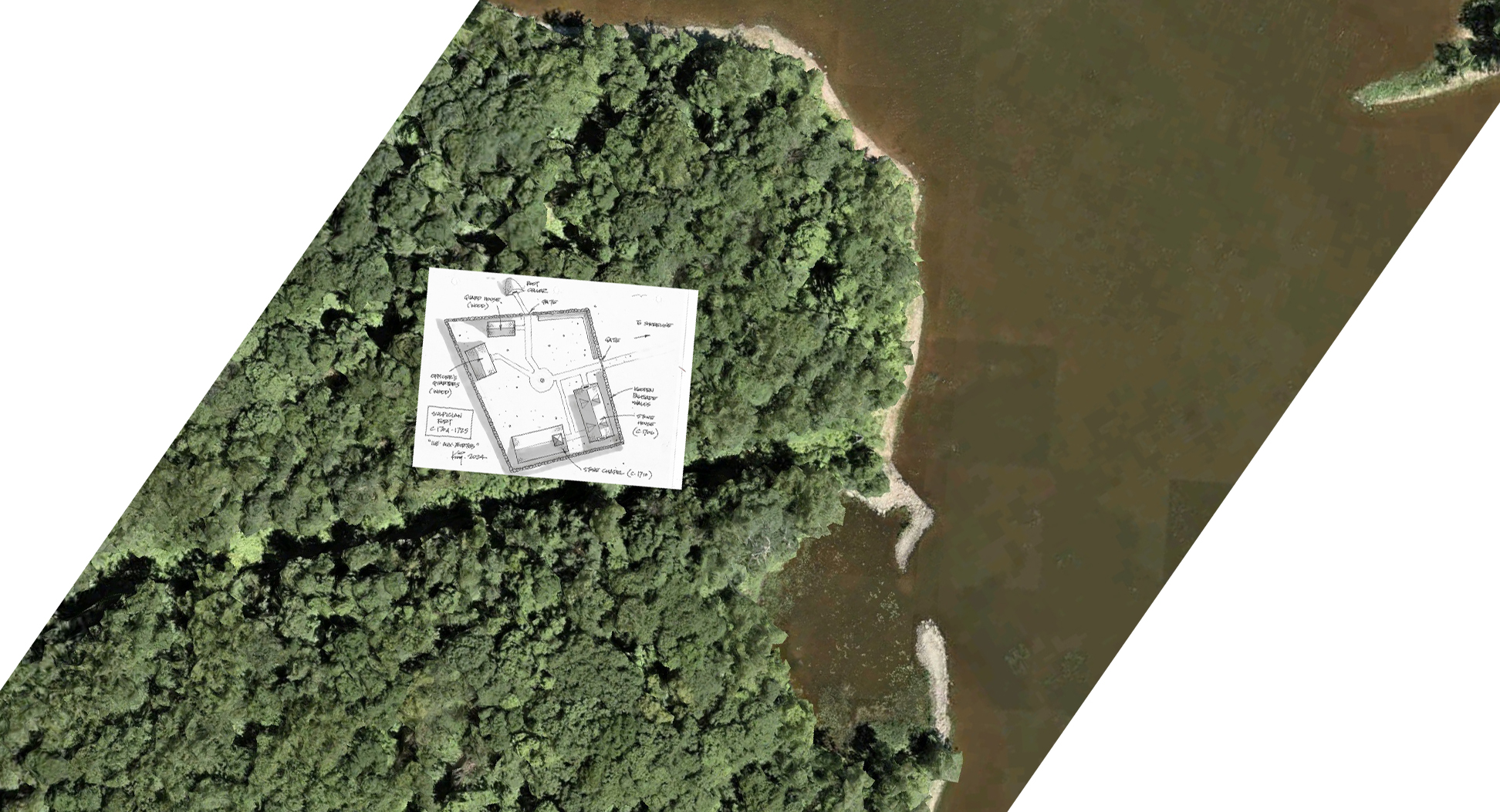
The first building on the island was built by Breslay in 1706 which was a stone house which also served as a chapel. A stone church was built later in 1710, and then the palisaded “fort” promised to help protect the Indigenous people. These foundations were uncovered in the archaeological investigations.
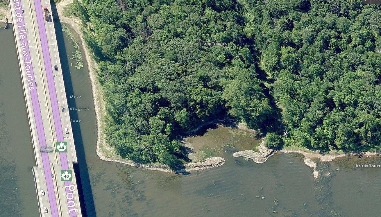
I have drawn what the fort may have looked like based on the archeological map layout and the description of other structures of that time period.


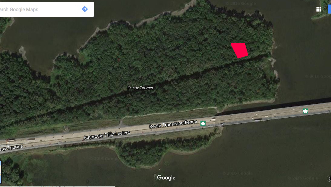
A wooden guardhouse and an officers’ house were erected at the Île aux Tourtes mission. An archeological excavation on the island revealed the old foundations of the fort of which I have overlaid on to a current aerial image of the island to show where it was located.

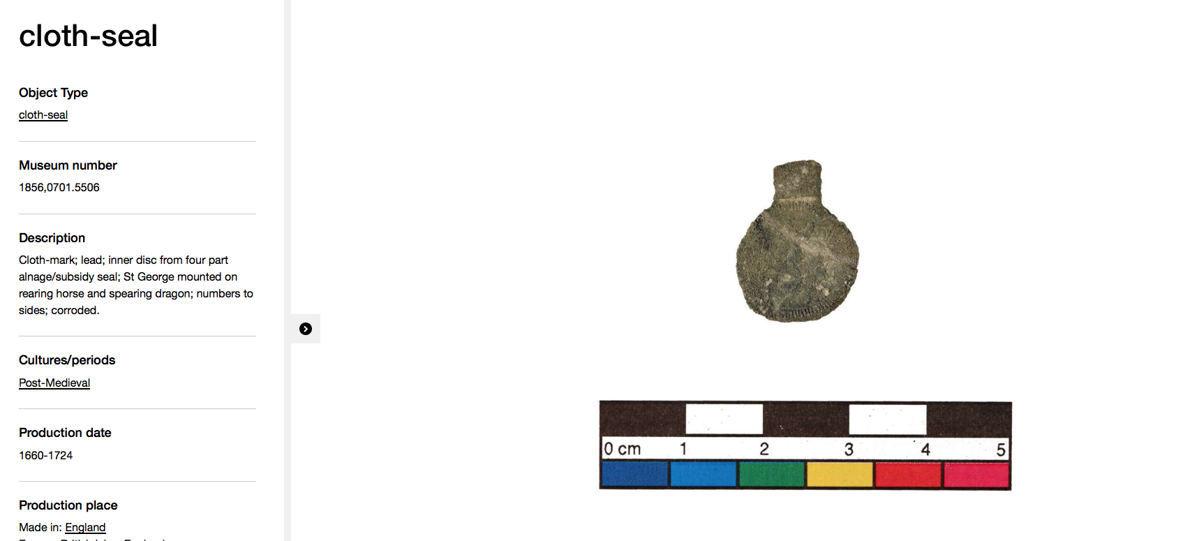
Also uncovered were a number of artifacts associated with this 300 year old fort, including metal rings with the Sulpician symbol, of which we learned about their “A&M” logo previously.


Lead seals were affixed to goods to indicate information such as place of origin, manufacture, quality, size, circulation, and taxation. These lead seals marked everything from tobacco and salt to bundles of various trade goods and affixed to a bale of goods at its place of origin and remained on the goods until they reached their final destination, this one being found on Ile-Aux-Tourtes.
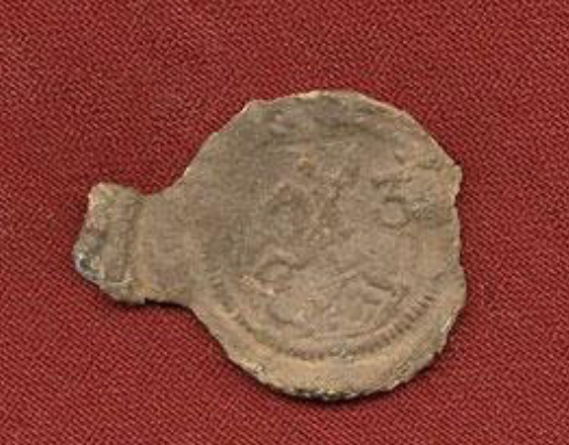

The one found on this island shows a horse and St. George spearing a dragon, the number 3 on it indicates that there was a levy of 3 pennies on whatever it was attached to. Curiously, this was made in England between 1660-1724 according to the British History Museum.
The Sulpicians abandoned the fort for reasons unknown sometime in the 1720s and then nature took over and it remained a hidden piece of history for centuries. Until the end of the 19th century, Île aux Tourtes had several owners, but none seems to have settled there. The original stone buildings quickly fell into disrepair or perhaps they were possibly destroyed by Benedict Arnold’s invading forces when he attacked Montreal during the Battle Of The Cedars in the American Revolution in 1776.

Benedict Arnold leading his Continental Army troops in military maneuvers during the Battle Of The Cedars took over the fort across from this island (Fort Senneville mentioned earlier) and burned it to the ground as they retreated back to the United States. It would not surprise me that we may find some remnants from that skirmish on the island in future investigations.
The remains of the church and a two-hearth fireplace were in existence and visible in the early 1840s and from 1891 and until the 1930s, several cottage cabins were built on the eastern point near the site of the original fort.
In 1958, a gas pipeline crossing the island from east to west was constructed and in 1961 the construction of the Île aux Tourtes highway and bridge to Montreal likely disturbed the archaeological remains on the southern part of the island.
From a well travelled highway, to 6000 year old prehistoric tools, burial grounds, and a 300 year old French Sulpician fort with possible other hidden archaeological treasures, this curious island provides a fascinating glimpse at a hidden history that begs further investigation.
Andrew King, January 2024
SOURCES:
https://en.wikipedia.org/wiki/Jean-Jacques_Olier
https://en.wikipedia.org/wiki/Society_of_the_Priests_of_Saint_Sulpice
https://www.britishmuseum.org/collection/object/H_1856-0701-5506
https://en.wikipedia.org/wiki/Battle_of_the_Cedars
Google Maps
