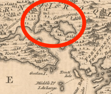
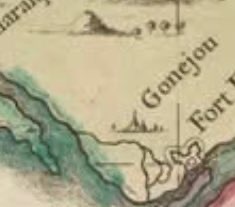
A recent study of an old map of the Great Lakes region revealed a curious detail that piqued my interest…a sketch of a village near Kingston called “Gonejou”. Having grown up in this area I had never heard of such a place and wondered if it was a case of mistaken geography and the map makers meant “Gananoque”.
However, further research revealed that there are more maps that show it and indeed there was such a village that existed in the 1600’s that apparently vanished without a trace. This is the search for the LOST VILLAGE OF GANNEIOUS.
BACKSTORY
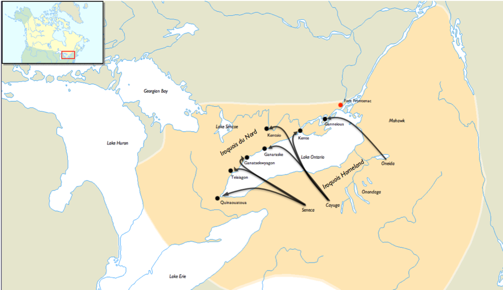
The map I was studying was from 1733 and it showed a host of unbeknownst-to-me villages with illustrations of buildings around Lake Ontario and the St.Lawrence River. These are places I had never heard of including the mysterious “Gonejou”…Kente, Kentsio, Ganaraske, Ganatsekwyagon, and Teiaiagon. It seems in the decade of 1660 AD various groups of Iroquois had established seven villages along the shores of Lake Ontario where trails led off into the interior to hunt and gather trade goods. These villages were “bases” set up by the Iroquois for the control the flow of furs from the north and west to their stronghold south, across Lake Ontario in what is now New York State.
The village in question, “Gonejou” was said to be a village created by the Oneida group that was located near the fertile and productive soils of the Hay Bay/Napanee area, but its exact location has never been determined. The other villages are known to be located at the following places:
Kente – on the Bay of Quinte near Carrying Place
Kentsio – on Rice Lake
Ganaraske – on the site of present day Port Hope
Ganatsekwyagon – at the mouth of the Rouge River
Teiaiagon – at the mouth of the Humber River
Gonejou as marked on the map is on earlier maps and marked as “Ganneious”, also spelled “Ganneous”. The name is most likely a likely misprint for the French “Gannejout(s)”, that means “Oneida”.
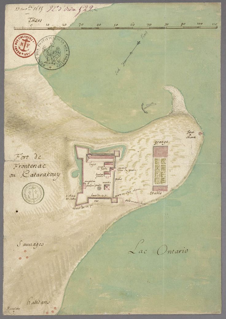
When the Oneida village was created in the 1660s, it was soon joined by new neighbours, the French, in 1673 when they built Fort Frontenac, which was located in modern day Kingston, Ontario about 40 kilometres east of said village Ganneious.
Fort Frontenac influenced Ganneious when French missionaries made several attempts to encourage the population in Ganneious to resettle closer to the Fort, in order to Christianize, Europeanize and encourage them to learn trades and farm.
In 1675, René-Robert Cavelier, Sieur de La Salle, and Father Louis Hennepin decided to embark on a journey from Fort Frontenac to Ganneious on a mission to convince the villagers to relocate closer to Fort Frontenac.
Hennepin actually wrote an account of this mission and journey in “A New Discovery of a Vast Country in America”:
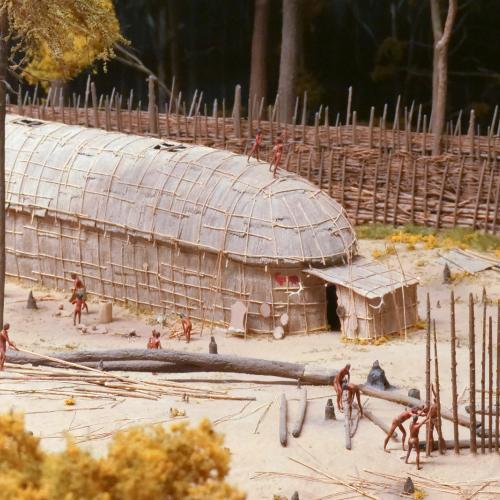
“While the Brink of the Lake was frozen, I walk’d upon the Ice to an Iroquese village call’d Ganneouse, near to Kente, about nine Leagues off the fort, in company of Sieur de la Salle above-mention’d. These Savages presented us with the Flesh of Elks and Porcupines, which we fed upon. After having discours’d them some time, we return’d, bringing with us a considerable number of the Natives, in order to form a little Village of about Forty Cottages to be inhabited by them, lying betwixt the Fort and our House of Mission.”
You can see on old maps of Fort Frontenac the cottages described for the moved Ganneious villagers. It would be about 12 years later when things turned sour and the new Governor of New France, Jacques-René de Brisay, Marquis de Denonville, came on the scene who was under order from France’s King Louis XIV who had instructed Denonville to “remove the fear of the Iroquois menace by humbling their pride.” Denonville recognized that the security of New France depended on stopping the Iroquois aggression and had soldiers brought in for this purpose. So in 1687, he led a punitive mission against the Iroquois that destroyed four of their villages, including Ganneious.

The Ganneious villagers were rounded up and held prisoner by Jacques Rene de Brisay de Donneville and took them to Montreal. Two hundred prisoners from the now destroyed Kente and Ganneious villages. After 1687, all seven of the Iroquois Villages on the northern shore of Lake Ontario were abandoned.
Roughly ten years later, in 1696, the village was re-settled by the Mississauga group of First Nations, but was apparently completely abandoned by the early 1700s, and then the surrounding land and the Eastern Ontario land was sold to the British in 1783 as part of the Crawford Purchase. The location of Ganneious has since been lost in time.
LOCATING THE LOST VILLAGE
Sourcing a variety of old maps from both the 17th and 18th centuries that may help us locate Ganneious, it became difficult to pinpoint an exact location. The maps from that time period are not exactly to scale with many features unlike known reality and our current maps.
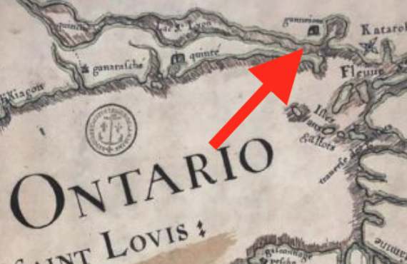
The earliest map I could find with Ganneious labelled is one from 1688, drawn one year after the village was destroyed by the French. It clearly shows a village labelled “Ganneious” west of Fort Frontenac (Kingston) on the northwest shore of a large bay, which I would speculate is Hay Bay in the Bay of Quinte.
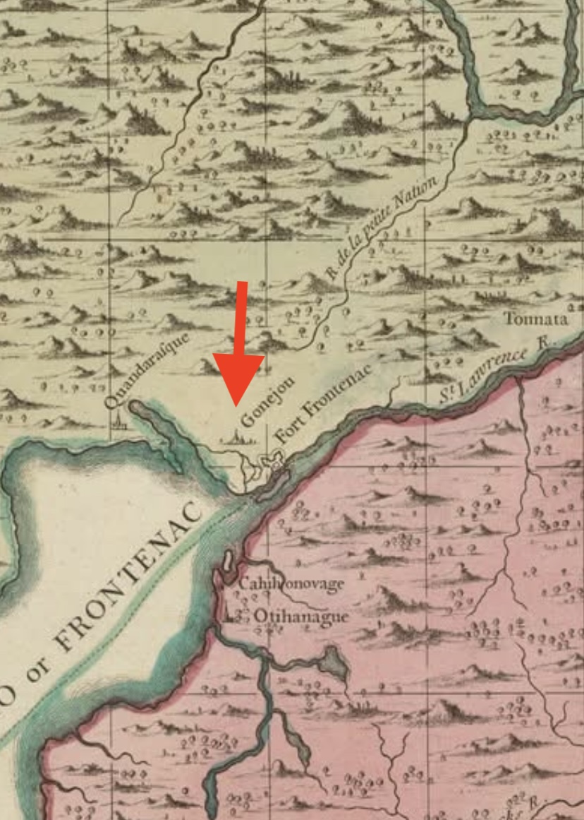
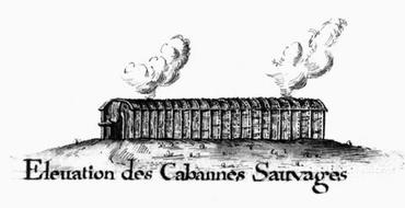
The next map I could find is one from 1733 that shows “Gonejou” marked with an illustration of village buildings. They also show it northwest of a body of water which looks to be a river of some sort, possibly the narrow part of Hay Bay.
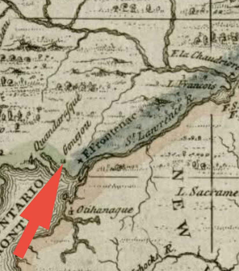
Next we have a map from 1756 made by the British that shows a village marked “Ganeouse”, again on the northwest shore of a body of water with a thin river leading to it. Again, I believe this to be Hay Bay.
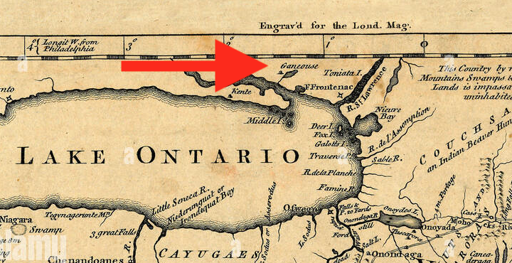
A British map from 1758 gives a more detailed look at the location, showing again, “Gannejouts” located on the north shore of Hay Bay just above where the narrow part opens up to the larger part of the bay. The Napanee River can be seen to the west of that, placing it in between. Some illustrative buildings indicate the “village”.

Our village in question then disappears off of maps soon after that and becomes lost in time. Heading to the local library in Picton, Ontario I came across a book called “Lennox and Addington” by Orland French who makes a fascinating claim the location of the lost village is off the Napanee River where two wrecks of French boats were found:
“About three kilometres upriver from its mouth there is evidence of a French trading post. A French bateau has also been found in the Napanee River next to this site.”

I could not find the source of the claim to follow up on it, but if anyone else knows about this, please let me know.
SPECULATING A LOCATION
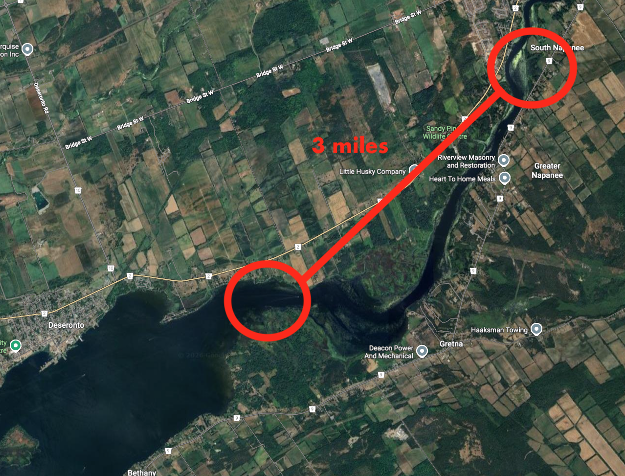
Referencing the old maps collected it seems our search now will narrow us into the area of the north shore of Hay Bay, near Napanee. The lost village is marked as being north of the large “lake” of Hay Bay, slightly inland inland from the narrow river.
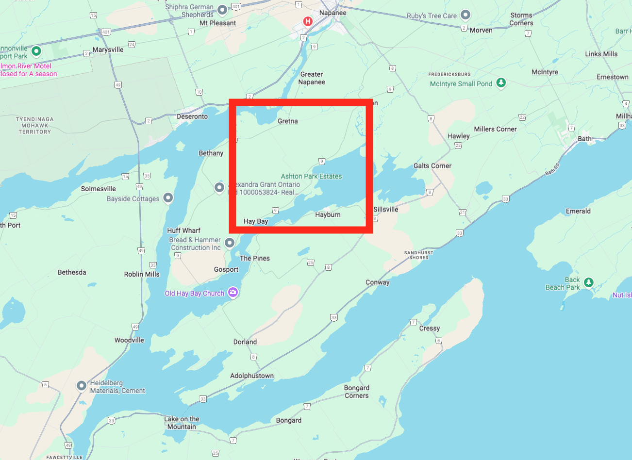
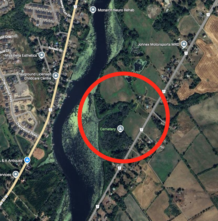
Using current Google Map imagery, we can roughly place Ganneious in the area that most closely resembles that geography, which places it in a certain area near Gretna.
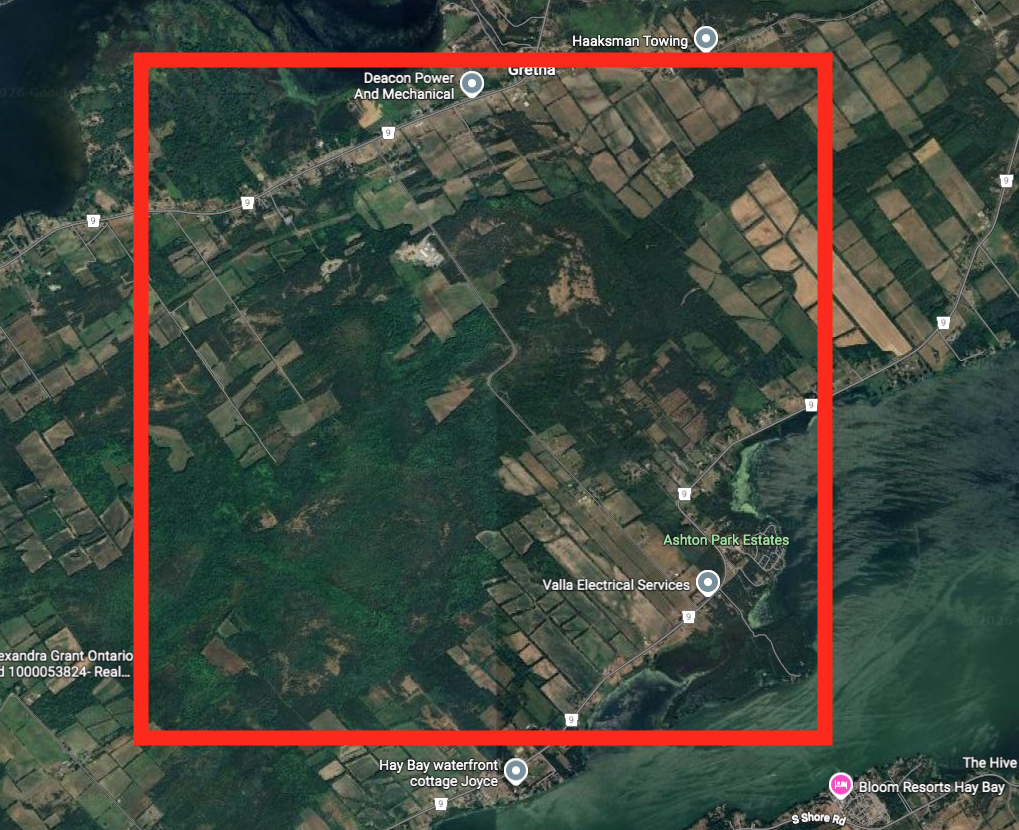
Having now narrowed that area down a bit, we can see that it is a mix of farmland and forested area…perhaps Ganneious lies somewhere in here…chances are it was probably plowed over by unsuspecting 19th century farmers who cultivated and cleared the land, not knowing a 1600s Iroquois village was there.
However, there are some areas that seem to be untouched forested areas. Perhaps within those regions something may give a clue to a location.

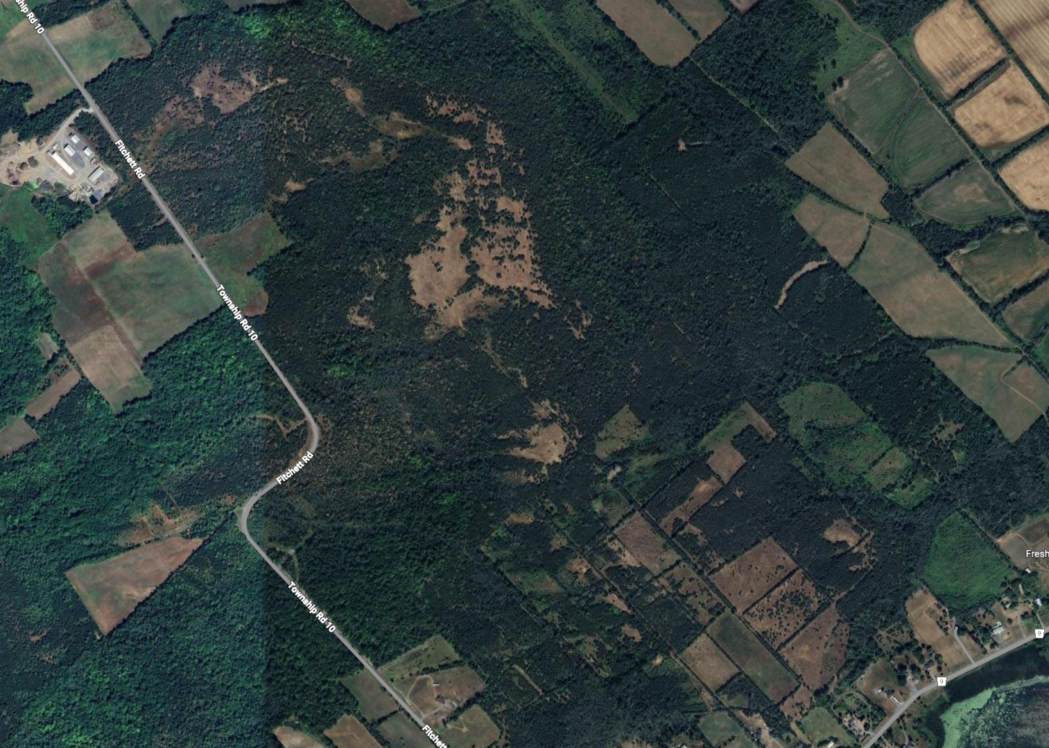
Using the Government of Canada Lidar 3D mapping tool, I was able to locate this area and use it to remove all the foliage and see the details of the topography and any unusual mounds or features that could indicate man made structures.
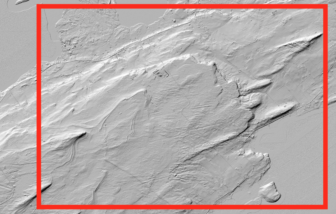
I am not familiar with the village building modus operandi of the Iroquois and where they likely would pick a location to build a village, but I would assume it would be on “high ground” as that provides the best protection from attackers and gives a better vantage point to look around the land.

Using that logic we can zoom in on a noticeable plateau in this region where two peculiar features can be seen. What looks to be man made, oval shaped structures that could indicate some kind of walled fortification structure around a village.
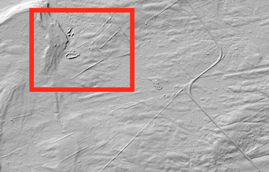
This of course is pure speculation of course, and it would take some professionals to gain access and study these targets.
CONCLUSION
Using a combination of old maps and modern day imagery we can speculate where the Lost Village Of Ganneious may lie, just northwest of Hay Bay in an area that contains some curious structures. This area is somewhat removed from the Napanee River where Orland states some wrecks of French boats were found. Perhaps they were part of the original expedition to locate Ganneious from Fort Frontenac in 1675. French personnel might have landed there and moved southwards to Ganneious instead of entering the narrow river part of HayBay, or they were just boats the French used during their missionary visits to Ganneious.
Without further investigation Ganneious remains a lost part of our important and complex nation’s history, somewhere out there waiting to be discovered…and I hope I am around to experience such a discovery.
Andrew King, January 2026
SOURCES
Google Maps
“Lennox & Addington” by Orland French
Wikipedia: Fort Frontenac, Ganneious, Iroquois
Government of Canada: The High-Resolution Digital Elevation Model Mosaic (HRDEM Mosaic)
