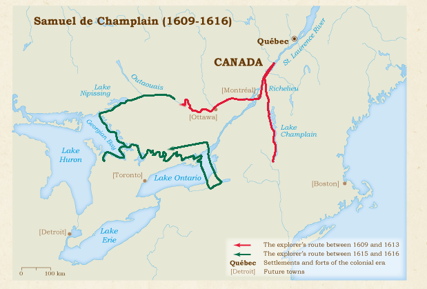
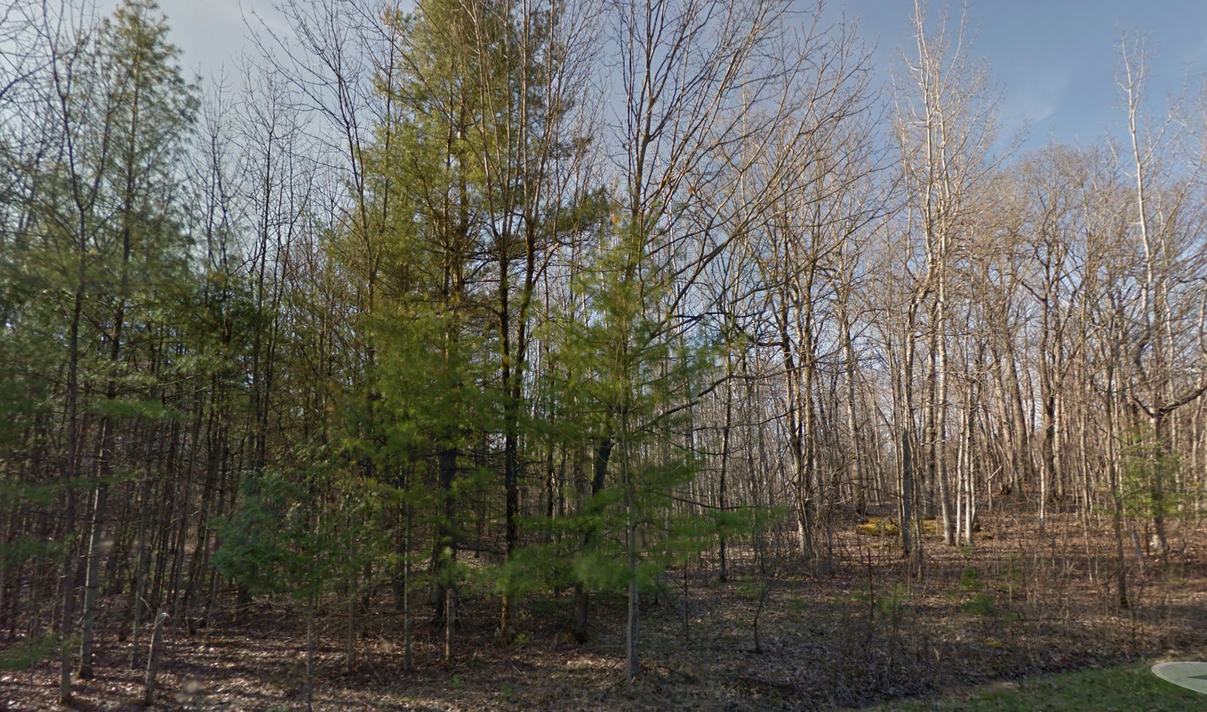
400 years ago this week one of the world’s most renowned explorers set out on an epic journey…This autumn marks the Quadricentennial of Samuel de Champlain’s adventurous voyage through Central-Eastern Ontario along its many waterways and through its forests. With a team of Huron warriors on a mission to defeat the Iroquois in what is now Upper New York state, Champlain walked and paddled through our own backyard. Using current mapping technology and Champlain’s very own detailed journal entries we can plot the famous explorer’s 400 year old expedition…

In 1615 on another exploration of the new frontier, Champlain made his way down the St. Lawrence River and was greeted by a large contingent from the Huron and Algonquin nations. The explorer met these aboriginal nations before on one of his earlier journeys, and now they asked Champlain to help them defeat the Onondaga and Oneida nations to the south in what is now Upper New York state. Champlain knew these opposition tribes to the south posed a great threat to the French fur trade routes along the upper St. Lawrence and Ottawa rivers. He realized that by allying with the Hurons and Algonquins, they may be able to defeat this threat to the south and clear the way for French trade on Lake Ontario, Ottawa River and St. Lawrence River.
In an agreement to help his allies, Champlain returned to Quebec to plan an attack and make the necessary equipment preparations for the journey that would take him and his native companions deep into enemy territory. That summer of 1615 his French contingent traveled by a flotilla of canoes along the Ottawa River to Morrison Island then along the Mattawa River and through Lake Nipissing. Working to promote strong alliances with the French between the aboriginal people he met en route, Champlain and company made their way along the French River into Lake Huron across Georgian Bay to a site near what is now Penetanguishene. He arrived in “Huronia” in August of 1615 and began to sit down with members of the Huron nation to plan their attack of the Iroquois at their large fortification across Lake Ontario in New York State. With the necessary preparations having been made, Champalin embarked in September 1615 with a massive war party outfitted with canoes laden with tribal warriors, armed Frenchmen, and the supplies needed to make the bold journey to defeat the powerful Iroquois to the south.
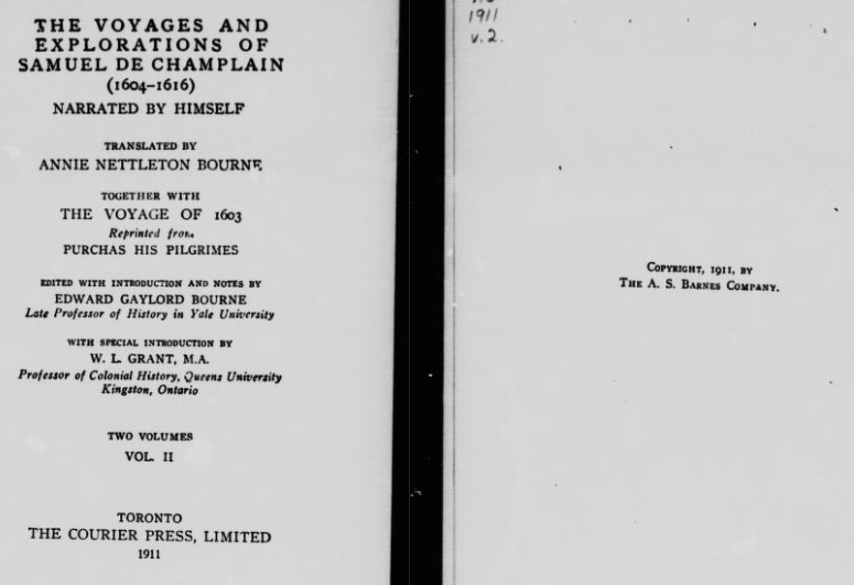
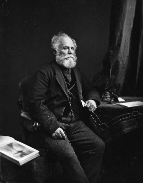
Thankfully for history’s sake, Champlain made a very detailed journal of this adventure, and in 1907, “Champlain’s Voyages et Descouvertures” was translated and printed by the American Historical Association into a book titled “VOYAGES and Explorations of Samuel De Champlain narrated by himself”

A translated copy of Champlain’s journal used to plot out his 1615 adventure.
Obtaining a scanned version of a Canadian 1911 version of the journal and isolating the journey Champlain made through Central-Eastern Ontario in 1615 we can re-create the trip. His entries are detailed, and the translation helps pinpoint exact locations that I was able to match to current existing landmarks. Having grown up in the same area in my teenage years and having sailed some of the exact same waters traversed by Champlain, I believe I was able to map out this epic journey as it happened 400 years ago.
MEASURING CHAMPLAIN’S DISTANCES
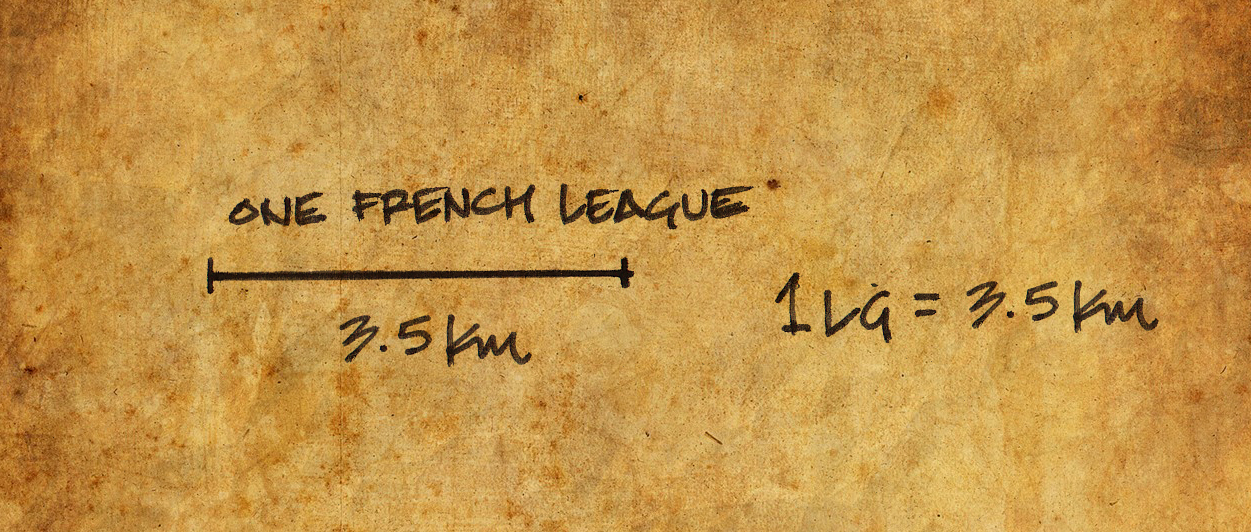
Before we begin we must first start deciphering this 400 year old adventure with an analysis of the original journal and how it translates into present day terms. The first mention Champlain makes about the start his journey is on Page 76 where he mentions they gathered two canoes with 12 of the strongest “savages”, continuing his way towards the enemy. Champlain then uses the term “lieue”or “league” to measure distance on his journey. But what is a league, how far is that in today’s modern measurement of distance? This of course is crucial to tracking Champlain properly and is a key element to matching his distances on today’s maps for an accurate plotting of his route.

A conversion of a 1600’s French league to our modern kilometres was necessary to accurately plot his journey.
The “old French league” was a measurement used by the French up until 1674 and was defined as 10,000ft. With Champlain traveling in 1615 and his journal of his exploits being published soon after, this falls into the right unit of measurement for that time. 10,000 feet converts into a modern metric measurement of 3.25km. The French League however differed with Champlain depending on what type of surface he was traveling on. A French Land League ranged between 3.25km-4.68km, (an average of 4km). Champlain used a different measure of league at different points of his adventures, on the open sea and St. Lawrence River he used a league that was 4.0-4.5km compared to the approximate 3.4km league he used for inland travel. Because Champlain was traveling over both land and water on this 1615 journey which makes it almost impossible to pinpoint an EXACT measurement of his mentioned league. So I will be using the average of 3.5km=one Champlain league.
THE JOURNEY
After leaving Huronia on September 1 1615, Champlain travels across Lake Simcoe and entered what is now the Trent-Severn Waterway where his journal mentions travelling south and entering Sturgeon Lake. From Sturgeon lake Champlain mentions:
“From it flows a river that empties into the great lake of the Entouhonorons”
The “Lake of the Entouhonorons” is Lake Ontario. Champlain describes the journey down the Otanabee and Trent rivers which empty into Lake Ontario from Sturgeon Lake as being “about 64 leagues-that is to the entrance to of this lake of the Entouhonorons”
Now we can utilize our measurement of a league (3.5km) which calculates 64leagues x 3.5km=224km. This distance mapped out on a current map where the Trent flows from Sturgeon Lake to Lake Ontario at Trenton is almost a perfect match.

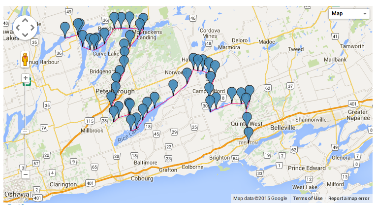
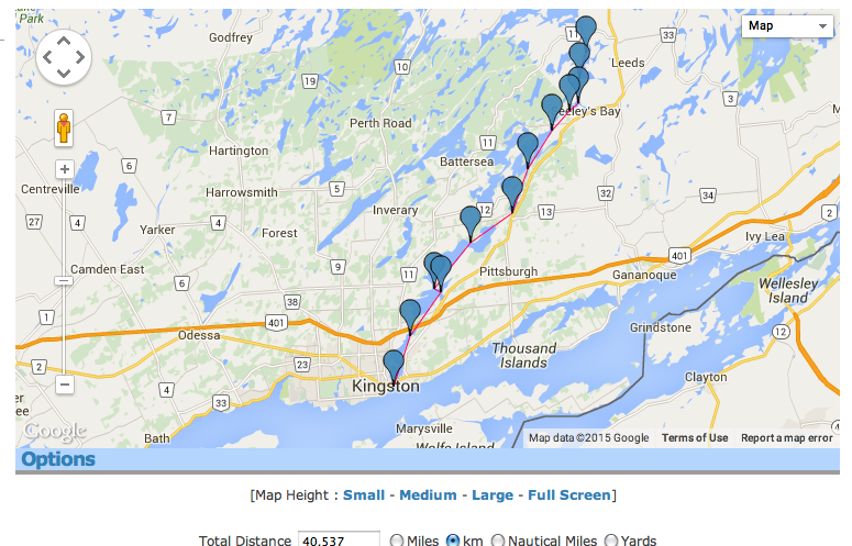
Using a mapping program we are able to track the “64 leagues” or 224Km Champlain mentions it took to go from Sturgeon Lake to where the Trent River empties into Lake Ontario at Trenton.

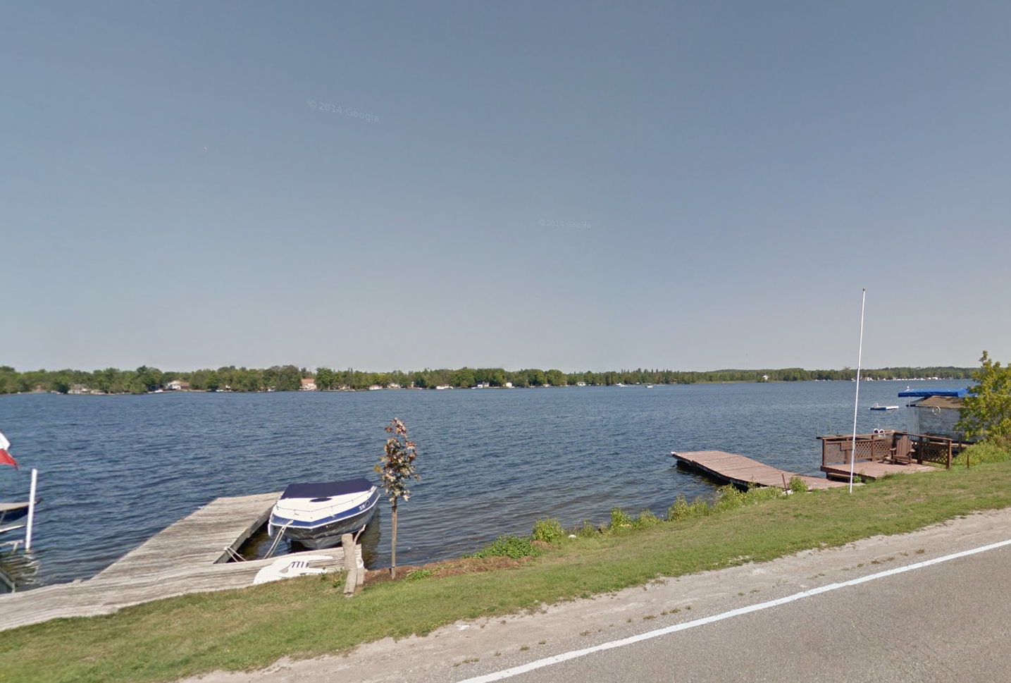
Our journey begins on at Sturgeon Lake where Champlain passed through in September 400 years ago. (GoogleMaps)
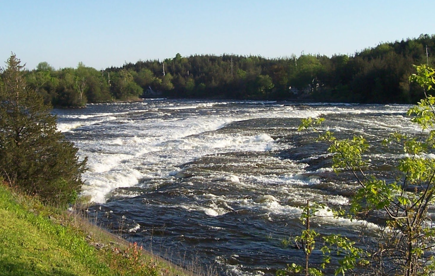
Champlain also mentions passing 5 rapids and smaller lakes along the way. The matches the pre-Trent canal rapids at Bobcaygeon, Buckhorn, Peterborough, and the many other falls and rapids they would have encountered along the Otanabee and Trent rivers.

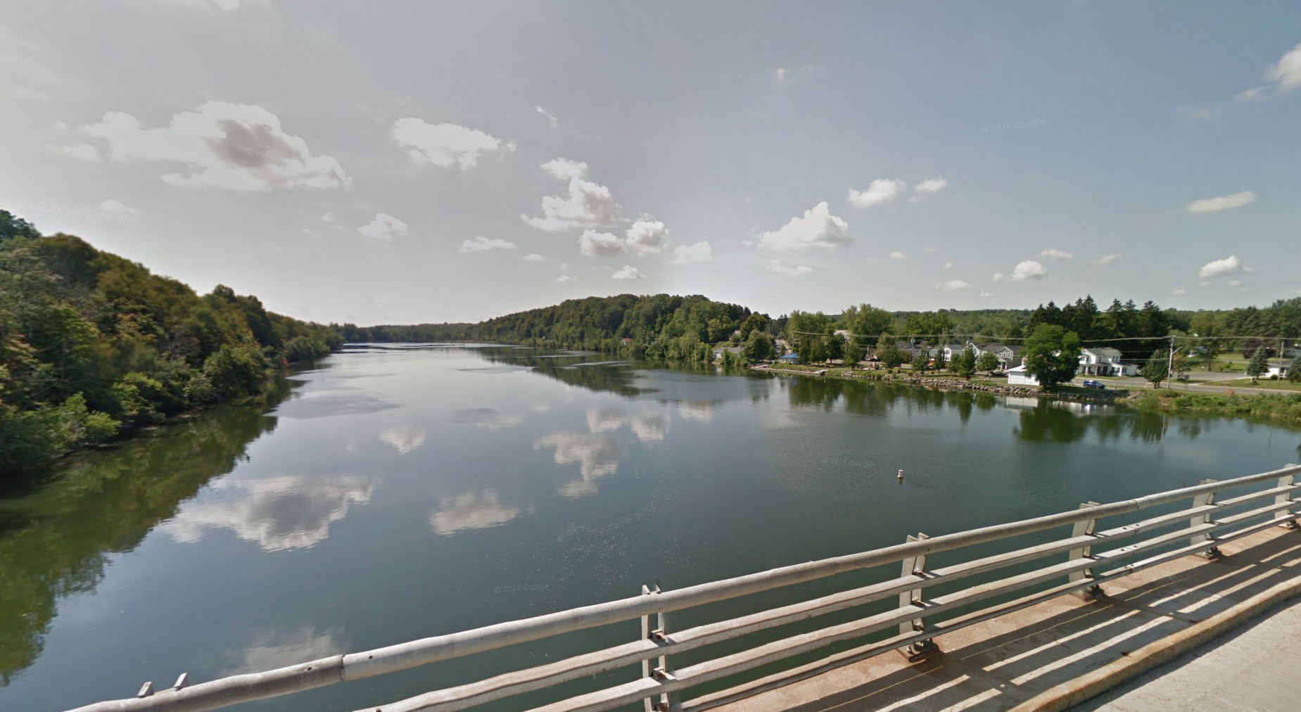
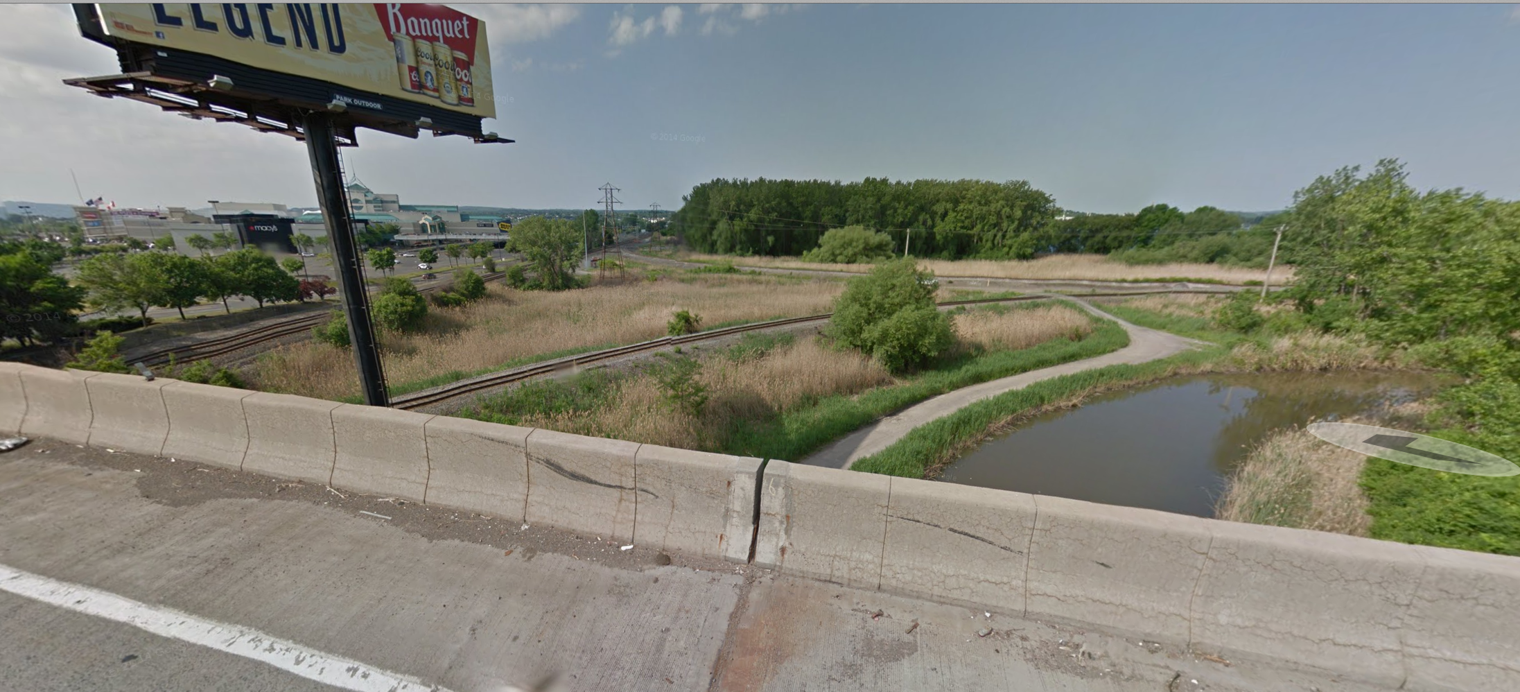
Otanabee River Champlain and his Huron warriors travelled along. (Google Maps)
Champlain mentions how beautiful the river area is and that it seemed eerily abandoned of people. It is noteworthy to mention that some think Champlain is speaking of Prince Edward County at this point, but the journal and mapping do not make this possible.

Some of the rapids Champlain mentions in his journal on the Trent River.
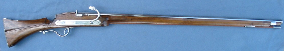
CHAMPLAIN’S WEAPON
Along the Otanabee and Trent, Champlain watches his native companions hunt with spears and one of them is injured when one of Champlain’s men tries to also hunt with their own weapon, an “arquebus” which is a type of matchlock musket used by Champlain and his French companions. A heavy weapon between 30 and 50 inches in length, Champlain’s arquebus fired 1 ounce lead balls through a straight barrel, capable of felling large game and men. This was Champlain’s weapon of choice on his adventure 400 years ago.

Champlain used an “arquebus” similar to this as his weapon of choice on the adventure.

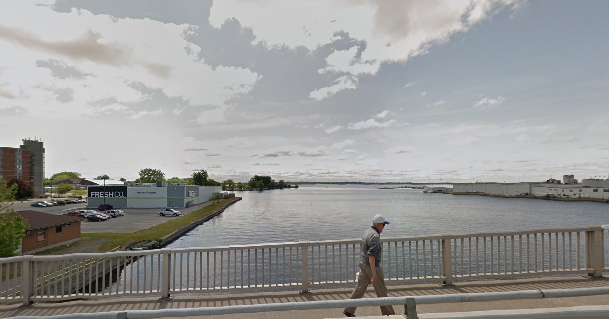
After Champlain and team empty into Lake Ontario (what Champlain calls Entouhonorons) at Trenton, they entered what is now the Bay Of Quinte and Prince Edward County. Passing along through the Bay Of Quinte past Deseronto, Picton and finally into the main body of Lake Ontario near Adolphustown, Champlain and company head east along the northern shore.

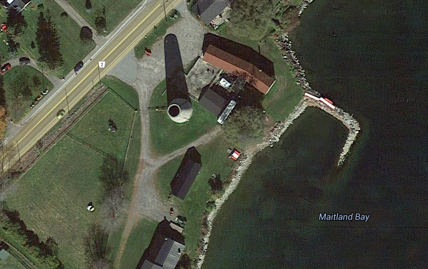
This is where Champlain would have exited from the river into “Lake of the Entouhonorons”, or as we now call it, Trenton on Lake Ontario.(GoogleMaps)
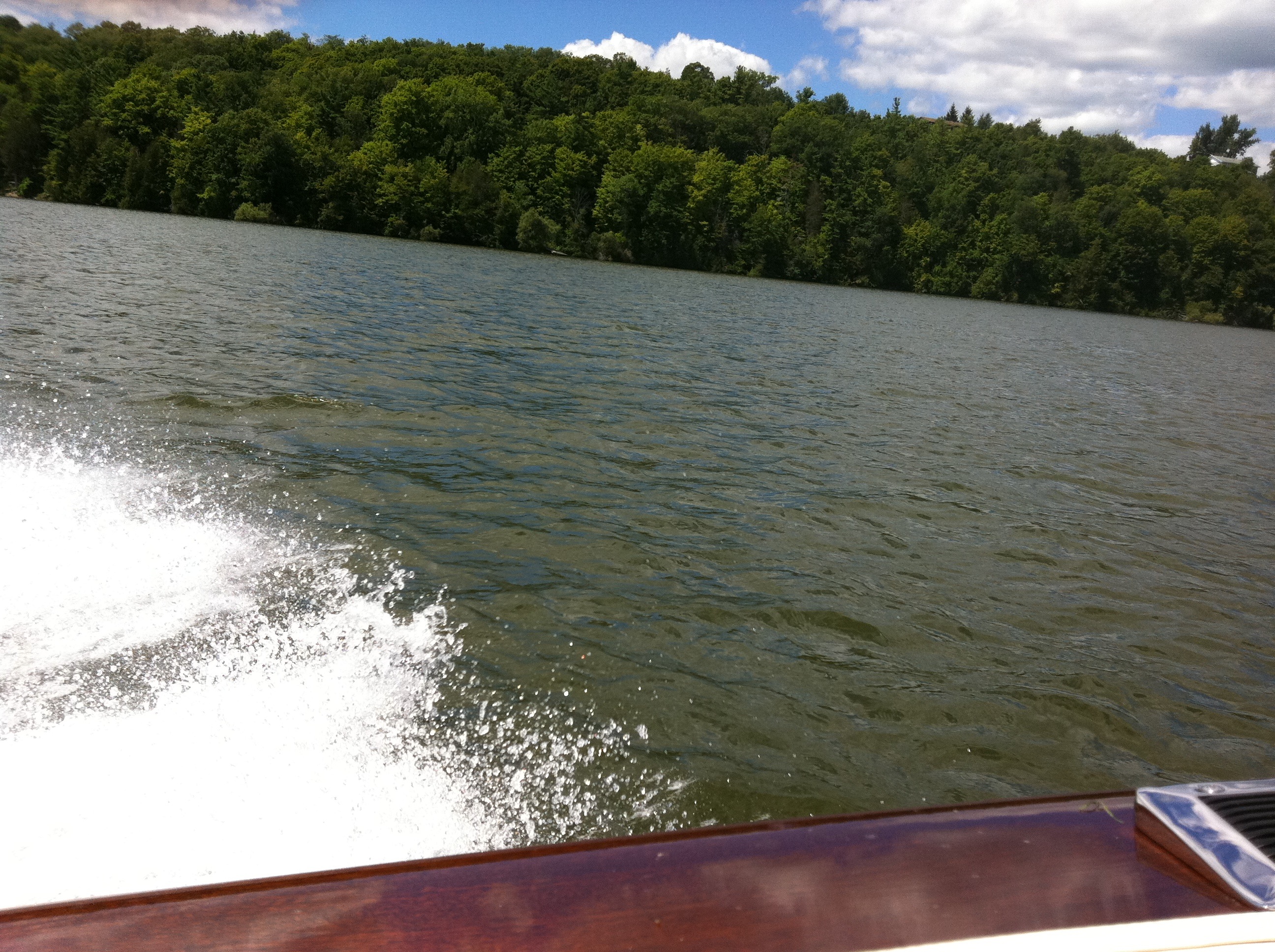
They would have passed Bath, Millhaven, Amherstview and Kingston. It is here that I firmly believe that scholars and the history books are incorrect in their assumption that Champlain cut down into the lake on the eastern end of Prince Edward County towards the Main Duck islands.

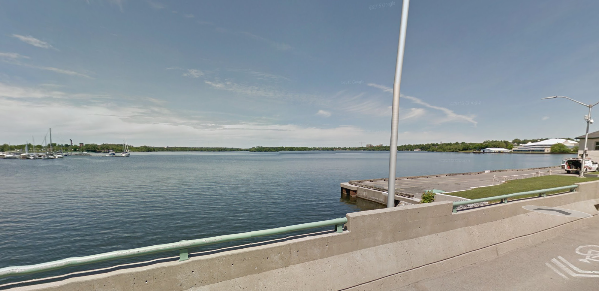
Cruising along the Bay of Quinte in the same waters Champlain traversed 400 years ago.

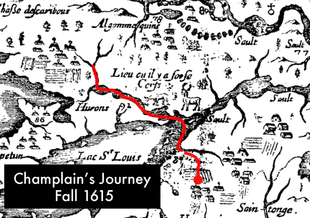
The route I believe Champlain took on his 1615 journey.

Champlain’s actual map he drew of the land he explored drawn in 1632. I marked his route in red.

Another map of Champlain’s with his route marked in red.

The accepted route Champlain supposedly took but I think it is incorrect.
Champlain mentions in the journal:
“we went across at the eastern end, which is the entrance to the great River St. Lawrence at latitude 43 degrees where there are some beautiful and very large islands in this passage”
This description tells me Champlain travelled along the northern shore of Lake Ontrio to Kingston, where the St. Lawrence begins as he mentions. It is here that there are also the “VERY beautiful and LARGE ISLANDS” he mentions would have been Amherst Island, Wolfe Island, Grenadier ISland and Galoo Island. Having sailed these exact waters, I know that this would make the most logical location to traverse Lake Ontario as it is more sheltered than the open lake of the accepted Main Duck Island route.

The gap where I think Champlain went through to go across Lake Ontario.

The “large beautiful islands” Champlain makes note of in his journal as he crossed the eastern end of the lake were lost likely Wolfe Islands, Galoo and Stony Islands to name a few.
Champlain’s native companions would have known this and also being in river canoes, have most likely traversed at the far eastern end of the lake around the shelter of the islands he mentions instead of going across the open waters of the lake with its treacherous autumn winds. Also, the latitude of 43 degrees he mentions puts Champlain in the Wolfe Island/Grenadier/Galoo Island area.
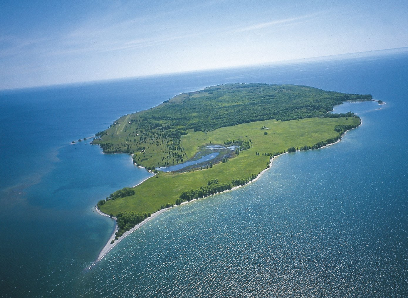
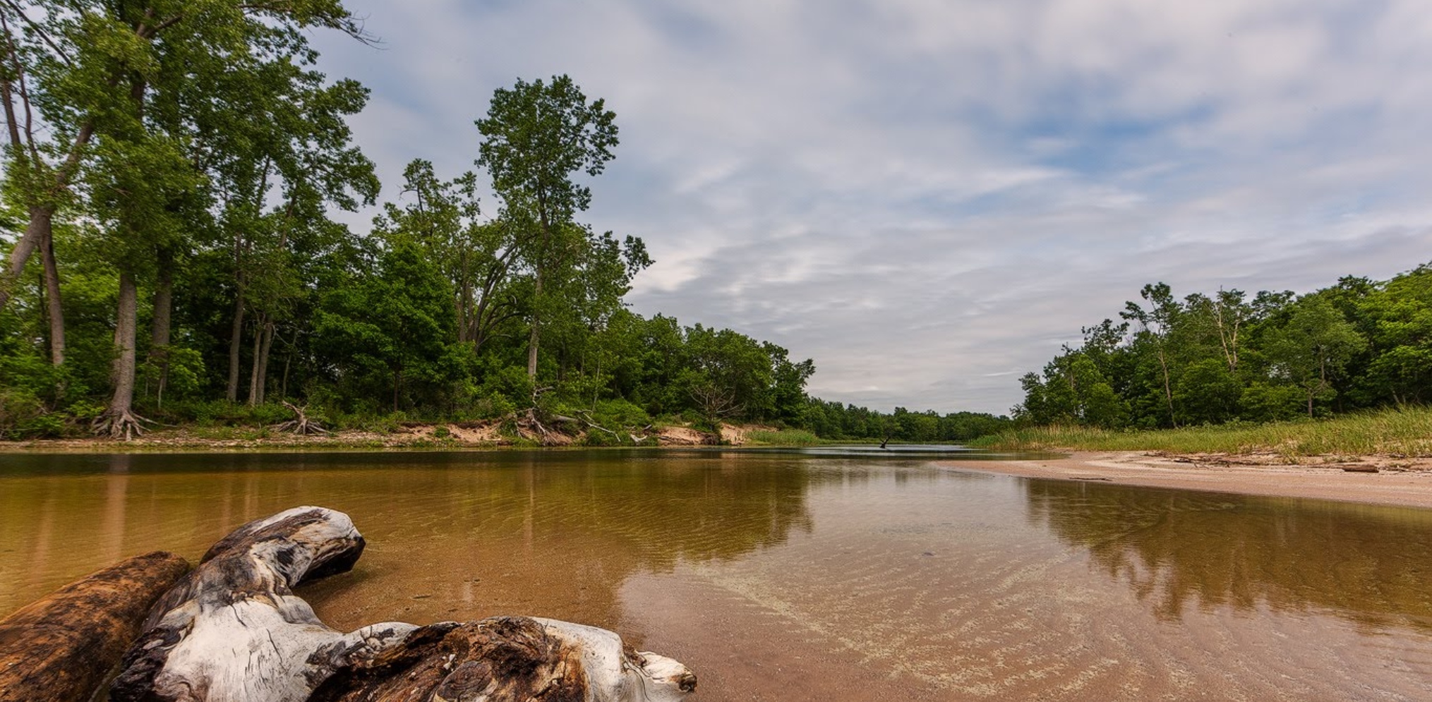
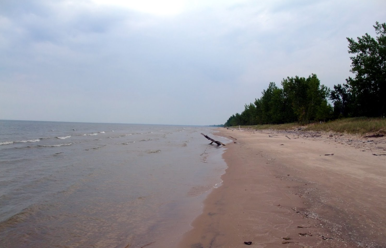
Using that area as his crossing point, the journal then mentions he traversed across “about 14 leagues to get to the other side of the lake in a southerly direction” . The distance of 14 leagues x 3.5km gives us a distance of about 50km they travelled across the lake. It is here, in late September 1615 that Champlain hit the shores of present New York state. The following journal details and description allow us to now pinpoint where this was, which I believe to be El Dorado Beach, NY.

Where Champlain likely landed in New York state in late September 1615.
ENTERING NEW YORK STATE
Champlain explains that once they reached the shore of the enemy and hid their canoes in the woods,
“we went about 4 leagues by land along a sandy beach , where I observed a very agreeable and beautiful country crossed by several little brooks and two small rivers which empty into this lake; and a great many lands and meadows..”
Champlain’s description and clues reveal:
- a sandy beach
- several little brooks
- two small rivers
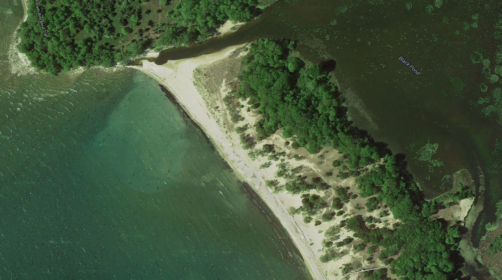
These clues all point to Champlain landing at what is now EL DORADO BEACH Preserve, just southwest of what is now Henderson, NY. NOT Hernderson Harbour as others believe. I think El Dorado Beach is where Champlain and his warriors first landed because it is a beach area that stretches south for exactly 14km that he mentions walking along (4 leagues x 3.5km=14km).

Aerial view of Champlain’s landing point.

The beach Champlain walked along with his invading war party.
The two small rivers he mentions would be Sandy Creek and the Salmon River. The “several little brooks” would be the various creeks that dissipate in from the beach. Next Champlain mentions in his journal “a great many ponds and meadows where there were an unlimited amount of game”.

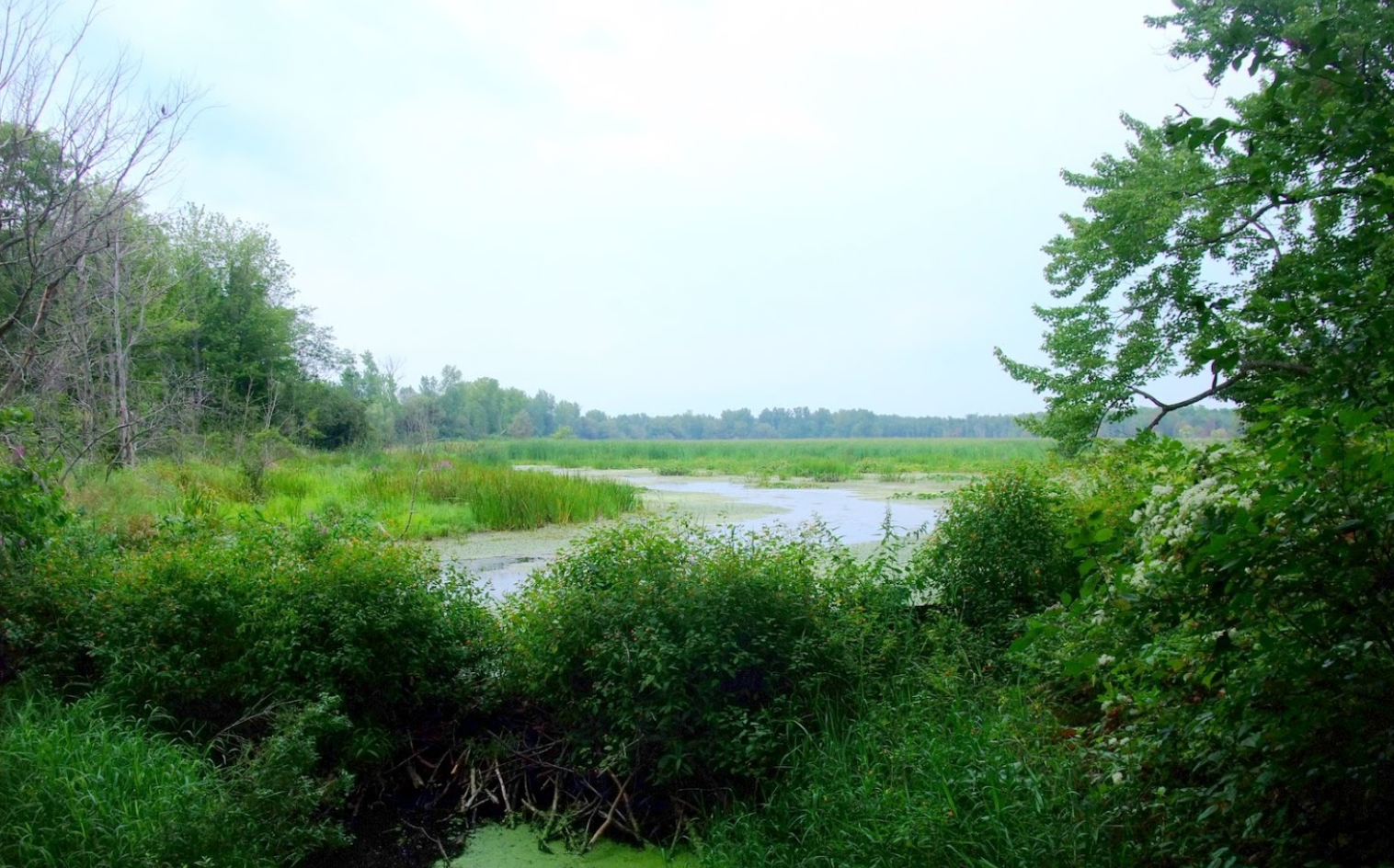
The marshes Champlain mentions with lots of game.
These ponds would likely be the Lakeview Pond, North Sandy Pond and many other ponds that lie behind the beach, now called Southwick Beach in New York state that he walked south along around Oct.1 1615. I am not sure if there has ever been a proper archeological investigation into this 14km stretch of beach area where Champlain landed and traversed, but I’m sure a number of artefacts lie buried in the sand from this 400 year old expedition, waiting to be discovered.

Beach Champlain walked along.
It is from this beach in NY state that Champlain continued down into Upper New York state for four days on foot through Oswego and Onondaga Counties to the Oneida River.

After walking along the coast of Lake Ontario, Champlain enters the Oswego River and follows its shores inland. (Google Maps)

Champlain followed the river inland to Lake Oneida that he mentions in his journal. (Google Maps)

The inland journey Champlain would have taken.
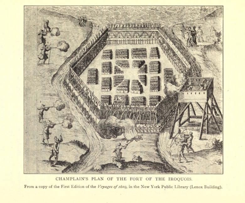
On October 9 Champlain encountered enemy Iroqouis while on scouting mission that they took prisoner. On October 10 1615, Champlain and his band of native warriors reached their destination: the immense palisaded fortress of the Iroquois.

Champlain’s own sketch of the Iroquois fortress he attacked on Oct.10 1615. Note the two rivers either side and Lake Onondaga at top.
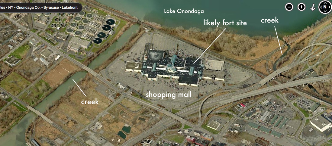
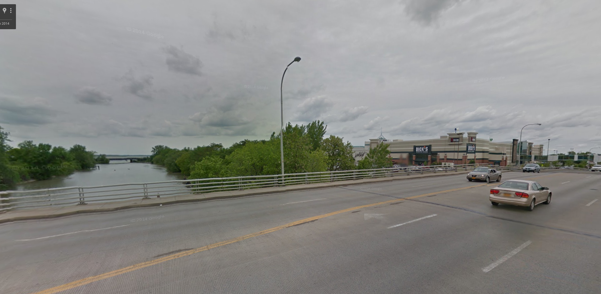
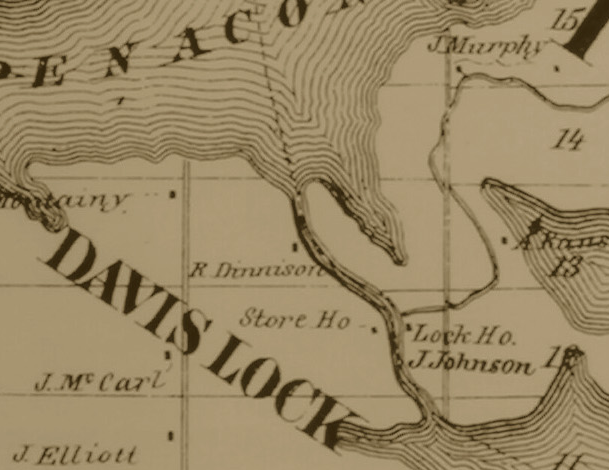
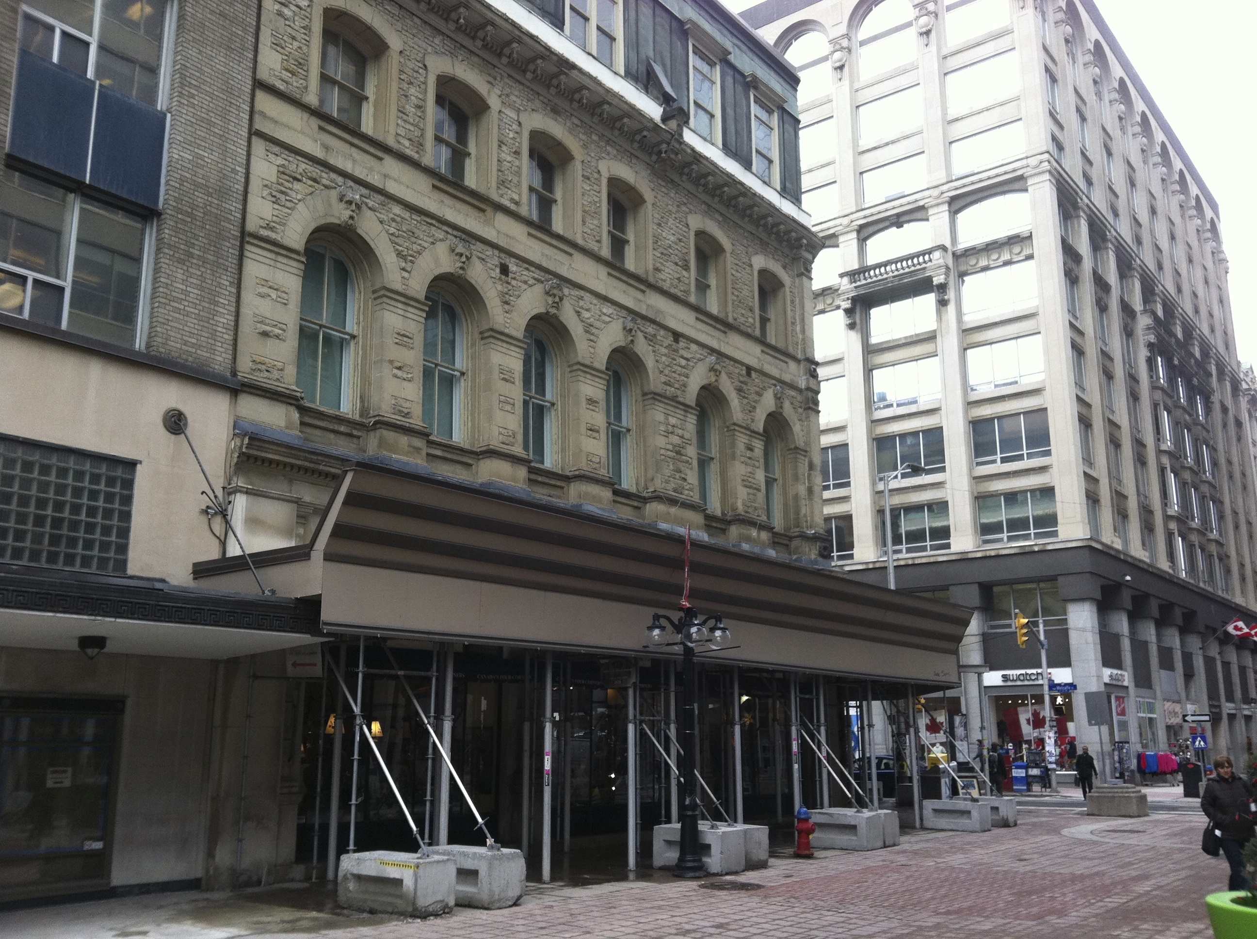
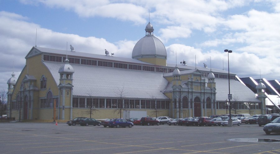
This was an Iroquois stronghold whose exact location has been the subject of much controversy due to Champlain’s scant details on getting there. Other than simply saying it was located “between two streams” there are few details that help locate where this fort would have been. In his 2009 book “Champlain’s Dream” author David Fischer speculates historians have been incorrect in their assumption the Iroquois fortress was in Fenner, NY within Madison County. Fischer postulates that the fort was probably in between two streams at the south end of Lake Onandaga in Syracuse NY where the present day Carousel Shopping Mall resides.

Where the fortress was it is now a shopping mall. Note two rivers either side.


Streetview of where the fort likely stood. Now a Syracuse shopping mall.

Other side showing the other river that surrounded it.
On October 10 Champlain began his assault of the enemy fortress, firing his arquebus at the enemy who retreated in shock of having never seen or heard such a weapon. An ensuing battle brought causalities and injuries to Champlain’s native companions who soon retreated in the woods surrounding the fort. The Iroquois fort was a hexagonal shaped wooden fortress made with high walls of sharpened log palisades. Champlain gave orders to burn the walls down and build a series of devices to penetrate the walled fort. Counting on being joined by 500 hundred other warriors from the north, Champlain set to work on a full on offensive attack of the Iroquois fort with disastrous results. The accompanying warriors did not take any orders from Champlain who was trying to rally his troops into some kind of sensible attack formation. Champlain recounts how the native warriors ran around in disarray without a proper plan of attack which frustrated him greatly, but Champlain “excused” them for their behaviour.

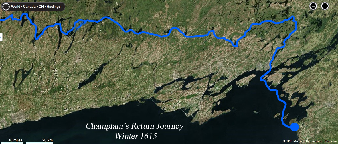
The complete route I believe Champlain took in 1615.
With his troops in disarray and two native chiefs injured in the failed attack, Champlain retreated to his own hastily made wooden fort with having sustained two enemy arrows lodged into his leg. The arrows had pierced his knee and leg which required attention and caused the explorer great pain. Camping out in their fort and enduring a number of further skirmishes until October 16th, Champlain joined his companions on a full scale retreat. With the enemy following Champlain’s team for about a couple of kilometres before retiring back to their fortress, on October 18th Champlain reached the beach of Lake Ontario from where they originally landed. Fighting snow, hail and cold winds, Champlain found their concealed canoes still near the beach and loaded up for a return across Lake Ontario to Kingston. Champlain pleaded to be returned to his settlement. Constructing a camp on the beach area near Henderson, NY, the team packed up on October 28th and as Champlain recounts:
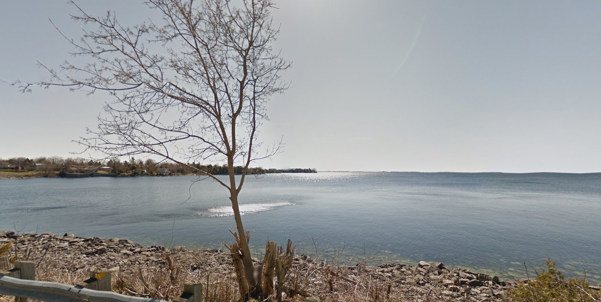
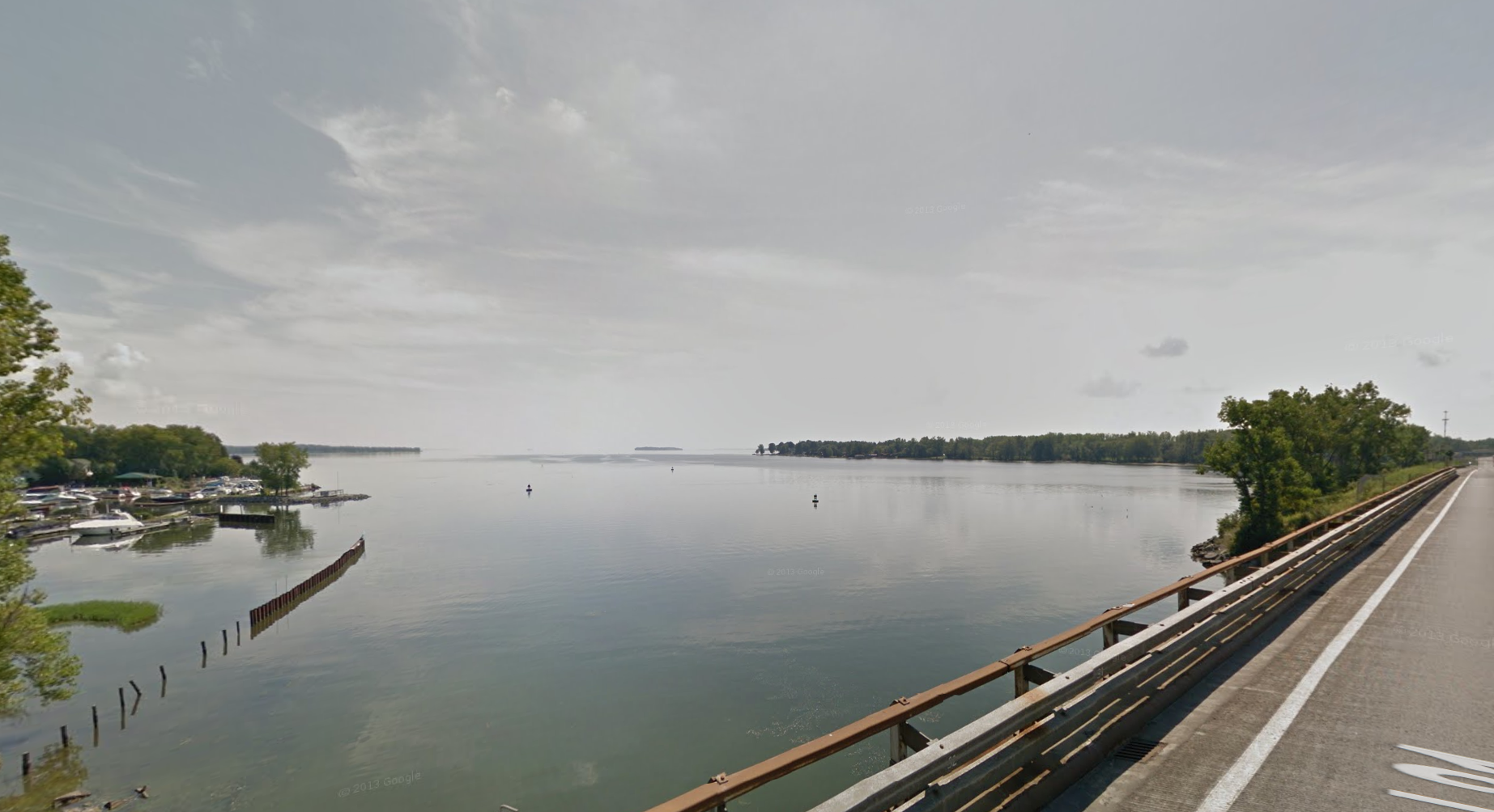
“after crossing from the island, the end of the lake, we entered a river some 12 leagues in length”. This I believe to be Cataraqui River, now part of the Rideau canal system.

Cataraqui River Champlain I think ventured up on his return journey.
This entry most likely refers to crossing “from the island” which would be Wolfe Island, over to Kingston, On and into the Cataraqui River. When we apply Champlain’s “12 leagues in length” it calculates to be 42km up the Cataraqui River, placing Champlain up near Seeley’s Bay, ON. and Whitefish Lake. Another possibility that works is that they took Millhaven Creek across from Amherst Island and up the 42km distance to Sydenham Lake. However, I strongly believe it was the former route mentioned since I have travelled down both, and Millhaven Creek is more of a trickle of a stream that would make canoe travel near impossible. This leaves the Cataraqui River as the most likely option and matches the “marshy” description in his journal.

View of the entrance to the Catarqui River from Lake Ontario.
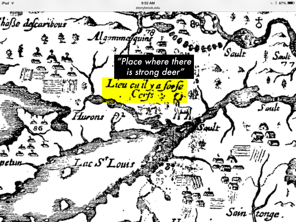
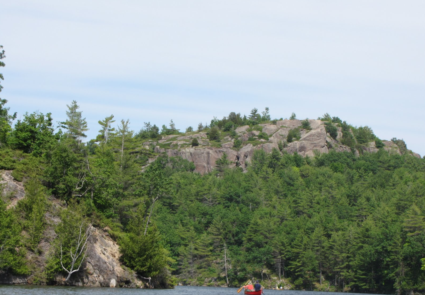
Champlain’s group built two or three log cabins most likely on the shores of Whitefish Lake, where a great deer hunt was established using native hunting methods of building traps and deer capture enclosures. This “great deer hunt area” is marked on a map made by Champlain in 1632 that is marked “Lieu Ou il y a Forte Cerfs” which when translated means “place where there is strong deer”. Having grown up in this area I can attest to the fact that even to this day there is a an abundance of deer in the surrounding woods.

Champlain’s map mentions the site of a great deer hunt he participated in. This matches to the area north of Kingston.
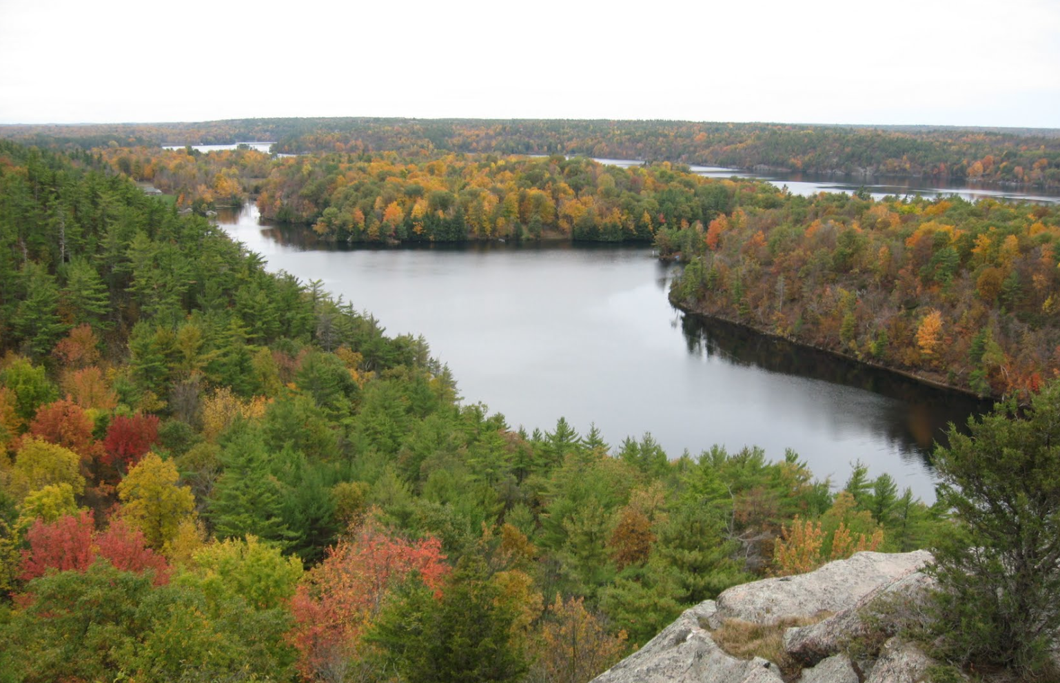
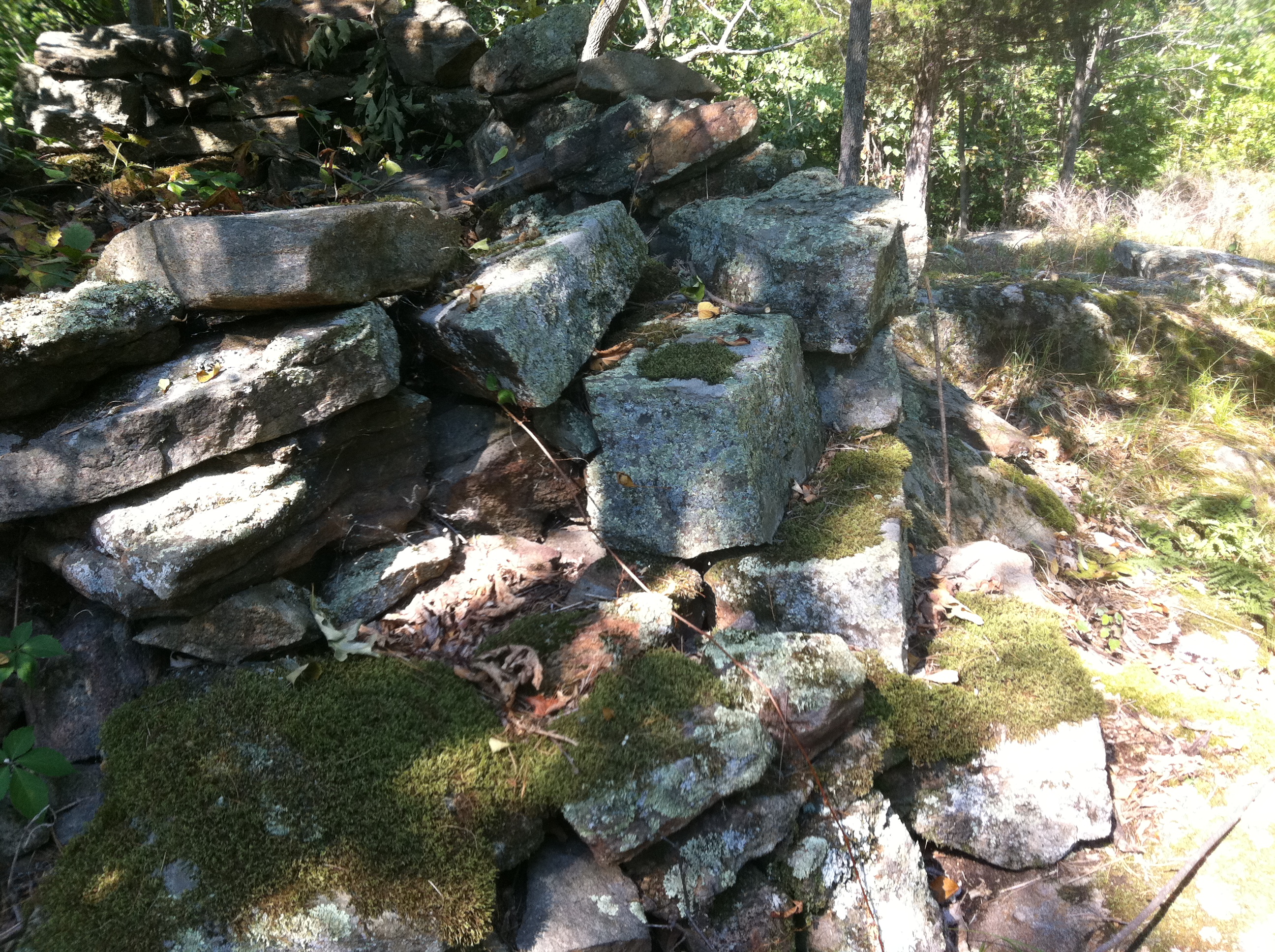
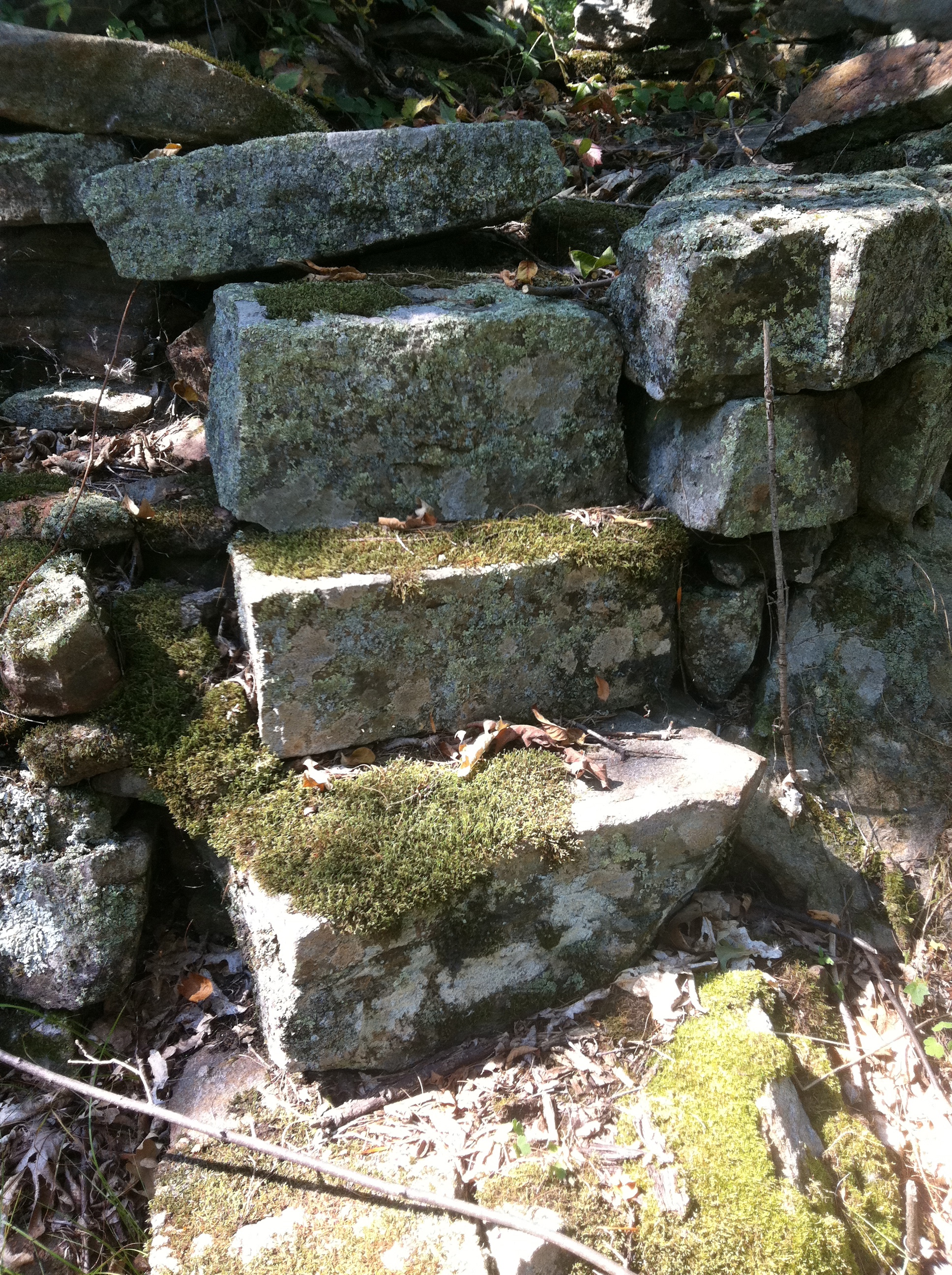
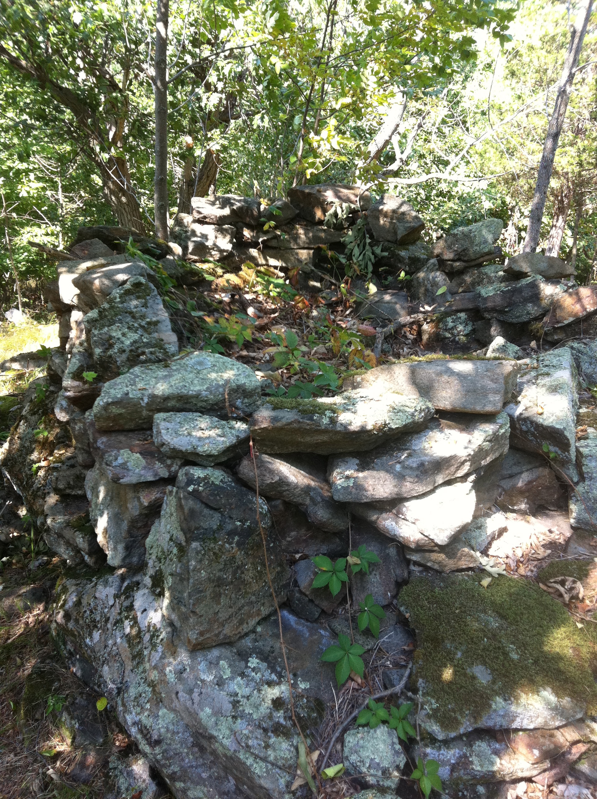
Champlain at this point on his adventure gets lost in the woods of which he transcribes into his journal in detail. Having wandered off trying to capture an unusual bird he had spotted, Champlain was separated from his native companions and was lost in the woods North of Kingston for days. Spending the first night at the foot of a massive tree, Champlain trudged on and came to a pond where he killed some birds of which he ate to survive. In what he describes as being about 5-6 days lost and wandering the woods north of Kingston, probably in the vicinity of Jones Falls where he came across a stream that he followed to a small lake about 4km in length which could very well have been on Whitefish Lake before the building of Rideau Canal in 1830 had flooded the land. Champlain mentions hearing a great waterfall and being surrounded by mountains, of which were probably Jones Falls and the mighty and nearby Rock Dunder mountain area respectively. There are no large mountains per say anywhere west of the Frontenac Axis geographical formation of which his terrain descriptions match.

Whitefish lake as viewed from a mountain Champlain possibly mentions in his journal, Rock Dunder.

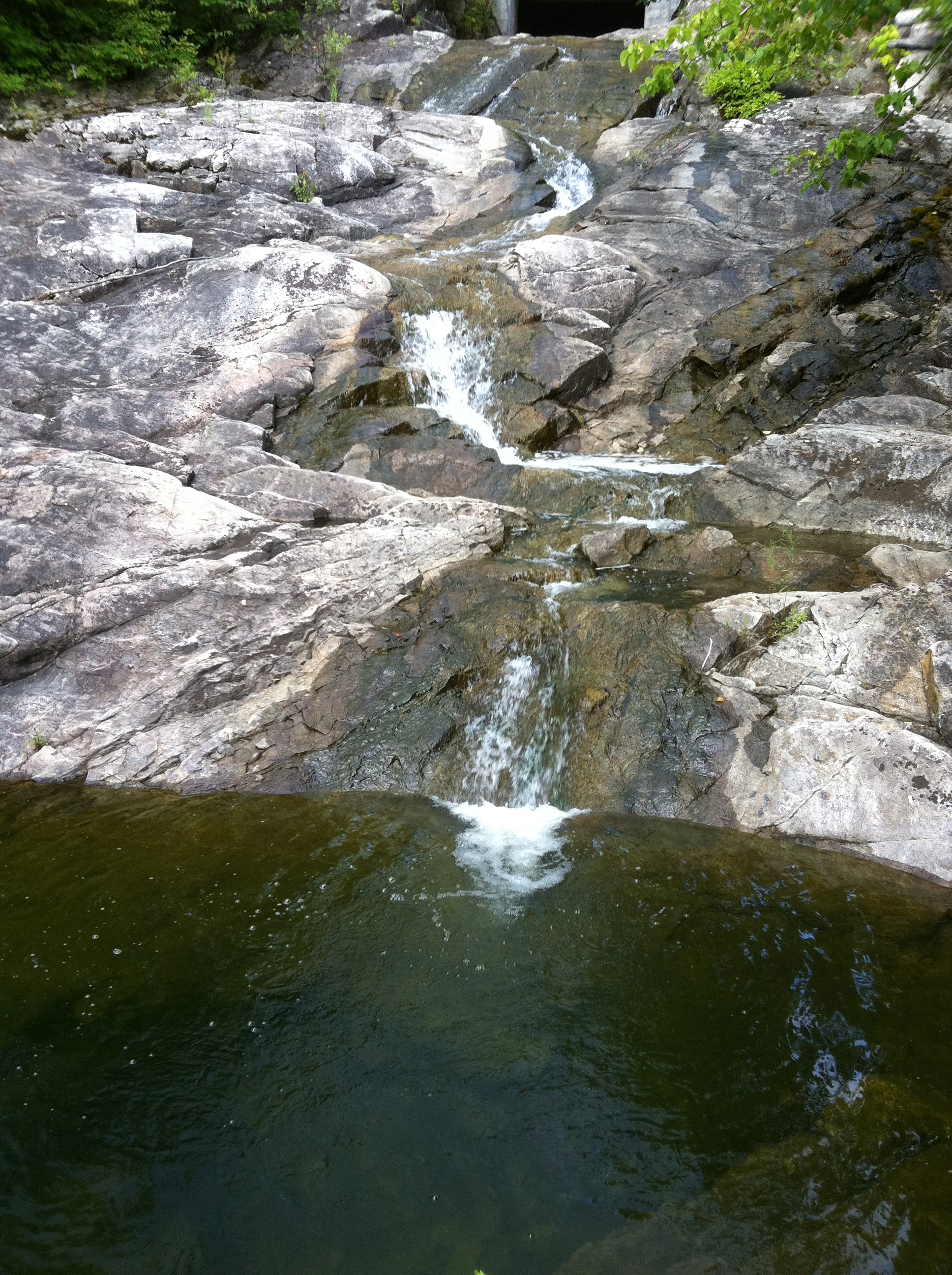
Champlain mentions the sound of a waterfall in his journal, which was likely the sound of the mighty Jones Falls before it was dammed up for the Rideau canal.
Following the river Champlain was finally re-united with his worried native companions who told Champlain that if had not returned, they would never again meet with the French in fear that they would think they had killed Champlain. It is something to contemplate that history could have been much different if Champlain remained lost in the woods and perished north of Kingston.

The possible return journey Champlain took in the late fall early winter of 1615.

A mountain Champlain mentions, could be Rock Dunder near Morton, ON, the highest point in Eastern Ontario.
From here, after spending about a month in the area north of Kingston, Champlain departed on December 4th and headed north west across frozen ponds and rivers, most likely traversing the areas of Tweed, Madoc, and the Kawarthas to arrive at their originating native village on December 20th. It is here where Champlain’s adventure concludes and spends the winter among the natives before returning to Quebec and later France.

Wooded area north of Kingston Champlain traversed in the winter of 1615 on his return to Huronia
CONCLUSION
Using Champlain’s journal and its descriptive details of landmarks and terrain, along with his units of league measurement we can put together a fairly accurate recreation of his journey four centuries ago. Of course it has a margin of error and speculation, but as previously mentioned, I have traveled these exact same areas and found many elements to match his journal descriptions. With this year marking the 400th anniversary of this epic journey it might be worth considering archeological teams from both Canada and the United States search the areas of this route for possible remnants of Champlain’s epic adventure 400 years ago into what was then, the unknown.