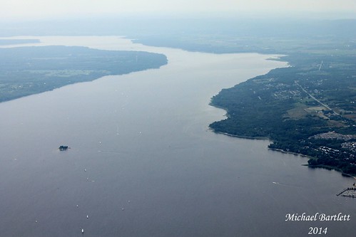
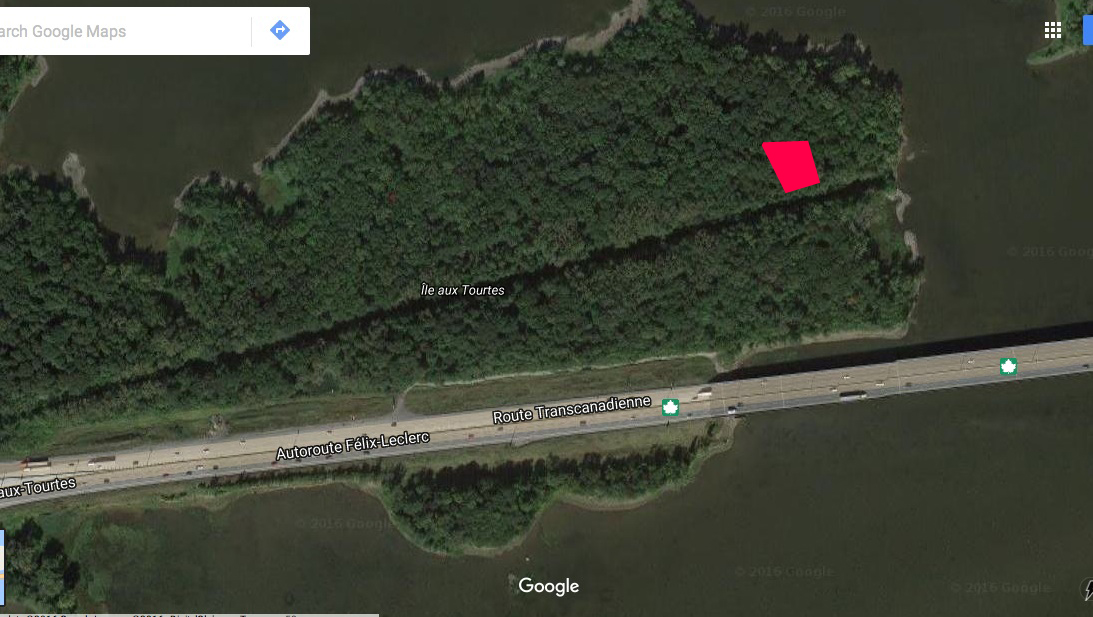
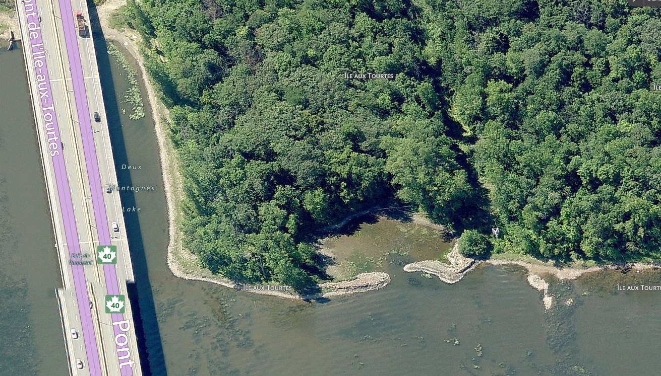
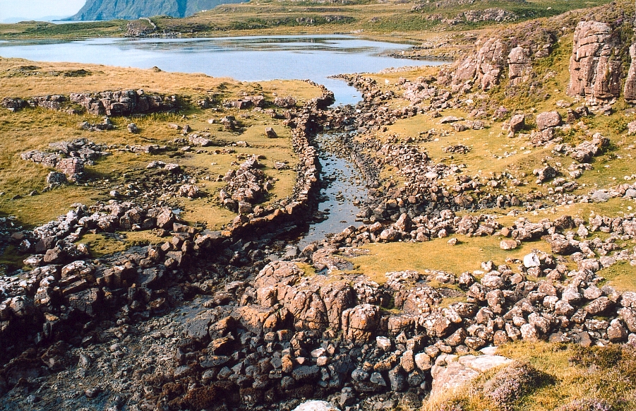
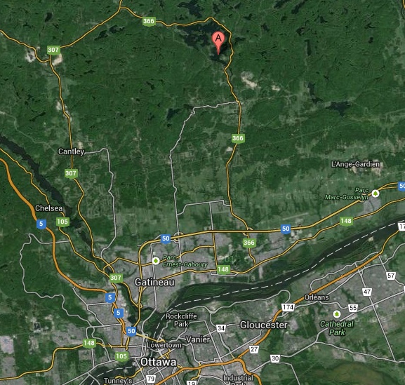
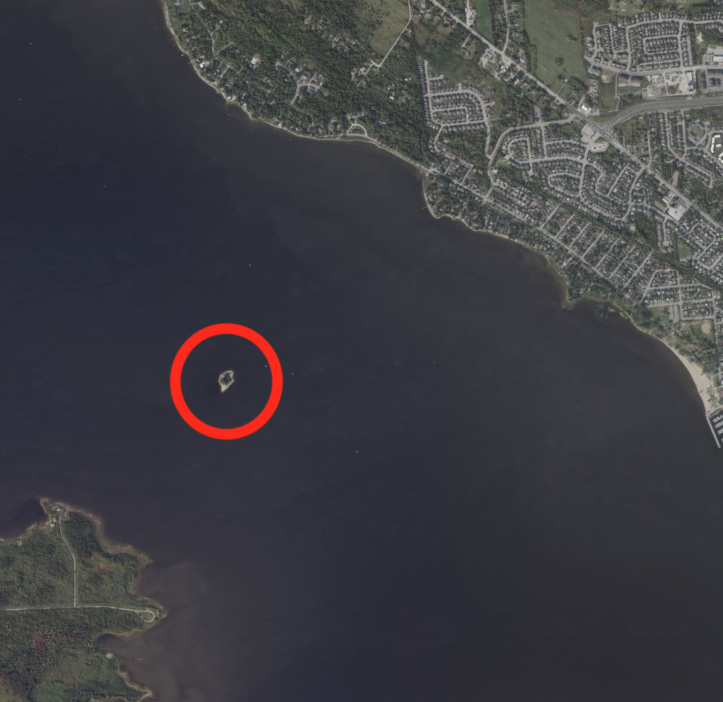
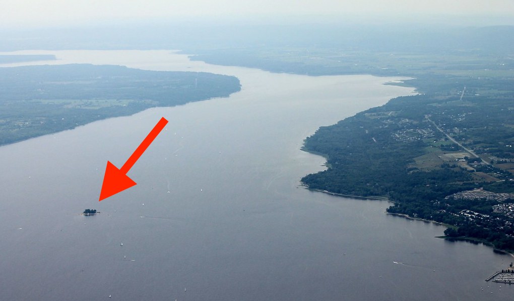
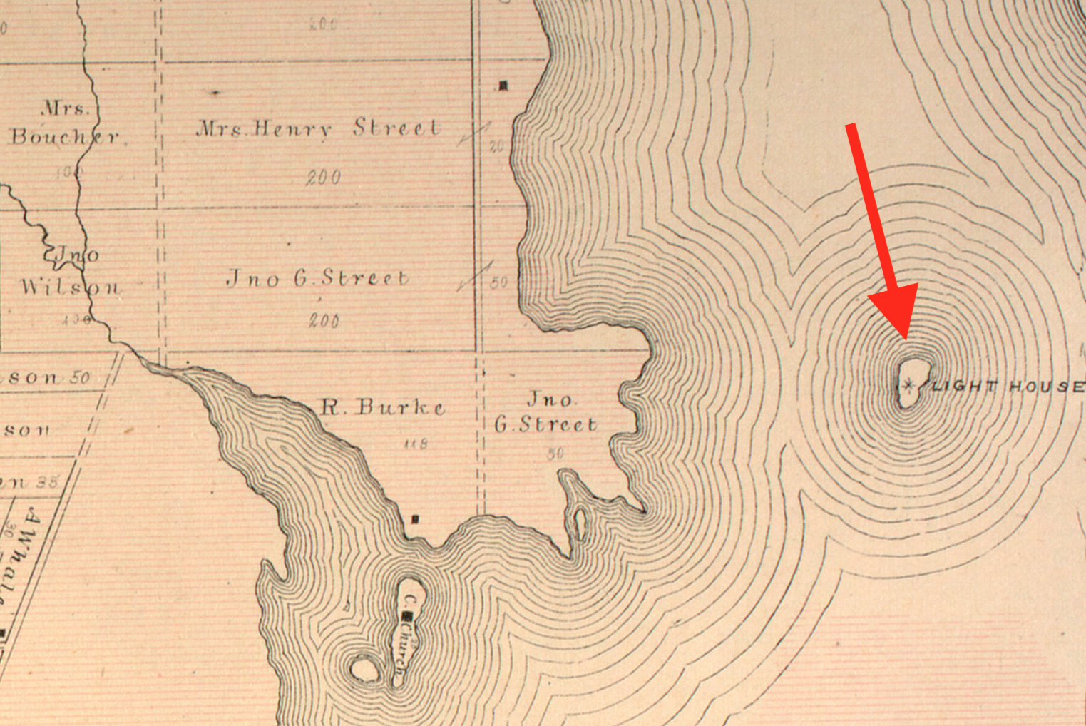
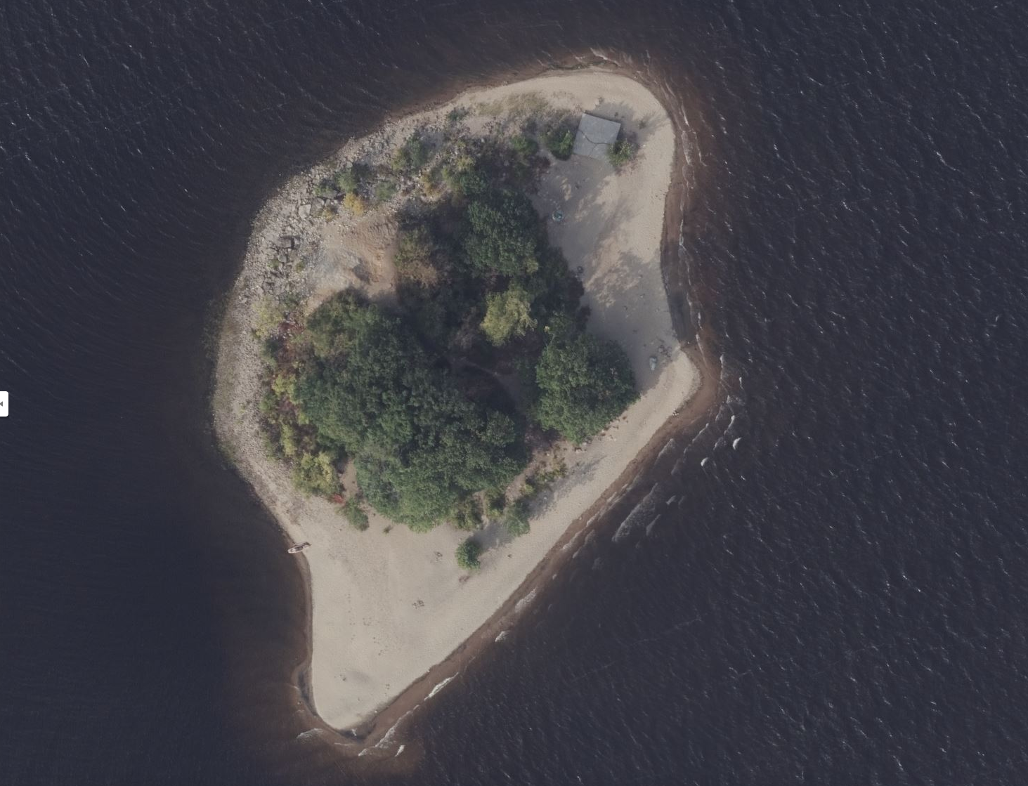
Situated on the Ottawa River approximately 18 kilometres northwest of downtown Ottawa lies a small island with such a haunting past it truly should be called, the Island Of The Dead.
What lies beneath the sands of this small, one acre island is a solemn reminder of our area’s turbulent ancient past, and reminds us of those that were here long before us. Dozens of buried skeletons, weapons and a mysterious inscribed stone tell a story of violence, ritual and what I believe is a place of extreme archeological importance.
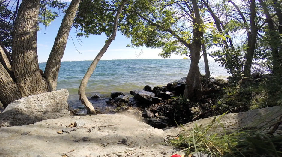
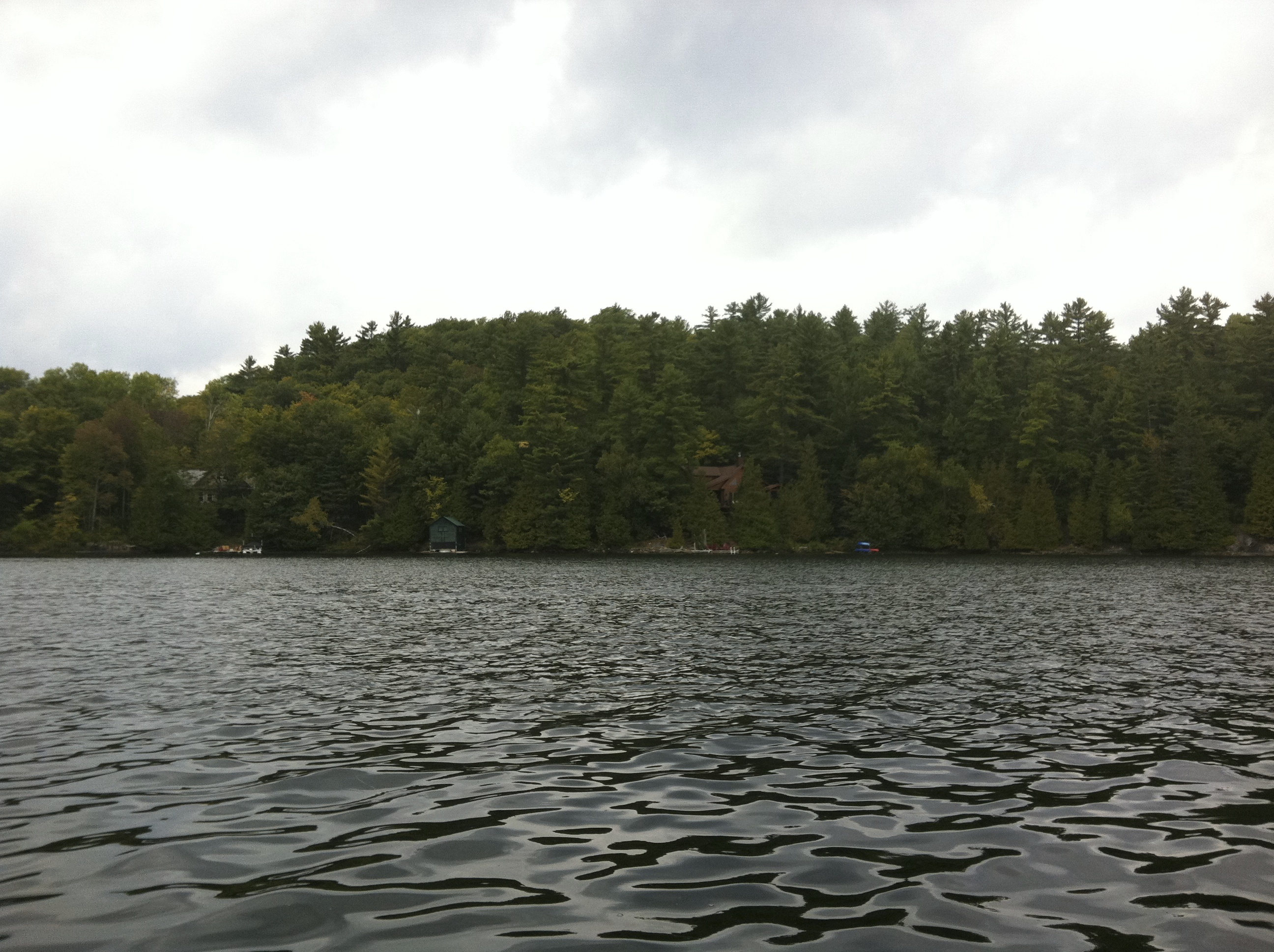
This seemingly innocuous sand island one kilometre offshore is often visited, but rarely those that step foot upon its shore fully comprehend what lurks below.
LIGHT THE WAY
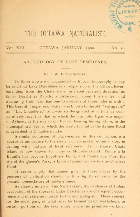
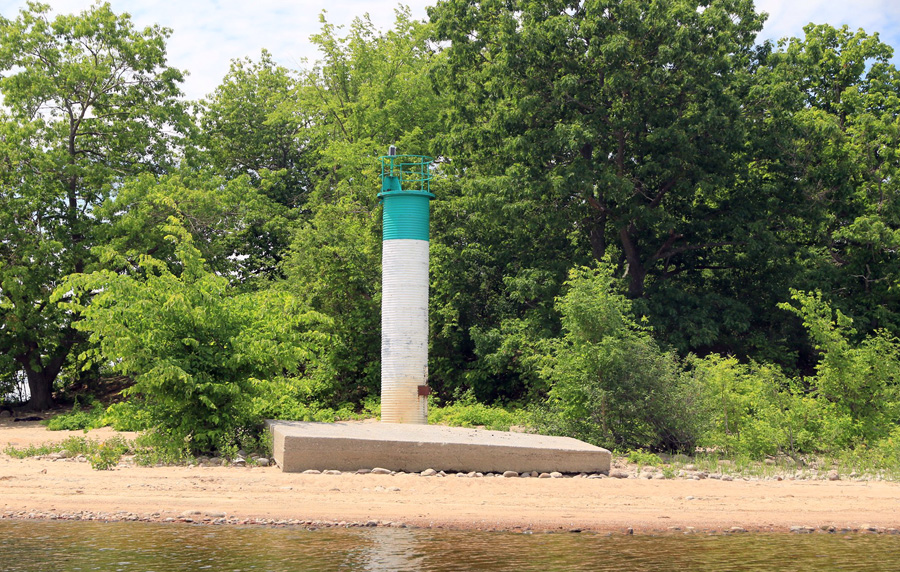
Our story begins with my recent research into the history of the Ottawa River, a history that I’ve recounted before through articles written about centuries old ruins, forgotten French forts, trading posts, shipwrecks and other incredible historical evidence that the Ottawa River was once an important conduit of goods and people. It was when I was researching the old lighthouses of the Ottawa River that I came across a most intriguing document from 1899 called the “Ottawa Field Naturalist” with an article within its pages entitled “Archeology of Lac Deschenes” by a T.W. Edwin Sowter.
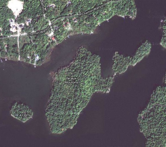
Sowter was the first archeologist of the Ottawa Valley, and upon his 1899 expedition to what was called “Lighthouse Island”, he made a most intriguing find: an ancient burial ground.


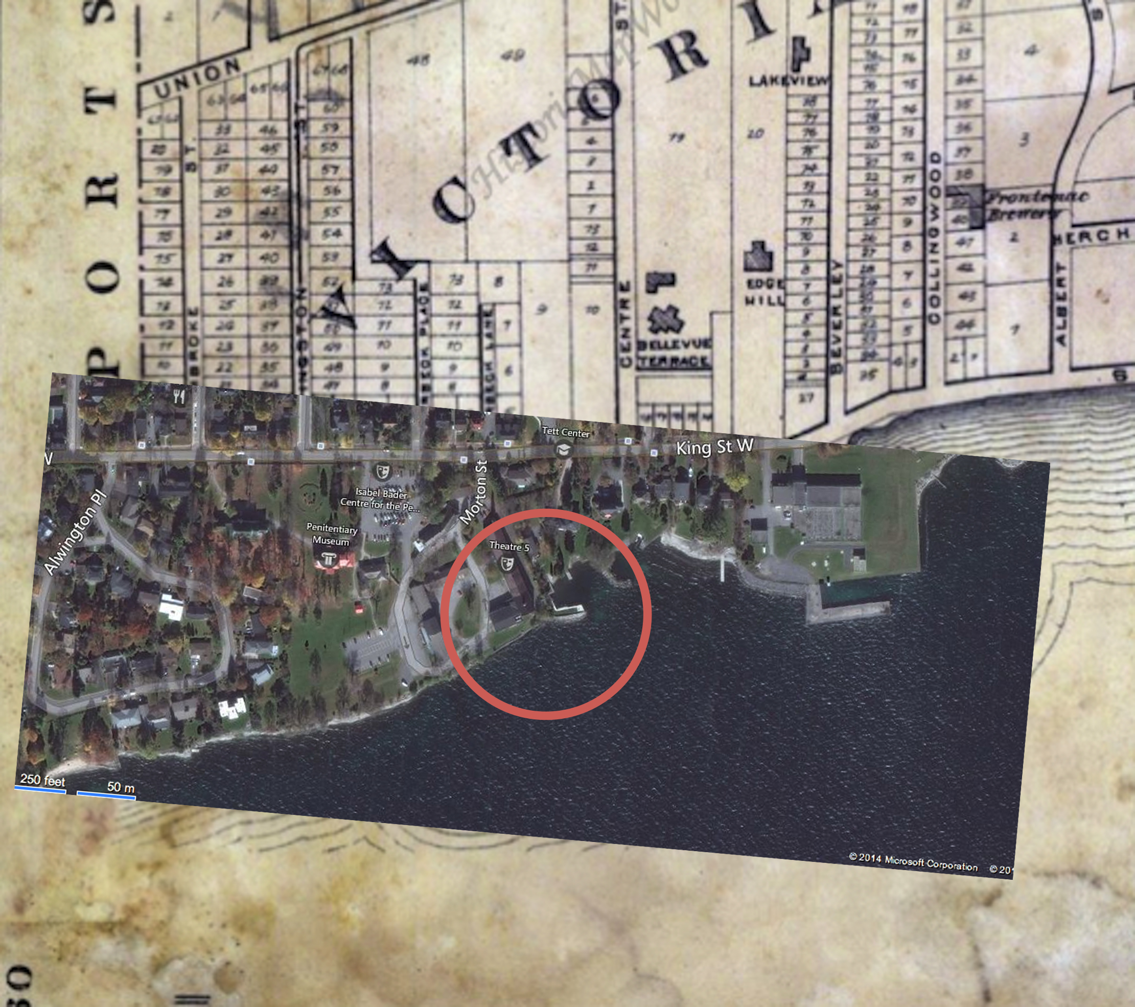
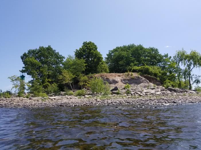
Now called “Aylmer Island” Lighthouse Island is approximately one acre in size and made up of an assortment of sand, boulders and gravel placed there by the last glacial event thousands of years ago. What was discovered by Sowter and others was abundant evidence of individuals wrapped in birch bark and buried 2-3ft below the surface in a what was described in his journal as being in a “recumbent” position which was unusual, because the known indigenous burial practice had the dead buried in a prostrate position.
Sowter mentions in his article that many more skeletons were found during construction of a lighthouse on the island which lead him to believe the island was a communal burying ground for more than one race of people. Sowter thought this since the burials he found did not align with any known local rituals.
A large pit was then uncovered that showed dozens of bones thrown haphazardly thrown into it rather than bodies carefully placed. Also unearthed were iron axes, knives, flints, and porcelain beads. Sowter hypothesized that such a large burial pit full of so many bones was likely the site of an Indigenous Huron tradition called the “Feast Of The Dead”.
FEAST OF THE DEAD
The Huron Feast of the Dead was a mortuary custom of the Wyandot people who resided in what is today central Ontario. The Wyandot were Indigenous peoples of the Northeastern Woodlands of North America, and speakers of an Iroquoian language. The custom of burying their dead involved the disinterment of deceased relatives from their initial individual graves followed by their reburial in a final communal grave. This ritual was both for mourning and celebration, and was documented by the Jesuit missionary Jean de Brébeuf who was invited in in the spring of 1636 to a large Feast of the Dead on a beach near Midland, Ontario.
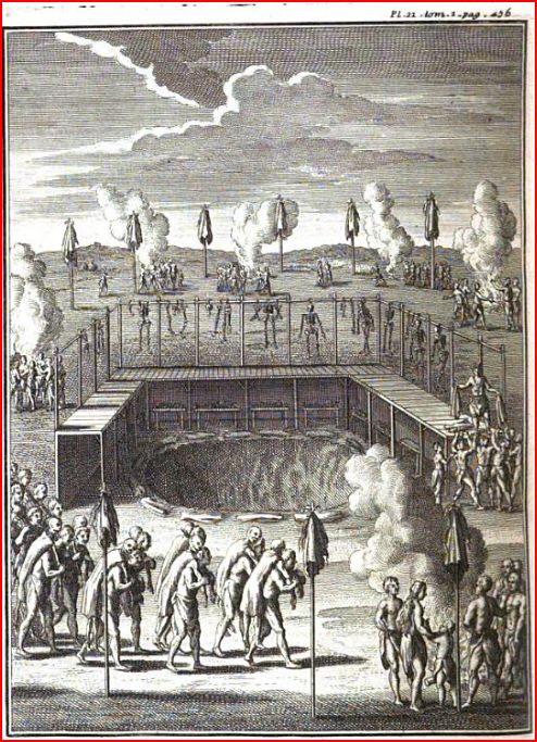
Mass reburials of their dead involved transporting remains to a new location outside their villages every ten years or so, sometimes many kilometres away from their villages. Bodies would be taken out of their initial graves with the remains cleaned in preparation for reburial at this new location, such as the one theorized to be at Aylmer Island. However, one key element to this theory throws a wrench into the pit, that being the Huron never resided near the Ottawa River.
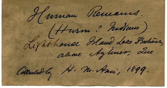

Sowter claims that the Huron may have been given sanctuary in the vicinity of Ottawa by the resident Algonquin people after they were defeated in other regions. The human remains uncovered in 1899 from these mass burials still reside at the Canadian Museum Of History and their origins I would guess still remain a mystery.
TOOLS IN TIME
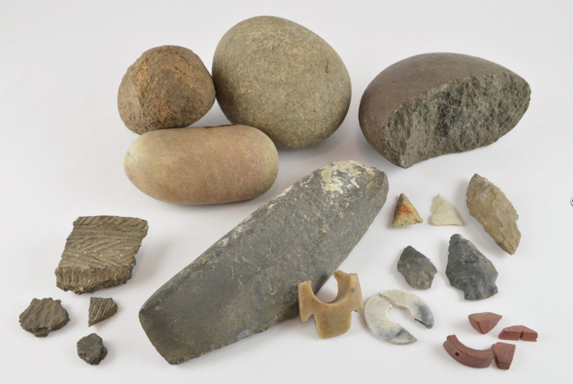
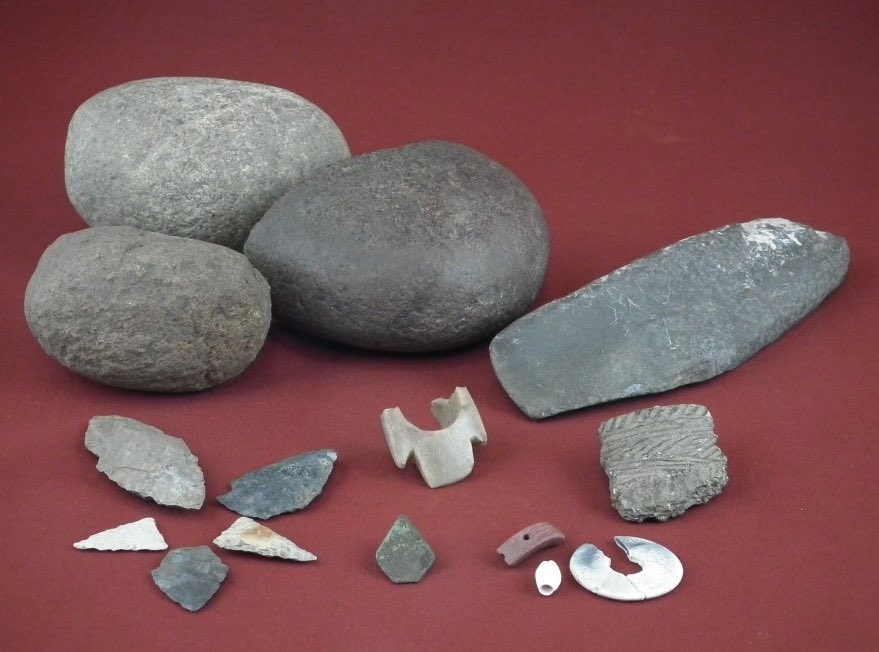
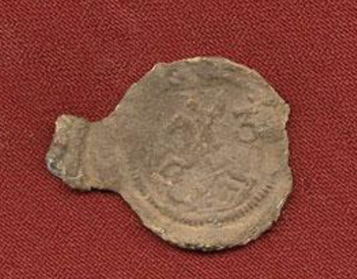
In 1898, a year earlier than Sowter’s visit, an old lighthouse was being demolished on the island to build a newer lighthouse and construction worker unearthed a most peculiar find. It was the skeleton of an individual found buried in a reclined seated position. Along with the skeleton many artifacts were found including a 2 pound iron axe, a knife with an intricate inlaid copper vine motif on its handle, and two other knives. A bone harpoon and fishing net needle, a copper kettle with an iron handle, a bar of wrought iron, sheets of lead, shell beads, and also human hair wrapped in birch bark.
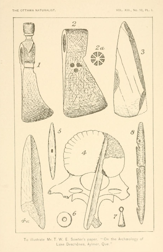
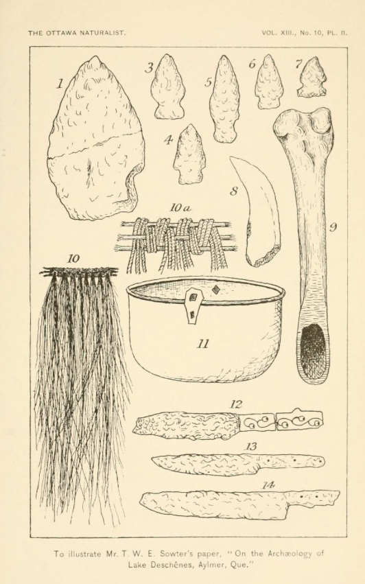
These items were sent to an archeologist in Toronto by the name of David Boyle who said the tools were of European origin, but no maker’s marks were evident so their purpose remains a mystery, perhaps used for woodworking according to Sowter and Boyle.
Boyle suggests the copper kettle was also of European make, with the woven fabric made from human hair or animal fur.
The skeleton found in this unusual seated position was examined and it was determined that the individual met his death by taking an arrow in the lower back. A bone arrowhead had pierced the lower spine vertebrae, paralyzing the unfortunate victim who was found centuries later on the island.
STONE SLAB

In addition to the array of skeletons, tools and other artifacts unearthed on the island, an unusual stone slab was found that was inscribed with “JPOT”. What this indicates is perhaps a grave marker of one of the skeletons, but it was never determined which skeleton it belonged to. Was this inscribed stone showing the initials of someone buried here? If not, JPOT seems like a bizarre name to be carved into a stone. Perhaps one day the stone can be recovered from wherever it now rests and studied further to determine its origins and meaning.
ISLAND OF MYSTERY
Throughout the turbulent and often violent history of the Ottawa River, it seems that Aylmer Island is a unique place that was perhaps specifically chosen for its special location. It faces both the rising and setting sun for those interred there. Many ancient burial rituals and sites incorporate the sun’s position into their location and I would suspect Aylmer Island was no exception, that that is my theory alone and one that was to be tested.
I have not been able to uncover any further details about the Island Of the Dead since Mr. Sowter’s expedition in 1899, so it remains unclear if any further excavations revealed more clues to this mysterious sanctuary in the middle of the Ottawa River. How many other artifacts lie waiting to be discovered beneath the sands of time, and how many other souls rest there? With such intriguing clues discovered over one hundred years ago, I am sure much more fascinating evidence awaits to be found by trained archeologists and Indigenous ambassadors. Perhaps future study can help unravel the mystery of this enigmatic island so close to the Nation’s Capital.
It would seem with such important history behind it that this island would be studied further and later protected from being disturbed. Until that time let us respectfully let those buried there lie in peace on their aptly named, Island Of The Dead.
Andrew King, March 2024
SOURCES
US INTERNET ARCHIVES: https://ia804701.us.archive.org/5/items/canadianfieldnat13otta/canadianfieldnat13otta.pdf
https://www.historymuseum.ca/cmc/exhibitions/archeo/sowter/amilabelse.html
https://www.historymuseum.ca/cmc/exhibitions/archeo/sowter/1900/sowter1900e.html
https://en.wikipedia.org/wiki/The_Huron_Feast_of_the_Dead
Google Maps
Apple Maps
https://open.canada.ca/data/en/dataset/957782bf-847c-4644-a757-e383c0057995