A few decades ago giant white letters that formed the word “OTTAWA” existed in a grassy field. Measuring almost 500 feet long by 100 feet tall, the massive lettering was visible from hundreds of feet in the air as aircraft flew over the Nation’s Capital. By chance on Google Maps, I found that although faint, the giant lettering is still visible today.
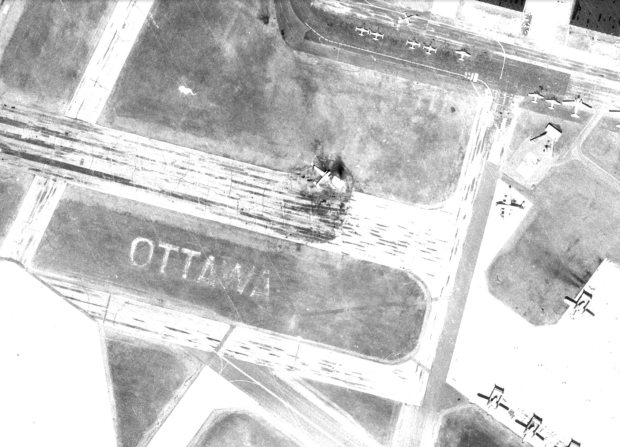
The 500ft “OTTAWA” sign visible in the grass circa 1965 along with some 1950s fighter jets and transport aircraft at CFB Uplands. (image GeoOttawa)
Now in 2017, these long lost letters still remain hidden in the grass of the MacDonald Cartier Airport, a faded reminder of a time when our city was marked with giant letters to welcome visitors to our fair city while up in the air.
Probably made from white stone or chalk, the giant letters were most likely part of the Ottawa Flying Club’s original runway which opened in 1928. These letters would have also marked the site of CFB Uplands, part of the Royal Canadian Air Force wartime training station of the British Commonwealth Air Training Plan which opened in 1942.
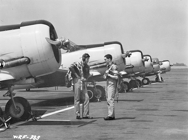
Fighter pilot training in Ottawa during WorldWar2. (image Library and Archives Canada/Wikipedia)
Our current MacDonald-Cartier International Airport roots go back to a time when a combined military base and public airport terminal on the site made it the busiest airport in Canada, reaching a peak in 1959 with 307,079 aircraft take-offs and landings.
This once unmistakeable giant OTTAWA sign would have clearly welcomed visitors and returning residents back to Ottawa with its 500ft of white letters as their aircraft circled above. I for one would like to be welcomed home by seeing a giant “Ottawa” out my airplane window, and that’s what happened until the early 1970s when it looks like the letters started to fade into obscurity.
Using geoOttawa and current aerial maps, I was able to trace the fading of the letters over time, watching them almost disappear.
Circa 1965 (image GeoOttawa)
Circa 1991 (image GeoOttawa)
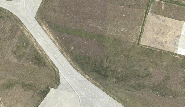
Circa 2002 (image GeoOttawa)
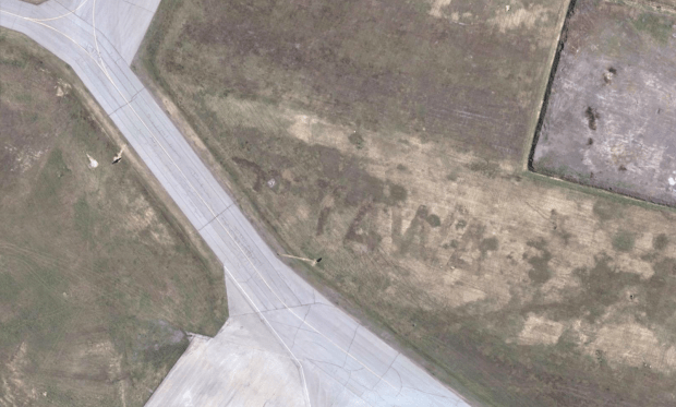
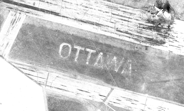
Circa 2007 (image GeoOttawa)
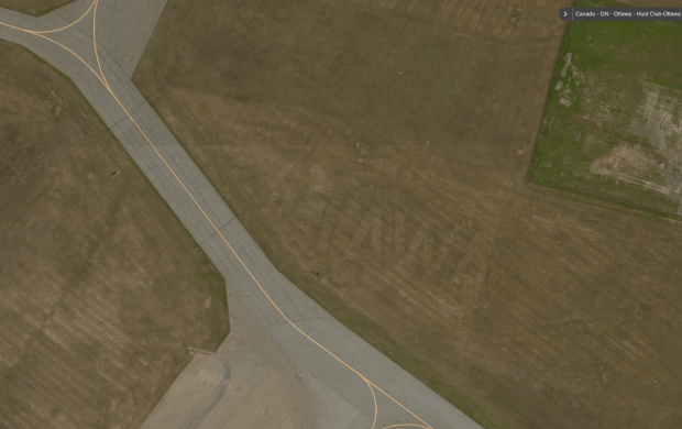
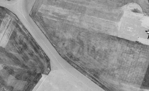
Circa 2016 (image Bing Maps)
The letters are faint, but still visible today, and with Ottawa2017 celebrations welcoming thousands of new visitors to the Nation’s Capital to commentate Canada’s 150th birthday, it might be a unique and fun idea to restore the large letters to their original splendour and once again enjoy OTTAWA’S GIANT OTTAWA SIGN.
Andrew King, January 2017
SOURCES
GeoOttawa
Bing Maps
Google Maps
https://en.wikipedia.org/wiki/Ottawa_Macdonald–Cartier_International_Airport

Found it on geoOttawa. GO is awesome, I spent many hours looking at the changes in Ottawa especially along the Ottawa River and along railroad lines. May I suggest you do a story about Ottawa’s long lost air-raid sirens? There used to be a few. We played around one that was on a tower when I was kid that was at the back of the playground at Lakeview Public School.
hi Ward, Thanks for reading! I would absolutely LOVE to do a story on those air raid sirens but I can not find any available info/pics…if you or anyone has some, please let me know! Cheers. -AK
I’ve never able to find a photo of any, either. The one behind Lakeview school they demolished in the late 70’s after my family left Ottawa. There was also a roof top one that was visible from the Queensway around Centretown West area. If you don’t mind me making another suggestion, there used to be a dirt stock car racing track in a farmer’s field along the 417 between Crystal Beach and Kanata. I found that searching GO for an abandoned sawmill my dad once took me too when I was a little kid that I was sure was in that area. I did a bit a research and easily found this link that made reference to the track. Anyways, you can still see it’s outline even after of decades of plowing and harvesting. http://www.canadianracer.com/lansdowne.asp
I really enjoy reading your articles.
we had at least 3 air raid sirens in Sudbury, I remember them clear as day. no photos exist that I can find, though.
hard to find pics!
Hi Andrew. I always look forward to your new discoveries. On Google Earth, if you follow the Timeline back to 10 April 2007, there is a really sharp photo of the entire sign. How can I send you a screen shot of it?
Thanks Doug, glad you like following along…I found that 2007 shot. Cheers!
I so enjoyed that story! Thank you.
Thanks for reading Elizabeth!
Just spent 25 minutes looking at it on Google Maps/Bing (45.3287344,-75.6827534).
Fantastic find.
Pretty cool stuff!