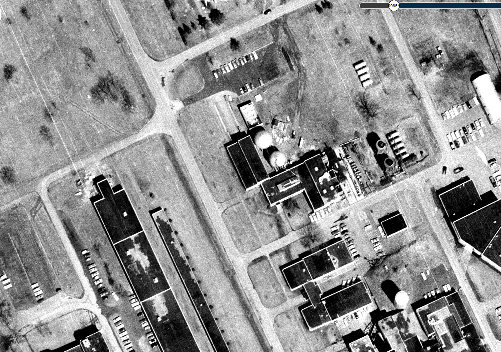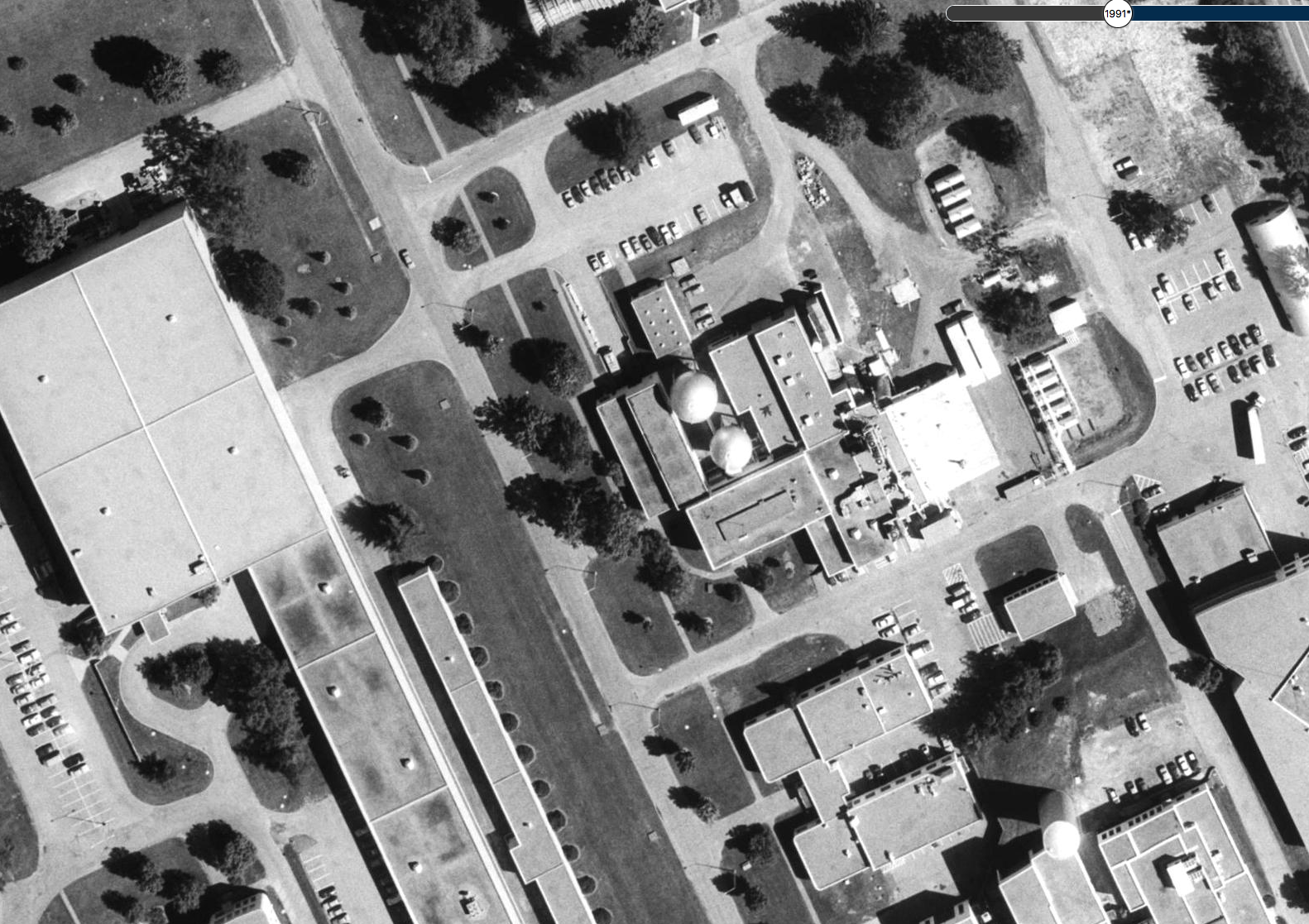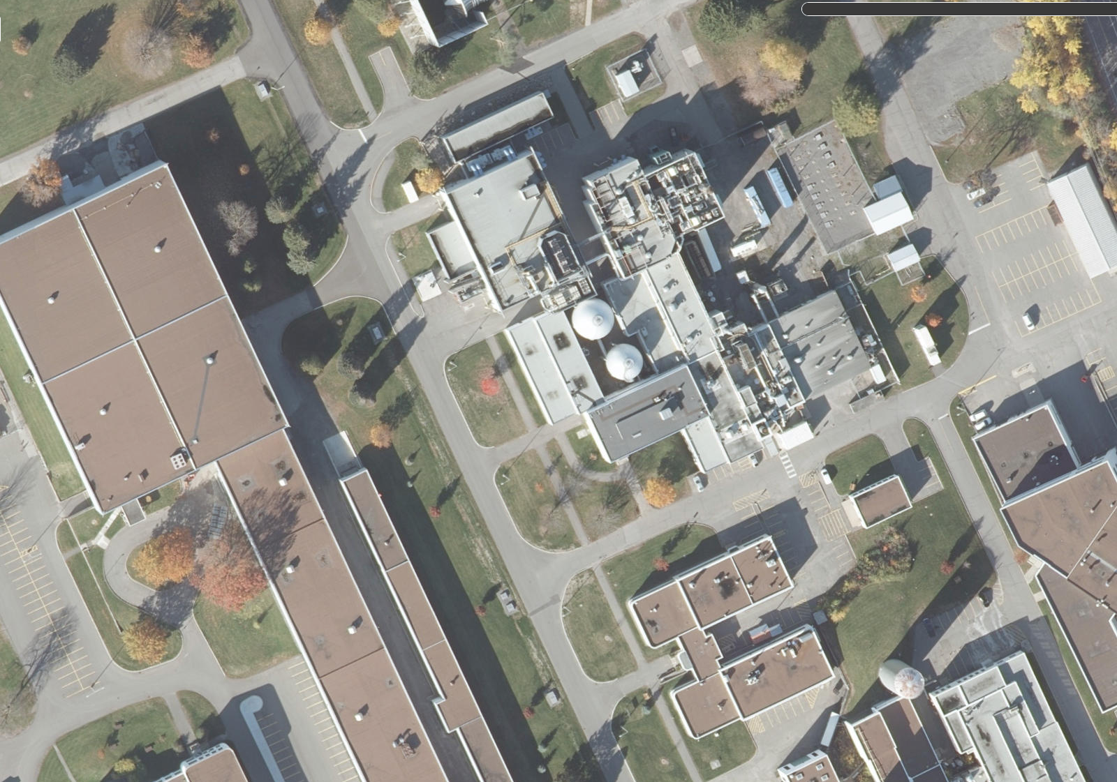
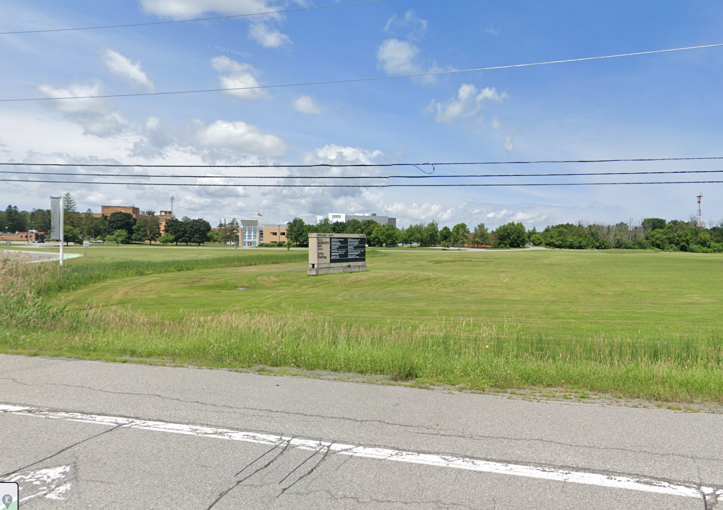
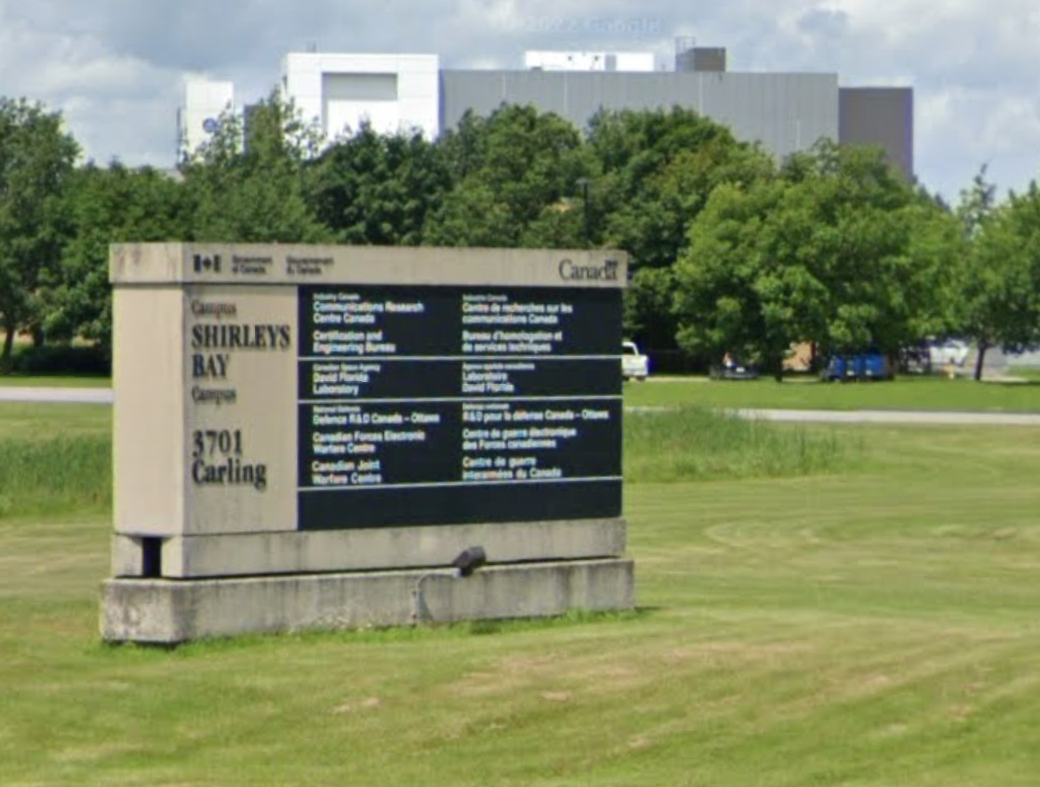
About fifteen kilometres west of downtown Ottawa is a secure facility that resembles the Hawkins Lab from “Stranger Things”…a guarded gate, weird radar dishes and a large red and white antennae. The sign out front in a typical government format lists the following being on site:
Communications Research Centre Canada
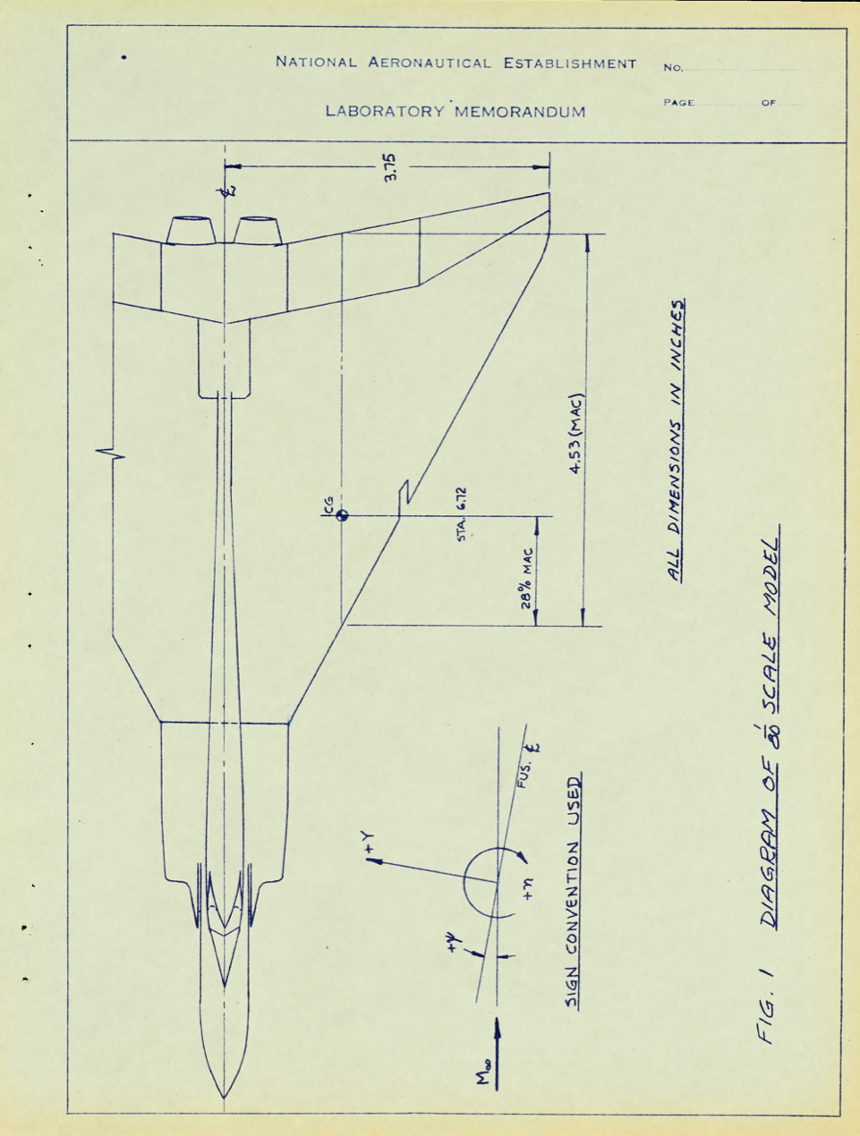
Certification and Engineering Bureau
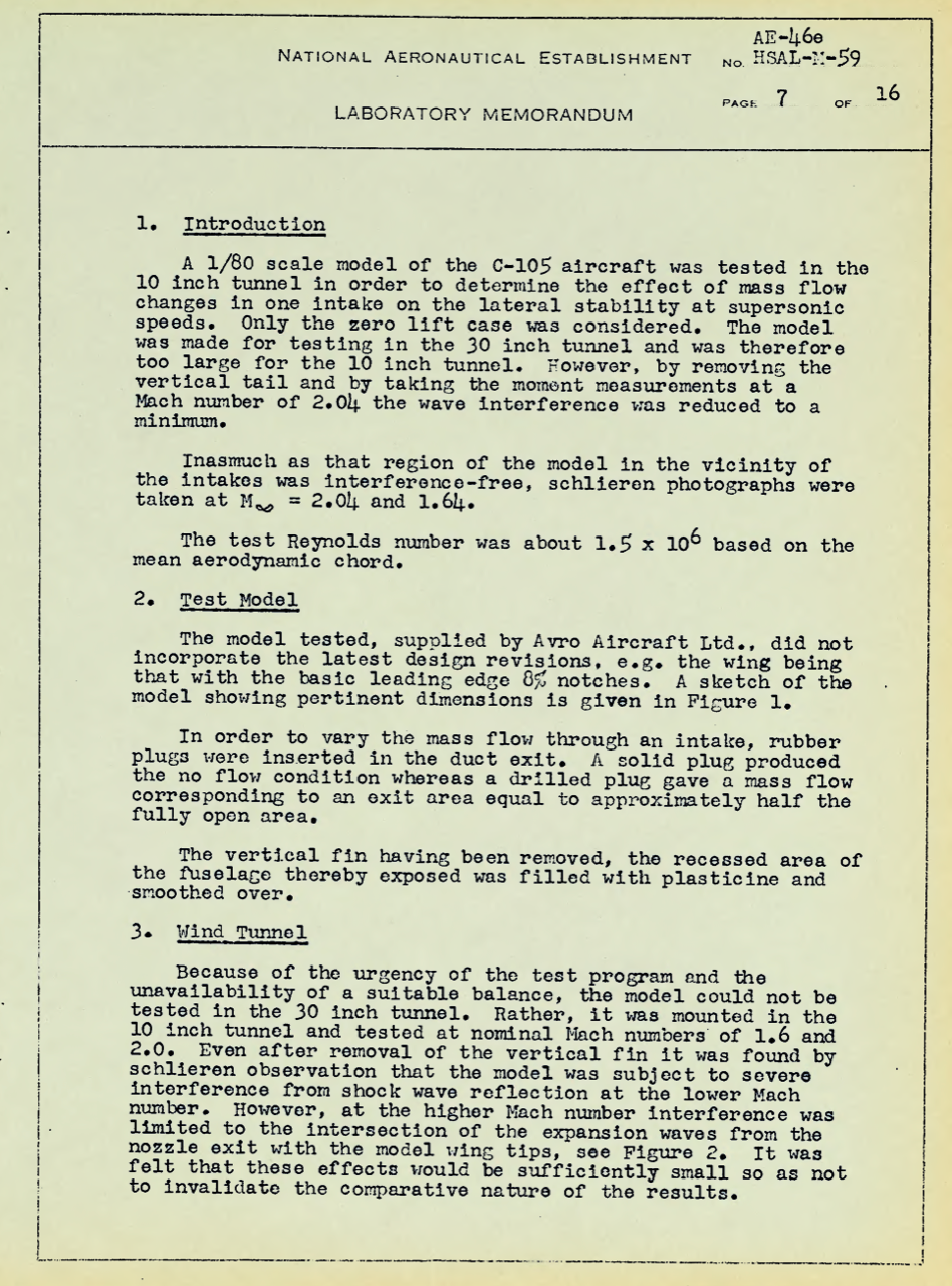
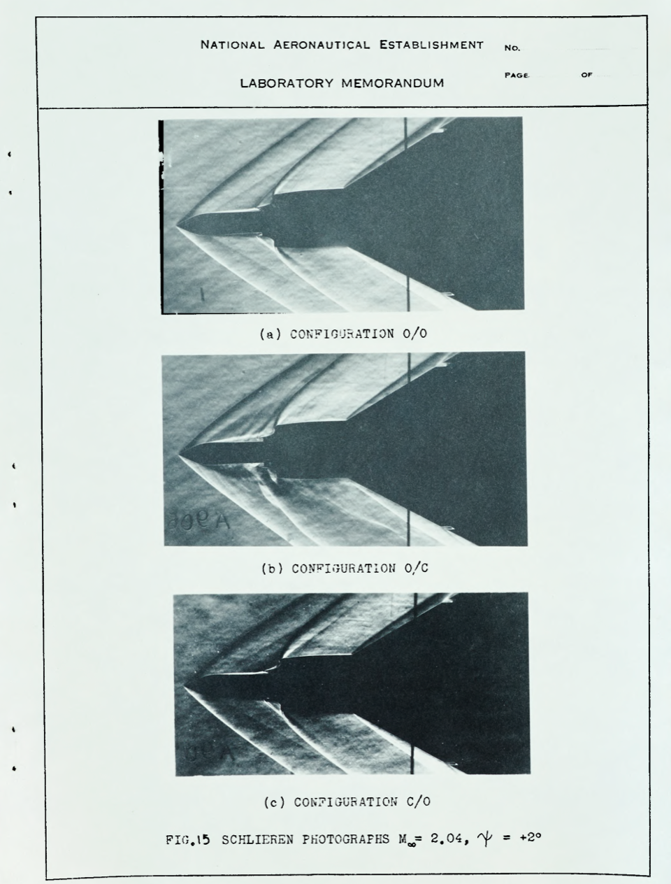
Donald Florida Laboratory
Defence Research and Development Canada
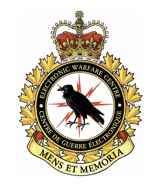
Canadian Forces Electronic Warfare Centre
Canadian Joint Warfare Centre
Wikipedia calls it a “Canadian military and civilian telecommunication research campus”, but I call it curious as I have personally witnessed black helicopters, weird lights and other oddities over this “campus”. So let’s take a closer looks at what might be Canada’s version of Area 51 if not DARPA (Defense Advanced Research Projects Agency)

The most intriguing tenant is the Defence Research and Development Canada (DRDC) which is a special operating agency of the Department of National Defence (DND), whose purpose is to “provide the Canadian Armed Forces (CAF), other government departments, and public safety and national security communities with knowledge and technology.”
Originally known as the Defence Research Establishment Ottawa (DREO), DRDC Ottawa is at Shirley’s Bay and develops develops technologies for:
Space Systems and Technology
Cyber Operations
Communication and Signals Warfare
ISR Applications
Radar Sensing Exploitation
Radar Electronic Warfare
Radiological Nuclear Defence
Navigation Warfare
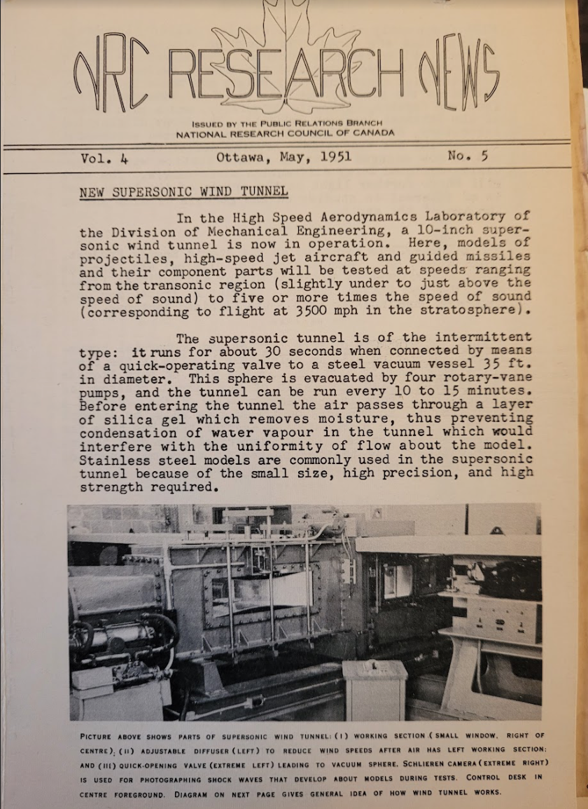
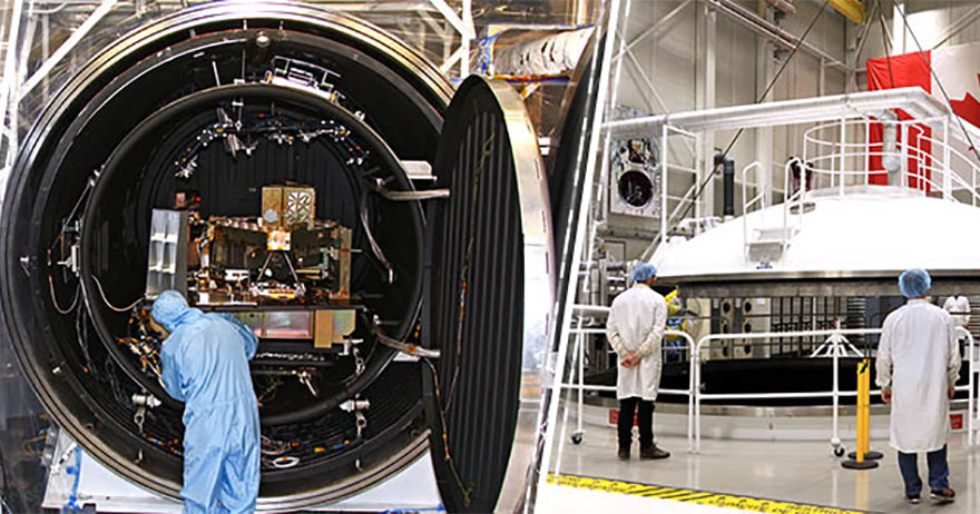
Now what’s interesting, there have been a number of technological innovations that have come out of Shirley’s Bay, including space technology and in the 1980s, a craft powered by microwaves.
MICROWAVE ON HIGH
Called SHARP, (Stationary High Altitude Relay Platform) this was a craft powered solely by transmitted microwave beams from the ground. as found from the files of the Communications Research Centre: “The SHARP concept envisages the use of pilotless airplanes as platforms for relaying telecommunication signals, providing surveillance and monitoring services. The airplanes would circle slowly for many months at an operating altitude of 21 kilometres and relay signals within a diameter of 600 kilometres (which is about the width of a Canadian prairie province). Microwave power would be transmitted from a large ground antenna system to a circling airplane. The power beam would be accurately focused onto the airplane. A rectenna (rectifying antenna), mounted on the lower surfaces of the aircraft would receive and convert microwave power to DC power. The DC power would be used to drive electric motors on the airplane for propulsion, to power the payload and control systems and to charge standby energy storage units.


It was successfully launched in 1987 but with government budget cuts, the program was scrapped and the craft placed into storage. I came across the craft for sale at a government auction and I am not sure where its current whereabouts may be.

BAFFLING BLAST
Back in the 1950s a mysterious large explosion was heard in the West End of Ottawa, and one of the suspects was Shirley’s Bay. A “Baffling Blast Shakes Capital” headline tells a story of an early morning explosion that shook houses across west Ottawa and Hull. The Defence Research Board at Shirleys Bay denied any knowledge of an explosion and the large blast was deemed a “mystery”.

PROJECT MAGNET
Another mystery at Shirley’s Bay involves the CIA backed “Project Magnet”, a special investigation unit to study unidentified flying objects (UFOs) for the Canadian Department of Transport (DOT) on December 2, 1950, under the direction of Wilbert B. Smith, senior radio engineer for the DOT’s Broadcast and Measurements Section.
Smith, the Defence Research Board and the National Research Council (NRC) were trying to determine that if UFOs did really exist, they might hold the key to a new source of power using the Earth’s magnetic field as a source of propulsion for their vehicles. The top secret project in Ottawa was also working with their American counterparts in the CIA to determine if this new UFO “power source” could be studied and harnessed.

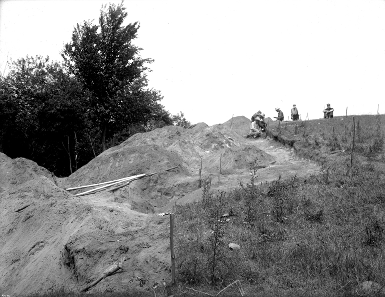
In 1952 the investigation was moved to Shirley’s Bay where UFO detection equipment was installed and by the end of October it became the world’s first UFO research facility. The 12 foot by 12 foot building housed instruments such as a gamma-ray counter, a magnetometer, a radio receiver (to detect the presence of radio noise) and a recording gravimeter within a 50 mile radius from the station.
Smith and his UFO research team at Shirley’s Bay conducted a number of experiments trying to attract UFOs to the area using their newly installed equipment. After months of potential UFO activity being recorded in the area, the facility soon had their most unusual occurrence. At 3:01pm on August 8, 1954 the instrumentation at the Shirley’s Bay installation registered an unusual disturbance. In Smith’s words “the gravimeter went wild”, as a much greater deflection was registered than could be explained by conventional interference such as a passing aircraft. Smith and his colleagues rushed outside their research building at Shirley’s Bay to view the craft that was creating such a enormous reading on their equipment. Once outside the building they were disappointed to find a heavily overcast sky with limited visibility. Whatever kind of craft that was up there was well hidden under the cover of clouds. The only evidence the researchers had of this large UFO was the deflection registered on the chart recorder paper.

Two days later Smith and the Shirley’s Bay research facility were abruptly shut down upon orders from the Department Of Transport. Many speculate the findings and strange occurrence at Shirley’s Bay prompted the project to go “underground”, with all findings entering the “TOP SECRET” status of operation elsewhere. Smith was allowed to remain if he chose to, but all government funding to conduct his UFO research was halted. Without government subsidies. Smith continued his research, funded by “other sources”. Smith carried on working at Shirley’s Bay, developing what he claimed was a breakthrough anti-gravity device. In a 1959 presentation Smith stated “ We have conducted experiments that show that it is possible to create artificial gravity (not Centrifugal force) and to alter the gravitational field of the Earth. This we have done. It is Fact. The next step is to learn the rules and do the engineering necessary to convert the principle into workable hardware.” Smith died of cancer 3 years later. It is unknown what happened to his study material from his extensive research at Shirley’s Bay.
MORE UFOs
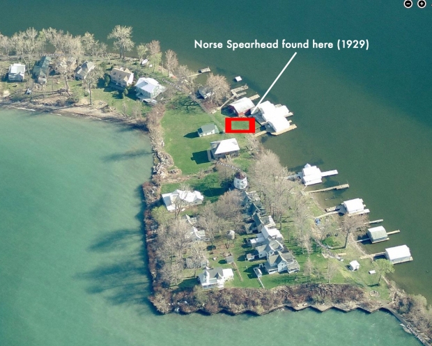
Coincidentally, 35 years later a few kilometres west of Shirleys Bay, one of the most well known UFO encounters occurred called “The Guardian Case”
Diane Labanek, a resident of the area, said that on the night of November 4th 1989, she witnessed an intense, bright light pass overhead, heading towards a swamp at the far end of the field south of her home. She said she also saw several helicopters earlier that evening using bright lights to scan the area.

Below is an edited transcript of the original letter sent by Guardian and his claim, and some further investigation into what could be a real incident:
From Guardian, 1989
“Canadian and American Security Agencies are engaged in a conspiracy of silence, to withhold from the world the alien vessel seized in the swamps of Corkery Road, Carp, in 1989.
UFO sightings in the Ontario region had intensified in the 1980’s, specifically, around nuclear power generating stations. On Nov. 4, 1989 at 20:00 hrs Canadian Defense Dept. radars picked up a globe shaped object traveling at phenomenal speed over Carp, Ontario. The UFO abruptly stopped, and dropped like a stone.
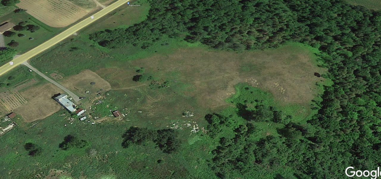
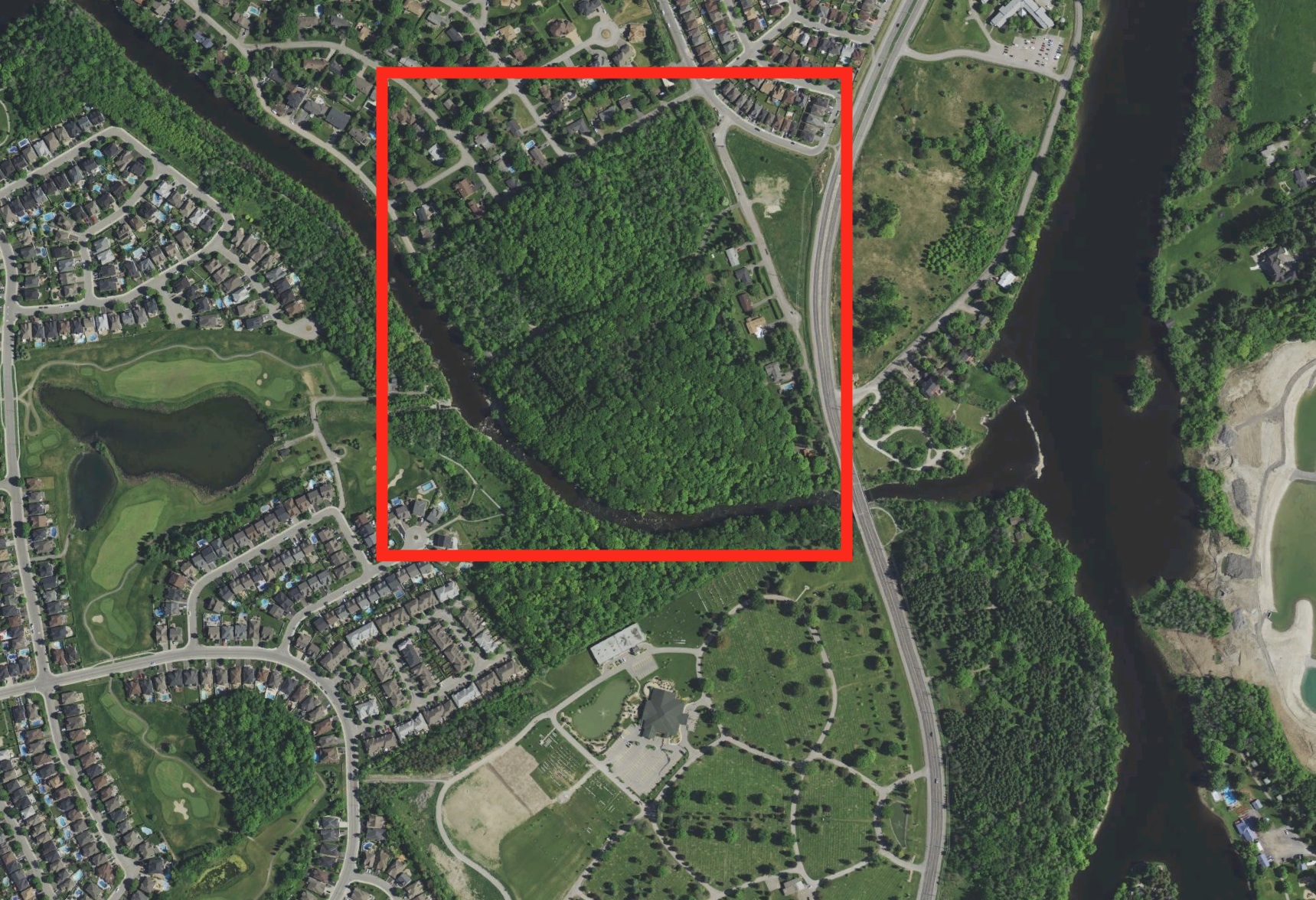
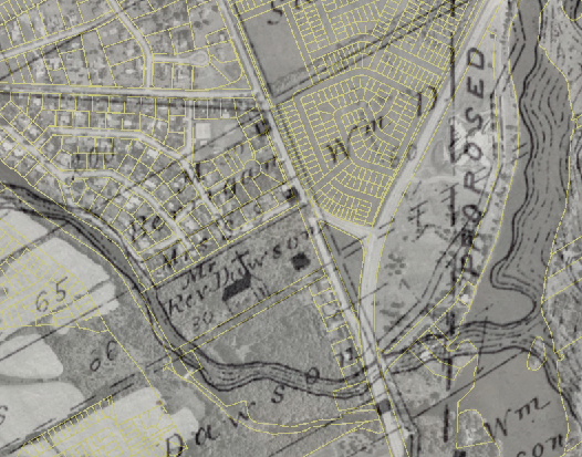
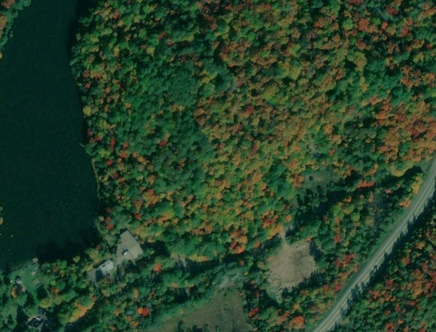
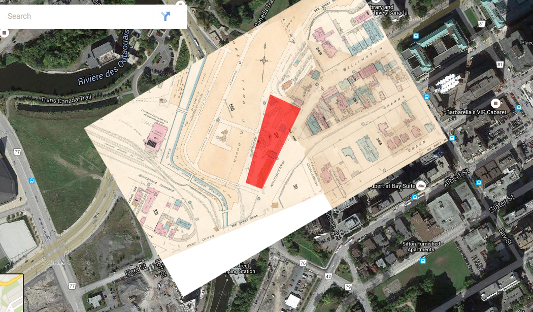
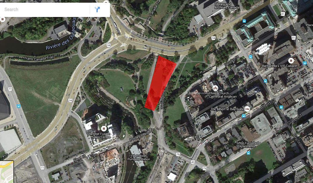
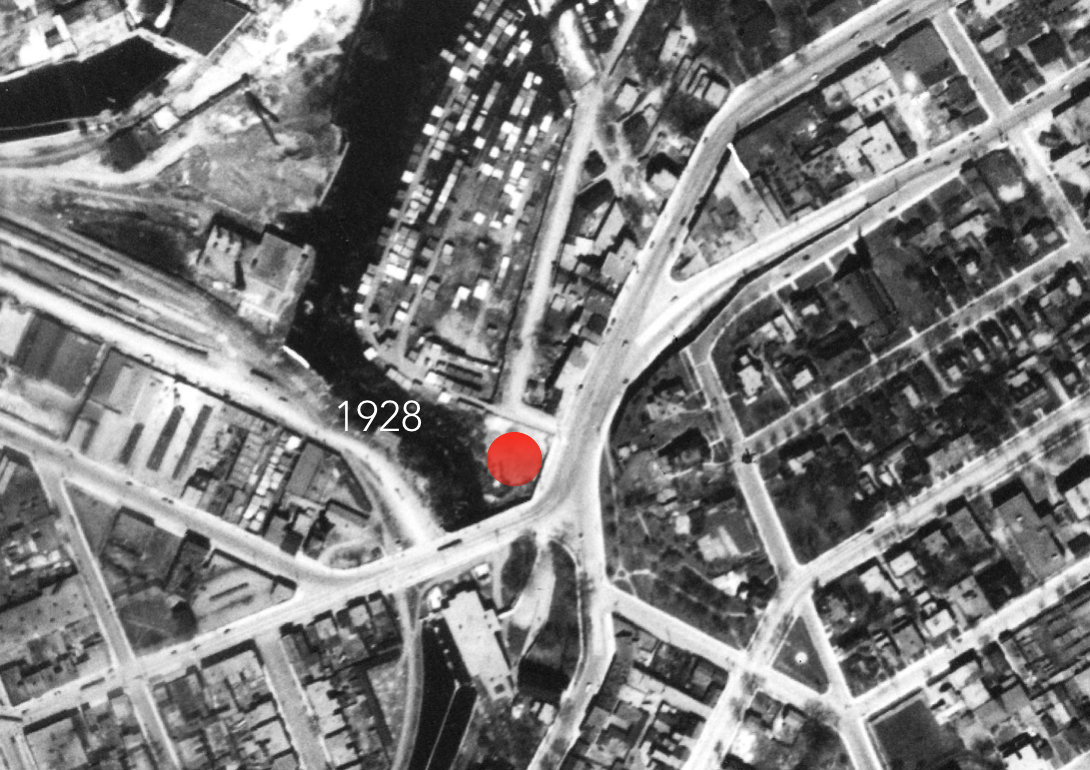
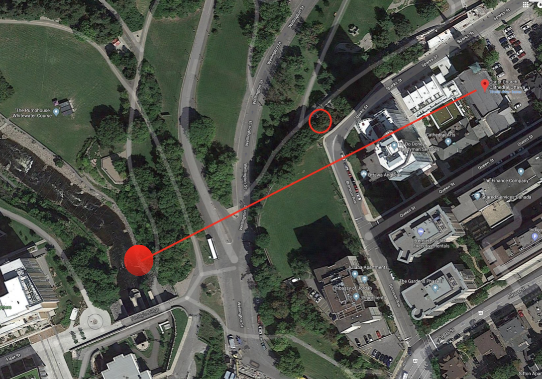
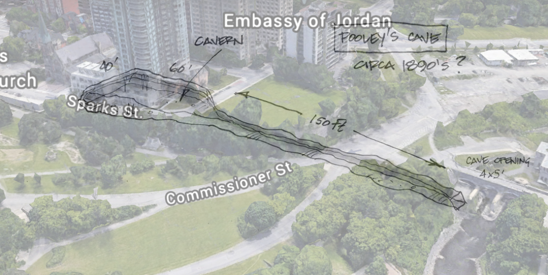
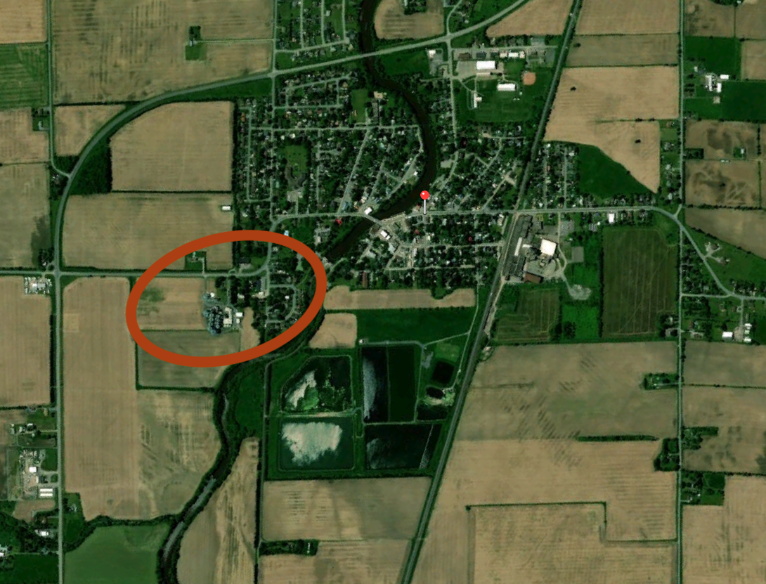
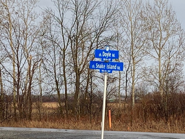
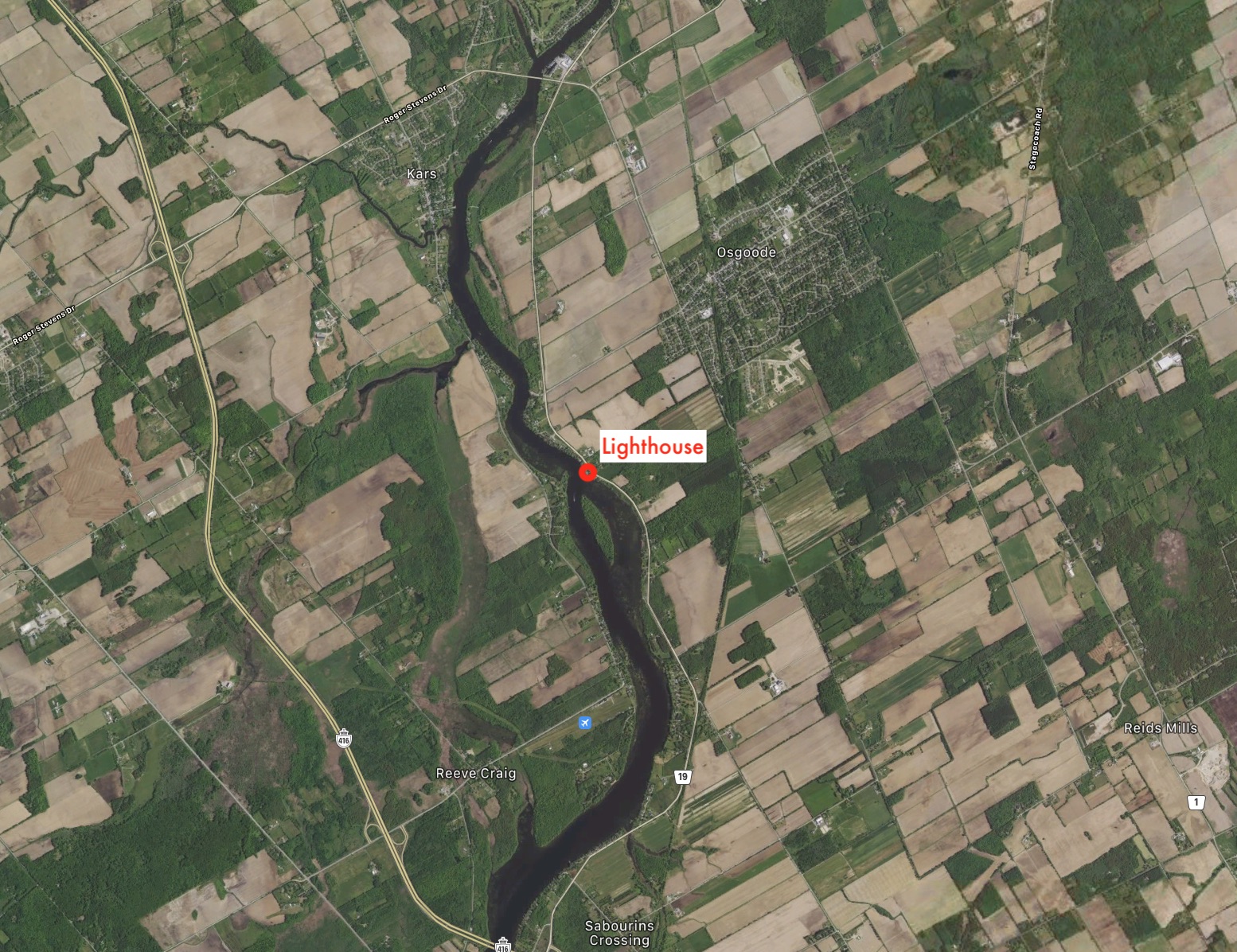
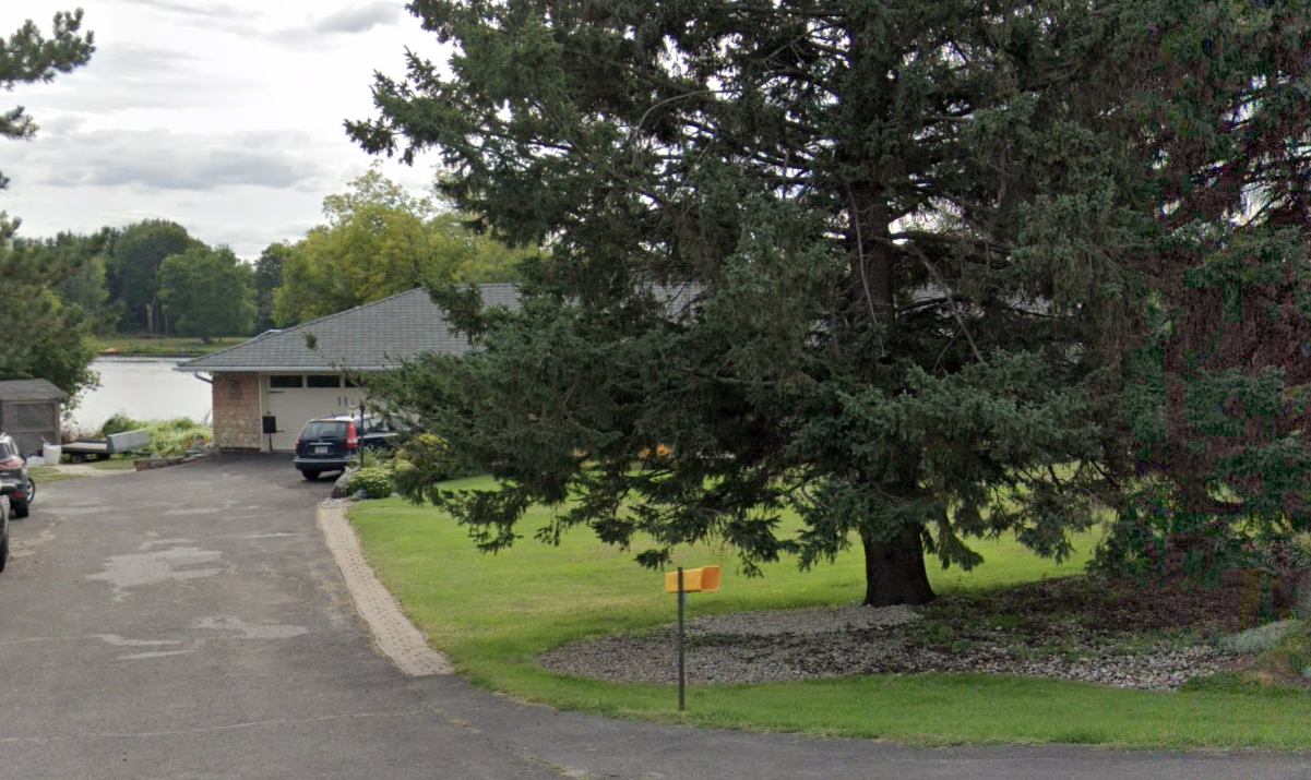
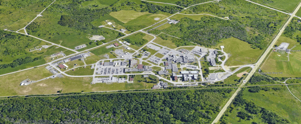
Canadian and American Security Agencies were immediately notified of the landing. Monitoring satellites traced the movements of the aliens to a triangular area. (see aerial map) off Almonte and Corkery Roads.
The ship had landed in deep swamp near Corkery Road. Two AH-64 Apaches and a UH-60 Blackhawk headed for the area the following night. The helicopters carried full weapon loads. They were part of a covert American unit that specialized in the recovery of alien craft.
Flying low over Ontario pine trees the Apache attack choppers soon spotted a glowing, blue, 20 meter in diameter sphere. As targeting lasers locked-on, both gun-ships unleashed their full weapon loads of 8 missiles each. All 16 were exploded in proximity bursts 10 meters downwind from the ship.
The missiles were carrying VEXXON, a deadly neuro-active gas which kills on contact. Exposed to air the gas breaks down quickly into inert components. Immediately after having completed their mission the gun-ships turned around, and headed back across the border.
Now the Blackhawk landed, as men exploded from its open doors. In seconds the six man strike team had entered the UFO through a 7 meter hatchless, oval portal. No resistance was encountered. At the controls, 3 dead crewman were found.
With the ship captured, the US Air force, Pentagon, and Office of Naval Intelligence were notified. Through the night a special team of technicians had shut-down and disassembled the sphere. Early the next morning Nov. 6, 1989 construction equipment and trucks were brought into the swamp. The UFO parts were transported to a secret facility in Kanata, Ontario…The ship was partially reassembled at the underground facility in Kanata. Unlike previous recoveries this one is pure military. Built as a “Starfighter” it is heavily armed and armored. In design no rivets, bolts, or welds were used in fastening, yet when reconstructed there are no seams. The UFO itself is made up of a matrixed dielectric magnesium alloy. It is driven by pulsed electromagnetic fields generated by a cold fusion reactor.”
Is this “Kanata facility” being referred to the Shgirley’s Bay complex with its advanced research facilities? One can only speculate. Upon researching Shirley’s Bay further, I came across another curious piece of content, that is coincidentally in the “Stranger Things” category regarding Shirley’s Bay. This is from Wikimapia that explains what is at certain locations on Google Maps.
“Kanata, just west of Ottawa, Canada is reportedly the location of an alien projects test center. Huge facilities for U.S. and Canadian military corps, the research center provides projects and storage for Area-51 or Dreamland. This site is also involved in an ongoing battle with an alien collective that has succeeded in infiltrating much of the governmental/military complex via sell-out by Industrialist, Fraternal and Intelligence agencies. Some joint US/Canadian forces are apparently resisting the takeover – infiltration – assimilation on the one hand and attempting to buy time via further appeasement on the other in order to develop defensive technology. However in making technology deals or attempts to appease the alien collective they have only succeeded in being drawn deeper into their system of occult – technological control, since they are able only to develop technological and intellectual parity at most in that the technology and intellect of the aliens, combined with their mastership of sorcery and supernatural warfare, has made the battle futile except for those who have succeeded in acquiring the supernatural power directly from the Creator that is necessary to meet and defeat the aliens in the supernatural realm, and in turn the intellectual and technological infrastructure of the alien collective which is incarnated – motivated – empowered & organized by Luciferian entities behind the scenes… i.e. in this war the chaplain is of equal if not greater value than the general, considering the aliens attack humankind on the spiritual – mental – physical levels simultaneously via advanced techno sorcery.”
EVEN MORE UFOs
Things just keep getting weirder. In 2009 I recall military helicopters circling near the Ottawa River at the Champlain Bridge and in typical Stranger Things fashion, I grabbed my bike and hastily made my way down to the river to see what all the commotion was about. Search and rescue helicopters and military vehicles as well as city police equipment had gathered around the river in what looked like a complex recovery operation.
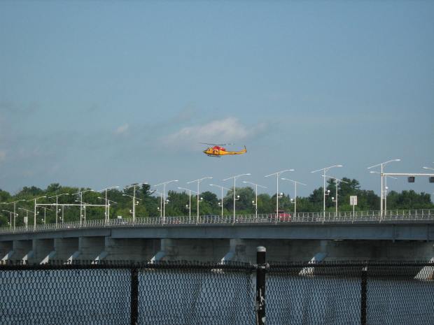
Further investigation revealed that the previous night people in Ottawa and in Gatineau reported they saw an object streak across the night sky around Shirley’s Bay and then crash into the Ottawa River with a “thunderous boom.” The object reportedly had lights on it and appeared to change course several times before it hit the water.
Multiple witnesses called authorities which prompted police, firefighters, paramedics and a helicopter from CFB Trenton to scour the waters for a downed aircraft. Using sonar and underwater cameras the investigation continued into the next day when an object was discovered about 30ft below the surface. An Ottawa Sun article stated that local police constable Alain Boucher said something was down there. “The size and the shape doesn’t lead us to believe it’s any piece of an airplane or fuselage or anything like that. It could be a rock, it could be a bunch of logs stuck together, it’s hard to say.”
Soon police remarked that due to a strong current in the river and because no aircraft were reported missing, there was no debris or oil slick the search was to be terminated. No known further investigation into what happened in the river that July night has been reported and the incident remains a mystery.
SHIRLEY’S BAY IS SURELY INTERESTING…
From UFOs to microwave powered craft, Shirley’s Bay seems to have its fair share of curious happenings surrounding it. Is it simply a government research facility working on new developments to “keep us safe” as they like to say, or is it something more complex at the complex? Are they reverse engineering a downed alien craft from the 1980s inside their labs or just making some new laser guided missile systems? Truly strange things surround Shirley’s Bay.
If anyone has further stories or information to add to this intriguing place on the map of Ottawa, please let me know, but until then, I will consider Shirley’s Bay to be surely something far greater than meets the eye.
Andrew King
January 12, 2023
SOURCES
https://www.asc-csa.gc.ca/eng/laboratories-and-warehouse/david-florida/about.asp