The history of Canada’s National Capital Region is always filled with stories of endurance and perseverance, of overcoming great obstacles in an undeveloped land consisting of forest and swamps. The first settlers in the Ottawa region came to an area inhabited by nomadic native Algonquin tribes with no real permanent structures, a land that was a clean and fresh piece of Canadian wilderness. So what was the first permanent structure to be built in our Nation’s Capital, who built it and where was it? Maybe an even bigger question can be asked: why is it not marked as a significant historical landmark in our capital region?
THE SEARCH BEGINS
History tells us that the first non-native settler to set up permanent residence was a fellow by the name of Philemon Wright. With most of Canada being settled by the French and British, it only seems logical that the first settlement in the Nation’s Capital would be built by someone from either of those nationalities. Surprisingly, that is not the case. The first permanent settlement in Canada’s Capital was built by an AMERICAN.
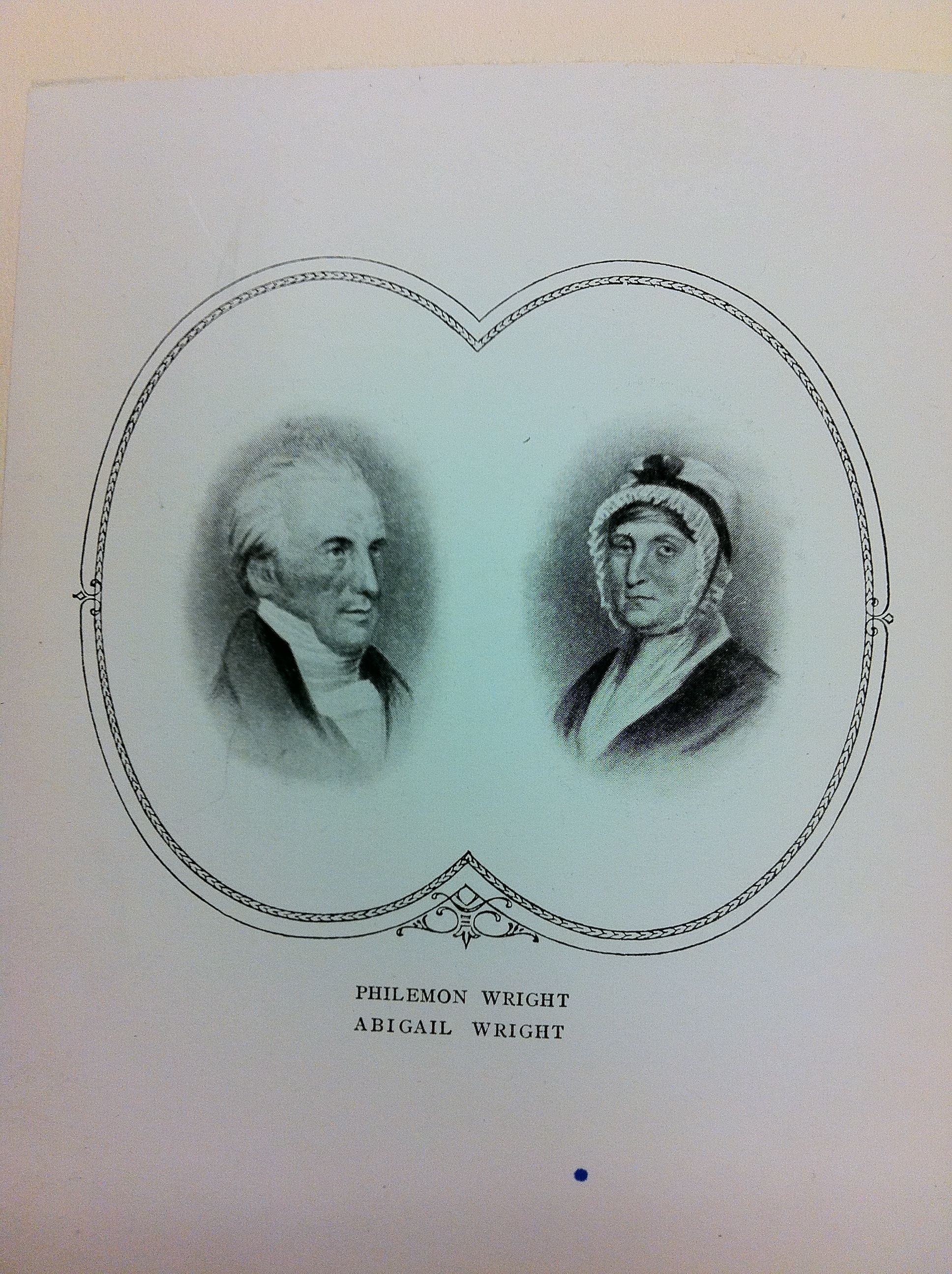
American ex-patriot Philemon Wright left Woburn, Mass. in 1800 with his wife, children and 45 others to settle what is now the National Capital Region.
Philemon Wright was an American who lived in Woburn, Massachusetts and dreamed of leaving the growing suburb of Boston for a new land, to create a prosperous new life in a fresh, untouched part of the continent. That part of the continent was the the unsettled land of Ottawa/Hull, a land that was being divided and given to men who would make it what it is today. Having fought against the British during the American Revolution, Wright knew it would not be an easy task to secure land now under British control.
Lucky for Wright, British authorities at the time were seeking to populate the vast new lands of their colonies. They arranged a program to have group settlements in the wilds of Canada. Interim land grants were given to leaders and associates, then the associates would hand over portions of their land grants to the leader as payment to the leader who did the exploration and surveying. One of these leaders was Philemon Wright, who visited Lower Canada often, specifically the area of Ottawa/Hull. After numerous visits to this area, he applied for a land grant to the British Empire. They approved his grant for a land settlement in this unknown land west of Montreal under one condition: Every adult male in his settlement must swear an oath of allegiance to the His Majesty, the King of the British Empire.

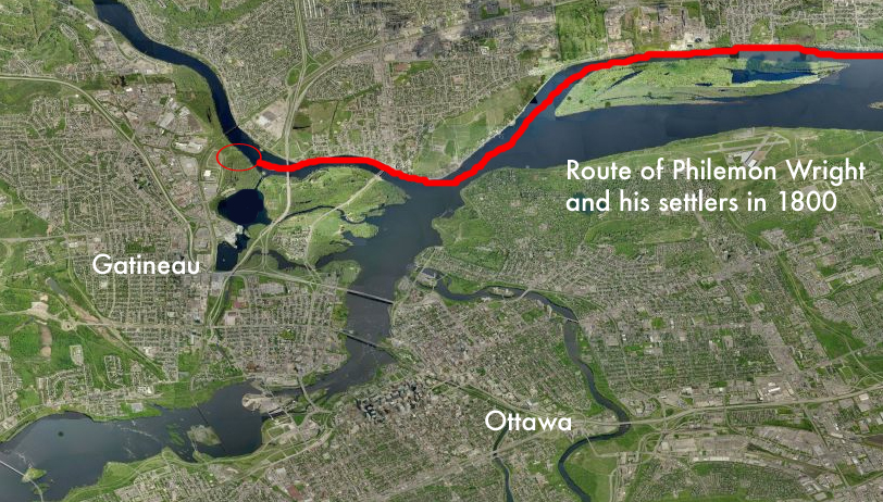
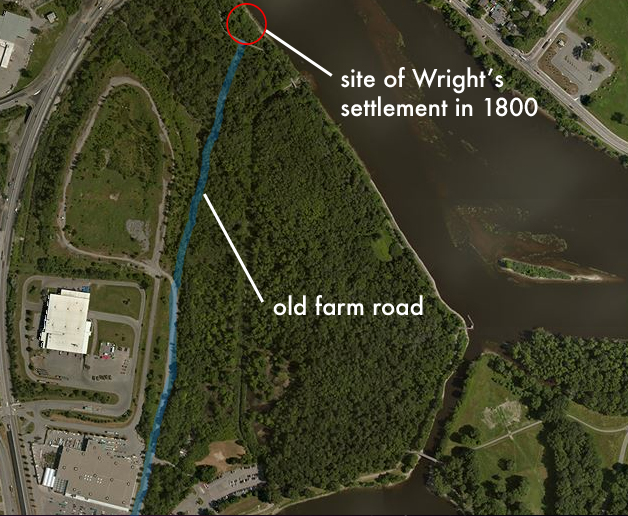
Wright’s 1800 journey northward from Massachusetts to Ottawa.
He convinced a number of his Woburn neighbours and family members to sign over their land grants to him, and join him as “associates” on a journey north to settle a land no other European had settled. With 50 men, women and children, labourers and axemen, Wright set off in horse-drawn sleighs in February of 1800 for Montreal. Arriving in Montreal in March, Wright and his men swore allegiance to the King Of England and received their land grant for an area where three rivers met, the Ottawa, the Rideau and the Gatineau. His land was to become what is now Lac Leamy Park.
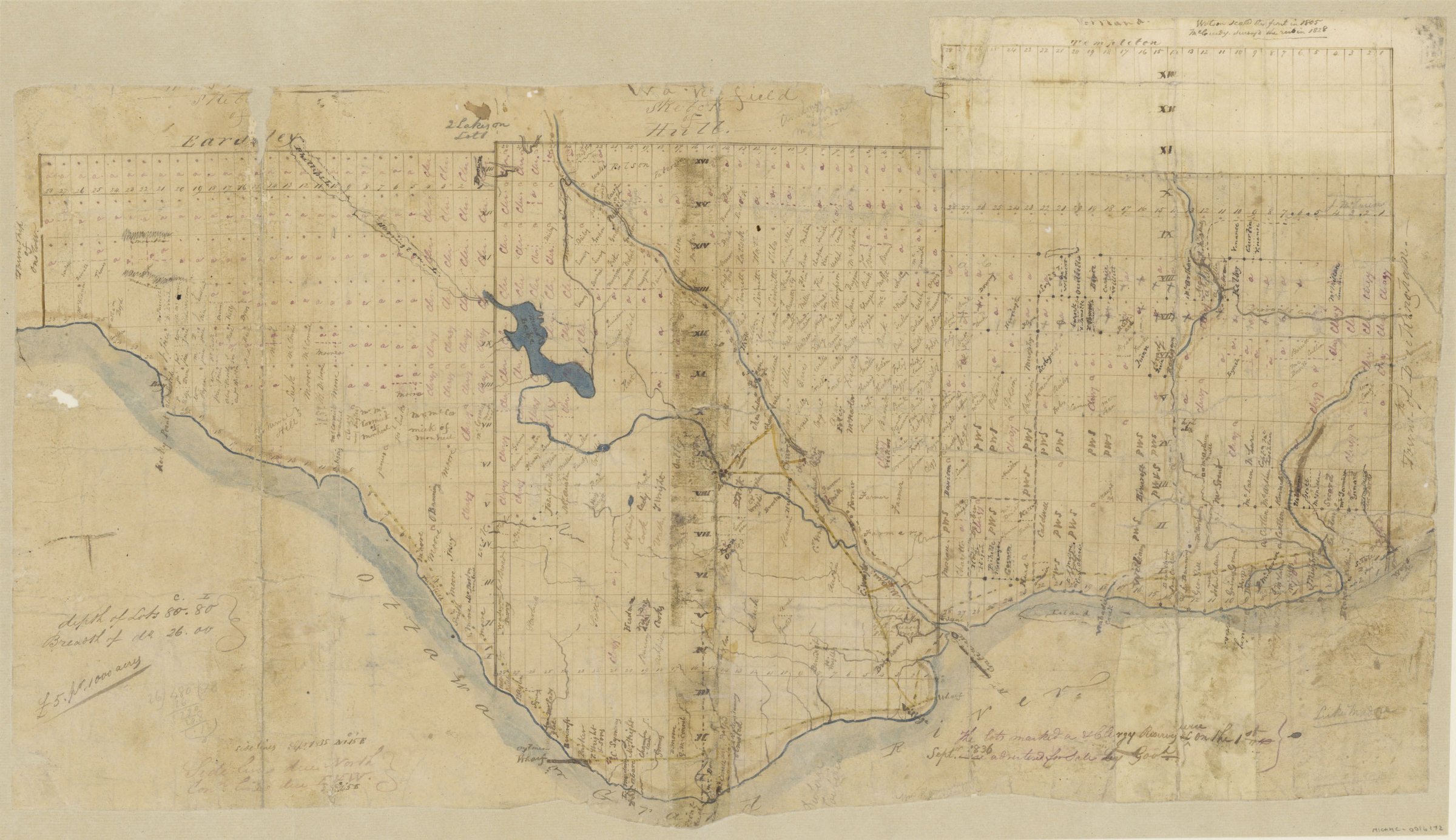
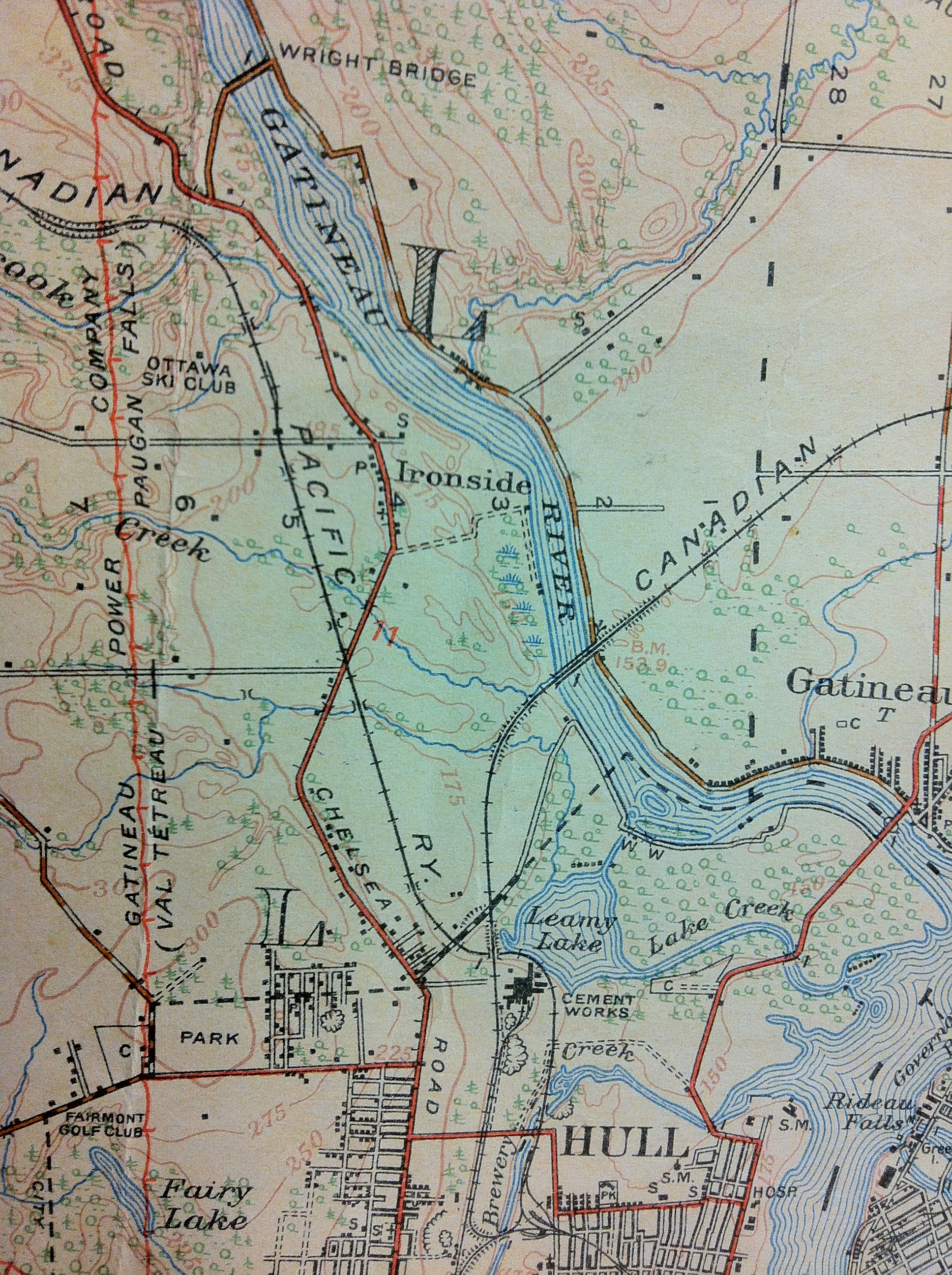
A map from 1836 that shows Philemon Wright’s land grant.
Crossing the frozen waters of the Ottawa River, Wright and his settlers arrived on the shores of the Gatineau with the aid of an Algonquin guide, who showed them safely to their new home. Philemon and his crew went up the steep embankment 20 feet from the shore and began to clear the area of trees, using felled logs to construct what would become the very first permanent home in the National Capital Region. Wright had soon cleared the land and built a farm, and also a road to the Chaudiere Falls where he built the first mill and began a logging empire that continued for over a hundred years. Wright moved from his log cabin to a new home he built in Wrightstown, the town named after him that sprung up around his mill at Chaudiere Falls that would later be re-named Hull. In 1835 he sold his original home and farm, which he called Columbia Farm, to Andrew Leamy, which the area and lake are currently named after.
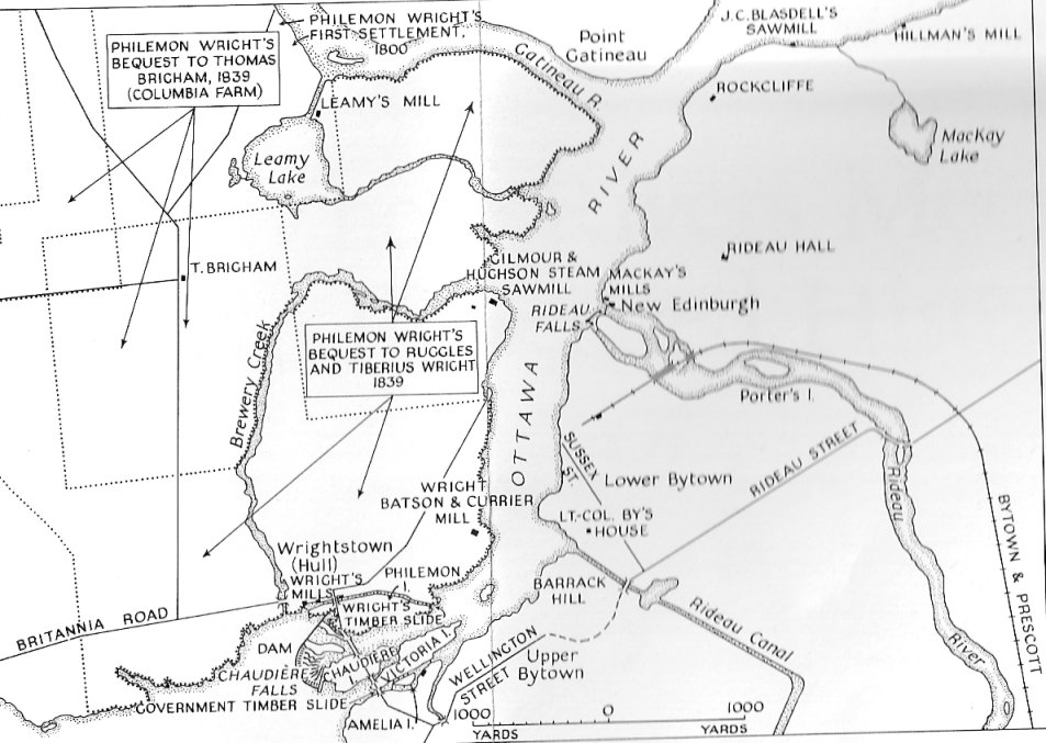
A map showing both Wright’s and Leamy’s properties.
LET’S GO THERE NOW
So now that we know where Wright landed and built his log cabin, what is left, if anything, of this original settlement? Old maps show his land and Columbia farm, and the original farm road is still in existence, although abandoned. The majority of Wright’s settlement is on NCC land at Lac Leamy Park in what is now Gatineau. The original Wright farm road, which led from his original log house to his prosperous mill over by Chaudiere Falls partially remains, but what of the original cabin from which the road led to?
Looking at old maps from the Ottawa Public Library, Wright’s personal memoirs of the first settlement, and researching various NCC and historical information about the area, we can put together a pretty good picture of what was and is there now.
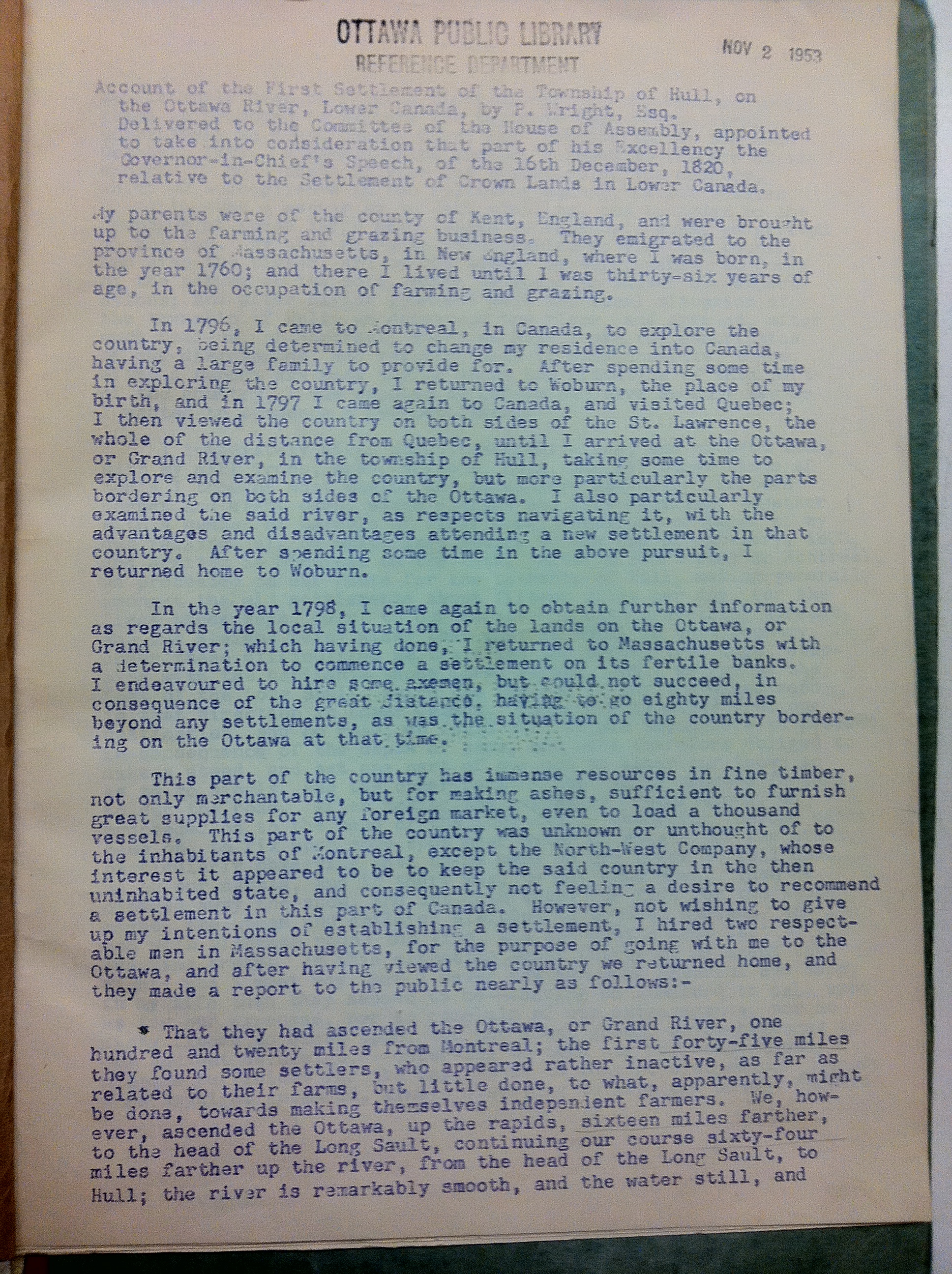
1820 personal account by Philemon Wright of his first settlement twenty years earlier.
A log building that was still standing in 1884 on Leamy’s farm was probably Wright’s first home. The Wright family called that home “The Wigwam”, and it is referenced numerous times in many historical accounts. The house itself was built as Wright says in his memoirs:
“…built of undressed tamarac logs in true rustic shanty fashion. The chinks between the logs and scoops of the roof were caulked with mass, driven in with a thin pointed handspike, over which a rude plaster of blue clay was daubed. The chimney was very wide and low, and was built above a huge boulder which formed the back of the fireplace. There was no upper story to the rude dwelling, which was partitioned off into bedrooms at each end, with a large living room, kitchen, dining room all in one, in the centre.”
 

A similar style log cabin to the one Wright built on the banks of the Gatineau River in 1800.
    
Unless the cabin was maintained and restored frequently, the chances of this original building remaining today are very slim. One account says the original cabin was moved in the 1950s to some unknown location within the city of Hull. Has anyone seen a log cabin in Hull? Please let me know if so! Whatever remains of it would not be much, so locating the site would be difficult. This is where the maps come in…
MAPPING HOUSE ONE
Using old maps we can see a variety of structures and the general area where Wright’s cabin could be located. NCC archeological documents identify a Wright dig site that was examined as file Name “Bi-Fw-24”. Using that code name, we can zero in on documents that reference that name. Recent STO transit studies that converted the nearby train tracks into a RapidBus transitway had an archeological assessment done and they identify the Wright home in their report.
An NCC website proclaims they found the original site of Wright’s home, but no other recognition is given:
“While stabilizing the shoreline of the river, the NCC conducted archaeological salvage excavations at the site of Wright’s original house. A wealth of domestic items were found, including earthenware pots and dishes, cutlery, buttons, religious medallions, combs and dolls.”
And:
“It was the conclusion of another archeological dig at that site that the foundations of that house dated from the early 19th century. The location was reburied for preservation and protection and the NCC has plans for future commemoration of the site.”
That NCC archeological investigation was in 2006. No marker, plaque or commemoration has been displayed since.
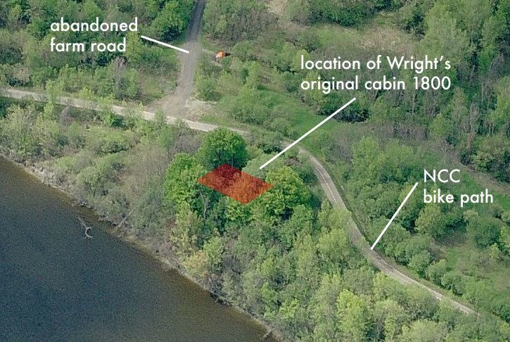
A Department Of Defence map from 1935 shows a structure, most likely the Wright cabin or a building from his homestead, at the end of the original farm road. Ghosting images together of these old maps with current aerial imagery provides us with accurate locations from which to investigate possible remains of Wright’s cabin.
1935 Department of Defence map showing building at the end of the Wright farm road.
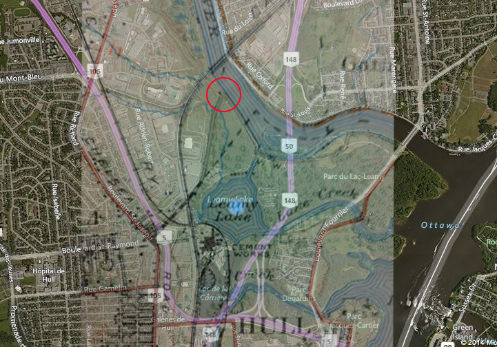
Ghosted 1935 map over current aerial map. (Wright building circled in red)
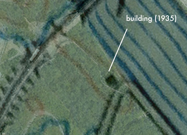
Close-up of 1935 map ghosted over current map.
FIELD INVESTIGATION
Packing a camera and a GPS, I was determined to locate this incredibly important piece of Canadian history. Joined by fellow history buff and friend Glen Gower, we headed out to see what we could find. The original old farm road, which is likely one of the oldest roads in the region, was easily located and traversed.
Using GPS coordinates from the map research, the location of Wright’s landing settlement was established and a survey of the area was conducted. The farm road ended at what is most likely the site of Wright’s house. The area was searched and some clues were found.
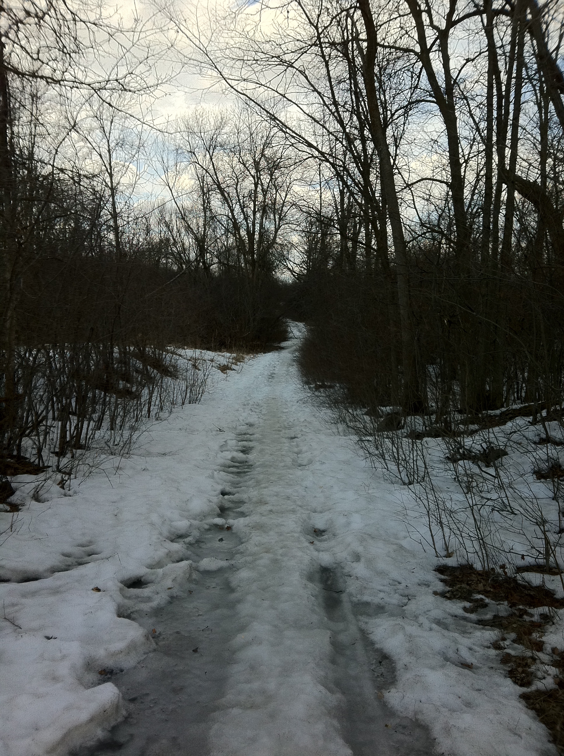
The abandoned Wright farm road leading to the site of his original cabin, possibly the oldest in the Capital Region.
An overgrown trench had been previously dug across the area, which is a common archeological technique when investigating a site. Axe marks were found on large, dead trees in the vicinity. Whether these are from 1800 when Wright’s axemen were clearing the land, or recent chainsaw marks has yet to be determined.
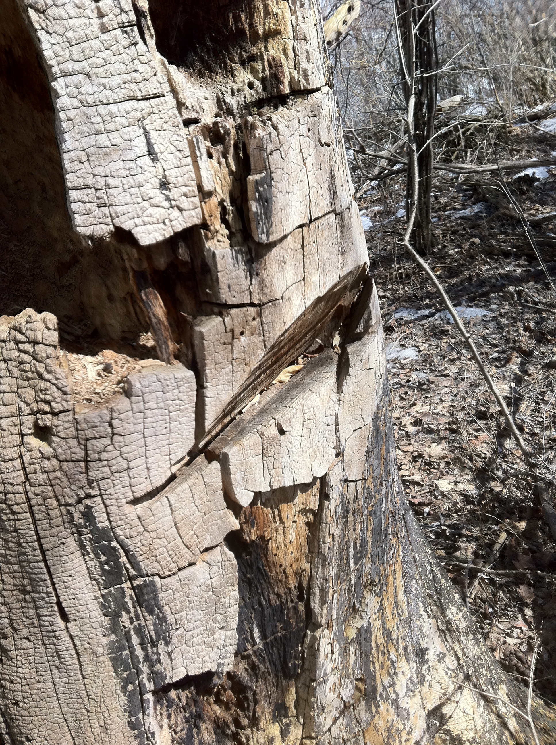
1800 axe marks or chainsaw on this old dead tree?
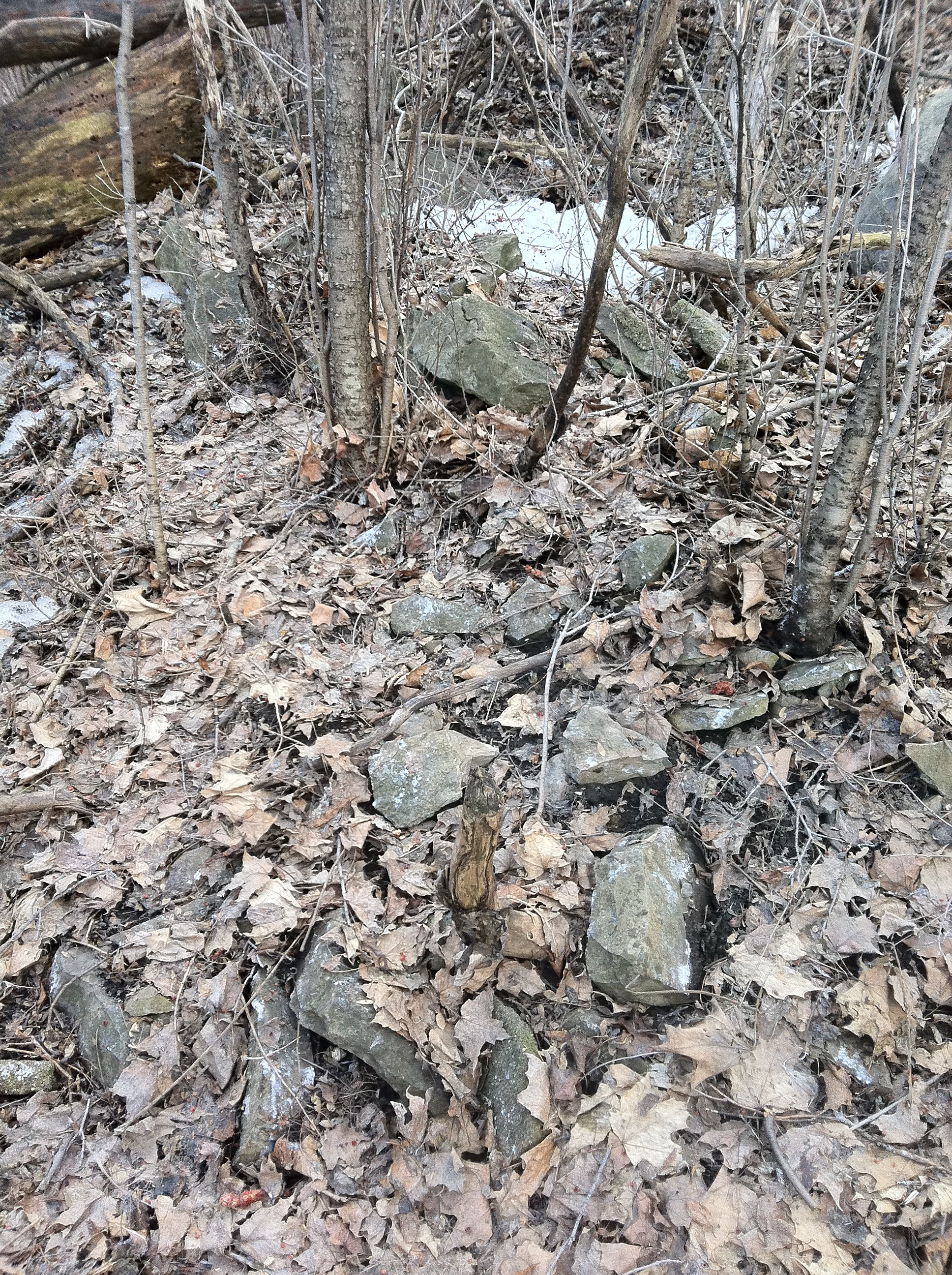
A mass of tumbled stones on the site could be remnants from the first settlement.
A mass of stones tumbled over an area of about 8-10 feet were discovered. This could possible be fireplace or foundation remains from the original cabin. Also noted was a deep pit dug into the ground nearby that may have been the outhouse latrine or a well.
In comparing the site to Wright’s notes, the area is indeed set back 20 feet from the shoreline of the Gatineau River, atop a steep embankment as he described.
Wright’s description of the initial landing on a steep bank of the Gatineau River.
Considering these clues, the maps, the archeological reports, and comparing to Wright’s own memoirs about the site, I can almost certainly conclude this site, a barren, overgrown, area off an NCC bike path, is the resting place of the very first home built in the National Capital Region. If not exactly there, it is very near by. It seems a shame that no marker or plaque commemorates the spot where our Capital was born.What’s even more bizarre is the fact that in 1980, the NCC and US State representatives erected what was the largest free-standing cast plaque in North America commemorating Wright’s settlement on the site of Wright’s original home….IN WOBURN, MASSACHUSETTS. The founder of Ottawa, Hull and Gatineau lies buried in a simple grave a few kilometeres away from his original home, but no plaque marks the inception point of what was to become Canada’s Capital Region.
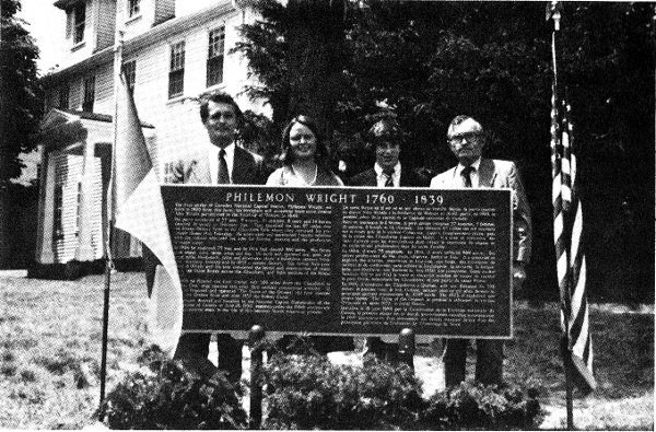
In 1980 a plaque, the largest free standing cast plaque in North America, was unveiled by the NCC and US State representative’s in Wright’s hometown of Woburn, Mass.
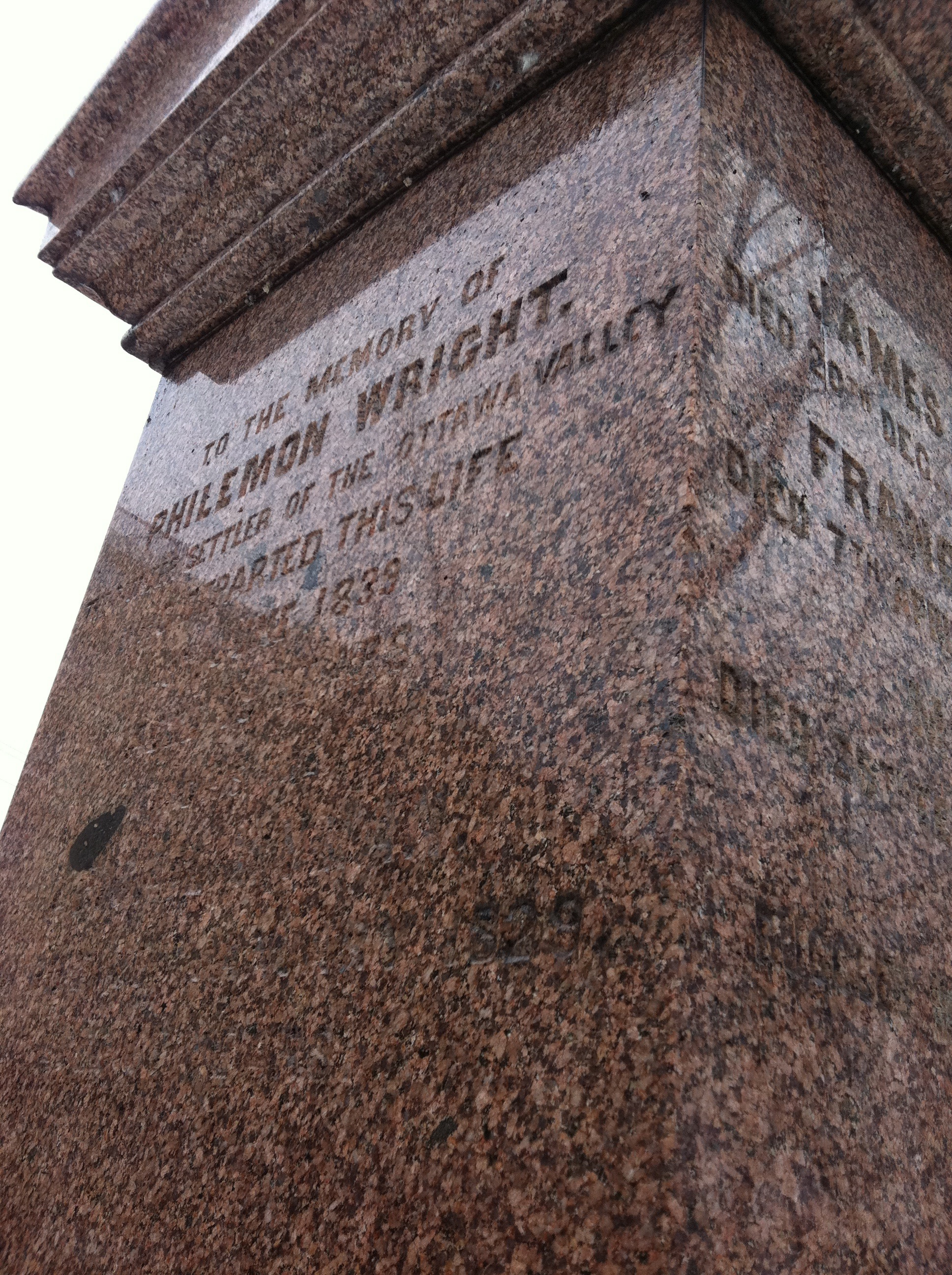
Gravestone of Philemon Wright, just west of the Chaudiere Bridge.
For whatever reason there is no plaque or any other indication of where Wright founded our city at the site. Whether or not it is because Wright was neither French nor British, but an American ex-patriot who founded the cradle of Canada’s Capital, this place is historically special and needs to be recognized. As a resident of this area I was saddened to stand on the spot where the man worked so hard to create a life for himself, who created a place that we call the National Capital Region, had nothing there to commemorate his efforts. Maybe because it is too remote, just a piece of overgrown NCC land in Gatineau, away from the downtown core, it remains ignored and forgotten. I would like to think that the legacy of Wright and what was our area’s first home, House One, will one day be made a place for all of us to visit, enjoy and remember in the years to come.
SOURCES
“Account Of The First Settlement Of The Township Of Hull, On The Ottawa River, Lower Canada”. By Philemon Wright, 1820. Ottawa Public Library.
http://en.wikipedia.org/wiki/Philemon_Wright
http://en.wikipedia.org/wiki/Andrew_Leamy
http://www.westquebecers.ca/?action=show&lid=11D7E-GQVKL-29AZ7&mid=32
http://www.gvhs.ca/publications/utga-memorial.html
http://www.ncc-ccn.gc.ca/property-management/what-we-manage/archaeological-investigations-ncc-lands
http://www.bytown.net/wrightpm.htm
Google Maps
Bing Maps

This is a fascinating report thank you for all your efforts. I always wondered about the old farm etc. Indeed I agree the NCC should mark the site and indicate clearly where the first house stood. Maybe politics play into it who knows.
Thanks for the support and interest…It seems a shame there is nothing there to commemorate the site of where it all began in our Nation’s Capital. Maybe someday.
Such a fascinating and ultimately sad story. If nothing else, a commemorative plaque belongs on or near the location researched in this article. I can hardly believe something this historically significant has been lost/overlooked.
Dianne Despault Suarez
>
I agree…For whatever reason there is not a single marker recognizing this historically significant site. Maybe some day!
Well done, guys! An intriguing piece of sleuthing!
Thanks…It was a fun adventure pinpointing the inception point of our National Capital Region.
I really enjoyed this article. Excellent historical research and it certainly indicates that we have not been doing a very job in this region in terms of marking and recognizing our historic sites. At a minimum, we need more historical markers and plaques. Thanks for doing undertaking this work – excellent stuff!!
Thanks for your interest and support of local history!
Thank you for taking such a keen interest in Philemon Wright. I am one of Wright’s many descendants (on my mother’s side, he was my great grandmother’s great grandfather).
WOW! That is some fine heritage…A descendant of the founder of the national Capital Region!
Thanks for reading.
Here’s an aerial view of the site from April 2015. https://youtu.be/CGyj-hOi1Ok
Hello Andrew, Philemon Wright is my Gr-Gr-Gr-Gr Grandfather. The road you were walking on was formerly called Leamy Road and the site you explore in this video is the site of Wright’s 2nd home.It ended up being Andrew Leamy’s home, as he married Philemon Junior’s daughter, Erexina. Andrew Leamy is my Gr-Gr-Grandfather. The site of Leamy’s large home was excavated by the NCC and it appears that it may indeed have incorporated some of Wright’s original 2nd home. In the 1950s, Leamy’s home was moved to a forgotten location in Hull. Wright’s 1st home, that he called ‘The Wigwam’, was built nearby, closer to the entrance canal of Leamy Lake. The lake was originally called Columbia Lake and Wright’s 1st & 2nd homes were built on what he called the ‘Gateno” (sic) Farm. He built a 3rd home, called ‘Standish Hall’ very near the Chaudiere Falls then built his last home in Hull called ‘The White House’, which borders on what is now called Hadley Street. The White House closely resembled the Wright Home that still exists in Woburn, Massachusetts, where Philemon Wright grew up.
Hi Rick! This is incredible to hear from you! Thanks so much for responding…it is hard to find info on where exactly the first house was, so this is valuable inside info! Would you mind if I added the info to the post as an update? Also, have been to the site of the first house? Is there anything there?
Thanks and what a legacy your family has.
AK
Hi Andrew, I have been to the site many, many times since I was a boy, first with my father and now with my grand kids. I have some interesting pictures and artifacts from the Leamy home site and the 1st home site (Philemon Wright’s). There is nothing left of Wright’s 1st cabin on the surface but there are still wood walls underground. The NCC has many artifacts in their closets but still haven’t displayed any of it after so many years. I have an interesting map you might like to have. Email me.
Also, you might want to visit the museum in the Brasseurs Du Temps (BDT) pub on Montcalm Street in Hull that outlines the Brewing & Distillery history pioneered in this area by Philemon, his wife Abigail & the family. BDT features a great bitter named 1821 that sports Philemon’s famous portrait. It’s my favourite (of course) BDT was founded by historian, Benoit Thériault who searched & found the location of Wright’s 1st home and managed the dig.
I need to correct one thing: The home built where the Standish Hall once stood was actually Ruggles Wright’s home, one of Philemon’s sons. Philemon’s 3rd home was the White House. sorry for the mistake.
My post above prompted me to further research the claim that Standish Hall was, at first, built by Philemon. I have found two sources to establish that fact. He built the Standish Hall
and moved to it from Gatino Farm in 1810.
A map of 1884 available at Library Archives and Canada shows in great detail the area of Leamy Lake, with farms, houses, barns, etc. This is the « CARTE 2 » in my blog (February 22, 2018 ; in French).
http://geo-outaouais.blogspot.ca/2018/02/le-canal-oublie-du-lac-leamy-qc-fin.html
I reduce size of picture in my blog, Go to the original :
Plan of the government works at the mouth of the Gatineau River. Surveyed by W.J. Macdonald. P.L.S. Ottawa, Dec. 6th 1884. J.H. Roy. No MIKAN 4133993. Library Archives and Canada.
Thanks so much for this additional info!
Bravo pour tous ces efforts de recherches qui sont destinés à rendre hommage à notre passé, comprendre d’où nous venons pour mieux choisir où nous allons.
Merci beaucoup!