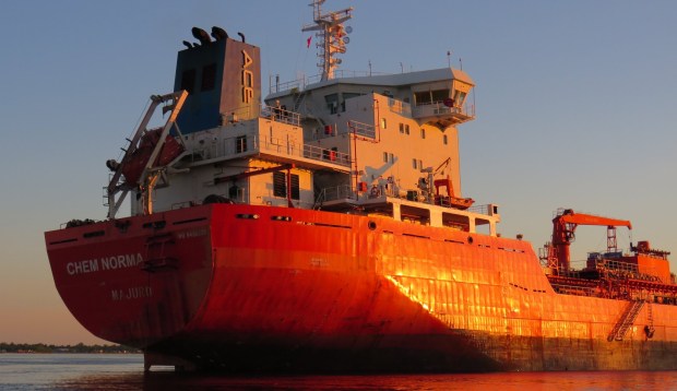
“Chem Norma” trapped on submerged 1800s ruins in the St. Lawrence River (Photo credit: @SeawayNNY: Suzy Austin)
The Saint Lawrence Seaway, that opened for marine traffic in 1959, is a system of canals and locks that allows oceangoing vessels to travel from the Atlantic Ocean, down the St. Lawrence River and into the Great Lakes.
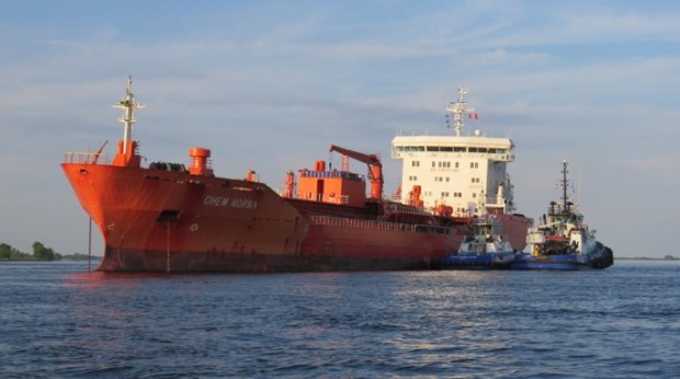
Listing to one side aground on the ruins of an old submerged village. (Image @SeawayNNY:Suzy Austin)
There is a currently a 145metre oil/chemical tanker that has run aground off the town of Morrisburg south of Ottawa, and it is still stuck there. What is trapping the vessel turns out to be the submerged ruins of an 1800s lock system, part of the now submerged ruins of a flooded village.
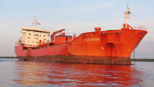
Trapped on the ruins of the old lock submerged below. (photo credit: @SeawayNNY: Suzy Austin)
In the 1950s in order to necessitate the building of the St. Lawrence Seaway, over 80 homes were moved and the entire downtown business district of Morrisburg was demolished and relocated to a shopping plaza. The CN railway line was moved 1.1 kilometers north of its original location. Countless historic buildings and other heritage artifacts were moved and assembled to create Upper Canada Village, a theme park tribute to the area’s first pioneers.

Current Google Map of Morrisburg, submerged portion of the village is shown in darker blue.
So how do we know if it has hit part of the old submerged village? We go to the maps.
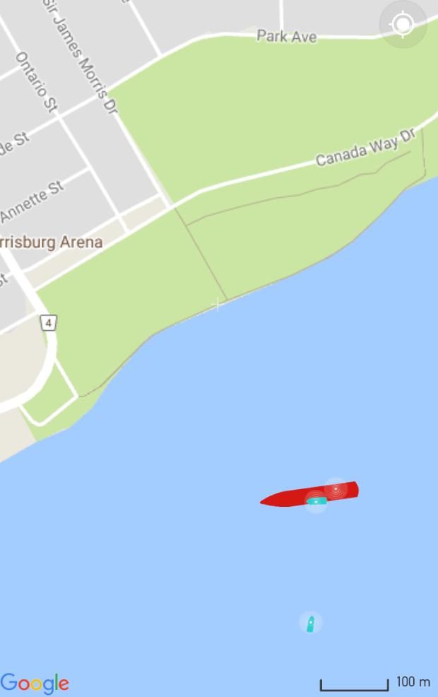
I took a screen grab of the aground freighter’s position on Marine Traffic App, “The Chem Norma” is registered from the Marshall Is.
Then using that app map, we can overlay it on a current google map…to match it up where it is exactly.

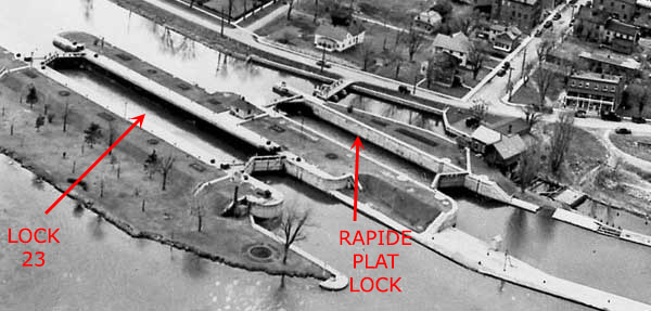
Then taking a pre-flooded aerial view of the town of Morrisburg, (it was partially flooded out for the St.Lawrence Seaway Project Of The 1950s) we can see what used to be there…

…and what used to be there was a massive OLD 1800s lock system and docks that serviced the old town of Morrisburg. It now lies submerged off the current shoreline, LOCK 23….and this is what the freighter has hit and is stuck on.

So there you have it, a modern day freighter ship trapped on the submerged remains of an old town and its locks, lying in the watery depths below.

Here is a photo of what the freighter has run aground on, before it got flooded. (image: Morrisburgdivesites.wordpress.com)
It seems history has come back from the depths to take hold of a modern ship.
With thanks to @SeawayNNY and https://morrisburgdivesites.files.wordpress.com/
Andrew King June 2018

will they eventually move the freighter?
It’s been freed now – they adjusted flow rates to raise the water level in that area, and the ship was able to float free of its impediment. Trying to pull it loose with tugs wasn’t working…
Excellent. You’ve got a real talent….many times alerts. Thanks
ouch. I come from a family of ‘boat nerds’ commonly called ‘freight freaks’; this is the stuff they get off on. I shall alert Father.
Great post.
Would have been good to give the date this occurred, May 29th 2018. It was impossible to know when from your article.
Looks like it was freed yesterday.
Peter Johns
I was in the U.S,N. and even a new ship got stuck on the Canadian side.
They did this on the other side of the river too. My dad’s birthplace of Moulinette, Canada was done away with like this. Their old church bldg. Is in upper Canada village.