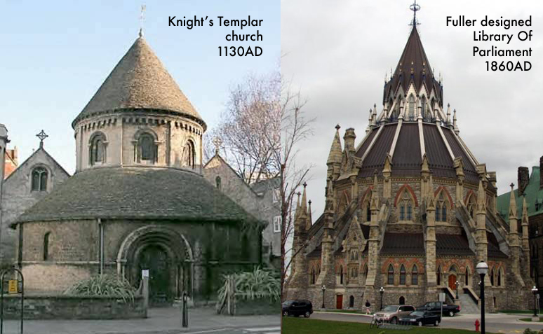
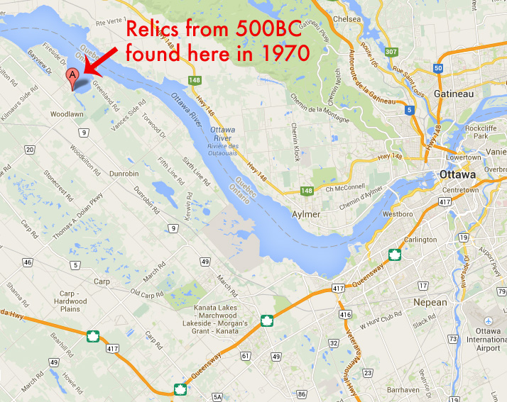
The Nation’s Capital contains some of the most stunning architecture in the country, most notably the Parliament Buildings. These prominent structures were designed by an architect by the name of Thomas Fuller. In studying Fuller’s work and his buildings, there is a recurring theme and design style that I believe are reminiscent of another style of architecture..that of The Knights Templar.
Could there be a possible connection between the ancient and mysterious Knights Templar and our city’s most prominent buildings? Is it mere coincidence many of Ottawa’s buildings share features of those built by a medieval order of knights known as the Templars? Well with a grain of salt let’s take a look and see what we can find…
The Knights Templar

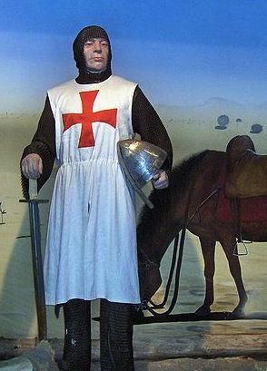
A Templar knight with the distinctive cross on the tunic.
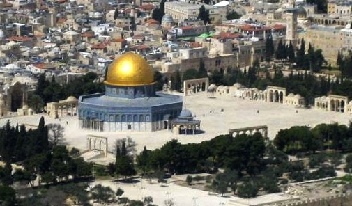
Formed in 1120, the Knights Templar were created to protect pilgrims to the Holy Land of Jerusalem. It began with nine knights, but quickly grew under the order of the King of France and the Pope of that time. They built their domed headquarters on what was supposedly the ruins of King Solomon’s temple in Jerusalem, forming their name the Knights of the Temple or “Knights Templar”.

The original Knights Templar domed headquarters in Jerusalem.
Templar knights, in their distinctive white cloaks with a red cross were among the most skilled fighting units of the Crusades and the non-combatant Templars managed a large economic infrastructure throughout Christendom, innovating financial techniques that were an early form of banking and building fortifications and churches across the Holy Land.
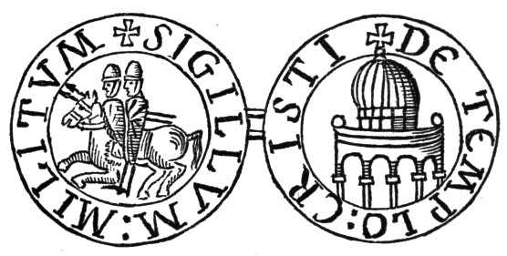
The original seal of the Knights Templar. The domed Temple on right.
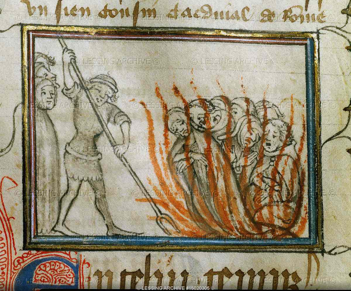
When the Crusades ended and the Holy Land they were sworn to protect was lost, the Knights Templar fell under suspicion by the King and the Pope of that time, the two figures who created the order in the first place. By 1307 mistrust of the Knights grew based on the Knights odd initiation rites and “un-Christian Practices”. King Philip IV of France and Pope Clement soon had the Knights Templar arrested, tortured then burned at the stake. On Friday the 13th of October 1307, many Knights Templar were rounded up and executed by the King under orders of the Pope. This is a popular reason Friday The 13th is regarded as an “unlucky day”.

Knights Templar being burned at the stake on Friday the 13th 1307.
Escaping persecution, hundreds of remaining Knights Templar knew that their fate was sealed and began to pack up their hordes of treasures, including what many believe to be the Holy Grail and other religious relics and loaded them onto a fleet of ships in the Mediterranean. The Templar ships left at midnight from La Rochelle, France and reportedly headed to where they were given asylum and refuge: Scotland.
It seems Robert The Bruce of Scotland gave the Knights Templar refuge in his land, having been excommunicated by the same Pope a year before the Templars were persecuted. Unloading men, treasures, and wealth into Scotland, the Knights went into hiding, taking their secrets and their myriad of skills with them. Their advanced skills in masonry, architecture and design can be seen in various church structures throughout England and Scotland to this day.

A medieval Templar church in the United Kingdom.
Templars as Freemasons
After almost 500 years of hiding from the Catholic Church, the order of the Knights Templar was resurrected in 1790 by Alexander Deuchar in Scotland under a new name: Freemasonry. Since at least the 18th century Freemasons have incorporated Templar symbols and rituals. The Freemasons have five separated degrees or orders: The Entered Apprentice, The Fellowcraft, The Master Mason, The Royal Arch and finally: The Knights Templar.
FULLER THE FREEMASON

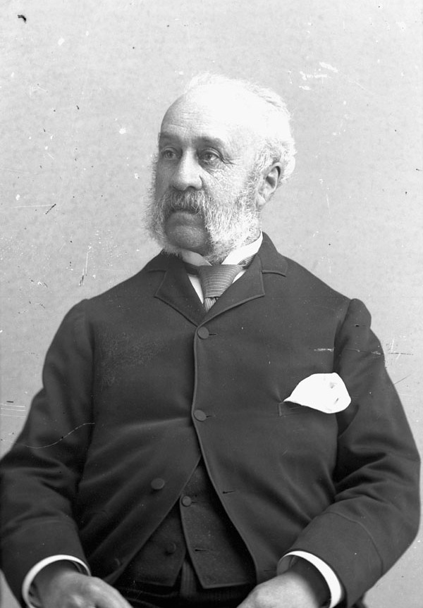
Thomas Fuller, architect of Canada’s Parliament Buildings and numerous churches in the Ottawa area.
Freemasonry began to grow with prominent men of society from the 1800’s onwards, and our architect Thomas Fuller was most definitely associated with them. Fuller was born in England and came to Canada in 1857 to set up an architecture firm specializing in stone buildings. Two years later he became Canada’s most important and large scale architect of some of our area’s most important buildings. The Fuller list of buildings he designed is extensive and all seem to be contracted in a short span of 15 years between 1860 and 1875 and all have some kind of Freemasonry association.

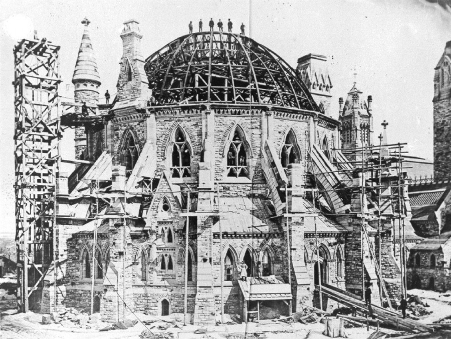
Fuller’s Library Of Parliament under construction 1860s. Note dome similar to original Templar headquarters at the Solomon Temple.
A relative newcomer to the country, Fuller was awarded the contract to design Canada’s Parliament Buildings in 1859. Here are the other buildings he designed:
1859 – Parliament Buildings (burned 1916) Library (remaining), Ottawa
1889 – Langevin Block, Ottawa
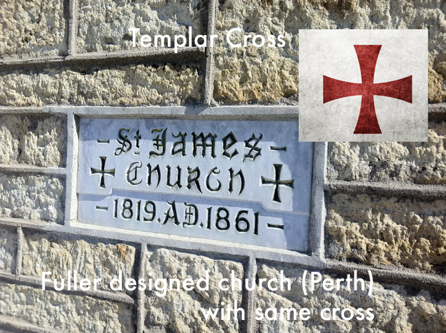
1861 – St. James Church, Perth
1862 – St. Paul’s Church, Almonte
1866 – St. Alban’s Church, Ottawa
1866 – St. James Church, Hull (burned 1900)
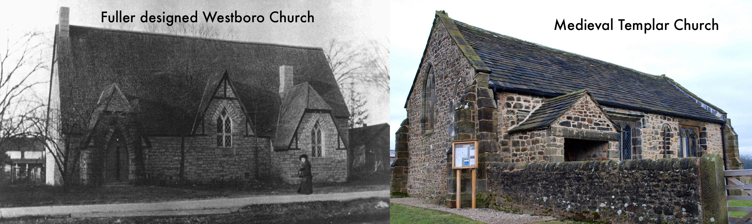
1866 – All Saints Church, Westboro
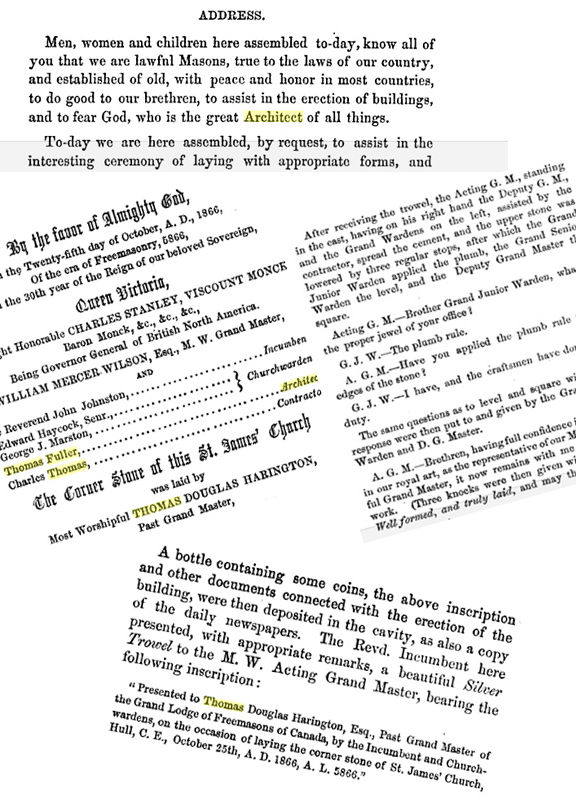
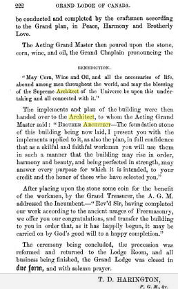
The ceremonies of laying the corner stone for these buildings were performed in full Masonic style, as outlined in this excerpt from the 1866 laying of the cornerstone of a church Fuller designed in Hull. An unusual and ritualistic ceremony that dates back to the time of the Templars.

A record of the unusual Masonic rituals that accompanied the laying of the cornerstone for Fuller’s buildings…this one a church in 1866.
LOOKING AT FULLER’S TEMPLAR/FREEMASON STYLE AND SYMBOLS
I leave it up to your own discretion and opinion, but I thought it would be interesting to compare what I think is a predominant Templar design style in Fuller’s buildings, an order he was associated with through his continuing work with the derivative Freemasons.
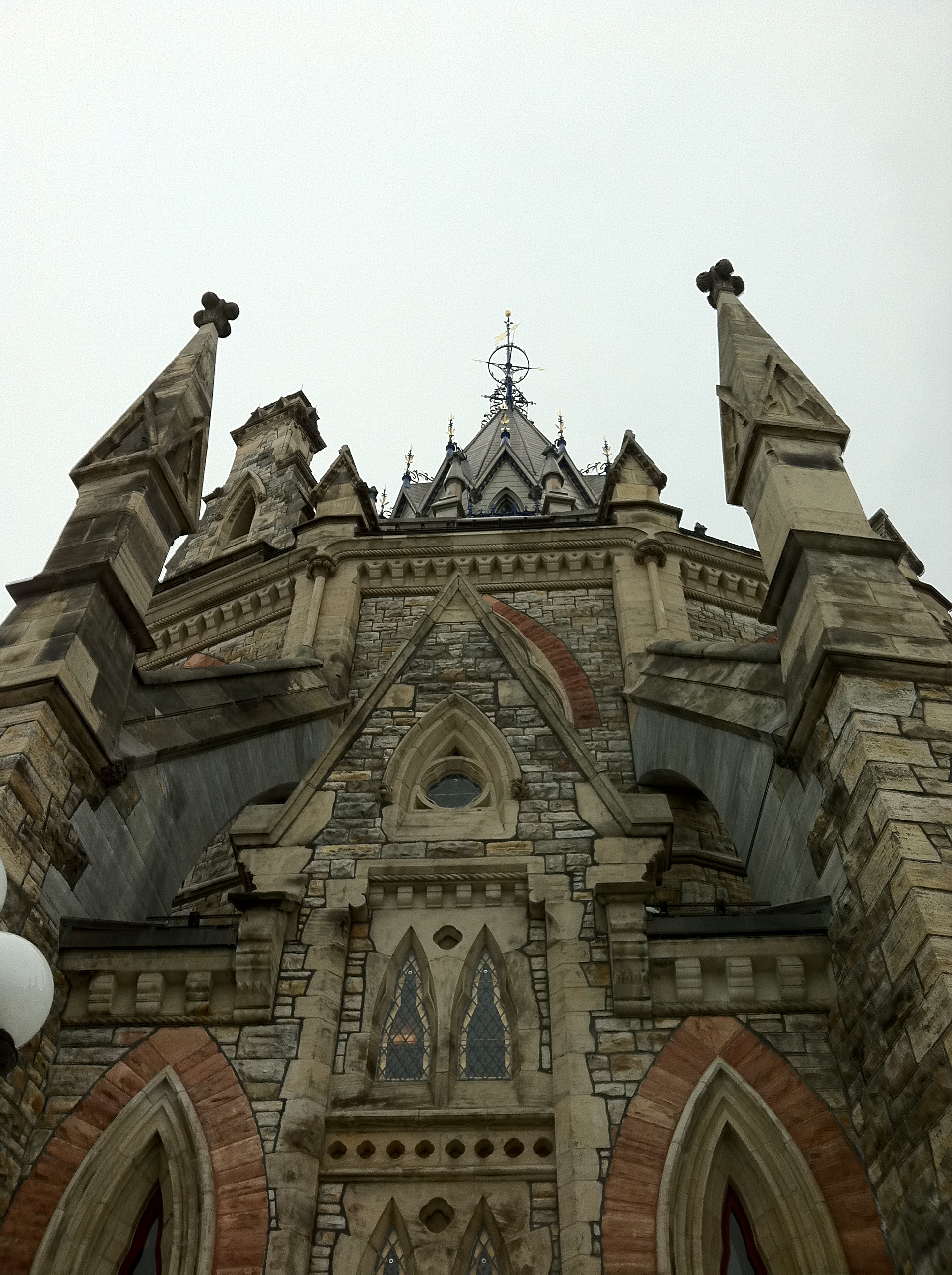
THE PARLIAMENT BUILDINGS – Library
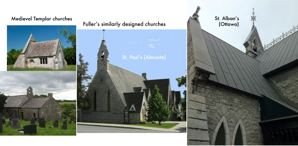
The Parliament buildings originally designed by Fuller were destroyed by fire in 1916 with the only remaining example of his work being the Library of Parliament. It was opened on February 28, 1876, and its similarities to the Templar churches of medieval times seems just too similar to be just a coincidence.
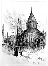
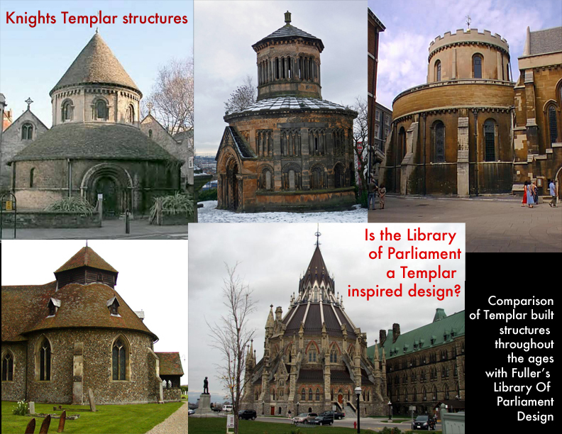
The Temple Church in 1892. (image Wikipedia)
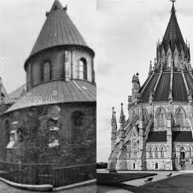
The original Temple Church in London, England (photo from late 1800s) built by the Templar Knights in 1180s in comparison to Ottawa’s Library of Parliament.

Detail of the Library of Parliament.
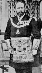
The Prince Of Wales, Albert Edward here seen in full Freemason attire.
Templar architecture has a predominant rounded temple relating to their original Solomon’s Temple structure. This can also be found in the parliament buildings with the library building in the rear. Circular and buttressed walls are also similar in both designs.
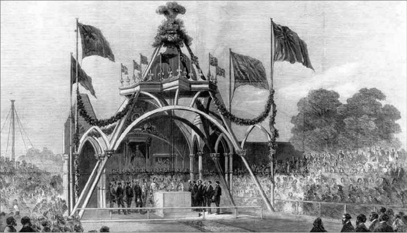
On September 1, 1860, The Prince Of Wales, Albert Edward, a known member of Freemasonry, presided over the Masonic ritual of laying the cornerstone of the Parliament Buildings. The Masonic Ceremony included The Prince Of Wales and Fuller exchanging Masonic vows while lowering the ceremonial stone. In 1875 Albert Edward became Grand Master of the Convent General of the Knights Templar.

The cornerstone of the Parliament Buildings being laid under Freemason ceremony on Sept. 1, 1860 by Fuller and the Prince Of Wales, soon to be Grand Master Of The Convent General Knights Templar in 1875.

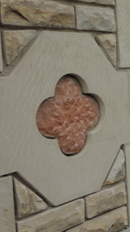
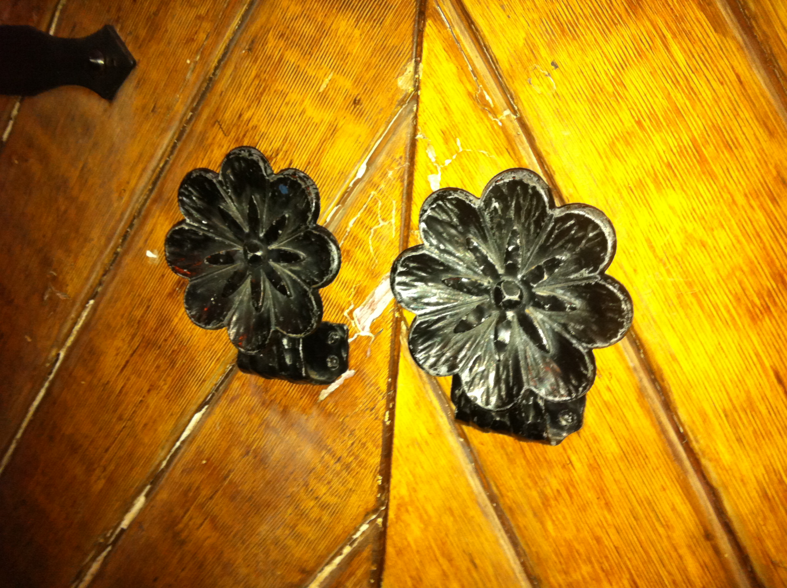
Also, Fuller’s library structure is adorned in a “rose” motif, a symbol in both Templar and Freemason beliefs often used in ceremonies and rituals. The rose was anciently a symbol of Dawn, of the resurrection of Light and the renewal of life. In the Scottish Rite of Masonry the rose has special connections where the rose has taken on the meaning of immortality.

Detail of the 4 petal rose symbol seen around Parliament, including the door handles.
The rose carved into every window of the library is a four-petalled rose, like the Templar cross, a cross of equal lengths to denote balance. The Templar cross can also be seen in the space between the petals.

Every window of the Library is emblazoned with the symbol of the 4 petal rose.

Note the hidden Templar cross that sits perfectly in the negative space of the rose symbol on the Library.
In an interesting continuance of the Fuller legacy, Thomas Fuller’s great grandson, William Fuller of Thomas Fuller Contracting Ltd. was awarded the contract to restore the Library of Parliament in 2002.
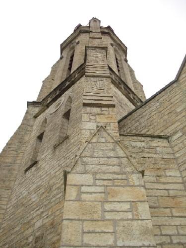
St. James Church, Perth, On

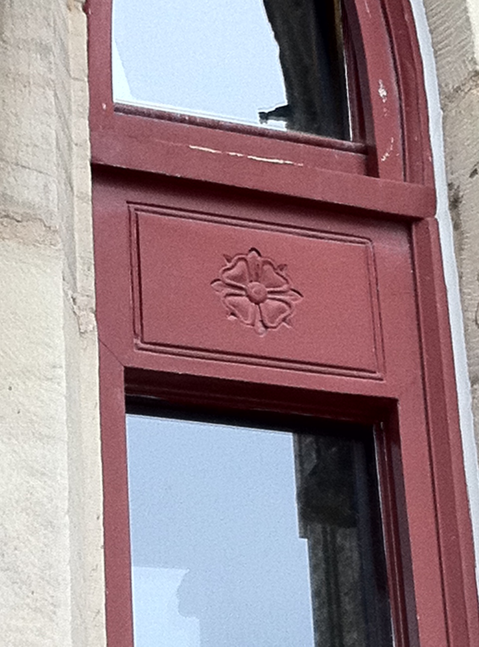
Built by Fuller as a garrison church, or military defensive building in 1861, the side walls were prominently buttressed for added strength and a tunnel was constructed to connect the church to the adjacent Court House. The cornerstone has the Knights Templar cross inscribed with the date. The church is designed in typical Fuller fashion, buttressed walls, low roofline and medieval castle style details, such as the elongated “arrow loop” windows.

Fuller’s chracteristic medival Templar style on the Perth church.
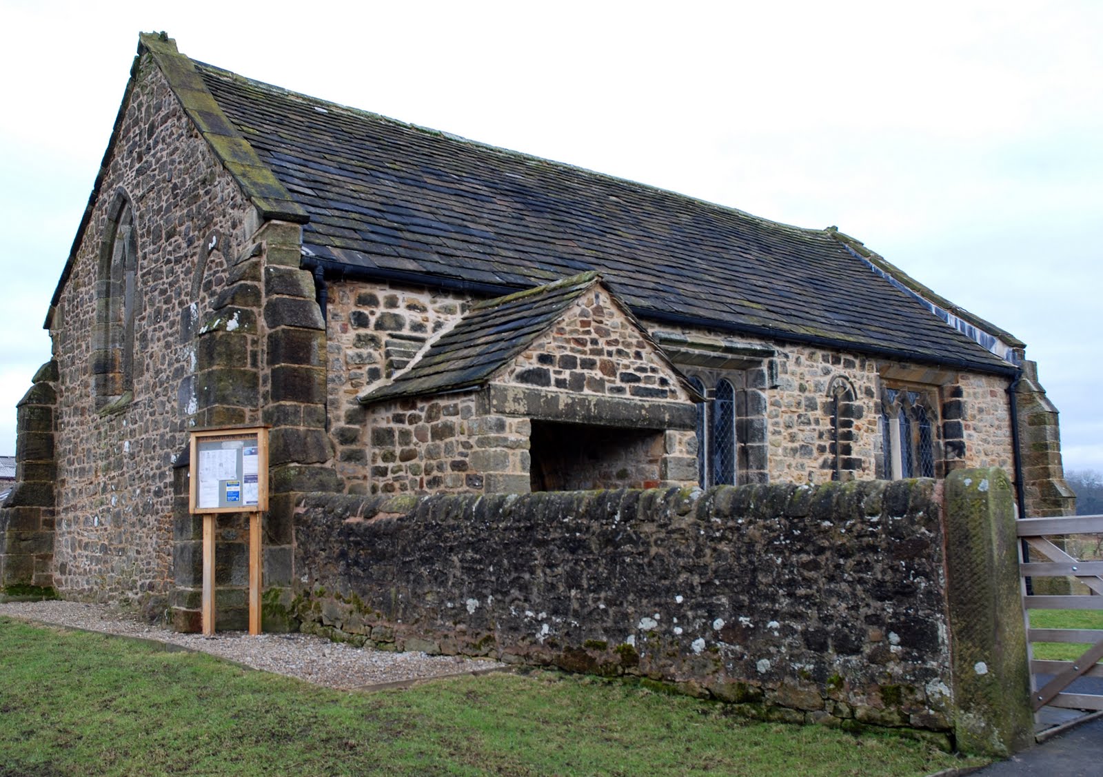
St. Alban’s, St. Paul’s & Westboro Churches

Comparison of Fuller’s Westboro church to a Templar church.
Fuller designed these churches all at the same time in his signature style paying homage to the English medieval churches he was fond of and used as inspiration for much of his work.

Rose door handles of Westboro church.
Medieval castle features such as arrow slits were implemented in his church designs as tall, thin windows. Low rooflines and buttressed side walls were used in all designs. The structures also contain many rose motifs.

ARCHITECT OF CANADA
From 1881 to 1896, Fuller was appointed Chief Dominion Architect for the Government of Canada, during which time he played a role in the design and construction of every major federal building.

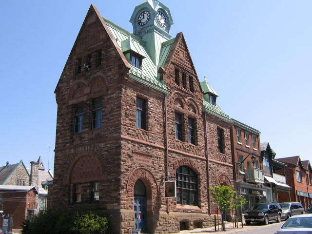
A Fuller designed Post Office in Almonte, ON.
The Minister of Public Works appointed Fuller Dominion Chief Architect. He wanted high design standards and to create an imposing government presence across the country. Fuller excelled in the design of small to medium sized public buildings tailored to individual sites, perhaps best seen in the smaller individually designed post offices. Now cherished community landmarks these picturesque structures, sometimes asymmetrically designed, often feature a blend of Gothic and medieval elements. This work can be seen in almost every town and city in Canada through post offices and court houses built in this time period.
Fuller witnessed the construction of approximately 140 buildings nationwide, of these approximately 78 were federal buildings and post offices. These buildings created and consolidated a federal government presence across Canada in a unified and distinct style.
FINDING FULLER
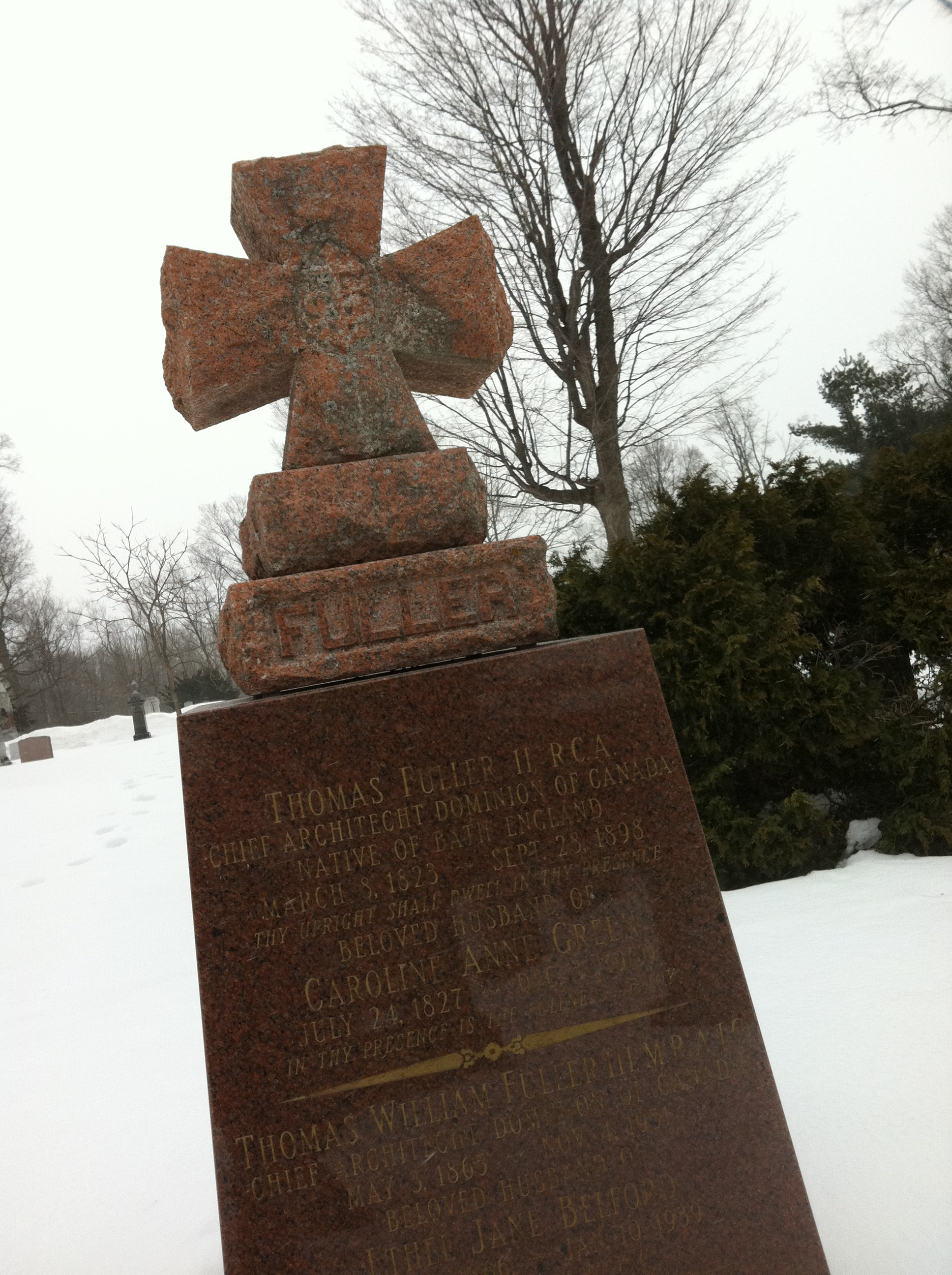
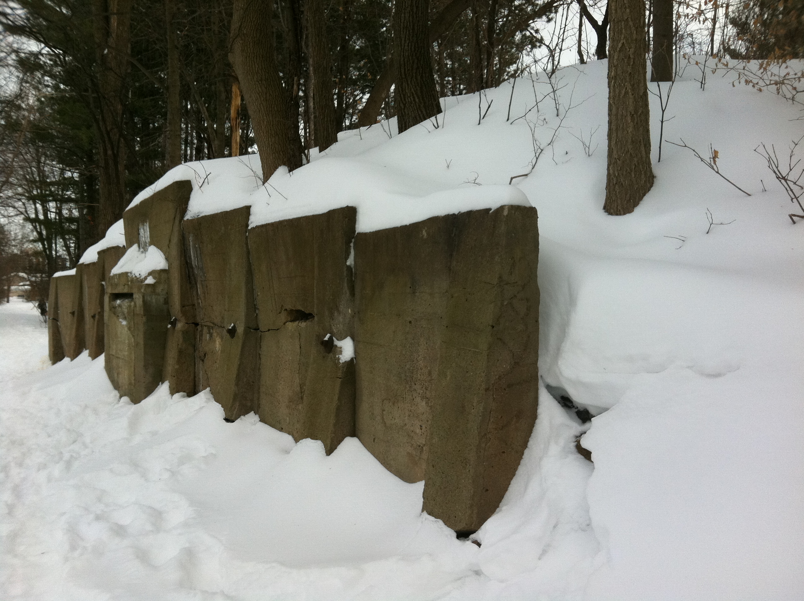
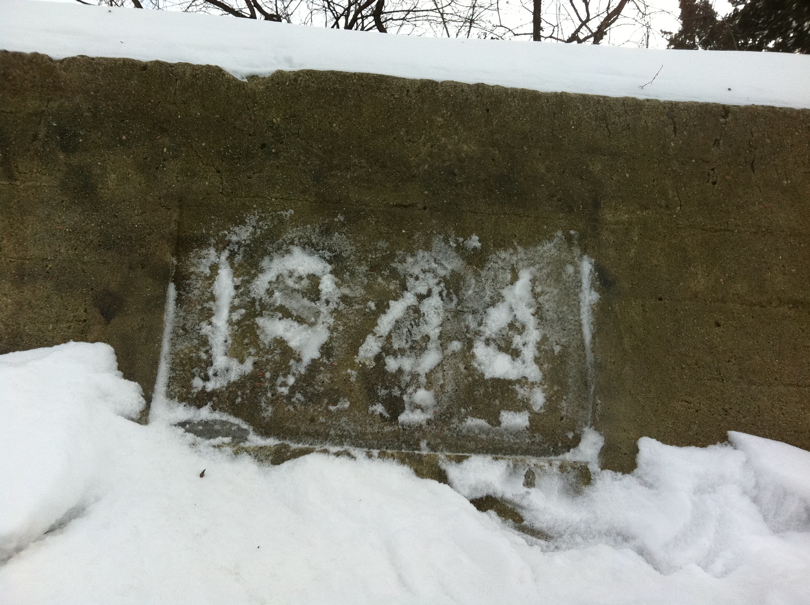
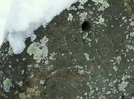
After studying the architecture of Fuller, I thought it would be best to confirm whether or not there was a Templar connection at his final resting place. Thomas Fuller died in 1898 and was interred in Beechwood Cemetery here in Ottawa. Through the help of the cemetery staff who brought up historical records and kindly provided me with a map, I located where Fuller was buried. If Fuller was indeed part of the Freemason or Templar movement, his gravestone would most likely have a symbol of that association inscribed upon it. Trudging through the snow I finally came upon his grave and sure enough, there above his name, was the Templar cross.

Thomas Fuller’s gravestone monument in Beechwood Cemetery.
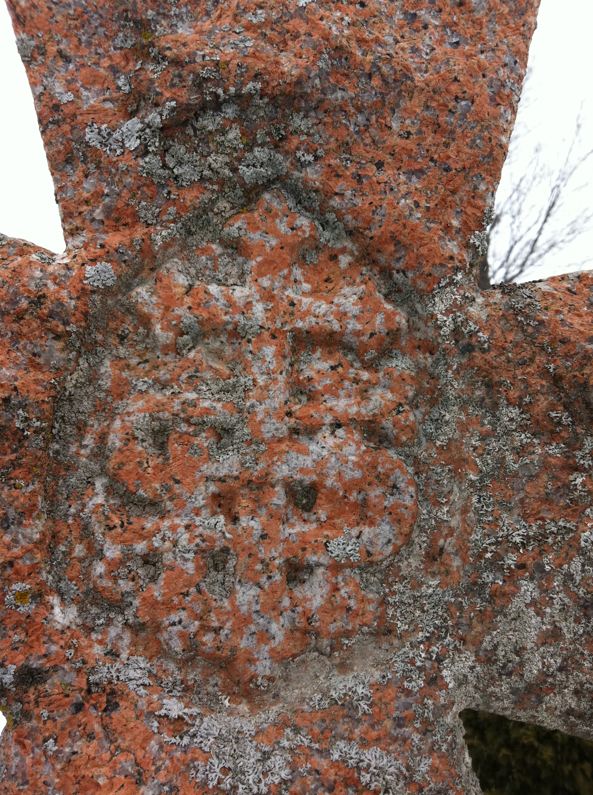
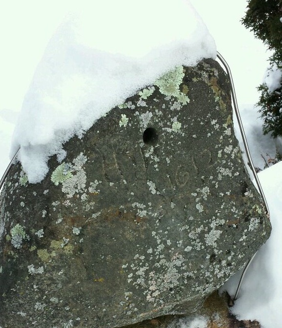
Inside the cross was an unusual symbol.

The symbol of “IHS” in the centre of the cross.

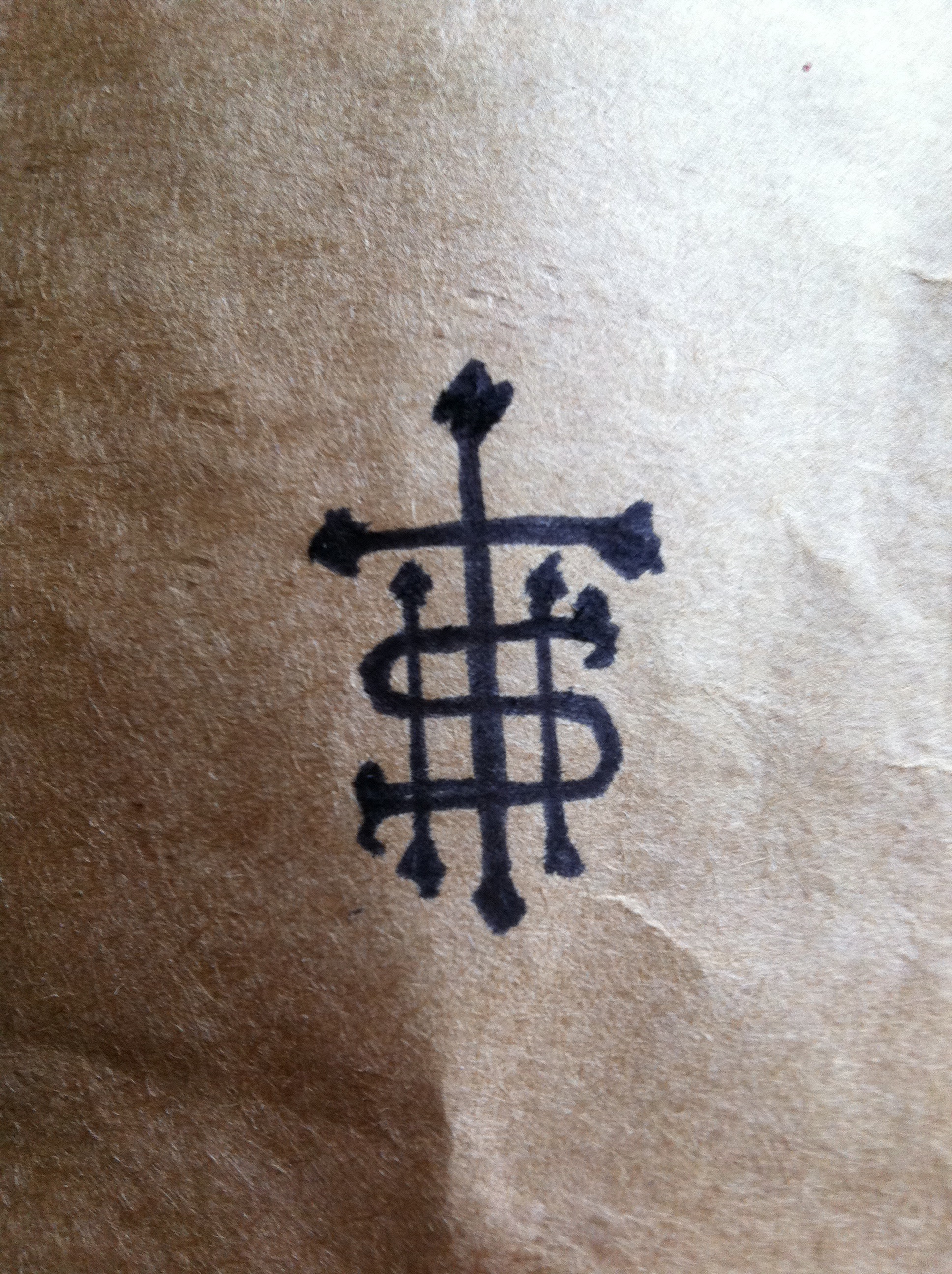
I made a clearer sketch of the symbol to help determine what it meant.
Sketching the symbol out it was later determined that it was the symbol of the letters “IHS”.Asking for help identifying this symbol through Twitter and researching the letters IHS and the Freemason/Templars, it was determined from the Grand Lodge of Freemasonry Symbology website that it stands for “In Hoc Signo”, or translated, “By this sign you shall conquer” ….
The motto of the Knights Templar.
So there it was in plain site….The architect of Canada’s Parliament Buildings buried under the Templar cross with their motto “By this sign you shall conquer”…and conquer he did…140 buildings across the country all designed by Fuller, a member of the ancient order of Knights Templar. Countless courthouses and post offices in small towns across Canada are of his design. Next time you happen to see a stately building in your travels, look for clues to a Fuller/Templar connection and enjoy the stately architecture he so carefully brought forth from the days of the ancient Order.
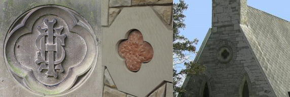
Comparison of the Templar IHS motto symbol in the rose cross shape and the symbol in Fuller’s work.
TEMPLARS IN OTTAWA TODAY
In addition to the work of Fuller, the Templar movement is still alive and well in Ottawa through the Order of Knights Templar…who have a website, you can visit here that states:
“Welcome to the Priory of Simon Peter, the Ottawa priory of the Knights Templar. Our official name is Ordo Supremus Militaris Templi Hierosolymitani
Our Order was founded on the principles first adopted by the original Templar Knights in the Year 1118 in their home in the Temple of Solomon in the Holy City of Jerusalem. In these modern times, we are international in nature with members from over 40 nations, ecumenical Christian in our religious beliefs welcoming Christian men and women on a basis of strict equality, having equal rights, opportunities and responsibilities. In the spirit of diversity and religious freedom, an “Order of Merit” is also offered as a form of membership to those of other faiths. We are focussed on matters of human rights, political and religious freedom, and humanitarian aid to the world’s less fortunate. We are officially recognized by the United Nations in Special Consultative Status and furnish official delegations to the United Nations in New York City, Vienna, and Geneva.
Like the Knights Templar of old, we operate as a modern-day worldwide network of educated professionals in such widely diverse disciplines as government officials, Members of the Diplomatic Corps, clergy, serving and retired members of Armed Forces and Police Forces, physicians and surgeons, engineers, historians, and humanitarian aid caregivers.”
The Templar movement is alive and well in Ottawa through the architecture of Fuller, but also in an ancient order that operates among us everyday. Look beside you, the person next to you could very well be a knight…
Please note: The opinions and ideas expressed above are based on my own observations and are not meant to be used as academic fact. They are presented as theory based on compelling evidence gathered from my personal research and study.