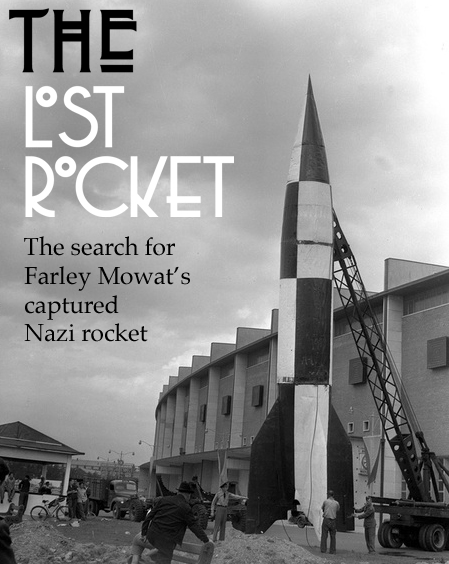
The Story of Canada’s Lost Nazi Rocket
(from material originally published in my column for The Ottawa Citizen November 7 2014, which can be viewed HERE.)
Canada’s lost V2 rocket story begins during the closing months of WW2 when a Canadian Army captain began to collect captured and abandoned German equipment to send back to Canada for analysis and museum display. The Captain in charge of this 1st Canadian Army Museum Collection Team was none other than famous Canadian author Farley Mowat.
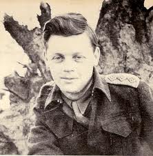
Captain Farley Mowat during WW2.
Farley Mowat in his book “My Father’s Son” outlines how Captain Mowat quickly assembled an impressive collection of German, tanks, vehicles and assorted equipment that can be seen today at the Canadian War in Ottawa.
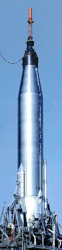
One such piece of captured German technology that was collected by Captain Mowat was an advanced 12 ton liquid fueled rocket, the V2, or (“Vengeance Weapon 2”), technical name Aggregat-4 (A4). It was the world’s first long-range ballistic missile, and the precursor to all modern rockets, including those used by the US and the Soviet space programs.

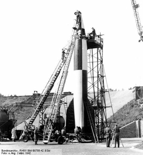
A German V-2 being tested at Werner Von Braun’s advanced rocket test facility at Peenemunde in Germany.
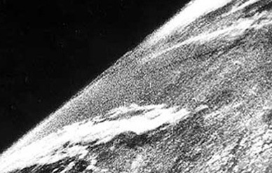
6,000 of these advanced rockets were built by German forces with half being fired onto Allied targets during the latter part of World War 2. Designed by Wernher von Braun, who was later an integral part of the American NASA rocket program and the NASA moon missions, this 50 foot tall rocket was the most advanced weapon of its day that paved the way for rocket and space exploration after the war. The very first photo from space was taken from a captured V2 rocket in 1946 launched by US scientists.
At the end of the war, a race began between the United States and the USSR to retrieve as many V-2 rockets and their support staff as possible. Three hundred rail-car loads of V-2s and parts were captured and shipped to the United States and 126 of the principal designers, including Wernher von Braun and Walter Dornberger, were in American hands. Von Braun, his brother Magnus, and seven others decided to surrender to the United States military to ensure they were not captured by the advancing Soviets or shot dead by the Nazis to prevent their capture.

The very first image taken from space was from a captured V-2 rocket in 1946.
BRINGING THE ROCKET TO CANADA
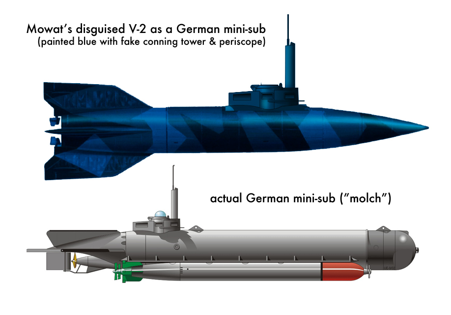
Due to the advanced technology of the V2 and its desirability by US, Russian and British research scientists, Captain Mowat was forbidden to take his captured V2 rocket back to Canada. This did not stop the determined Mowat who knew this was a valuable prize for Canada, and took the necessary action to get the rocket back to Canada. With British guards protecting the rocket which was now on a train, Mowat and his team apparently got the guards drunk, then loaded the rocket off the side of the train and onto a trailer. They then transported the rocket to Holland to a waiting Canadian cargo ship bound for Montreal. With Americans that would surely confiscate the rocket, Captain Farley and his team disguised it as a German submarine, painting the rocket blue and adding a fake periscope.

Mowat disguised the captured V-2 as a German mini-sub in order to smuggle it past American guards to get it back to Canada.
It was loaded without incident aboard the Canadian cargo ship and safely made it’s way back to Canada where it was unloaded in Montreal, dismantled, studied and blueprinted at the Canadian Armament Research & Development Establishment (CARDE) in Valcartier, Quebec.
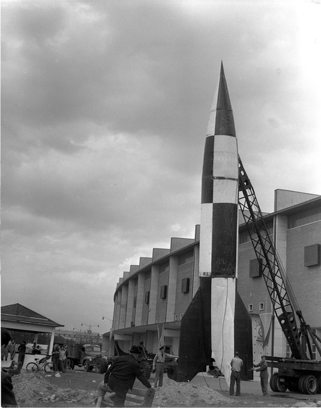
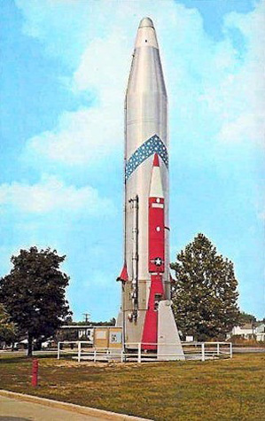
After being scrutinized by CARDE, the Department of Defence loaned the captured V2 to the CNE in Toronto to display at the 1950 CNE. Re-painted in its German test pattern paint scheme at CFB Centralia, it was transported to Toronto where the CNE placed it upright on display for the many visitors see at the 1950 CNE. After that, the history of Canada’s V2 rocket falls into relative obscurity.

The captured V-2 rocket as seen on display at the 1950 CNE in Toronto.

Department of Defence crew preparing to display the V-2 rocket at the 1950 CNE in Toronto.

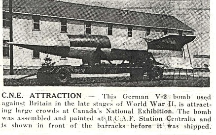
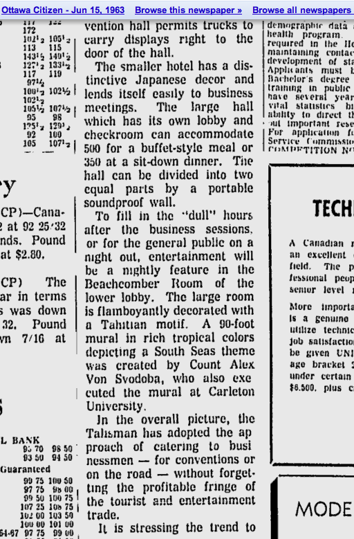
A newspaper clipping showing the V-2 after being studied by CARDE between 1945-50 and re-painted to be shipped to Toronto for display at the 1950 CNE.

With its nose cone damaged (from a truck backing into the hitch it seems) the V-2 after its display at the CNE. Where it went after the CNE remains a mystery.
WHERE DID IT GO?
A retired Air Canada pilot, David Savage, who lived in Picton, Ontario during the 1960s may be able to provide some possible clues as to the final resting place of the lost V2 rocket. Picton, a small town in Prince Edward County, three hours from Ottawa, once had a massive airport full of hangers, buildings, barracks and other assorted military establishments from its WW2 role of training RCAF pilots and crew. In the 1960s, the base was still operating, but was then used for storing surplus aircraft and artillery training. Surplus P-51 Mustangs, B-25 Mitchell bombers and other assorted aircraft were stowed away to be sold off for scrap or to private collectors. In his recent book “Camp Picton”, local author Ian Robertson mentions the V2 rocket in great detail. I contacted Mr. Robertson who graciously offered his time to tell me about the V-2 that apparently ended up in Picton, Ontario in 1961.
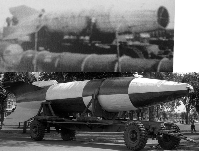
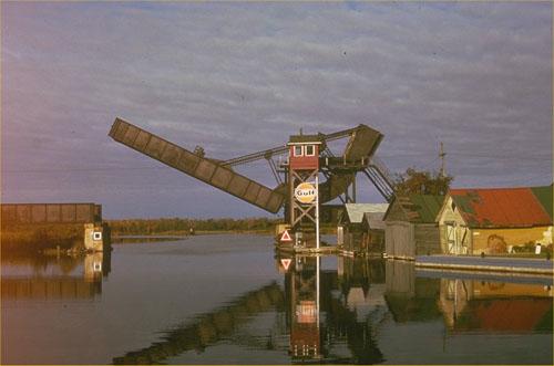
A photo that appears in Robertson’s book taken by Mr. Savage as a teenager in 1961 clearly shows what appears to be the lost V2 rocket sitting on its side, apparently on the same trailer used to transport it around at the CNE, weathered and missing its crumpled nose cone. The unmistakable shape and size is clearly that of a V2 rocket. It seems logical that it was brought to the Picton airbase for storage with all the other unwanted old DND equipment. Savage left Picton in 1962, never knowing what happened to the V2 he captured on film. The base closed in 1969, and the the whereabouts of the V2 closed with it. No further information about what happened to the stored rocket can be found.

Comparing the 1961 photo taken by Savage in Picton with the 1950 CNE photo of the V-2 rocket. (top photo courtesy of Ian Robertson from his book “Camp Picton”)
Comparing the 1961 Picton photo with the 1950 CNE photo provides a definite match, even when the two photos are superimposed on top of one another. An exact match.

Super-imposing the 1961 photo by Savage over the 1950 CNE photo of the V-2 provides an exact match.
Locals in Picton who also grew up during the 1960s recall the V2 and other unwanted old equipment being bulldozed into the base landfill site. If this is the case, a very significant piece of world history lies under the surface in Prince Edward County waiting to be discovered, preserved and exhibited in a Canadian museum along with the fascinating story of how it got there. Having grown up in the area myself, and flying out of this airport many times with my dad who kept his plane here, I can attest to the fact there are many wartime artifacts strewn around the area.

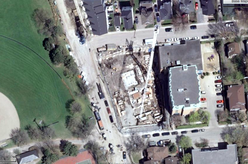
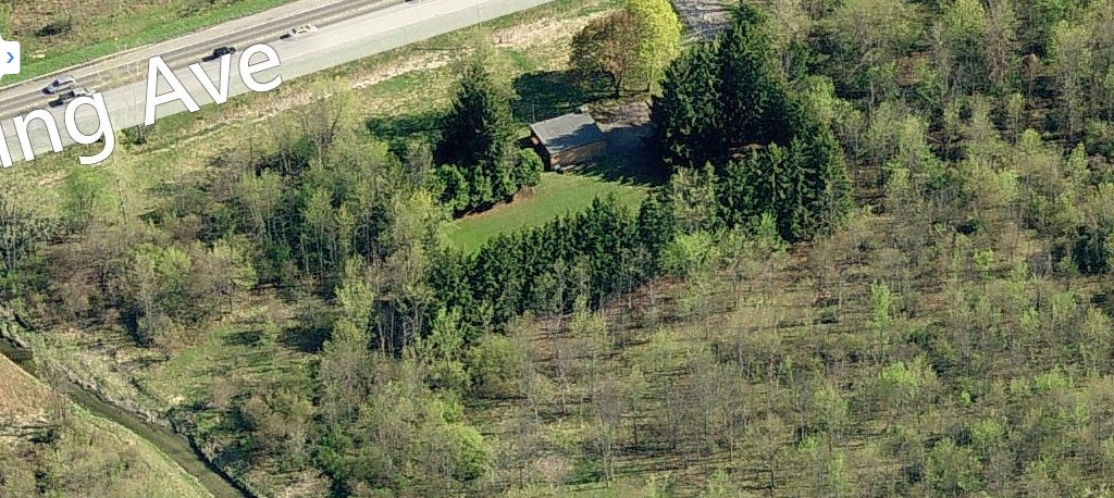
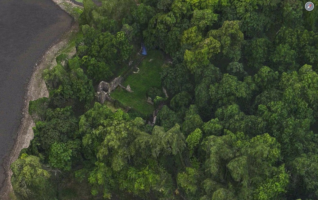
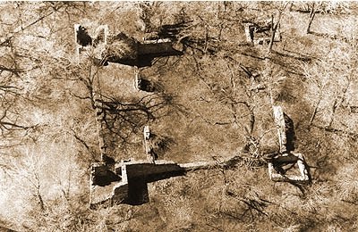
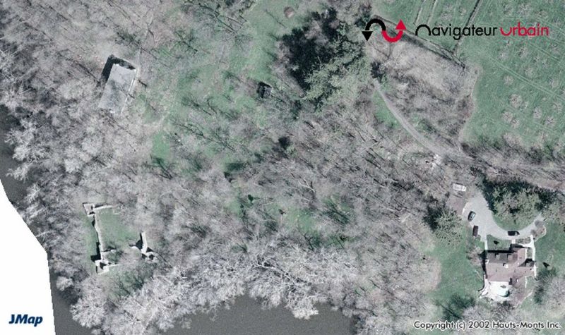
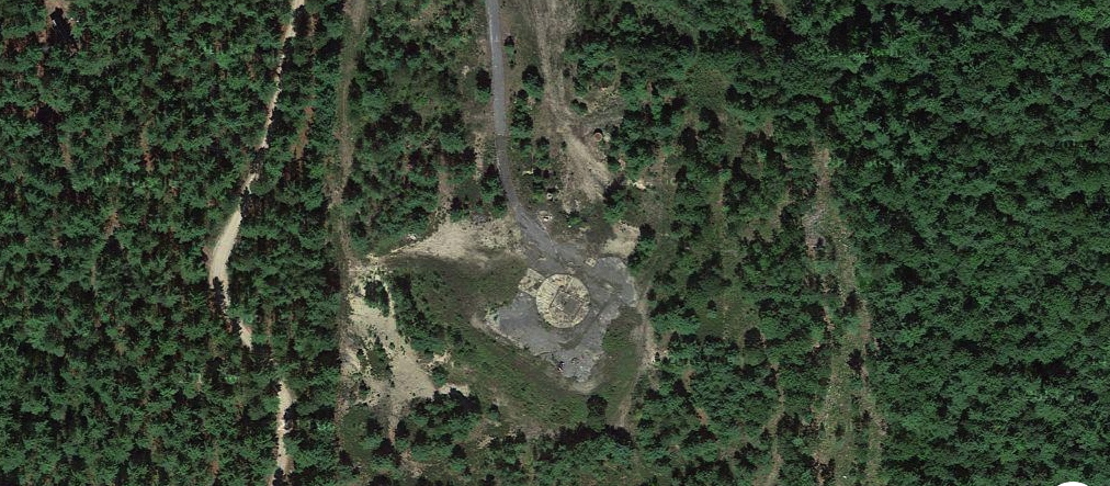
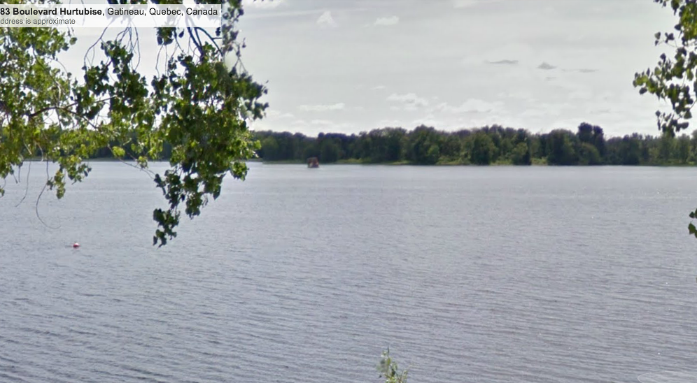
Aerial view of Camp Picton as it looks today, and the last possible resting place of the V2 rocket.
The airport landfill site lies south of the current runway. Loch-Sloy currently owns the airport property.


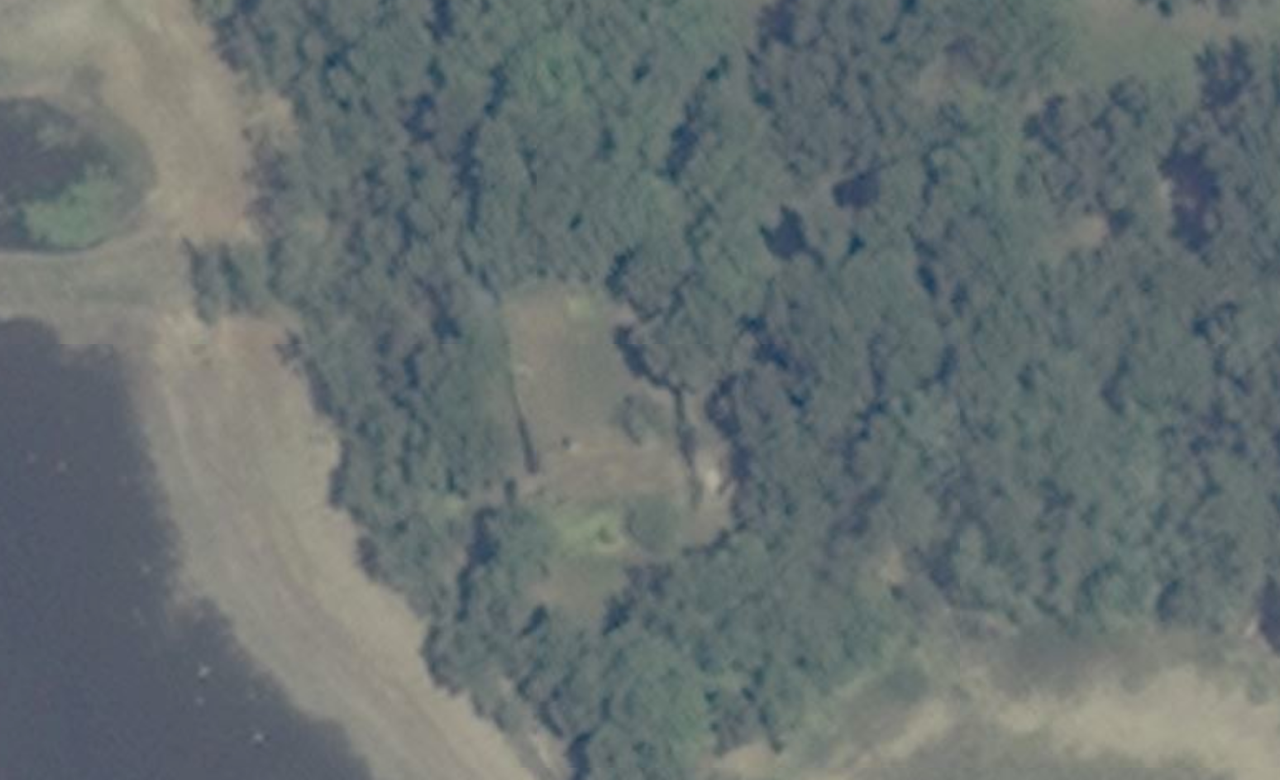
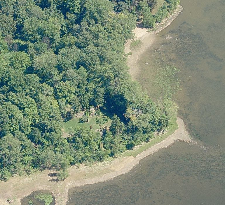
The landfill area at Camp Picton as it looks today. The lost V-2 rocket could very well lie below its surface.
The airport property, including the landfill area, is currently owned by Loch-Sloy Holdings Ltd. who have reported that the landfill area is a “contaminated” zone and further investigation or digging would be hindered by this designation. Does Canada’s lost V2 rocket sit buried underneath a layer of dirt in Picton? With only 20 remaining in the entire world out of the original 6,000 made, it would certainly be a worthwhile endeavour to excavate the area and find out once and for all if indeed our captured German WW2 rocket truly remains lost.
Sources
“Camp Picton: Wartime to Peacetime” by Ian S. Robertson 2013
Google Maps
Bing Maps
http://canadianaerospace.weebly.com/canadas-lost-v-2.html
Wikipedia


