Dug Out of Time

splashtitle

Recent news of a possible second ancient Norse settlement on Canadian soil could add an exciting new chapter to our nation’s history. Sea-faring explorers from Scandinavia traversing the Atlantic in planked ships to Newfoundland further ignites our imagination as to who visited our country over a thousand years ago. At that time, this country would not have seen anything like the Norse ships that reached our shores. I then wondered what watercraft people here would be familiar with thousands of years ago? Some research uncovered an archeological document from 1990 that reveals an ancient vessel inscribed on a stone found south of Ottawa, a vessel that is not a thousand years old, but apparently eight thousand years old.

ANCIENT SAILORS

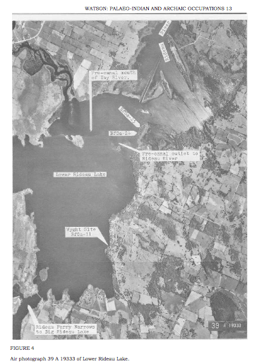
Just south of the Nation’s Capital lies the tranquil cottage region of Rideau Lakes which comprises of Westport, Perth, Portland and Newboro. This area was once part of an archeological study in the 1980s that uncovered numerous artifacts from a period of time known as the Archaic period. The Archaic period occurred between 8000-800BC, or in other words, a time that was 3,000 to 10,000 years ago. This period of history saw a significant change in climate as the giant glaciers that once covered our region receded and new deciduous trees, animals and fish began to appear in a much warmer environment.
Screen shot 2016-03-21 at 12.34.09 PM

Archeological sites from the Archaic period that uncovered numerous artifacts. (from Watson: Paleo Indian and Archaic Occupations) 

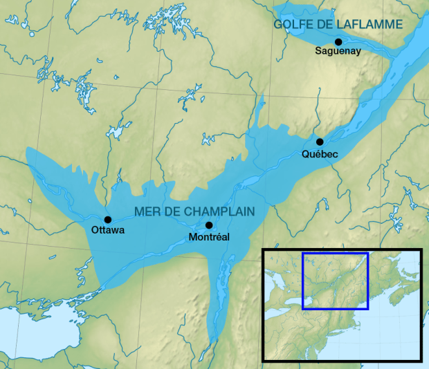
During this time after the glaciers receded, a giant body of water covered most of our region called the Champlain Sea, a vast ocean that contained whales, seals and other creatures, many of whom their remains have been found in local sand quarries. A blue whale skeleton was found in the 1800s in Smith Falls which now lies at McGill University in Montreal, and other ancient whale bones have been found in Pakenham, and even at the Ottawa Airport.
Champlain_Sea

The Champlain Sea showing the extent of its coverage. (image: Wikipedia)
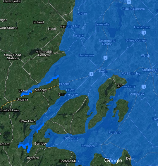
champlain sea

This composite drawing shows where the extent of the Champlain Sea and where it would have covered the region of the Rideau Lakes.
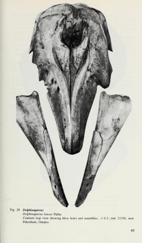
Screen Shot 2015-06-22 at 1.52.14 PM

An ancient whale skull from the Champlain Sea that once covered our area found near Pakenham, On.

Once the Champlain Sea eventually drained, people who once camped on its shore now moved into this new, warmer region and began to use stone tools, grinding and flaking them to assemble weapons for hunting in the bountiful lands that provided game, nuts and berries.

In 1990 an archeologist by the name of Gordon Watson compiled a report on some ancient objects recovered from these people south of Ottawa and determined they were from tribes that had gathered to hunt and fish on the shores of these Rideau lakes around 6000 B.C. (8,000 years ago). Rivers and lakes around here took their present conditions about 2,000 years after the retreat of the Champlain Sea. These ancient people that moved in used stone tools and copper obtained from ancient mines on Lake Superior to fashion weapons and utensils to survive in our region, for hunting and fishing in many of the same lakes we have cottages on today.
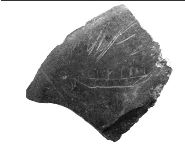
dugout

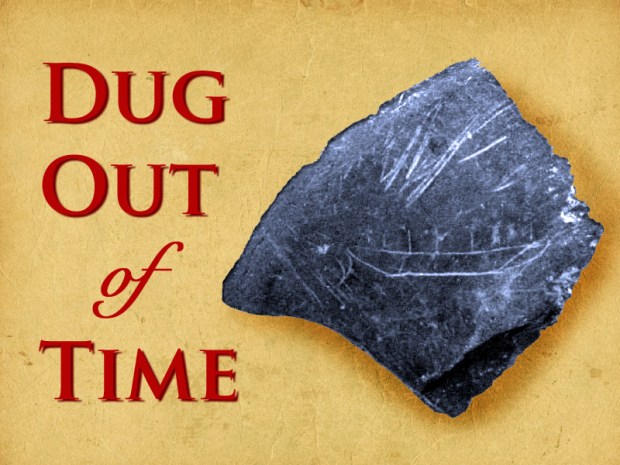
The inscribed rock that apparently shows a watercraft found in the Rideau Lakes area, presumably from the Archaic period. (from Watson: Paleo-Indian and Archaic Occupations)

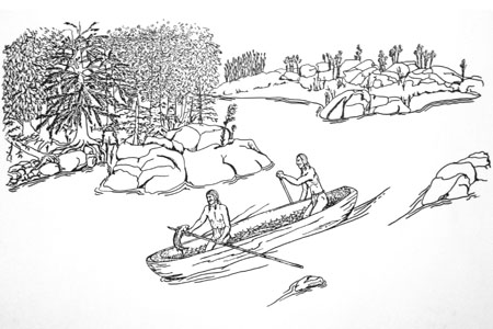
Of particular interest within these artifacts archaeologists collected in the 1980s was a rock that has an inscription of what appears to be a watercraft with 6 people in it. It was found on the surface of an ancient campsite during this archeological exploration and was discovered along with chipped stone points, ground stone axes, copper projectile points and hooks. Although it cannot be radio carbon dated as it is not an organic material, finding Archaic type ground slate tools alongside it substantiates the idea that these ancient people from 8,000 years ago had a type of watercraft of which they inscribed its image onto a rock.
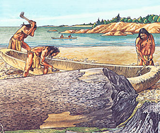
people4500

middle_archaic

Archaic people would have carved out felled trees into dugout canoes used for fishing and travelling.

They most likely built boats for fishing in these newly formed glacial lakes, canoes dug out of logs from felled trees. Hacked and carved canoes would have been used for traveling the many waterways they used for fishing and trading objects, perhaps traversing great distances to acquire objects from as far away as Ohio and the Gulf Of Mexico. A number of ancient sites near Kingston have turned up salt water exotic sea shells and metals not from this area which shows they either used watercraft to travel extensively, or other people from far away, came here.

What was found on a rock in the 1980s could very well be the first image of a watercraft in Canada, as most other representations of boats in either petroglyph form (carved rock) or pictographs (painted images on rocks) date from 2,000 years or 5,000 years ago respectfully. The current whereabouts of this fascinating 8,000 year old boat inscription is unknown, perhaps it is hidden away with other artifacts on a storage shelf in some museum, or forgotten in a lost storage bin. It would be a shame if it is locked away since it could very well be one of, if not the first, image of a Canadian boat that should be displayed proudly for all to enjoy.


Andrew King, Ottawa Rewind, April 2016

SOURCES

Click to access oa50-1-watson.pdf

http://diggingontario.uwo.ca/Archaic.html

https://en.wikipedia.org/wiki/Champlain_Sea


OPERATION PLOUGH: Top secret vehicle designed in Ottawa to take on Nazis

Ottawa has been home to a number of secret projects throughout history, from bat-like flying wings developed at the National Research Council to the world’s first UFO monitoring station, this city is no stranger to strange projects. At the height of World War 2, the Nation’s Capital was home to National Research Council classified development programs, some we may never hear about again. These classified programs included the development of atomic energy, radar technology and the lesser known development of a classified top secret vehicle to take down snow bound Nazis. Part of an elaborate plan dubbed “OPERATION PLOUGH”, Ottawa staff designed a snow vehicle that would see service in the US Armed Forces, but is rarely acknowledged as such. Here is the story of Ottawa’s top secret WW2 program to develop what is known as the WEASEL.

image

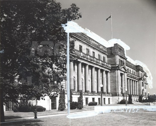
The Sussex Drive National Research Building where secret WW2 projects were developed. (photo: NRC)

During World War 2 the chief industrial threat was the creation of heavy water used in the German atomic weapon research at Rjukan in Norway. In March 1942 an eccentric British inventor by the name of Geoffrey Pyke proposed an idea called Project Plough to Lord Louis Mountbatten, Chief of Combined Operations Headquarters in England. This idea would see Allied commandos be parachuted into Norwegian mountains and establish a base on glaciers for commando attacks against the German army stationed there. These troops would be equipped with a radical new snow vehicle to disarm the Nazis and prevent Hitler from further developing nuclear capabilities. The special forces would require a snow vehicle that would be light enough to be carried in aircraft and dropped by parachute and be durable powerful and able to climb through all types of snow.

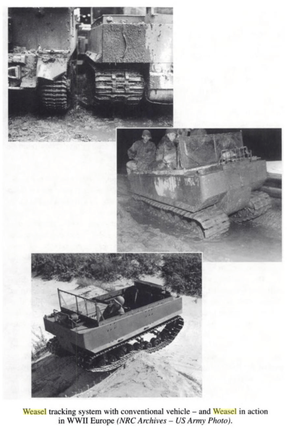
6020 M29 Weasel 02

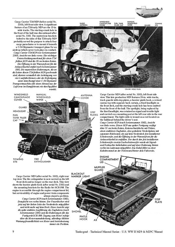
The Ottawa designed WEASEL, as produced by Studebaker in WW2.

The British realized they did not have the industry or capacity to produce a snow vehicle and called upon their US counterparts to devise this special snow vehicle. They in turn decided to call upon another ally with much experience with snow and cold: Canada.

The newly formed National Research Council in Ottawa was commissioned to work on this ambitious project due to their recent research on ski and snow science. Also of value to this special project was an employee of Ottawa’s NRC, George Klein who had developed the special ski science that focused on the interaction of snow and ice with certain materials.

Devbdepos

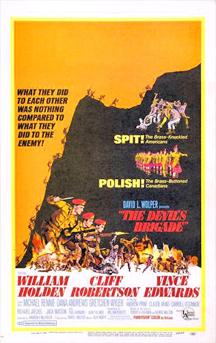
The classified vehicle developed in Ottawa was to be used by the infamous Devil’s Brigade (1968 film poster)

This top secret snow vehicle project was thus headed by Klein and the NRC in Ottawa for Operation Plough, headed by a crack commando team the “Devil’s Brigade” which comprised of elite Canadian and US personnel.  Klein and his Ottawa team would develop a secret snow vehicle called the WEASEL.

klein-klein_8

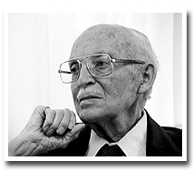
George Klein, who developed the WEASEL and would later aid in the development of the Canada Arm for NASA’s space shuttle.

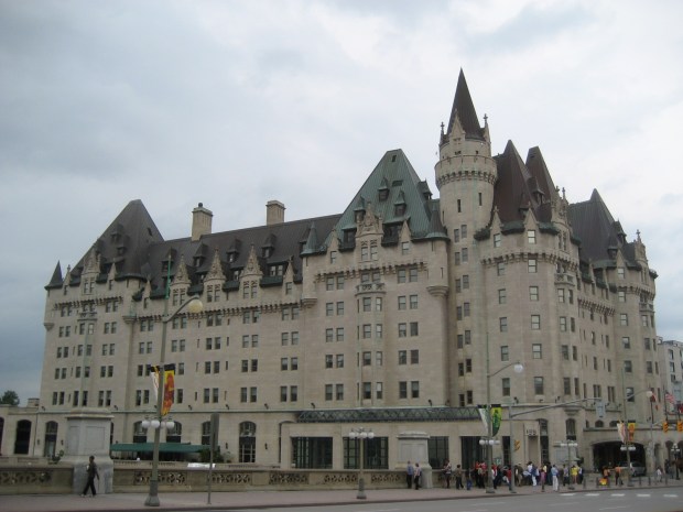
Originally  called code name PLOUGH, the vehicle was developed in Ottawa under the guidance of Mr. Klein, an inventor who would later develop the CanadaArm for NASA’s Space Shuttle, the electric wheelchair and the Canadian CANDU nuclear reactor. In June of 1942 Mr. Pyke from Great Britain came to Ottawa and both he and Klein poured over design ideas at the Chateau Laurier for this new secret snow vehicle. Klein got to work immediately and the vehicle was developed at the NRC labs on Sussex Drive in Ottawa while the Americans put together an operational training force in Montana to train in snow conditions.

Chateau_Laurier_2

Klein and Pyke drew up plans for the classified snow vehicle at the Chateau Laurier in 1942. (photo:Wikipedia)

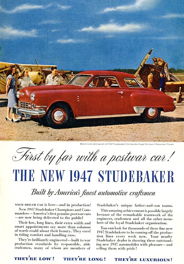
Canadians were already ahead of the game having their 1st Canadian Special Service Battalion in operation before merging with this new American task force dubbed the Devil’s Brigade. The newly formed  commando unit would require a unique WEASEL vehicle for Operation Plough in the winter of 1942-43 which gave the NRC less than 12 months to come up with a working prototype. Kevin delivered a prototype model from the Ottawa NRC research labs and the US military contracted the Studebaker Corporation to manufacture the vehicle in the numbers needed for Operation Plough. Studebaker used a Model 6-170 Champion engine, a 6 cylinder 169.6 cu in (2,779 cc) cubic inch 4-stroke engine running on 72 octane gasoline delivering 70 bhp at 3,600 rpm.

Screen Shot 2016-03-29 at 8.06.09 PM

Klein’s Ottawa design would have full tracks of rubber instead of the usual half tracks with skis and the use of all rubber wheels and rubber faced sprockets so ice and snow would not jam the mechanisms during cold operations. The Studebaker engineers went with an all metal track against Kein’s wishes and so he developed his own rubber track at the Rubber Labs here in Ottawa. After the prototype WEASELS underwent tests in the Alberta snow, the metal tracks and components iced up and it was realized that Klein’s rubber idea was needed.

cc47Studebakerad-or

US automaker Studebaker manufactured the Ottawa-born WEASEL.

Studebaker then produced 15,000 of the Ottawa born Weasels, but Operation Plough in Norway was cancelled and the unique vehicle was used instead in Normandy invasion, the swamps of the Pacific Theatre and after the war in both Arctic and Antarctic explorations where its uniquely Canadian design abilities to deal with snow and ice were put to good and reliable use.

id_m29_3_full

The WEASEL in its element carrying WW2 troops through snow.

The M29 Weasel was in service with the US Army but it is rarely attributed to being designed here in Ottawa. Perhaps for our 2017 celebrations we can have one drive down Sussex Drive in honour of the Ottawa ingenuity that has been kept modestly quiet behind Ottawa doors for so many years.

Sources

George J. Klein: The Great Inventor
By Richard I. Bourgeois-Doyle, National Research Council Canada, National Research Council Canada. Monograph Publishing Program. 2004


Ottawa’s first public timepiece is North America’s second-oldest sundial

TITLE

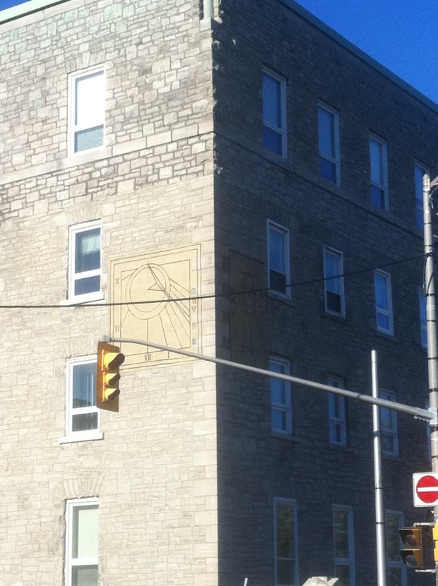
North America’s second oldest sundial and Ottawa’s first public timepiece sits largely unnoticed on a corner of Sussex Avenue.

This Sunday March 20th the Northern Hemisphere enters The Vernal (Spring) Equinox, an astronomical event in which the plane of the Earth’s equator passes through the centre of the Sun, which occurs twice a year, once in March and again in September. During this event, both day and night are of equal duration across the globe. Ancient cultures like the Mayans would celebrate the occasion by performing rights of fertility. The Norse would worship Eostre, the Norse goddess of fertility and new beginnings, symbolized by eggs and rabbits, traditional symbols of modern day Easter. In addition to these sun worshippers, Ottawa has its own ancient device that harnesses the sun…an old sundial.

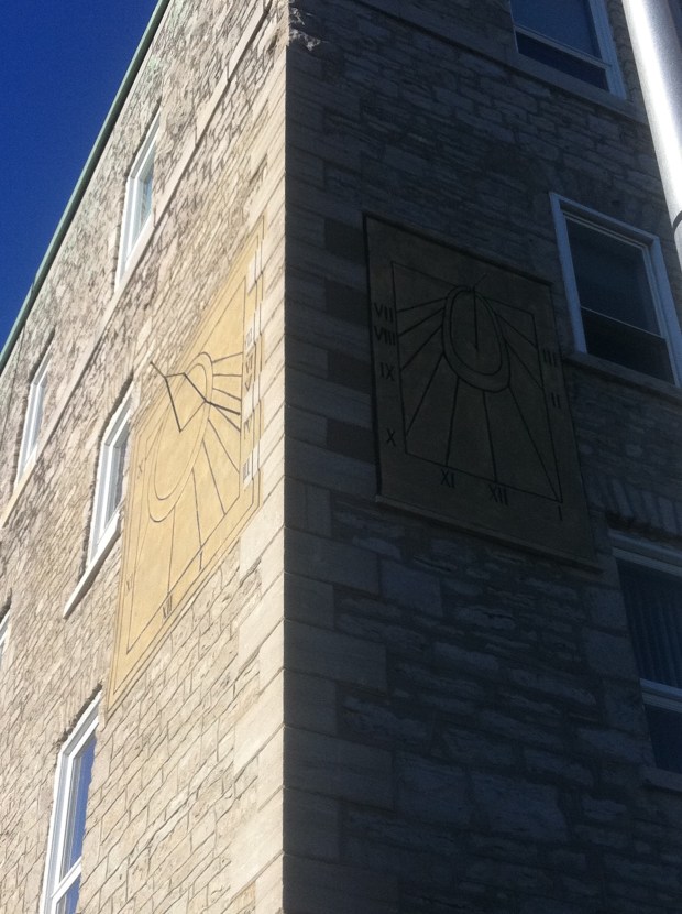
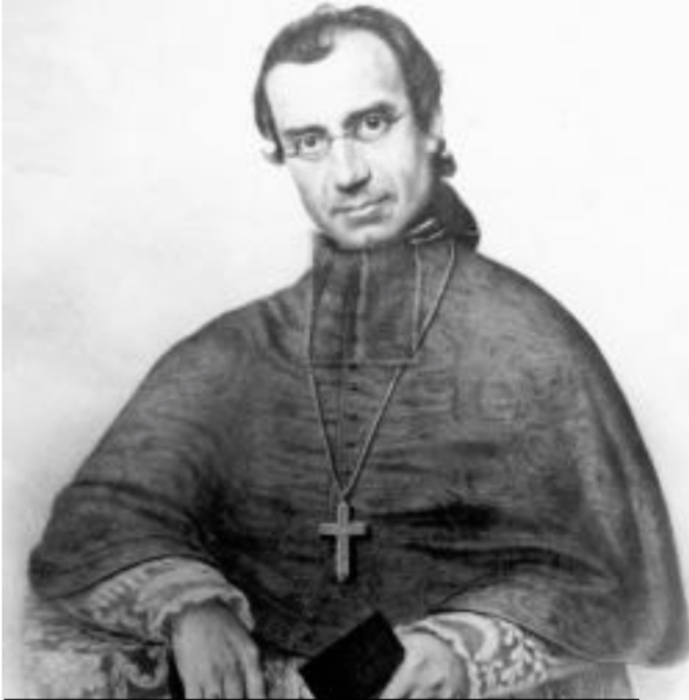
At the corner of Bruyère and Sussex in downtown Ottawa there is an unassuming marking on a building that was constructed in 1851. It is the second oldest sundial on the continent (one from 1773 in Quebec City is the oldest). Ottawa’s unique vertical sundials were built by Father Jean-François Allard, who had come from France and assigned as Chaplain to the Mother House.

Screen Shot 2016-03-16 at 12.53.05 PM

Father Allard built what is now Ottawa’s first public timepiece in 1851. (photo R. T. Bailey & Sister Louise Sequin)

Besides being a spiritual advisor to the nuns, he was a professor of Geography, Geometry and Mathematics with a keen interest in astronomy and the movement of the sun. Allard got to work designing and building the sundials on the southwest corner of the building and completed them on March 29 1851. It became the first public timepiece in Ottawa and the first of its kind in Canada.

dialmarked

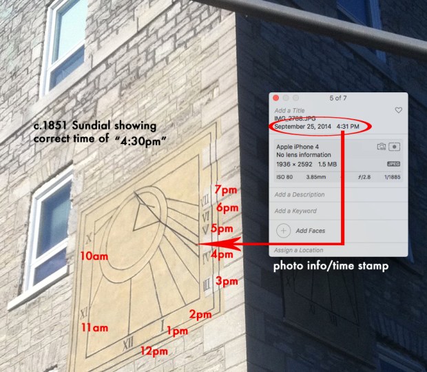
After 165 years in the sun, the dial still maintains the correct time as matched to a photo with accompanying time stamp.

The two dials, 7×8 feet on the west side and approximately 7×4 feet on the east side, use black painted iron “gnomons” that capture the shadow of the sun and mark the designated time carefully with Roman numerals. The western dial has hour lines from 10 AM to 7 PM and the eastern dial has hour lines from 7 AM to 3 PM. These dials predate the use of time zones and show local solar time and they have been giving the correct time since 1851.

Celebrating its 165th anniversary this March 29th, the modest timepiece sits quietly unnoticed in downtown Ottawa, continuing to correctly give the time to all citizens who pass by. I think it might be time to dial in some attention to this timepiece, giving it some “time in the sun” so to speak, a recognition it rightfully deserves as being North America’s second oldest sundial and the National Capital’s first public timepiece.

Andrew King, OttawaRewind.com, March 17, 2016

SOURCES

http://sundials.org

http://www.historicplaces.ca/en/rep-reg/place-lieu.aspx?id=15271

“Sisters of Charity of Ottawa Sundials” by R. T. Bailey & Sister Louise Seguin SCO, NASS, St. Louis, Aug 2008

Mystery Of The Buried Blade

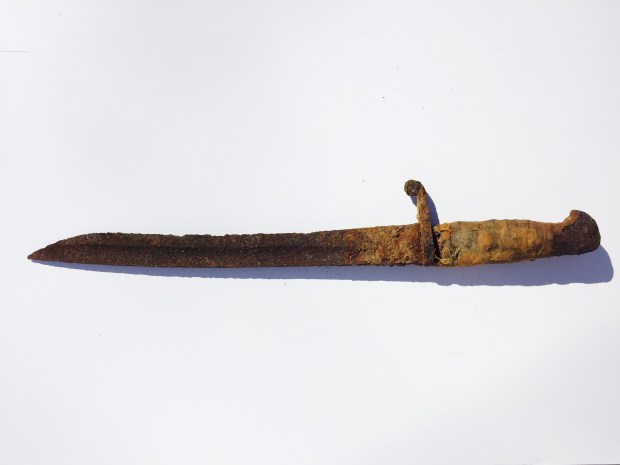
The area of Constance Bay located twenty five kilometers north of downtown Ottawa is no stranger to dramatic historical events. Previously OttawaRewind.com uncovered archeological documents revealing an ancient settlement from 500BC on its sandy shores and more recently that it was the site of a gruesome Fur Trade battle in the 17th century. From ancient times when the Ottawa River was an aqua-highway conduit used to transport copper ore from mines on Lake Superior to the Atlantic Ocean to its more modern role as a colonial outpost, the shoreline of the Ottawa River is if full of history waiting to be uncovered. That being said, it was not unusual to be contacted by a reader in Constance Bay who had unearthed a rusty sword in her garden two years ago. After contacting the War Museum without answer and knowing the area is largely unrecognized for its historical importance, I grabbed my own gear and headed to Constance Bay in search for answers to this Mystery of the Buried Blade.

THE FIND

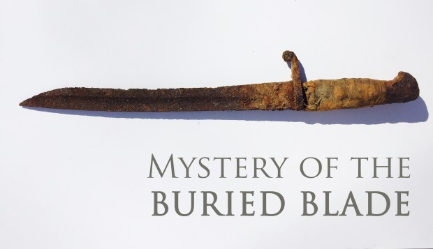
Kim and Steve Fagan of Constance Bay live a stone’s throw from the sandy beach edge of the Ottawa River, an area of significant historical action, much of it not known to the public who have been building homes and cottages along its shoreline. Two years ago while doing some gardening, Kim was shoveling a garden plot and hit something metallic. “We were digging out a garden in the front yard and we found it about 12 inches below the surface.” said Kim Fagan, who has kept the blade in her closet, unsure of what it was. Pulling out of the sandy soil a relic from another time, Fagan had no idea how or why a sword ended up in her garden. It was only after reading the article in OttawaRewind that she thought it might be something of historical importance.

FullSizeRender

The blade found buried in Kim and Steve Fagan’s front yard.

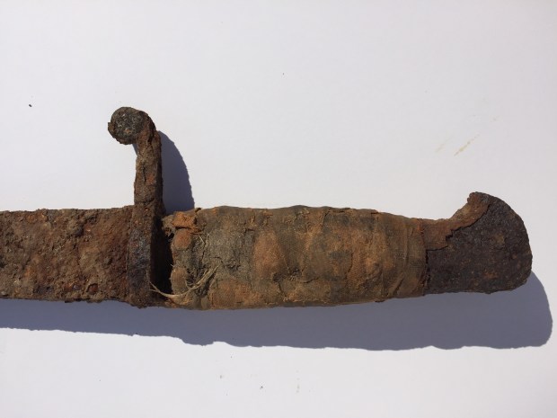
Driving the short distance to Constance Bay I examined the blade in person and noted details about its construction, noting that its shape seemed less like a sword but more like a knife blade. The hilt reminded me of old bayonets I had seen in museums. Asking Fagan to study the blade further I measured the sword to be about a half metre long with an obviously modified hilt where cloth had replaced either a leather or wooden handle that had long since disintegrated. The hilt had been broken on one side, and the blade had a curved, almost scimitar shape to it like sword blades of the Middle East.

IMG_7475

The hilt of the sword looked to be broken and once wrapped in cloth.

Comparing the photographs to various resource sites on weapon blades, it seemed more and more likely not to be a sword but rather some kind of bayonet. I narrowed my search down to antique bayonet websites that provided more of a match to the relic’s shape than any sword.

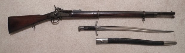
I contacted Derek Complin of bayonetsplus.com, and a member of The Society of American Bayonet Collectors for his thoughts on this buried blade. Complin, an avid collector and obvious expert on all things bayonet concurred the blade was that of a bayonet, more specifically “A British Pattern 1860 sword bayonet”. Complin explained that these were issued to troops in Canada to be used with the Snider Short Rifle. The buried blade had at one time been subjected to a shortening of its blade and “the removal of the muzzle ring, and the grips, which appear to have been replaced with a cloth binding.”

Complin speculates the buried bayonet was “sold out of service at some point, or perhaps left service along with a retired soldier, and was modified or adapted for less warlike use.”

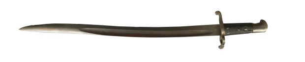
Researching more about this idea of it being a bayonet, I found that the unearthed blade matches almost perfectly the size and shape of the British Victorian Volunteer P1860 Short Rifle/Snider Sword Bayonet just as Complin theorized. Using photos of the original and superimposing them overtop the rusted old blade, the match was undeniable perfect. It was a modified bayonet blade from the 1860’s, once paired to a Snider/Enfield short rifle first issued to Canadian forces in 1867. A shipment of 30,000 of these rifles arrived from Great Britain in August of that year.

comp1swordcompghost

comp2sword

The original 1860 yataghan sword bayonet compared to the buried blade shows an exact match. (top photo Derek Complin)

This bayonet was based on the North African and Middle Eastern Yataghan swords, with their distinctive curved blades. Why that odd shape was chosen is unclear but some think the curve ensured that the blade was out of the bullet trajectory when it was attached to the end of the rifle. The bayonet was only issued for the Snider SHORT rifle, which in turn, was issued only to Sergeant’s and higher ranking officers in the Canadian Militia of that time.

ShortSniderMark3

The Snider/Enfield Short rifle and the bayonet sword issued with it to the Canadian Militia in 1867. (photo britishmilitariaforums.yuku.com)

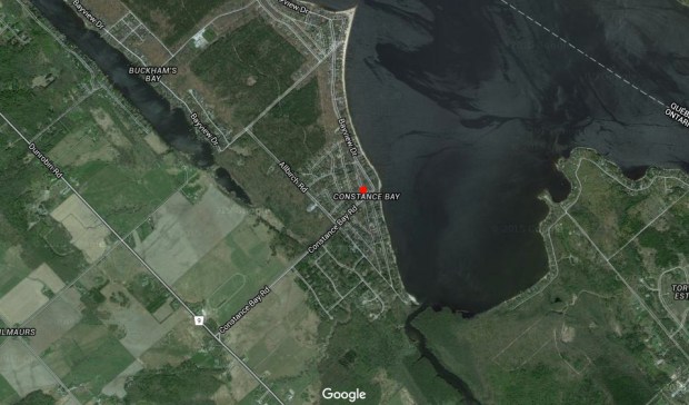
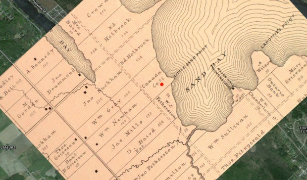
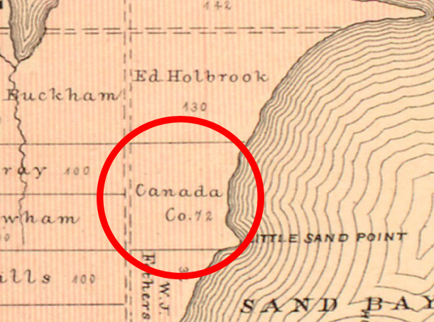
How the bayonet became buried in the sands of Constance Bay is open to conjecture, but a study of an 1880 map shows the land of the current Constance Bay village was once property belonging to the Canada Company. The Canada Company was a large private chartered British land development company, to aid in the colonization of Upper Canada. The Canada Company helped emigrants by providing safe ships, low fares, implements and tools, and inexpensive land. The company surveyed and subdivided crown land areas, built roads, mills, and schools and advertised it to buyers in Europe. The company then brought new settlers to these area by means of a boat, which the company also owned.

conbaycomp1mapconbaycamp2map

conbay1880closeupmarked

An 1880 map of the area shows the land that is now the village of Constance Bay was once owned by the Canada Company. (red dot is where blade was found)

Perhaps the buried bayonet was part of a settler’s tools in a new land, or maybe it was a lost relic of a military operation in that area that was forgotten and buried over time. The Fagans have no plans for the 150 year old weapon but said they’d be “happy to donate it to a museum if they want it.”

compghost

The possibilities of how a modified 19th century bayonet became buried on the Fagan’s property remains open to the imagination, but we can be sure that this was once a military bayonet yataghan sword used by a higher ranking member of the Canadian Militia. Perhaps it was modified and used as a tool for carving out a new life in the unsettled wilderness north of the newly formed Nation’s Capital, or part of some other more nefarious business. Whatever the case may be, the area of Constance Bay continues to provide significant relics of our past that lie buried in the sands of time.

Andrew King, OttawaRewind.com 2016

Special thanks to Kim & Steve Fagan of Constance Bay and Derek Complin who graciously offered their time and information for this post.

SOURCES

bayonetsplus.com

https://en.wikipedia.org/wiki/Canada_Company

https://en.wikipedia.org/wiki/Yatagan

http://britishmilitariaforums.yuku.com/topic/13496#.Vt3zLoRiNBy

Google Maps

McGill Digital Atlas Project.

Ottawa’s Sealed Mid-Century Underground Tunnel


IMG_7207

Before security and safety issues were of concern, Ottawa had a number of publicly accessible underground tunnels that allowed residents to escape the frigid above-ground winter temperatures and move about in conditioned comfort.

The most famous of these underground tunnels is probably the one that links The Chateau Laurier with the old Union Station, once connecting train passengers to the hotel without ever having to step outside. Now closed to the public, this tunnel will most likely never be accessible again after the old tunnel becomes part of the new Senate Building. Accommodating  the Senate chamber while the Centre Block undergoes major rehabilitation work, it is expected that the Senate will remain there for up to 10 years.

Screen shot 2016-02-15 at 4.09.37 PM

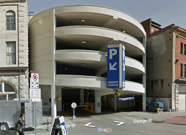
The former Freiman’s Parkade where the subterranean tunnel was accessed. (Google Streetview)

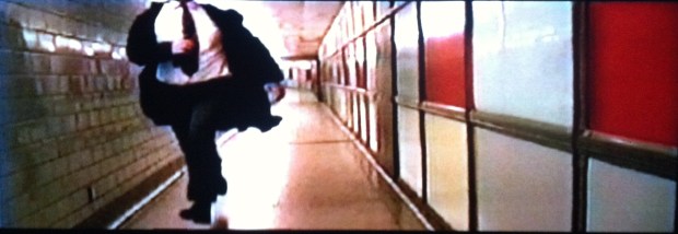
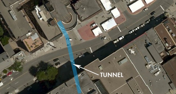
A lesser known tunnel under Ottawa is a sealed mid-century tunnel that once connected Freiman’s Shopping Mall (now Hudson’s Bay) to their own Parkade facility on George St. This tunnel was closed sometime in the early 2000’s but I was fortunate enough to record the tunnel on video back in 1999 when I filmed a chase scene for a short film I was working on.

tunnelMARKED

Having recently stumbled across the closed off entrance in The Bay basement while looking to buy a Hudson’s Bay wool blanket to escape the cold, I was reminded to dig out the old VHS tape that documents this tunnel also used to escape the cold.

photo

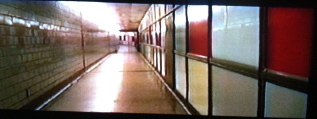
The now sealed entrance to the tunnel from The Bay that is now used for storage. Note the painted over coloured acrylic panels.

The tunnel is actually a phenomenal piece of mid-century architecture, utilizing materials and an aesthetic that provides a unique glimpse back to mid-century shopping conveniences. Resembling a colourful set piece from the TV show “MadMen” I dusted off the poor-quality VHS tape of the tunnel and have posted this piece of subterranean history below.

IMG_7211

BACKGROUND

On November 4 1959 Freiman’s Department Store opened their “ultra modern” parkade on George street, a Guggenheim museum inspired spiral parking garage that linked to their store across the street by an air-conditioned and heated tunnel. In a ribbon-cutting ceremony that saw the Mayor and other community leaders attend, guests toured through the 231 foot tunnel that was finished in glazed subway tiles and a kaleidoscope of coloured acrylic panels that also acted as storage compartments for seasonal store decorations in Freiman’s.

IMG_7206

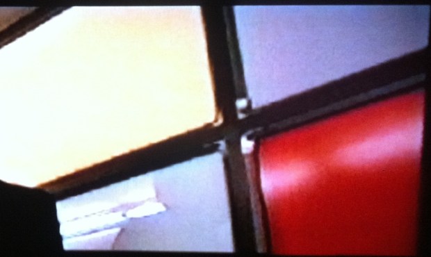
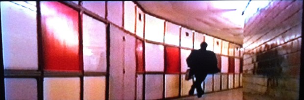
A still from the film that shows the coloured panels and storage area behind them.

After Freiman’s department store was acquired by the Hudson’s Bay Company in 1972, the tunnel remained opened and in service until sometime in the early 2000’s, probably just after 9-11 when security concerns likely forced the tunnel to close.

Screen shot 2016-02-09 at 7.42.34 PM

Screen shot 2016-02-09 at 7.41.37 PM

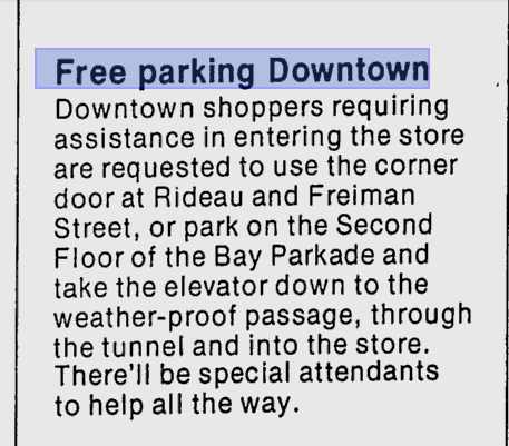
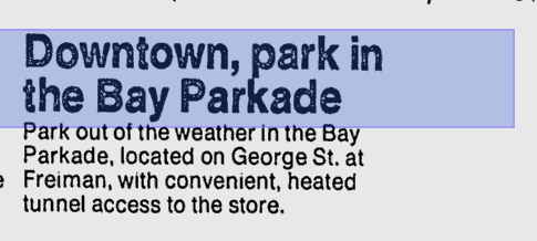
Ads in the newspaper entice shoppers to use the “weather-proof” passage. (GoogleNews)

It has remained sealed since then, and The Bay has closed off the tunnel entrance and used the area for storage but the original 1959 illuminated sign can still be seen. The entrance from the Parkade side has also been sealed and locked.

With this unique time capsule of a tunnel forgotten below the city, lets take a closer look with some stills of the scene filmed there in 1999. If you would like to see the full film clip of the tunnel chase scene you can see it here.

IMG_7209

The 231 foot length of the tunnel was finished in glazed tile and multi-coloured acrylic panels.

IMG_7212

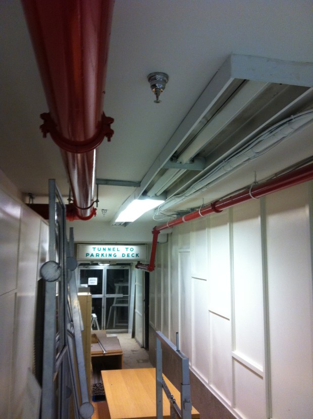
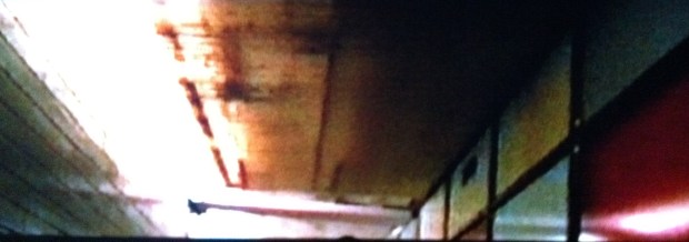
The ceiling of the tunnel was a typical 1959 tunnel ceiling with odd pipes and eerie clinical fluorescent lighting.

SOURCES

Google Maps Streetview

Ottawa Journal

Ottawa Citizen

Bing Maps

PARLIAMENT ILLUMINATED


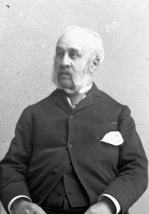
parliamentillumToday marks the 100th Anniversary of Canada’s original Parliament Buildings being destroyed in a fire that swept through the structure on February 3 1916. All that remains today of the original Parliament structure is the Library of Parliament, a unique round building at the rear of the current Centre Block. Designed by Thomas Fuller, an architect and member of the Freemasons, the original buildings have a unique connection to an ancient Order and their secret symbology.
thomas_fuller_canadian_architect

Thomas Fuller, architect of the original Parliament Buildings and Freemason.

The unusual characteristics of our original Parliament buildings designed by Fuller constructed in 1860 have already been examined in a previous post, the “Knights Templar and Canada’s Parliament Buildings” . The connection to the ancient order of Knights Templar and the Freemasons was exposed but now we will look closely at a new connection to that of the Eye Of Providence, the most notable depiction of this eye being on the reverse of the Great Seal of the United States, which appears on the United States one-dollar bill.

BACKGROUND

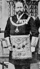
The original Parliament buildings began their construction September 1 1860 when The Prince Of Wales, later to become King Albert Edward, a known member of Freemasonry, presided over the Masonic ritual of laying the cornerstone of the Parliament Buildings. The Masonic Ceremony included The Prince Of Wales and Fuller exchanging Masonic vows while lowering the ceremonial stone. In 1875 Albert Edward became Grand Master of the Convent General of the Knights Templar.

founda1

Prince Albert, shown here in Freemason attire, presided over the ritual of laying the cornerstone for Parliament.

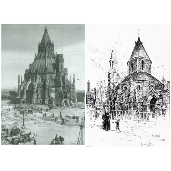
The Library of Parliament shares an uncanny resemblance to the Temple Church of the Knights Templar built in 1185 in London, perhaps a coincidence but with Fuller’s connection to Freemasonry and their subsequent link to the Templars, it seems unlikely.
IMG_6428

Comparison of the lone surviving Library of Parliament on the left (c.1860) after the fire of 1916 and on the right, the Templar Temple Church in London (c.1185)

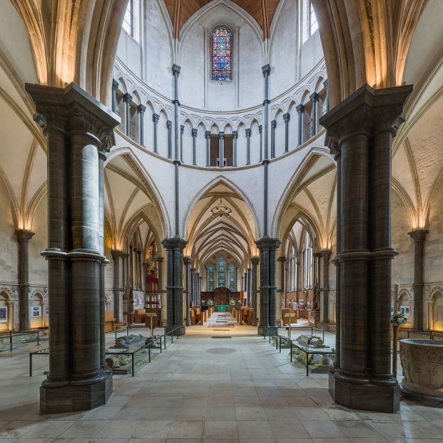
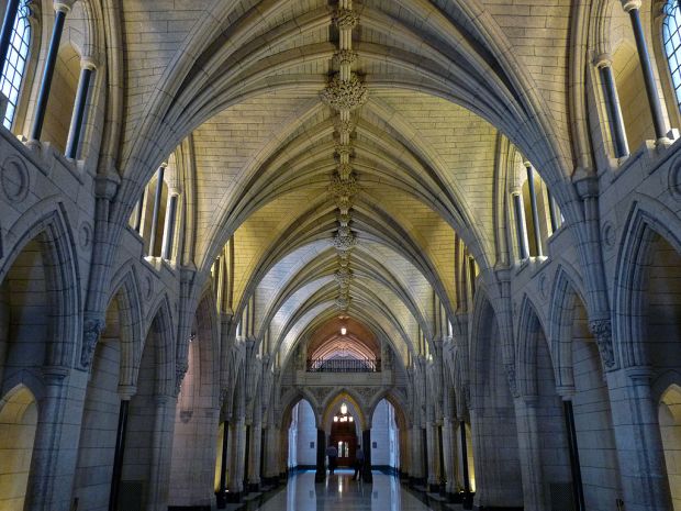
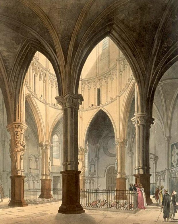
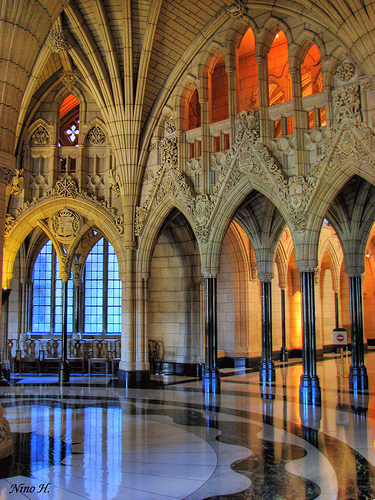
To have the exterior of the Parliament Library resemble a Templar church is one thing, but to have our Parliament INTERIOR also match Templar architecture is another. The interior of the Parliament buildings compared to the interior of Templar churches are shown below.
1024px-Temple_Church_5,_London,_UK_-_Diliff

Interior of Knights Templar temple church, London, 1185AD.

1024px-Hall_of_Honour-Centre_Block-Ottawa

Interior Hall Of Honour, Centre Block of Parliament, Ottawa. 

Temple_Church_edited

Interior chamber Templar church, London 1185AD.

IMG_6426

Interior Parliament Buildings, Ottawa. 

The influence of the Knights Templar and Freemasonry has also been connected to the Eye of Providence on the Great Seal of the United States, which appears on the United States one-dollar bill. This eye in a triangular shape above an unfinished pyramid was adopted as part of the symbolism on the reverse side of the Great Seal in 1782.

Dollarnote_siegel_hq

The Eye of Providence as part of the Great Seal on the reverse side of the U.S. One dollar bill.

It was first suggested as an element of the Great Seal by the first of three design committees in 1776. The use of the same symbol within Freemason symbology dates to 1790 and of all the members of the various design committees for the Great Seal, only Benjamin Franklin was a known Freemason.

IMG_0764

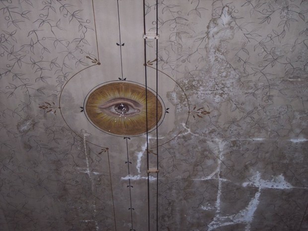
The “All Seeing Eye” symbol used in a 19th century Freemason hall. 

Now in 1860 when the Parliament Buildings began construction in Ottawa under Fuller, the symbology of the ancient Order seems to have made its way into Canada’s original centre tower as we will see below…

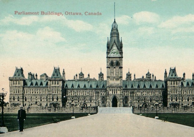
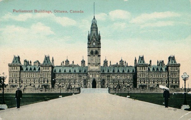
OriginalCentreBlockPostcard

The original 1860 Parliament Buildings as built by Fuller before the 1916 fire.

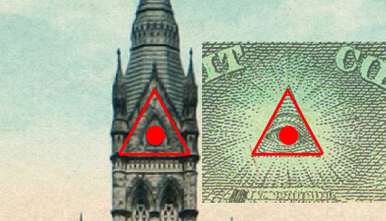
comp1

Zooming in on the original tower in comparison to the Eye Of Providence. 

comp2

Superimposing the Eye of Providence over the original tower and clock we see the two match perfectly.

comp4

The “eye” aligns perfectly to the original round clock, the triangle is also a perfect match with all respects to angles and proportions. 

One could argue that this is pure coincidence, and that Canada’s original Parliament building was in no way meant to incorporate the Freemason symbol and Eye Of Providence. But as I am learning, there seems to be a deeper meaning as to why things are designed a certain way.

On this 100th Anniversary of the fire that destroyed the original building, look closely at what other symbols can be found in buildings designed by Fuller and their connection to an ancient order that is still operating among us today.

SOURCES

https://en.wikipedia.org/wiki/Centre_Block

https://en.wikipedia.org/wiki/Temple_Church

https://en.wikipedia.org/wiki/Eye_of_Providence

Constance Bay Revenant

The 17th Century Fur Trade On The Ottawa River was just as gory as The Revenant…

The recently Oscar nominated film “The Revenant” follows the exploits of colonial fur traders in the American mid-west and the ensuing conflicts with native people whose land they encroach upon. The film explicitly conveys the harrowing battles between the  fur traders and native warriors through gruesome tactics and fights to the death. It may seem like a distant part of the past that occurred in a distant part of the United States wilderness but in fact, equally gruesome fur trade battles happened right here in Ottawa on the banks of the mighty Ottawa River, the superhighway of fur trade in the 17th and 18th centuries. One such battle happened just a few kilometres north of the city in Constance Bay. 

warpartymarked

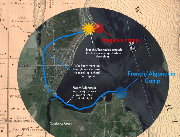
The site of a bloody battle during the fur trade era on the shore of the Ottawa river.

Originally published in a 1909 edition of  The Ottawa Naturalist (Vol. XXIII, No. 4: 61-68 & Vol. XXIII, No. 5:92-104) author and early local historian T. W. Edwin Sowter heard a story one night while camping at Chats Falls near Fitzroy Harbour on the Ottawa river, and, though far in the past for him in 1909, the tales of the “Indians” and the bloody battles that occurred on the sands of the Ottawa prompted him to record and publish a gruesome verbal tale of the Fur Trade from the latter part of the 1600’s at Constance Bay.

Suzor_Cote_-_Coureur_des_Bois_-_Artefacts_Canada.32874209_std

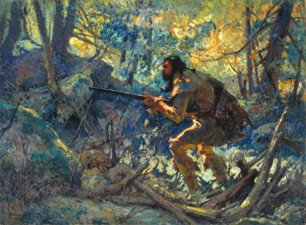
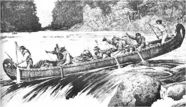
The French allied with the Algonquin/Hurons against the Iroquois along the Ottawa River. (painting by Marc-Aurele de Foy Suzor-Cote)

Constance Bay is a body of water about half an hour’s drive north along the Ottawa River, a quaint community of cottages and monster waterfront homes, but unbeknownst to many is the fact the area was the scene of a bloody battle as depicted in The Revenant film. A spit of land known as Big Sand Point, a sandy beach area now lined with cottages, was once scattered with the bones of “Indian warriors” as the author Sowter describes, and who actually uncovered skeletal remains and associated battle relics within the sands.  Sowter tells of a war-party of Iroquois warriors who, having taken possession of big Sand Point at Constance Bay, defended themselves to the death against a force of French and Algonquins, “who surprised them in a night-attack and butchered them all.”

Algonquins

Algonquins. (Wikipedia)

The Iroquois and Algonquin/Huron tribes were enemies at the time, “a time when fierce conflict was bred from a desire to mercilessly destroy the other in a campaign of extermination.” Sowter describes how the Ottawa River portage areas were dangerous, full of war-parties of natives who held these places with a “toll with the tomahawk and harvested with the scalping-knife the fatal souvenirs of conquest.”

Screen Shot 2016-01-18 at 8.02.19 PM

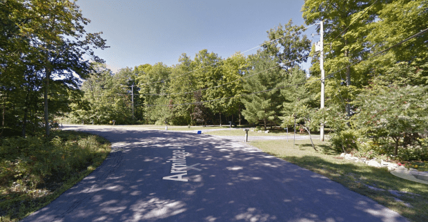
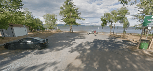
The site of the French camp as it appears today. (GoogleStreetView)

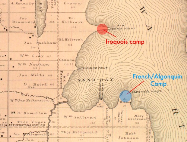
The area of Sand Bay, at the outlet of Constance Creek, has two opposing points of land across the bay, Big Sand Point to the NorthWest and a place called Pointe à la Bataille, now called Horseshoe Bay off Armitage Drive. The two points are about a mile apart with the outlet of Constance Creek almost in the middle.

battlelines1

A map from 1880 shows the areas where the enemies were camped. (McGill Digital Atlas)


According to the story told by Sowter, a party of French fur-traders, together with a number of friendly natives set up a camp on Pointe à la Bataille. They lit their fires, cooked their meals and rested after a long journey along the Ottawa River in their canoes. The night was not to be restful however, as the campers noticed a glimmer of fire across the bay. A reconnaissance party was sent out and it was determined a large war-party of Iroquois were in a barricaded encampment at Big Sand Point. The French and Algonquins knew they would probably also soon be discovered and realized that the Iroquois camp, with its fierce warriors, would soon inflict a horrific attack on their own camp.

ottawa-river-route-5

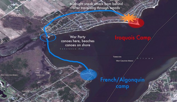
The French/Algonquins knew it was either “us or them” so they devised a plan to attack them first. The French were outnumbered and decided not to enter into diplomatic relations with the enemy who would surely torture and kill them. It was decided they would attack them in their sleep under the cover of darkness. Sowter recounts how the French and their allies knew very well that “if their plans miscarried and the attack failed, the penalty would be death to most of their party, and that, in the event of capture, they would receive as fiery and painful an introduction to the world of shadows as the leisure or limited means of their captors might warrant.”

It was near midnight, the  French attacking party left their camp at Pointe à la Bataille and quietly paddled their canoes over to Constance Creek where they ditched them and headed into the surrounding forest. I have personally visited this site and it is still quite a forested wilderness with the distinct possibility relics from this battle are still to be found, hidden for centuries under the cloak of time.

Screen Shot 2016-01-18 at 8.06.08 PM

The site of the bloody battle is now a quiet beach area. (GoogleStreetview)

Taking a long detour through the forest now known as Torbolton Forest, owned by the City Of Ottawa, the attack proceeded to reach behind the enemy enabling the French and their allies to rush the enemy barricades from the rear while sentries and guards were positioned on the shore of the river.

CbayAttack

The French and their allies then swept upon the unsuspecting Iroquois with devastating effect as Sowter explains, “Many of the Iroquois died in their sleep, while the rest of the party perished to a man, in the wild confusion of a midnight massacre.” A grim attack that shed the blood of men onto the sands of what is now a peaceful cottage community.

Sowter later visited the site of this gruesome attack and uncovered “the bones that are found in the drifting sands at that place” and discovered “the remains of friend and foe who fell in that isolated and unrecorded struggle.”

So, if you happen to visit that area or live there, keep an eye out for the lost relics of a bloody attack on the shores of Constance Bay, a part of our Ottawa River fur trade history that rivals that of any Hollywood movie.

SOURCES

https://en.wikipedia.org/wiki/Algonquin_people

http://www.historymuseum.ca/cmc/exhibitions/archeo/sowter/1909/sowter1909e.shtml

BING MAPS

GOOGLE MAPS

McGill Digital Atlas

Raiders Of Antarktika: Secret WW2 Nazi mission exposed on WikiLeaks

splashpage

In the 1981 Steven Spielberg film “Raiders Of The Lost Ark”, Indiana Jones pursues Nazis who have recovered the Ark of the Covenant, a religious relic with great powers. The plot of the film was created and written by screenwriter Philip Kaufman who based it on Adolf Hitler’s World War II obsession with recovering supernatural religious artifacts, including his supposed possession of the ‘Spear Of Destiny’.

A new Indiana Jones adventure in Antarctica?

A new Indiana Jones adventure in Antarctica?

Used by the Roman centurion Gaius Longinus to pierce the side of of Jesus upon the cross during his crucifixion, Hitler obtained the relic and later knowing the end of the Third Reich was near, German U-boats were supposedly loaded up with Nazi treasure including the Holy Lance and spirited away to a secret base in Antarctica. A story perhaps worthy of another Indiana Jones film, but upon further research in to this fantastical claim it turns out there actually was a secret Nazi mission to Antarctica. A recent WikiLeaks Document (10.1017/S003224740600578X) exposes a 2006 report that explains in great detail the very real…

RAIDERS OF ANTARKTIKA

Published in 2006 by the Scott Polar Research Institute and written by Colin Summerhayes from the University of Cambridge and a Canadian who does corporate research in predictive trend analysis, Peter Beeching, the expose entitled “Hitler’s Antarctic base: the myth and the reality” explains in great detail the actual events of a Nazi expedition to Antarctica, the supposed secret WW2 British task force sent to flush them out, the mysterious disappearance of German U-boats after the war, their appearance in Argentina months after the German surrender, a subsequent post war operation by the United States and the mysterious detonation of nuclear weapons in the sub-continent. It is all quite marvellously unbelievable, and after sifting through the information, some startling evidence brings to light what seems to be a real-life Indiana Jones movie.

The area of Antarctica surveyed by the secret Nazi expedition in 1939.

The area of Antarctica surveyed by the secret Nazi expedition in 1939.

THE FACTS

With much conspiracy speculation swirling around, it is hard to isolate what actually happened in Antarctica and what the Third Reich was actually up to there. According to the WikiLeaks report there is concrete evidence that the Nazis did indeed conduct a secret operation in Antartica in 1938-39 under the guise of a “scientific operation” but it was in fact a survey mission to claim parts of the relatively unknown continent for Germany.

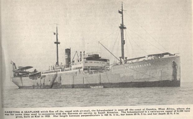
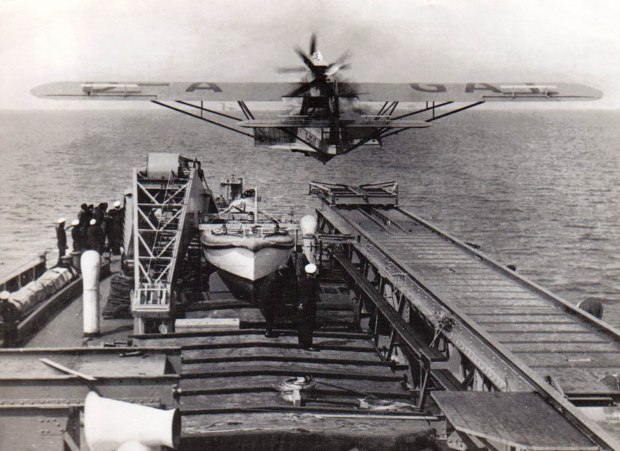
The Schwabenland ship used in the 1939 expedition with the Lufthansa seaplanes that were catapulted off the ship.

The Schwabenland ship used in the 1939 expedition with the Lufthansa seaplanes that were catapulted off the ship.

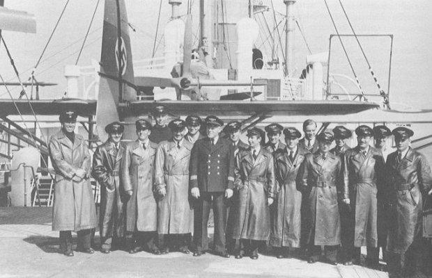
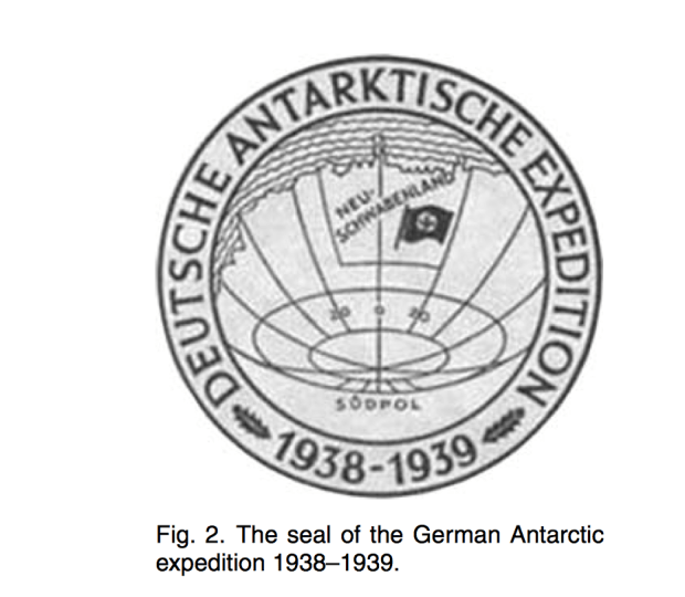
This expedition was organized to claim a piece of Antarctica for Germany and to find a place suitable for a whaling fleet. Authorized by Herman Goering as part of the German four-year plan for economic development, on 17 December 1938 the “New Swabia Expedition” left Hamburg for Antarctica aboard the MS Schwabenland, an expedition with 33 members plus the Schwabenland’s crew of 24.

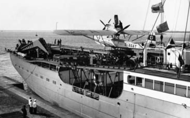
Dornier Do 15 seaplanes aboard the Nazi expedition ship.

Dornier Do 15 seaplanes aboard the Nazi expedition ship. (photo: WikiLeaks)

The Nazi Antarctica expedition members aboard the Lufthansa ship during the 1939 operation.

The Antarctica expedition members aboard the Lufthansa ship during the 1939 operation.

MS Schwabenland was a German catapult ship owned by the Deutsche Luft Hansa company (the predecessor to the modern day airline Lufthansa, but legally not associated). The Cambridge document publishes very rare photos of this Nazi expedition and the aircraft used to claim parts of Antarctica when they arrived in January 1939. Survey “bombs”, aluminum cylinders emblazoned with the Nazi swastika were air dropped from the Lufthansa Dornier D15 seaplanes launched by catapult from the Schwabenland ship.


The Dorner Do15 seaplane being catapulted off the ship for the Nazi landing in Antarctica.

The Dorner Do15 seaplane being catapulted off the ship for the Nazi landing in Antarctica. (photo: WikiLeaks)


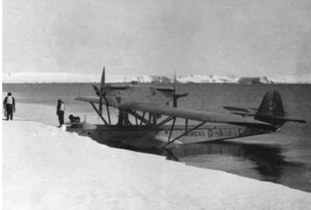
One of the German Dornier sea planes arriving on the ice shelf of Antarctica.

One of the German Dornier sea planes and pilots arriving on the ice shelf of Antarctica. (photo: WikiLeaks)

Altogether the Nazi expedition flew over hundreds of thousands of square kilometres and took more than 16,000 aerial photographs, some of which were published after the war along with colour photographs of the operation. This indeed actually happened and to this day those 1939 survey markers are probably still there buried under the ice in Antarctica. Germany made no formal territorial claims to New Swabia, and no whaling station or other lasting bases were apparently built there. Yet, the myth continues perhaps in part to the 1943 statement by Admiral Donitz of the German Navy who said “The German submarine fleet is proud of having built for the Fuhrer, in another part of the world, a Shangri-La on land, an impregnable fortress.”

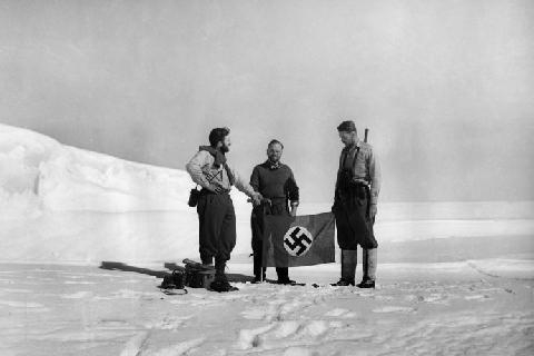
The Nazi flag being placed on Antarctica. 1939. (photo: WikiLeaks)

The Nazi flag being placed on Antarctica during the secret expedition. 1939. (photo: WikiLeaks)

Screen Shot 2015-08-13 at 8.45.47 PM

OPERATION TABARIN

It is now known that during WW2 another expedition was sent to Antarctica, but this time the British sent in a team under the name OPERATION TABARIN, perhaps to flush out any Axis bases since the Kriegsmarine (German navy) was known to use remote Antarctic islands as rendezvous points, and for sheltering U-boats and supply ships.  Unknown to Churchill at the time and led by Lieutenant James Marr, on Saturday January 29, 1944 a team of 14 from the Admiralty and the Colonial Office left the Falkland Islands in two ships, HMS William Scoresby and Fitzroy, for Antarctica. The British operation saw the first ever bases to be constructed in Antarctica completed.

THE COLLAPSE OF THE NAZIS AND THE MYSTERIOUS MISSING UBOATS

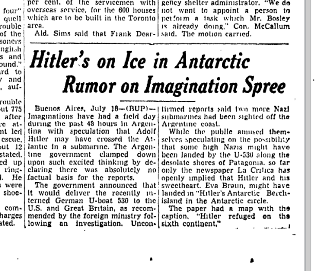
After the defeat of the Nazis, Admiral Donitz, Hitler’s successor after his death, gave the order for all U-boats to surrender to Allied forces. Almost all did except for U-530 and U-977, two German subs that vanished for two months after the official surrender, but later appeared in an Argentinian harbour, one without log books and missing crew lists. Speculation arose, and the Toronto Star even published an article “Hitler’s On Ice in Antarctica”.

a 1946 article in the Toronto Star about the theory Hitler escaped with treasures to Antarctica. (GoogleNews)

A 1945 article in the Toronto Star about the theory Hitler escaped with treasures to Antarctica. (GoogleNews)

Reports began to circulate that Hitler knowing his imminent demise had ordered documents and artifacts loaded aboard U-boats to take them to Antarctica under “Project Valkyrie 2”. A book by Nigel Braddon “The Mystery Of U-33: Hilter’s Secret Envoy” describes how four lead lined bronze boxes were loaded aboard the U-boats and ordered to cache them in Antarctic caves.

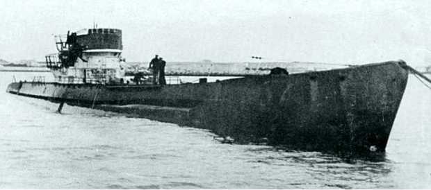
The surrendered U-boat U-530 after arriving in Argentina two months after the war's end.

The surrendered U-boat U-530 after arriving in Argentina two months after the war’s end.

U-530 did go missing after the war, her captain, Oberleutnant Otto Wermuth, had decided to surrender in Argentina but did not explain why it had taken him more than two months to reach there, nor why the submarine had jettisoned its deck gun, or why the crew carried no identification, nor what had happened to the ship’s log. After interrogation and explanation of the reasons behind the delayed appearance in Argentina, the German sub was taken by the US Navy and sunk during target practice in 1947.

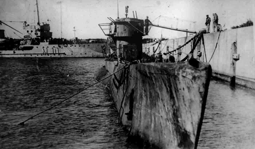
U-977 after surrennder in Argentinian harbour 99 days after the end of the war.

U-977 after surrennder in Argentinian harbour 99 days after the end of the war.

The other sub, U-977 left for waters south after the war with its captain, Oblt.z.S. Schaffer, deciding to sail to Argentina rather than surrender. The U-boat made various stops along the way and later Schäffer wrote a book: U-977 – 66 Tage unter Wasser (“U-977 – 66 Days Under Water”), the first postwar memoir by a former U-boat officer. That sub was also sunk by target practice by the US Navy in 1946.

OPERATION HIGHJUMP

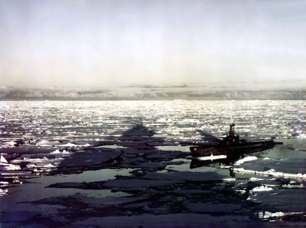
The WikiLeaks document continues to explain the various conspiracies surrounding stories of a Nazi base in Antarctica and tells of a very real US task force sent there in 1947 under the code-name OPERATION HIGHJUMP, officially titled The United States Navy Antarctic Developments Program. In 1946–1947, the United States Navy organized an operation by Rear Admiral Richard E. Byrd Jr. with Task Force 68, an operation involving 4,700 men, 13 ships, and 33 aircraft.

A US sub in Antarctica waters as part of Operation Highjump. (photo: Wikipedia)

A US sub in Antarctic waters as part of Operation Highjump. (photo: Wikipedia)

Operation Highjump’s primary mission was to establish an Antarctic research base. Another US led task force returned in 1947 under the code-name Operation Windmill, the United States Navy’s Second Antarctica Developments Project, an “exploration and training mission”.

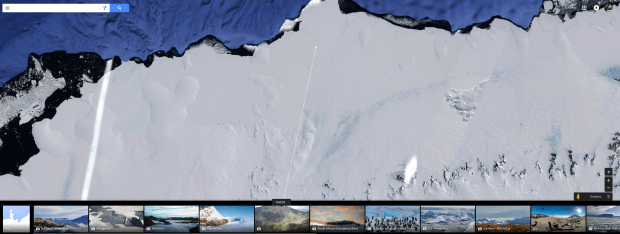
A Google Earth image showing the area surveyed by the German expedition 1939.

A current Google Earth image showing the area surveyed by the German expedition of 1939.

CONCLUSIONS

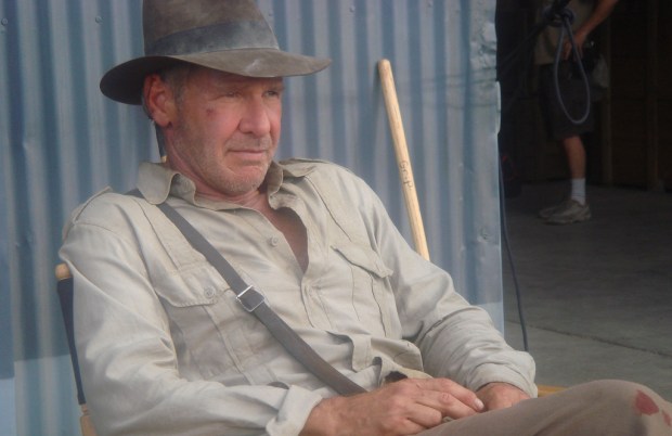
The extensive report by Summerhayes and Beeching seems to successfully disprove any notion of an “Antarctica Conspiracy” and thoroughly researches all angles of the Nazi connection and the post-war military operations. You can read the full document here. Peppered amidst the snowbanks of speculation are flakes of truth, and even though its likely fiction, a secret Nazi submarine base in Antarctica certainly makes for a good script to propel Indiana Jones back to the big screen in a unique new adventure. Below are some composite photographs based on these stories that bring that idea to life in Indiana Jones and the Raiders Of Antarktika.

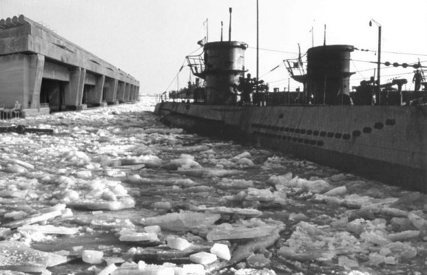
A secret U-boat base built on the shore of Antarctica. (NOTE: fictional composite photo)

A secret U-boat base built on the shore of Antarctica. (fictional composite photo)

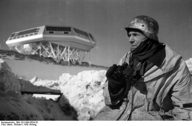
A german soldier keeps a look out for Indiana Jones at a remote Antarctic outpost. (NOTE: fictional composite photo)

A german soldier keeps a look out for Indiana Jones at a remote Antarctic outpost. (fictional composite photo)

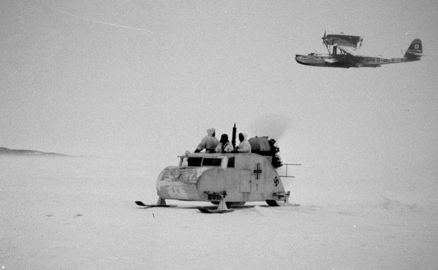
German tracked snow vehicle on patrol for Indiana Jones with a Dornier seaplane above. (Note: fictional composite photo)

German propellor powered snow vehicle on patrol for Indiana Jones with a Dornier seaplane above. (fictional composite photo)

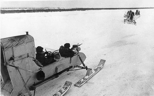
German Aerosleds take chase after Indiana jones successfully retrieves the lost Spear Of Destiny.

German Aerosleds take chase after Indiana jones successfully retrieves the lost Spear Of Destiny.

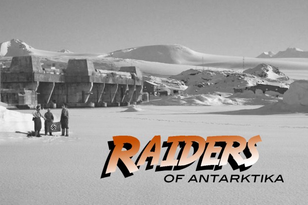
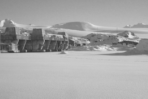
A concrete Nazi bunker constructed on Antarctica contains secrets yet to be exposed. (Note: fictional composite photo)

A concrete Nazi bunker constructed on Antarctica contains secrets yet to be exposed.  fictional composite photo)

The arrival of Indiana Jones brings out a welcoming party on Antarctica.

The arrival of Indiana Jones to Antarctica brings out a welcoming party.


SOURCES

WikiLeaks: https://wikileaks.org/gifiles/attach/49/49783_.pdf

National Post: http://www.nationalpost.com/news/story.html?id=2356e6bb-5122-47f1-844a-047a13f2db1d

Wikipedia: https://en.wikipedia.org/wiki/New_Swabia

Wikipedia: https://en.wikipedia.org/wiki/MS_Schwabenland_(1925)

Wikipedia: https://en.wikipedia.org/wiki/Operation_Highjump

Wikipedia: https://en.wikipedia.org/wiki/Operation_Tabarin

Wikipedia: https://en.wikipedia.org/wiki/Operation_Windmill

Google Earth

Ottawa’s Secret Cold War Missile Bunkers

QRA-splash

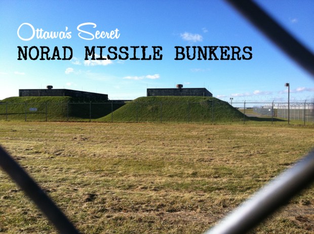
As the cold of winter once again grips Ottawa, a remote group of buildings quietly stands as a relic of our Cold War past, once a secret NORAD base of operations during a very different war on cold..that of the nuclear age.

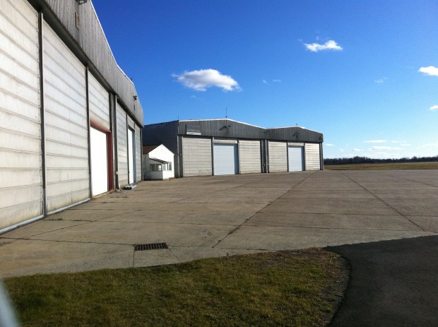
A unique abandoned Cold War fighter jet hangar sits forgotten in Ottawa.

A unique abandoned Cold War fighter jet hangar sits forgotten in Ottawa. Hangar doors now modified to a single narrow door.

At the height of the Cold War in Ottawa, the threat of nuclear attack by Soviet Russia was taken so seriously that a QUICK REACTION ALERT or QRA station was constructed on the outskirts of town at Uplands Air Force Base off Hunt Club Road. Now forgotten and hidden behind rusting barbed wire fencing, this unique defence facility constructed sometime in the late 1950’s was a special unit of the Royal Canadian Air Force base and played a key strategic role in the air defence of Canada and North America during the Cold War. Part of North America’s Air Defence, or NORAD, Ottawa’s QRA station formed part of a network of 5 other Canadian all-weather jet fighter bases armed with missiles and possible nuclear capabilities to counter surprise attacks by Soviet bombers in North American airspace. An excellent blog set up by Steffan Watkins, “Camping Canadian” explores various Cold War sites in Canada in amazing detail, and outlines the various QRA sites in Canada, including the station here in Ottawa. A direct link is HERE.

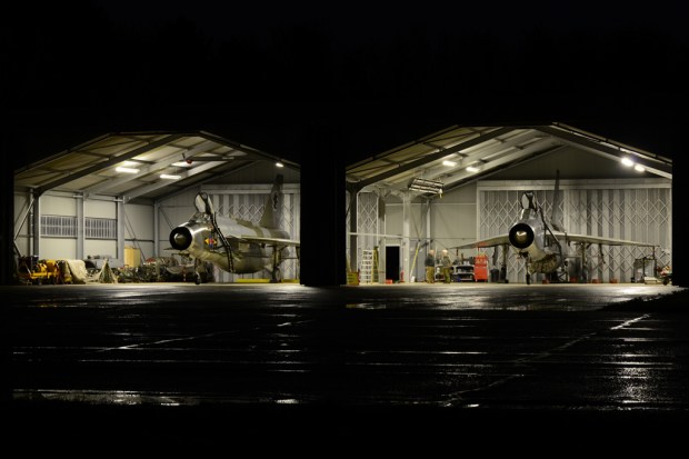
A photo of a RAF QRA hangar still in operation.

A photo of a RAF QRA hangar still in operation.

Screen Shot 2016-01-04 at 3.00.17 PM

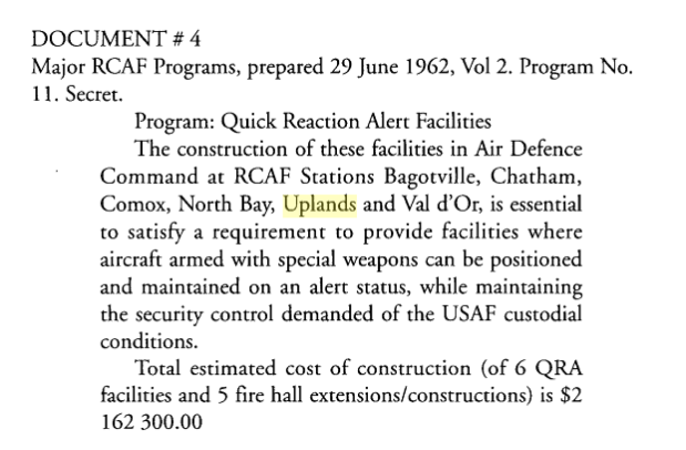
In a document prepared in 1962 labelled as “PROGRAM 11-SECRET” Ottawa was to house a special jet fighter intercept station “essential to satisfy a requirement to provide facilities where aircraft armed with special weapons can be positioned and maintained on alert status, while maintaining the security control demanded of the USAF custodial conditions.”

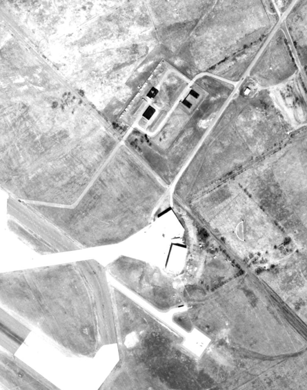
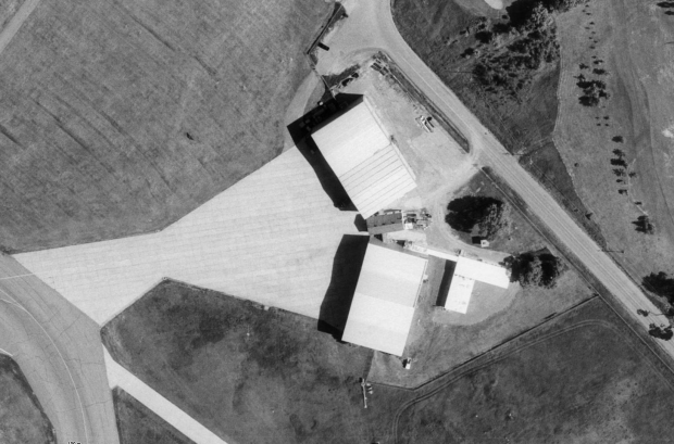
a 1950s satellite image shows the special NORAD QRA facility. Missile bunkers located at top.

A 1950s satellite image shows the once remote NORAD QRA facility. Missile bunkers located at top.


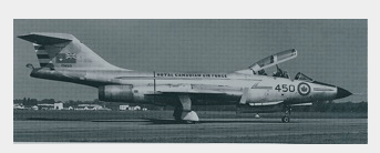
The actual CF101 Voodoo fighter jet that would have been stationed inside the special QRA hangars.

Photo of an Ottawa based CF101 Voodoo fighter jet that would have been stationed inside the special QRA hangars.

A special isolated hangar and some missile bunkers were constructed at a remote part of the Uplands airport that would house Cf-101 Voodoo fighter jets supplied by the USAF after the cancellation of the Avro Arrow program. Ottawa would most likely have seen Avro Arrows stationed in these specially built QRA intercept hangars if the Arrow program was not cancelled. Along with the special windowless secret hangars, special bunkers were constructed to house missiles for these jets on alert, including nuclear missiles. The Voodoo’s primary armament was the nuclear-tipped AIR-2A Genie unguided air-to-air rockets, and was used as Canada’s primary means of air defence.

A model of the Ottawa NORAD Alert fighter jet.

A model of the Ottawa based NORAD Alert fighter jet.

Another 1962 document labelled “PROGRAM NUMBER 10-SECRET” it is mentioned that “special weapons (most likely nuclear) needed to be housed. “A requirement exists to provide RCAF Station Uplands with special armament storage facilities to accommodate the ready-use weapon loads required by CF101 aircraft and to provide these bases with facilities for security control of such weapons.” I was unable to find confirmation that nuclear weapons were actually stored in the bunkers, but it seems likely if the Voodoo was usually armed with the Genie missile. A future Ottawa Citizen article says no nuclear weapons were ever housed in Ottawa.

Currently unused, the Cold War era facility is clearly in good shape, even the pilots mess hall and barracks are still standing.

As of November 2015, the Cold War era facility is clearly in good shape, even the pilots mess hall and barracks are still standing.

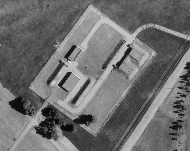
These “special weapon” facilities were indeed built, and can still be seen today near the QRA hangars at the south end of Ottawa’s airport. Surrounded by barbed wire fencing there are a number of these special built concrete bunkers surrounded by earth piles meant to absorb any explosion of the missiles inside the bunkers. Air vents can clearly be seen from the road sticking above the bunkers and a quick Google map search clearly shows these missile bunkers in aerial images of the area.

A 1965 aerial image shows the missile bunkers for the fighter jets armament.

A 1965 aerial image shows the missile bunkers for the fighter jets armament.

as seen from the road the facility that once housed the standby-fighters during the Cold War.

As seen from the road the facility that once housed the standby-fighters during the Cold War.

as seen from the road the facility that once housed the standby-fighters during the Cold War.

IMG_6593

The bunkers as they appear today that once housed the missiles for the Voodoo fighters in the nearby hangars.

Operational as 410 Squadron as of Christmas Day 1961, these secret NORAD QRA stations provided a unique lifestyle for its occupants during the Cold War.  Ottawa pilots and ground personnel spent up to a week at a time inside the hangar, ready to jump into a ready fighter jet at a moment’s notice. In the event of an alert, hangar doors quickly opened allowing the jets to take off almost immediately. Eating facilities and sleeping quarters were located in between the two hangars, and the bunkers situated a few hundred metres away housed the missiles that the planes would be armed with to intercept the Soviet aircraft.

Screen Shot 2015-11-08 at 6.00.34 PM

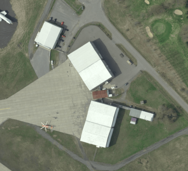
a current aerial image of the old Cold War facility. Net ORANG medi-vac chopper.

A current aerial image of the old Cold War facility. Note ORANG medi-vac chopper.

In 1964 Defence Department cuts axed the QRA NORAD facilities and Ottawa’s unit was disbanded with its 8 Voodoos saying farewell to the Nation’s Capital. At midnight on March 31 the commanders give up alert commitment and 410 Squadron ceased to exist.

An Ottawa Citizen article describing the shut-down of the NORAD facility in Ottawa.

An Ottawa Citizen article describing the shut-down of the NORAD facility in Ottawa.

Of the six QRA facilities constructed, only a few remain in existence. The QRA facility in Bagotville, Quebec was designated a National Historic Site in 2005, and with Ottawa’s facility in relatively good condition despite sitting unused in a remote part of the airport, it would seem appropriate to take the necessary steps to protect and preserve this unique part of Ottawa’s, and Canada’s Cold War history.

SOURCES

Bing Maps

Google Maps

GeoOttawa

Google News

“Canadian Nuclear Weapons: The Untold Story Of Canada’s Cold War Arsenal” by John Clearwater, 1998

CF-101B Voodoo, No. 410 Squadron, RCAF Station Uplands, 1960s (1:72) by Hobby Master Diecast Aircraft
Item Number: HA3709

“Camping Canadian” a blog by Steffan Watkins: http://campingcdn.blogspot.ca/2012/11/rcaf-voodoo-and-genie-storage-facilities.html


CHRISTMAS MYSTERY: A B17 Bomber from Ottawa loaded with Christmas cargo disappeared without a trace on December 15th 1944

b17

(This story originally appeared as part of an earlier post from December 2013 HERE)

During World War 2, Ottawa’s Rockcliffe air base operated a total of six B17 Flying Fortress aircraft that were outfitted as transport “mailbirds” ferrying thousands of letters and packages between Canada and the fighting forces overseas in Europe. Tracing the serial numbers of each of the B17s I was able to uncover what happened to each of these mailbirds during their wartime mail missions. Most were eventually either damaged or scrapped, but one in particular, B17 Serial#9203, went mysteriously missing. This is the story of Ottawa’s lost B17…a MailBird Mystery.

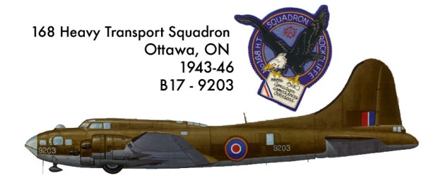
B17-9203 from Ottawa's Rockcliffe 168 Squadron and its insignia crest patch worn by crew during World War 2. (Patch image CC-SY)

B17-9203 from Ottawa’s Rockcliffe 168 Squadron and its insignia crest patch worn by crew during World War 2. (Patch image CC-SY)

In October of 1943 Rockcliffe airport became the site of 168 Heavy Transport Squadron which was formed to handle the large quantities of mail that needed to be delivered to personnel serving in the European and North African campaigns during World War Two. 168 Squadron became the site of a bustling hub of mail from across Canada that needed to be delivered to the troops and service personnel overseas. Love letters, family correspondence, birthday and holiday gifts as well as freight were all transported to the men and women far from home, boosting morale and keeping them connected to loved ones back home. B17-9203 had just delivered a load of Christmas mail to Canadian troops serving in North Africa through a Royal Canadian Air Force base in Morocco.

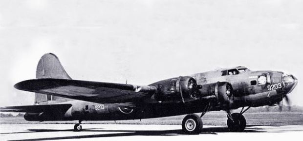
USAF file photo of Hillcoat’s B17-9203 from Rockcliffe painted in RCAF markings. Note serial number “9203” painted on the nose. It was on its way home when it disappeared over the Atlantic Ocean in 1944.

USAF file photo of Hillcoat’s B17-9203 from Rockcliffe painted in RCAF markings. Note serial number “9203” painted on the nose.

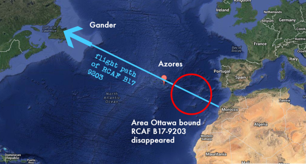
On December 15 1944 the aging B17 Flying Fortress from Ottawa, handed down from the United States Air Force, was loaded up with return Christmas mail bound for the Nation’s Capital. Pilot Horace Hillcoat and his crew of eight prepared the B17 to return home for the holidays with their precious Christmas cargo. Throttling up the four radial engines of the B17, Hillcoat lifted the mailbird into the Moroccan skies, heading for the Azores, a small group of islands in the North Atlantic Ocean. After a brief stop there, Hillcoat would then fly to Newfoundland before reaching his destination at Rockcliffe, Ottawa. Leaving the African shoreline, Hillcoat took the B17 across the Atlantic headed for the island airstrip some 1,500 km away. As they lost sight of the African coast, B17-9203 and its crew were never heard from again.

azores-map

When contact was lost with Hillcoat’s B17, a search and rescue mission scoured the area of the ocean where the plane may have disappeared. Some mailbags were found floating on the surface of the ocean, but no other signs of wreckage, survivors or debris were ever found. No distress calls or radio contact was made before the plane disappeared. B17-9203 had simply vanished. Hillcoat and the crew were classified as “Missing”.

Was Hillcoat and his crew ambushed by attacking German Luftwaffe aircraft, sending them to a watery grave? Did the well-used B17 suffer a mechanical malfunction and Hillcoat unsuccessfully ditched his plane in the Atlantic? Another theory is that the ill-fated B17 was shot down by anti-aircraft guns aboard a German U-boat prowling the waters below the B17. A number of German U-boats shot down Allied aircraft in the vicinity of the Azores, a fate that could have taken down Hillcoat’s aircraft. Numerous U-boats were also sunk by Allied anti-submarine patrols in that area with their sub crews taking their secrets and records to watery depths. It is quite possible Hillcoat’s B17 was shot down by one of these sunken U-boats with the story submerged along with it.

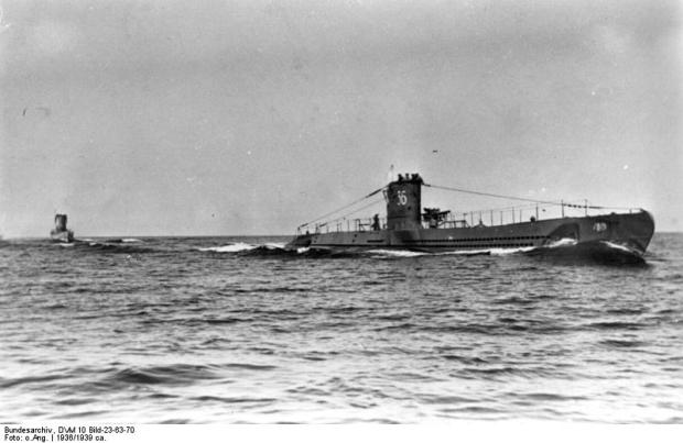
Did a lurking German Uboat down Ottawa's Christmas Cargo over the Atlantic?

Did a lurking German Uboat down Ottawa’s Christmas Cargo over the Atlantic? (photo Wikipedia)

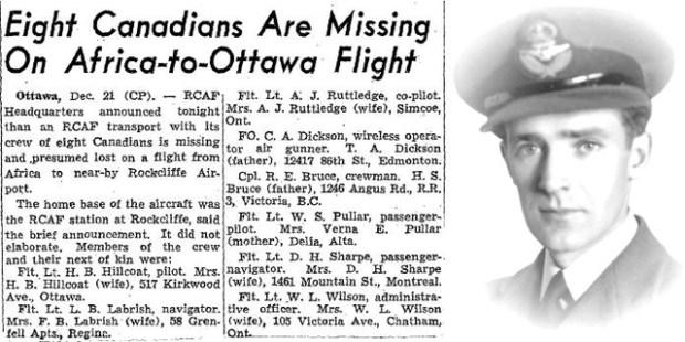
A 1944 newspaper clipping from December 21 reports the missing plane with a listing of all those on board. It turns out that the pilot, Horace Hillcoat was actually the only crew member of the eight aboard that was from Ottawa. He and his wife lived on Kirkwood Ave. in Westboro, and the house is still there today.

photo16

Hillcoat and the rest of the crew aboard the ill-fated Christmas B17 are part of the Commonwealth AirCrew Memorial on Sussex Drive.

Hillcoat and the rest of the crew aboard the ill-fated Christmas B17 are part of the Commonwealth Aircrew Memorial on Sussex Drive.

Hillcoat’s plane and its Christmas cargo were never found and with its crew still deemed missing, they join hundreds of other missing aircrew from World War Two on the Commonwealth Aircrew Memorial on Sussex Drive. The lost Christmas B17 from Ottawa continues to be an enduring mystery that may never be solved.